February 1, 2017
Hello Coast Survey,
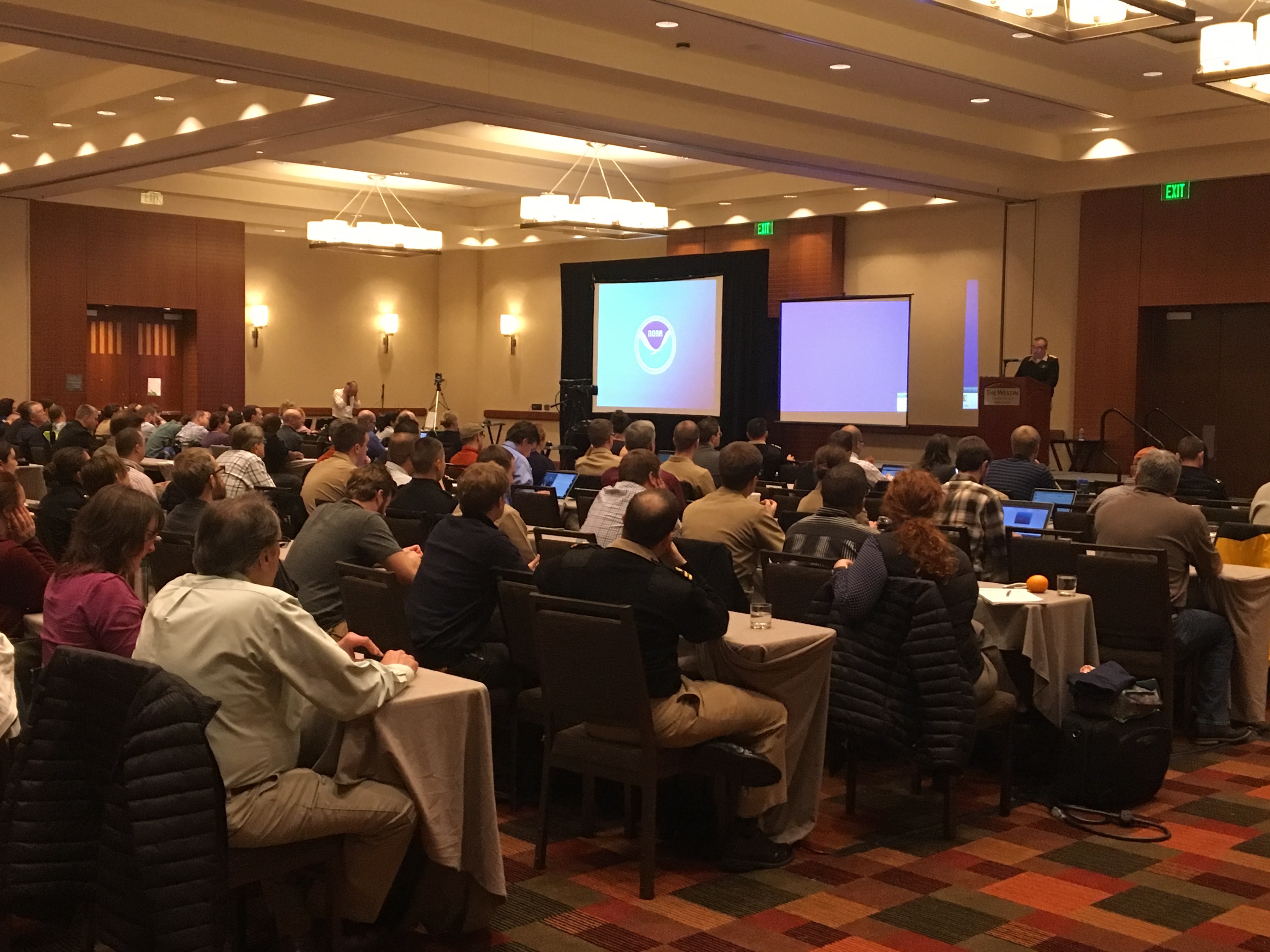
I had the honor of seeing many in our hydrographic community last week at the Field Procedures Workshop in Virginia Beach. I was really impressed by the passion, broad perspective, can-do spirit, and inclusiveness of the gathering. I was pleased to see many of our private sector and interagency colleagues there as well.
For those who are interested, Hydrographic Surveys Division has posted all of the materials from the workshop on an internal google site.
This week I am at the USACE Engineer Research and Development Center in Vicksburg, Mississippi, and the National Water Center in Tuscaloosa, Alabama. My goals are to better understand the current state and plans for inland rivers navigation, help integrate USACE control structure operations with the National Water Model, and build momentum toward integration of this model with our coastal hydrodynamic model in the tidal Mississippi.
![]()
Rear Admiral Shepard M. Smith
Navigation Services Division (NSD)
Andy Kampia will be backfilling for Rachel Medley as the Customer Affairs Branch chief while she is on detail as the deputy hydrographer. Andy is joining NSD from the Marine Chart Division, where he is the chief of Products Branch A. Brian Akers has stepped up to serve as acting branch chief of Products Branch A while Andy is in NSD.
LT Tim Smith recently left the NOAA Corps, leaving the Alaska navigation manager position vacant. Thank you for your service! LT Matt Forney will be filling in as the Alaska navigation manager until LT Bart Buesseler fills the position at a later date.
Coast Survey Development Lab (CSDL)
Eric Younkin started in CSDL as a physical scientist. Eric was formerly with the NOAA Corps in the Hydrographic Systems Technology Branch's Atlantic field liaison position. He will be working on hydrographic processing infrastructure and metrics, innovations in hardware (e.g. new GPS base stations), and new concepts for hydrography.
CSDL welcomes Scott Sherman as the SDLC manager on detail. We are excited to have Scott manage SDLC and continue to improve the project management center and documentation. CSDL would also like to give a big thanks to LaTonya Wilson from MCD for the excellent work that she did during her time as the SDLC manager.
Hydrographic Surveys Division (HSD)
Douglas Wood recently joined HSD Operations Branch as a physical scientist. Doug started his career with NOAA working onboard NOAA Ship Thomas Jefferson and augmenting on other hydrographic and fisheries survey vessels. Doug took a break from NOAA to be a research associate and complete his master’s degree in Earth sciences at Syracuse University. In 2015, Doug returned to NOAA as an associate contractor for CSDL's Hydrographic Systems & Technology Branch.
Meredith Payne recently joined HSD Operations Branch after five years with the Washington State Department of Natural Resources. Meredith has a strong physical science background in geology, oceanography, and remote sensing, and has expertise in cartography, and professional technical editing. She specializes in the application of GIS and Esri products for environmental science needs. Her knowledge of the QPS software suite, along with ArcGIS—especially the Maritime for Bathymetry module–will enhance data collection, archiving, and visualization efforts at NOAA.
Rita Bowker joined HSD’s Atlantic Hydrographic Branch (AHB) as a physical scientist after sailing on NOAA ships Thomas Jefferson and Rainer for over five years. Rita has an education in oceanography and geodesy (with a few sailing, pottery, and dance classes thrown in) and has previously worked at USGS and a private lab. Although Rita specializes in transforming many tiny dots into a meaningful picture of the seafloor, she is eager to work with others in developing SOPs, teaching techniques, and volunteering with the community.
Clint Marcus joined AHB after serving onboard the NOAA Ship Fairweather for five years. Prior to working at NOAA, Clint received his BS in Marine Science from the Maine Maritime Academy. While at the academy, he worked for NOAA during the summers on NOAA ships Rude, Oregon II, Nancy Foster, Pisces, and Shimada in the augment pool as a general vessel assistant. Clint also served nine years in the Navy as a Sonar Technician on submarines.
Bobby Short has re-joined AHB as a physical scientist after working as an environmental scientist with California's Department of Water Resources, surveying the Sacramento/San Joaquin Delta. Bobby is committed to helping realize NOAA's mission of expediting the ping-to-chart process in a safe, accurate, and professional manner. He received his bachelor's in geography from Humboldt State University in 2003 and is proud to have served in the US Army, driving an M1A1 Abrams tank from 1995 to 1998.
Laura Pagano re-joined the Pacific Hydrographic Branch (PHB) after a 10 year detour to NSD's Navigation Response Branch. Laura started her NOAA career as an intern at PHB in 2005, and briefly hired on as a physical scientist before heading to the field parties in 2007. She served as a team member and ultimately Team Lead for NRT-6, leading hydrographic surveys in San Francisco Bay and elsewhere on the California coast. Laura's return will increase PHB's understanding of NRT operations and survey projects.
Colin Stewart is new to NOAA but has over 25 years experience in oceanography and hydrographic surveying. His career to date has included work for the Naval Undersea Warfare Center and Williamson and Associates (where he was involved in NOAA-contracted surveys of the south coast of Long Island). Most recently, he was a private contractor working on the search for the MH370 aircraft in the Indian Ocean. This experience in private industry and offshore surveying will be valuable as HSD seeks to make greater use of outside source data.
NOAA Open House
Would you like to volunteer at the 2017 NOAA Open House? Coast Survey has two activities this year (see descriptions below) and we'd love your help engaging with our open house visitors!
Simple Child's Play: Bringing Landscape to Life
Let this 3-D dynamic topographic map and sand bring your landscape to life! Learn how to shape contours, create mountains, rivers, lakes, and underwater topography with the sweep of your hand. Watch how erosion, elevation changes, and artifacts on the seafloor can impact your landscape. Come play in the sand while you learn!
The Nation’s Nautical Chartmaker
Before digital images and “printing on demand,” nautical charts were hand-engraved on copper plates and reproduced on single printing presses. See an actual historic printing press, historic copper plate engraving, and printed charts produced by 19th century chartmakers: the U.S. Coast and Geodetic Survey, a NOAA predecessor agency.
The 2017 NOAA Open House will be held on Saturday, February 11, 2017. If you'd like to sign-up for a two-hour shift AND receive comp time for doing so, please coordinate with your supervisor.
If you have any questions, contact Lorraine Robidoux (lorraine.robidoux@noaa.gov; 301-713-2698, x122) for the topo map activity, or Dawn Forsythe (dawn.forsythe@noaa.gov, 240-429-6125) for the printing press interpretation.
Combined Federal Campaign
HSD's Pacific Hydrographic Branch alone raised $6,482 for CFC. Thank you especially to Priscilla Haskell and Brooke Maser for your leadership in helping to make this happen. Job well done.
Other News

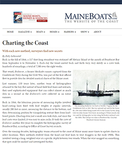
A recent article in the online publication MaineBoats.com nicely captures the historical and current efforts to chart the Maine coast. Read article.
2/6-2/10 - Navigation Managers Meeting in Silver Spring
2/10 - 210th Anniversary of the Survey of the Coast
2/11 - NOAA Open House - Come learn all there is to know about NOAA! This family friendly event runs from 9 a.m. to 4 p.m. in Silver Spring. For volunteer opportunities, see below.
2/16-2/20 - 2017 Miami International Boat Show

