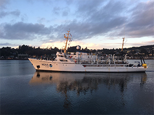
NOAA Ship Rainier sets survey standard in new multiagency partnership
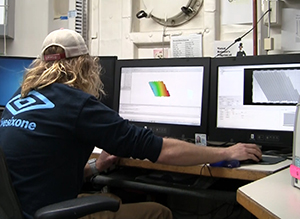
Mike Hewlett, survey technician on board NOAA Ship Rainier,
analyzes bathymetry data collected offshore of Morro Bay, CA.
In early October, NOAA Ship
Rainier surveyed an area offshore of Morro Bay, California, as the first field effort associated with the multiagency campaign off the west coast called, "Expanding Pacific Research and Exploration of Submerged Systems (EXPRESS)."
Rainier’s participation, testing of new methods for collecting backscatter, and early completion and delivery of data prompted a letter of appreciation from Joan R. Barminski, the director of BOEM’s Pacific region to RADM Silah, director of NOAA’s Office of Marine and Aviation Operations. In the letter Barminski states, “I want to express my sincere appreciation to the officers and crew of the NOAA Ship
Rainier…Early concrete successes are critical to developing partnerships…From planning through execution and product delivery,
Rainier delivered. The survey set
the standard for the partnership.” For more information, contact
Michelle.Levano@noaa.gov.
Coast Survey releases final version of the National Charting Plan
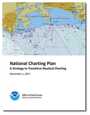
NOAA releases final verion of the National Charting Plan.
Coast Survey's Marine Chart Division (MCD) recently released the final version of the
National Charting Plan, which gives NOAA chart users a better understanding of what to expect of nautical charts in the future. The changes described in the plan will allow Coast Survey to be more responsive to the evolution of charting and address the public’s need for navigation data over the next several years. The plan outlines a suite of products that are more useful and safer to navigate with by providing more precise, higher-resolution charts with the most up-to-date navigation information. The comment period to solicit stakeholder feedback on changes to NOAA’s future nautical chart products was open from March 1 – July 1, 2017. The final version of the plan addresses and clarifies commenters’ questions and concerns. For more information, contact
Colby.Harmon@noaa.gov.
Informal training session informs U.S. Army Corps of Engineers on benefits of using satellite-derived bathymetry

Satellite-derived bathymetry subset of the Chesapeake Bay
shows shoaling trends and potential chart discrepancies.
Mid-Atlantic navigation manager,
Lt. Cmdr. Ryan Wartick, and
Lt. Anthony Klemm provided an informal training session to the U.S. Army Corps of Engineers (USACE) on the use of satellite-derived bathymetry (SDB) to detect shoaling as well as standard operating procedures for SDB data processing. The USACE was interested in producing a similar bathymetric product without the use of expensive fieldwork. The request for informal training resulted from a presentation Lt. Cmdr. Wartick gave to the U.S. Coast Guard (USCG) and USACE on the use of SDB to update charts in high priority Chesapeake Bay areas. For more information, contact
Ryan.Wartick@noaa.gov.
Coast Survey's products and services promoted at the International Workboat Show
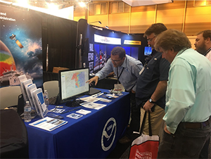
Kyle Ward showing Savannah Pilots recently acquired
offshore bathymetry data obtained by NOAA Ship Ferdinand
R. Hassler.
Coast Survey's
Tim Osborn, eastern Gulf navigation manager,
Kyle Ward, southeast navigation manager,
Christy Fandel, acting Customer Affairs Branch chief,
Neil Weston, technical director of the Coast Survey Development Lab,
Sam Debow, Navigation Services Division (NSD),
Lt. Cmdr. Matt Forney, Coast Survey staff office, and
Darren Wright, National Weather Service (NWS), attended the
International Workboat Show in New Orleans, Louisiana. This show is geared toward commercial vessels and mariners with over 1,100 vendors displaying their products. The team interacted with a wide-range of vendors to promote the national charting plan and learn about outstanding charting needs and improvements. For more information, contact
Tim.Osborn@noaa.gov.

NOAA Ships
NOAA Ship Ferdinand R. Hassler - Alongside in New Castle, New Hampshire.
NOAA Ship Thomas Jefferson - Alongside in Norfolk, Virginia.
NOAA Ship Fairweather - Alongside in Newport, Oregon.
NOAA Ship Rainier - Alongside in Newport, Oregon.
Navigation Response Teams
NRT 1 - Team is in Mobile, Alabama. Operations are suspended until the team's training is complete.
NRT 2 - Team is in Fernandina Beach, Florida. Vessel crossdeck is complete, boat is survey and response ready.
NRT 4 - Team is in Galveston, Texas. Vessel crossdeck is complete, boat is survey and response ready.
NRT 5 - Team responded to a USCG Sector New York request in the East River as part of an accident investigation into a ferry allision and will respond to another USCG request to locate and position a sunken sailboat in Raritan Bay, New Jersey.
Bay Hydro II - Bay Hydro II has been hauled out of water for winter maintenance.
Contractor operations
Leidos - R/V Atlantic Surveyor is in Galveston, Texas, during a data processing period.
Oceaneering - Field data collection is complete. Office processing and reporting is in progress.
David Evans and Associates - R/V Preston continues to survey the Mississippi Sound and vicinity.

Staff Updates
CSDL's Coastal Marine Modeling Branch welcomes Dr. Wei Wu . Dr. Wu recently worked with the University Cooperation for Atmospheric Research (UCAR) on NOAA's VDatum team where she developed and upgraded tide models to determine uncertainties in VDatum's tidal datum transformations. Dr. Wu earned her Ph.D. in oceanography from Texas A&M University and has extensive oceanographic, atmospheric, and climate modeling experience working at Brookhaven National Laboratory, the University of North Dakota, and the Ocean University of Qingdao, China.
Dr. Gregory Seroka joined CSDL's Coastal Marine Modeling Branch from the NWS Ocean Prediction Center, where he worked with the I.M. Systems Group on coupled hydrodynamic and meteorological model development and on S-412 weather overlays for Electronic Chart Display and Information System (ECDIS). Dr. Seroka earned his Ph.D. from Rutgers University in estuarine, coastal ocean hydrodynamic model development. He has expertise in ROMS modeling applications and coupled hydrodynamic-meteorological modeling.
Lucy Hick is serving as the acting chief of CSDL's Geospatial Applications Development Branch (GADB) on a 120-day detail. She comes to CSDL from the NSD where she recently served as acting division deputy. Prior to NSD, Lucy worked as a project manager in the Hydrographic Surveys Division, and was also a team lead for one of NSD's navigation response teams. Lucy has bachelor's degree in Ocean Engineering from the Florida Institute of Technology, and is currently working to complete an master's degree in GIS management.
GADB chief, Kurt Nelson, is serving on a detail to the OCS Portfolio and Project Management (PPM) team, working to advance CSDL's goals to streamline the PPM process and oversee the management of the projects within the portfolio.
Corey Allen, Hydrographic Surveys Division (HSD) Operations Branch, began a detail in September as acting branch chief. Corey is a longtime HSD employee. We’re excited to be able to harness Corey’s technical expertise and leverage his leadership during this transition of branch leadership.
Lt. Cmdr. Olivia Hauser is the incoming branch chief for HSD's Pacific Hydrographic Branch (PHB). Olivia most recently served as the executive officer on the NOAA Ship Thomas Jefferson, providing steadfast leadership to her crew and management of the complex hotel and business services on board the Thomas Jefferson. She also provided extra operational and administrative support during Thomas Jefferson's Hurricane Maria response. This is Olivia’s third tour with Coast Survey, her first and second tours were in CSDL's Hydrographic Systems and Technology Branch (HSTB) as the HSTB East Coast liaison and then as HSTB branch chief. Olivia brings dedication and positive energy and we’re looking forward to working with her in this new capacity. Welcome back, Olivia!
Thank you to Cecelia Linder, National Marine Fisheries Service, for a great job as the acting branch chief of PHB from June through October 2017. Cece was an asset to PHB and to the HSD during her tenure as acting branch chief, working closely with the two branch team leads and diving headfirst into the technical and administrative details of the job. Cece showed great initiative and introduced a valuable outside perspective, all while advocating for the needs and interests of PHB.
Thank you as well to Pete Holmberg, who stepped in as acting branch chief at PHB after Cece left and before Olivia fully onboarded. Pete’s ability to seamlessly transition from team lead to acting chief is invaluable and ensures a consistent leadership presence even in times of transition.
Awards
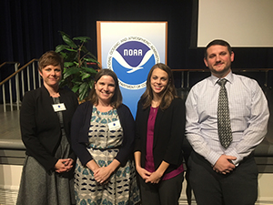
Emily Clark, Kathleen Jamison, Amanda Phelps, and Jason
Greenlaw at the NOS annual employee recognition and
awards ceremony. (Giuseppe Masetti not pictured)
Congratulations to our Coast Survey colleagues who were honored at the NOS annual employee recognition and awards ceremony.
Kathleen Jamison (chief, Resource Management Staff) received the 2017 NOS EEO and Diversity Award,
Amanda Phelps (Resource Management Staff) received the 2017 NOS Team Member of the Year award,
Giuseppe Masetti (UNH/Joint Hydrographic Center) received the 2017 NOS Team Member of the Year award,
Jason Greenlaw (Coast Survey Development Lab) received the 2017 NOS Team Member of the Year award, and
Emily Clark (Acquisition and Grants Office) was nominated by Coast Survey and received the NOS Peer Recognition Rafting Award.
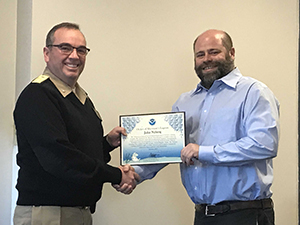
Rear Adm. Shep Smith presents John Nyberg with the Silver
Sherman Award.
At last week's senior staff meeting,
John Nyberg, chief of the Marine Chart Division was chosen as a Silver Sherman Award recipient for exceptional leadership of NOAA's charting program, leading the completion of the NOAA chart load into the nautical information system database, and development of the National Charting Plan. The Silver Sherman is awarded on an ad hoc basis by each member of NOAA leadership. It recognizes an individual who has performed work above his or her normal requirements, achieved a milestone that contributed significantly or critically toward the attainment of a particular program goal, or demonstrated leadership toward process improvement of a significant magnitude.