December 7, 2016
Hello Coast Survey,
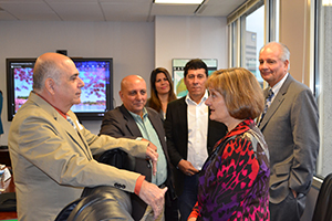
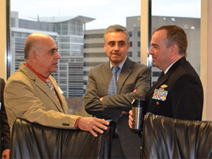
I am pleased to report that we had another very successful visit here in Silver Spring with the delegation from Cuba’s National Office of Hydrography and Geodesy. We had the opportunity to discuss revisions to the U.S. Cuba international chart (INT chart 4149) and are well on our way to releasing it in late December. This marks a historical milestone for Coast Survey as it is not only the first cooperative charting product between the U.S. and Cuba during the modern era, but it is possibly the last new international chart our agency will create. You can read more about this project in our spotlight section below and on our blog. Superb work by all who made this visit such a success!
![]()
Rear Admiral Shepard M. Smith
NOAA ships and NRTs
Alongside NOAA Marine Operations Center, Pacific Dock in Newport, Oregon. Congratulations on the completion of the 2016 field season where the ship and crew completed 9,653 linear nautical miles (3,077 LNM were part of the National Marine Fisheries Service project, FISHPAC) and 619 square nautical miles (289 SNM were part of the National Marine Fisheries Service project, FISHPAC) of survey activities. Bravo zulu CDR Mark Van Waes and crew!
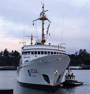
NOAA Ship Rainier
Alongside NOAA Marine Operations Center, Pacific Dock in Newport, Oregon. Congratulations on the completion of the 2016 field season where the ship and crew completed 2,436 linear nautical miles and 154 square nautical miles of survey activities. These metrics were achieved while enduring 89 days of unplanned repair activities. Bravo zulu CDR EJ Van DenAmeele and crew!
NOAA Ship Thomas Jefferson
Alongside Colonna Shipyard in Norfolk, Virginia, for a three week drydock period. Congratulations on the completion of the 2016 field season where the ship and crew completed 4,864 linear nautical miles and 192 square nautical miles of survey activities. These metrics were achieved while enduring 97 days of unplanned repair activities. Many of the survey activities were accomplished while conducting a field detachment survey while the ship was in drydock. Bravo zulu CDR Van Westendorp and crew!
NOAA Ship Ferdinand Hassler
Alongside their homeport, New Castle, New Hampshire. Congratulations on the completion of the 2016 field season where the ship and crew completed 10,630 linear nautical miles and 643 square nautical miles of survey activities. Bravo zulu LCDR Matt Jaskoski and crew!
Bay Hydro II
Conducting survey activities in central Chesapeake Bay and processing Hudson River survey data.
NRT 1
Preparing to travel to the boatyard that constructed the newly designed NRT vessels for final inspections and acceptance of final delivery.
NRT 2
Conducting survey activities in St. Andrew Sound, Georgia, and verifying depth post Hurricane Matthew.
NRT 3
Preparing the boat for survey activities and staging in Seattle, Washington.
NRT 4
Processing Galveston Bay data.
NRT 5
Processing Hudson River data.
NRT 6
Consolidating assets to transfer them to Seattle, Washington.
The Atlantic Hydrographic Branch was sad to say goodbye to Physical Scientist Tyanne Faulkes but looks forward to working with her in her new position at the Pacific Hydrographic Branch. While at the Atlantic Hydrographic Branch, Tyanne was an invaluable SAR-reviewer and field contributor, and became the branch's resident expert on ellipsoidal-referenced surveying practices. She will continue much of this great work on the West coast.
CDR Dan Simon will be on detail to Coast Survey as part of NOAA's Leadership Competency Development Program. CDR Simon will be working on developing a strategy for implementing the Seabed 2030 initiative for Coast Survey and partners. The GEBCO - Nippon Foundation - Seabed 2030, is a global program with the focused goal of compiling a high resolution openly available digital bathymetric model (DBM) portraying the world ocean seabed at the highest resolution possible from the coast to the deepest trenches by the year 2030. This DBM should efficiently provide bathymetric information to end users and leave no features of the world ocean floor smaller than 100 m unmapped by the completion of the program. Welcome aboard CDR Dan Simon!
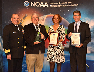
Awards
Combined Federal Campaign
The Pacific Hydrographic Branch held its annual CFC potluck lunch on November 15. The event was attended by local Coast Survey staff as well as personnel from the OMAO Small Boat Program. The branch's CFC coordinators Priscilla Haskell and Brooke McMahon arranged two speakers from local CFC charities and held a drawing for donated items. The potluck is the centerpiece of the branch's CFC effort, which typically raises approximately $4500 toward the campaign.
12/7-12/8 - NOS CFC basket raffle, 10 a.m. to 2 p.m. in SSMC3 first floor lobby. Enter for a chance to win the great basket Coast Survey contributed! $1/one ticket or $5/six tickets. All proceeds go to CFC.
12/14-12/17 - Meso American and Caribbean Sea Hydrographic Commission annual meeting in Brazil where NOAA will announce the release of the U.S. Cuba international chart (INT chart 4149).

