November 9, 2016
Hello Coast Survey,
I try to avoid having my communications to you sound like a travelogue, but I can't resist sharing a couple of stories from my trip to California last week.
First, I was proud to lead the delegation of Coast Survey folks to the ESRI Oceans Forum, where I was joined by Ashley Chappell, Patrick Keown, Allison Wittrock, Michael Bogonko (UNH), Michael White (UNH), and Evan Robertson (NCEI). In the few years since Coast Survey started using ESRI broadly, we have developed some deep expertise, and integrated it into several mission-critical functions. Our participation really showcased our role in the larger GIS community of practice at NOAA and the ocean community. ESRI continues to develop new tools that open new opportunities for us to grow with the technology in the coming years. Thank you for all the hard work during this enterprise-wide transition.
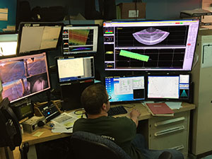
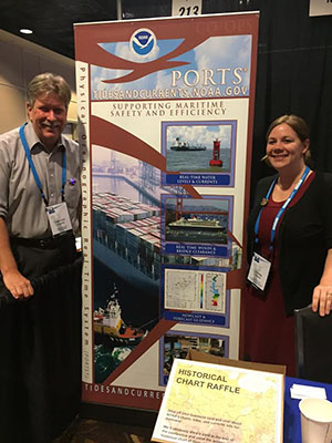
Second, I visited the ports of Los Angeles and Long Beach, where we have a testbed project in place to optimize the "environmental intelligence" we provide to the ships, pilots, and marine exchange to help them improve the efficiency of the ports. I am pleased to report that their integration of the high resolution bathymetry with PORTS, weather, model, and wave data into a decision support tool for planning ship movements into and out of the port is now complete. In Long Beach, they are working with the captain of the port to ease the blanket draft restriction of 65 feet to allow them to bring in deeper draft ships based on a quantitative risk management system. The first milestone is anticipated for January, where they plan to bring in the first 66 foot draft tanker. They anticipate additional draft increases as they become more comfortable with the system. Each additional foot of draft means millions of dollars of additional capacity. Thanks to all of you who worked with our Foundation Four partners to get this project off the ground.
Lastly, on Friday we celebrate Veterans Day on the anniversary of the armistice ending World War I, 98 years ago. Please take a few minutes to thank your colleagues, friends, and family members for their service to our country to preserve our values and way of life.
![]()
Rear Admiral Shepard M. Smith

Staff updates
Rachel Medley, NSD's Customer Affairs branch chief, will serve as acting deputy hydrographer until CDR Liz Kretovic arrives this summer. Rachel will develop the portfolio for this new position, focusing on outreach and external engagement with Congressional offices and federal partners.
Vanessa Self Miller, HSD Atlantic Hydrographic Branch (AHB), was selected for the international affairs rotational assignment. She is an IHO Cat A Hydrographer from the University of Southern Mississippi. Her work in HSD primarily focused on hydrographic survey acceptance reviews and field support.
HSD's Operations Branch welcomes the newest member of their team, Christina Belton. Christina comes to HSD from the National Weather Service (NWS) with considerable GIS experience, having worked with Coast Survey and other agency data to contribute to NWS' hurricane surge models. Christina is actually returning to Coast Survey, in 2014 she did an internship project involving analysis of the top 174 US ports. Cody Guilday, a recent graduate of the University of Delaware,is joining HSD's AHB from NRT5 and is currently sailing aboard NOAA Ship Ferdinand Hassler.
Coast Survey pilot diversity internship program
Coast Survey is currently recruiting mentors/supervisors for the pilot "Internships in Marine Geography," which is a 10-week summer program starting in 2017 created to recruit and place a diverse group of interns in positions anywhere within Coast Survey. The program is part of a new partnership with the National Park Service and a third-party non-profit, Greening Youth Foundation, that specializes in recruiting and placing students and recent graduates from diverse backgrounds at federal agencies. Interns will work full time (40 hours per week), will be paid $15/hour, and their housing is included to encourage applicants from around the country to apply. There is no additional cost beyond time for the host division. Interns may be placed at Silver Spring HQ, regional offices, or in the field.
It is not required for the intern to be supervised by a federal manager; however, Coast Survey employees looking to supervise and mentor an intern must obtain approval from their supervisor to participate. The deadline for host office participation in the program is November 30, 2016. To host an intern as part of the Internships in Marine Geography, Hollings, or unpaid program, the intern's future mentor/supervisor should enter basic position information using the Google Request Form. More information on each type of internship is available through the Coast Survey Internship Info Sheet. For more information, contact Kathleen Jamison at kathleen.jamison@noaa.gov.
Silver Spring office reconfiguration
Montgomery County permits are tentatively scheduled to be issued on November 21. Construction will begin once the permits are issued. Coast Survey front office staff are scheduled to move into the new office space on December 30.
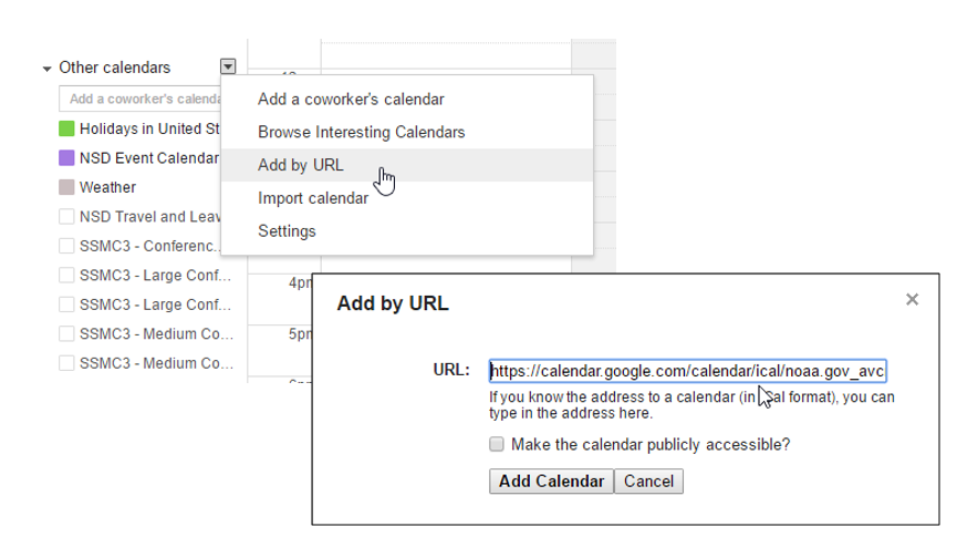
ical/noaa.gov_avcri4tnoj4l349h6cup
fn21uo%40group.calendar.google.com/
public/basic.ics. Contact Lucy.Hick@noaa.gov if you know of any additional events that should be included in this calendar.
The Commerce Data Academy is offering a free Intro to Data Analysis course on November 16. Information on this and other courses can be found on the Commerce Data Academy's website.
Esri is offering a free course on Going Places with Spatial Analysis. This six week course begins November 9.
Take the NOAA GIS survey
The NOAA GIS Committee is conducting an internal survey to identify how it can better serve the NOAA geospatial community. The survey should take about 10 minutes to complete. Take the survey here: https://www.surveymonkey.com/r/FRZGLX8
2017 Esri FedGIS Conference
Registration is now open for the 2017 Esri FedGIS Conference. This conference will be held February 13-14, 2017 at the Walter E. Washington Convention Center in Washington, DC. Registration is free for federal employees and contractors.
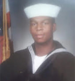
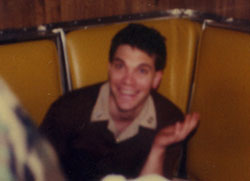
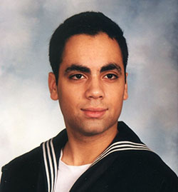
Many of our Coast Survey staff and contractors have proudly served in the U.S. Armed Forces. Can you guess who these seven Coast Survey veterans are? The first person to email coastsurveycommunications@noaa.gov with the correct answer will receive a $10 Starbucks gift card.
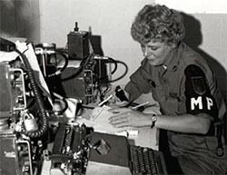
This veteran served as an MP in the U.S. Army and for eight years in the National Guard.
This veteran, recruited in Great Lakes, Illinois, spent eight years in the U.S. Navy as a cryptologic technician.
This veteran spent five years in the U.S. Navy as a submarine watch officer specializing in operations and nuclear weapons.
The photo of this veteran was taken when he first reported to the USS Abraham Lincoln (CVN-72). He served for four years in the U.S. Navy.
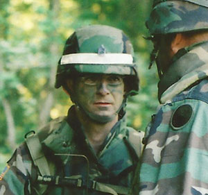
This veteran served in the Maryland Army National Guard. He was a Sergeant First Class (E-7) at the time this photo was taken.

This veteran spent three years in the U.S. Army as a tactical operations wire specialist. He is 18 years old in this picture.
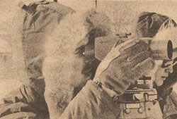
This veteran was assigned to the geodetic survey office at Griffiss Air Force Base in Rome, New York.
11/16 or 11/17 - Workplace bullying workshop hosted by Coast Survey's EEO & Diversity Committee; 9:30 a.m. to 11:00 a.m.
11/29 - 2016 NOS employee recognition and awards ceremony
11/29-12/1 - Cuban delegation visiting Coast Survey
11/30 - Coast Survey CFC corn hole tournament and lunch

