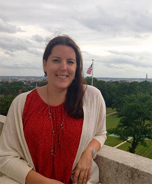
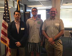
International Hydrographic Organization Assembly meets in Monaco
IHO Director Mustafa Iptes, RDML Smith, IHO Secretary
General Robert Ward, and Denis Hains- Hydrographer
General of Canada at the IHO Assembly meeting in Monaco.
The
International Hydrographic Organization’s 2017 Assembly met in Monaco, the last week of April. Coast Survey’s director,
RDML Shep Smith, was alternate U.S. head of delegation led by the Department of Defense with interagency representatives from NOAA, National Geospatial-Intelligence Agency, Navy, and the Department of State. The outcome of the meetings and deliberations were favorable to the U.S. and reflected strong endorsement of NOAA leadership in the development of new technologies to collect bathymetry as well as support for the global bathymetric database housed at NOAA National Centers for Environmental Information (NCEI) in Boulder. One development of note is the Secretary General of the International Seabed Authority's expression of readiness to contribute data holdings to the NCEI database effort. The assembly also elected new leadership of the IHO for the next three years which reflects a further endorsement of NOAA priorities to advance data standards (S-100 series) and others. The IHO was established in 1921 as an intergovernmental organization charged with charting the oceans and fostering cooperation among member states for safe navigation. The organization has grown over the years and, with the addition of five new members at the Assembly, now numbers 87 member states.
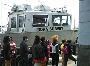
Students visit Charleston to learn about coastal hazards
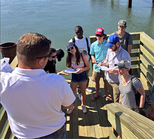
Kyle Ward explains the importance of bench marks and
vertical control to high school students.
High school students from New York City recently traveled to Charleston, South Carolina, for a research trip focused on hazards in coastal communities. As part of their trip, they met with
Kyle Ward, Southeast navigation manager, at the CO-OPs tide station at the South Carolina Ports Union Pier Terminal to learn about the importance of bench marks and vertical control in the context of severe storms and high tide events.
With Hurricane Matthew in the recent past and king tides occurring the week of their visit, their trip was a huge success. The Port Authority shared their appreciation via
Twitter.
Precision Navigation presented at Safepilot workshop in Baltimore
CAPT Rick Brennan presents precision navigation at the
Safepilot workshop in Baltimore.
CAPT Rick Brennan, chief of the Hydrographic Services Division, and Rachel Medley, deputy hydrographer (acting), attended a Safepilot workshop on portable pilot unit (PPU) usage in Baltimore, Maryland. Workshop attendees represented technology working groups for their respective pilot associations ranging geographically from the Mississippi River to the Canadian Great Lakes. CAPT Jorge Viso, president of the
American Pilots Association, kicked off the workshop discussing the history and value PPUs have provided to the piloting community since the 1980s. CAPT Brennan delivered a presentation on
precision navigation focusing on NOAA's efforts to support quality gridded bathymetry and observed and predictive data sources to PPU manufacturers. CAPT Brennan's presentation focused on the maturation of the industry and technological advances through collaborative efforts with maritime users, 3rd party data providers, and NOAA, highlighting that these collaborative discussions and applications will grow innovative solutions to address the variety of issues experienced by commercial mariners in U.S. ports and waterways.
Students learn about NOAA and navigation response in Houston
High School students learn about the marine industry in
Houston.
Dan Jacobs, team lead for navigation response team 4, and
Alan Bunn, Western Gulf Coast navigation manager, showed off NOAA’s response vessel and hosted a NOAA booth at the 6th annual Maritime Youth Expo in Houston, Texas. The purpose of the expo is to expose local high school students to the opportunities in the maritime and logistics industry. The event has grown from around 50 attendees to nearly 500 in just six years. A total of 35 exhibitors (seven from schools and non-profits, 14 from the maritime industry, and 14 from governmental agencies) contributed to the success of this year’s expo. Students had the opportunity to tour the boats landside and dockside, throw heaving lines, try on dive equipment, and talk with the many professionals present at the expo. The most popular items at the NOAA booth were the NOAA websites one-pager, and the NOAA Corps information brochure.
Coast Survey's work will be highlighted in the Journal of Geophysical Research
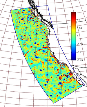
Map showing results from the West Coast Operational
Forecast System.
Coast Survey's work will be highlighted in the Journal of Geophysical Research (JGR) with a special issue devoted to Integrated Ocean Observing Systems' (IOOS) Coastal Ocean Modeling Testbed (COMT) projects. The image pictured to the left, showing results from the West Coast Operational Forecast System (WCOFS), a project which leverages research done as part of one of the COMT projects, will be featured on the cover of this special JGR issue. WCOFS is a collaborative project between the National Ocean Service (Coast Survey, Center for Operational Oceanographic Products and Services, IOOS) and
NOAA's Satellite and Information Service (NESDIS). The Coast Survey Development Lab is one of the co-leads on the development of WCOFS that assimilates satellite data provided by NESDIS. The goal of the WCOFS project is to provide 3-7 day forecasts of the entire West Coast.
Coast Survey visits NOAA Hurricane Hunters Tour
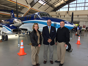
CDR Nicole Cabana, Mike Aslasken, RDML Shep Smith at the
Hurricane Hunters Tour.
This week
RMDL Smith and
Rachel Medley attended the
NOAA Hurricane Hunters Tour at Reagan National Airport in Washington, D.C. While there, they met with representatives Captain Mike Silah who oversees the OMAO P3 fleet and CDR Nicole Cabana, RDML Lopez's chief of staff for aviation. RDML Smith also spoke with Mike Aslasken, National Geodetic Survey's Remote Sensing Division. Mike was at the event representing the
King Air, which responds to natural disasters collecting imagery with both oblique and nadir views. As part of the holistic NOAA navigation services message, Mike distributed Coast Survey one-pagers on our navigation managers and navigation response team, promoting NOAA navigation services during emergency response activities. Mike also printed several booklet charts from our website, which he told Rachel Medley were gone within the hour. This event looks like a good way for Coast Survey to reach a new audience in terms of NOAA navigation products and services. Look for this to be among the outreach opportunities for Coast Survey to participate in.

NOAA Ships, NRTs, and Contractors:
NOAA SHIP
THOMAS JEFFERSON
TJ personnel involved in the work witht the U.S. Naval Seal
Cadets, CO CDR Chris Van Westendorp, XO LCDR
Olivia Hauser, FOO LT Forrest. Not pictured: ENS Dale
Gump, SST Ligon.
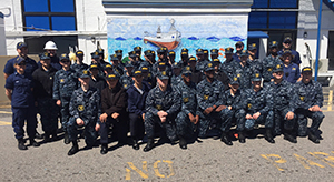
NOAA Ship
Thomas Jefferson has been using time alongside productively, despite unexpected delays. Foremost among the accomplishments during this time have been - 1) outfitting two new launches for survey work, including installation of survey systems, as well as the accomplishment of an offset survey in partnership with National Geodetic Survey personnel (
Kevin Jordan and
Ryan Hippenstiel); 2) supporting Marine Operations Center Atlantic (MOC-A) in conducting outreach work with U.S. Naval Sea Cadets. This event, held on April 9, involved 50 Sea Cadets from around the Commonwealth of Virginia, and encompassed many aspects of NOAA's work.
TJ's contributions included a tour of the ship, as well as a hands-on demonstration of
TJ's Z-Boats.
NOAA SHIP
FERDINAND R. HASSLER
NOAA Ship
Ferdinand R. Hassler is alongside U.S. Coast Guard Curtis Bay Shipyard for scheduled alongside repair period. Tentative completion late July.
NOAA SHIP
RAINIER
NOAA Ship
Rainier had a busy winter in Newport, Oregon, completing Kodiak and Ketchikan surveys from 2016 and servicing several engineering systems.
Rainier wants to acknowledge the hard work of our
ET Department for the thorough system integration performed on all launches, including new radars and chart plotters.
Rainier’s
Deck and Engineering departments did a masterful job of putting the ship back together and preparing it to sail as the repair period ended. The ship’s
Steward Department deserves recognition for taking on stores while understaffed and then preparing meals at the high standard they continually meet. Additionally,
Rainier’s
Survey Department was able to complete, package, and send off all previous year surveys prior to sailing for the first time in at least several years. Also, physical scientist support from the Pacific Hydrographic Branch was integral in the hydrographic survey readiness review (HSRR) process. Many thanks go to
PS Toshi Wozumi,
PS Jessica Ramsay, and
PS Laura Pagano for their assistance and continued ability to help train our survey crew. And finally, the efforts of
LTJG Debroisse, who helped
Rainier install and patch its Velodyne lasers for shoreline acquisition for two of our launches.
Rainer departed Newport on April 11 to transit to their project grounds in Kodiak, Alaska. After conducting GPS Azimuth Measurement Subsystem (GAMS) calibration for the ship and conducting a patch test at Eastern Bank in the Strait of Juan de Fuca,
Rainier made their way north through the Inside Passage.
Rainier welcomes aboard augmenting
SWO LCDR Sarah Duncan, who is gaining the opportunity to observe and assist with launch patch testing and mainscheme acquisition for OPR-P136-RA-17.
LT Steven Loy has stepped up to lend his expertise in assisting NOAA Ship
Oscar Dyson with preparation of their ME70 multibeam echo souner unit in a search and recovery effort for F/V
Destination, lost at sea in February of this year.
NOAA SHIP
FAIRWEATHER
NOAA Ship
Fairweather will be ready to head out and start the season on Thursday, May 11, provided the weather cooperates.
LTJG Patrick Debroisse will be departing the ship for his new assignment as Junior Officer in Charge (JOIC) of R/V
Bay Hydro II. LTJG Debroisse will be Bay Hydro II's first ever JOIC, a position which should increase continuity for the platform and be positive step for Coast Survey. We'll be sad to watch him go, but wish him the best going forward.

Staff Updates
Timothy Wilkinson, Lucas Blass, and Charles (Wess) Rowland.
Coast Survey welcomes three new navigation response team members this week.
Lucas Blass will be reporting to NRT2 in Fernandina Beach, Florida;
Charles (Wess) Rowland will be joining NRT4 in Galveston, Texas; and
Timothy Wilkinson is headed to NRT3 in Seattle, Washington. The new team members spent part of last week in Silver Spring, Maryland, for orientation and meeting with staff. Welcome!
Katie Ries sits alongside Dawn Forsythe as she reads the
inscripton on her Jefferson Cup.
Dawn Forsythe, communication specialist in Coast Survey's staff office, retired on April 29. During her eight years at Coast Survey, Dawn loved exploring history and was a master at telling the Coast Survey story as background to our modern achievements. The most meaningful project Dawn worked on was the finding of U.S. Coast Survey steamer
Robert J. Walker and honoring the 21 men who died. We are very fortunate that Dawn left us with an excellent historical reference she compiled over the last year,
Nautical Charts Contribute to Econonmic Growth and National Defense, 1807-1945. This 80-page collection of historical charting vignettes is a quick introduction to the role our predecessors played in the nation's geopolitical events, and proves the necessity of charts in maintaining U.S. growth and stability. We will miss you Dawn!
We wish
Sasha Pryborowski well as she moves from the Integrated Ocean and Coastal Mapping team to serve as a program analyst with NOAA's National Marine Fisheries Service Management and Budget Office. Sasha played an integral part in the progress made at NOAA and interagency levels on such projects as the National Coastal Mapping Strategy, National Ocean Policy implementation and ocean mapping coordination. Sasha, we will miss you in IOCM and Coast Survey!
Events
Please join us for Coast Survey's annual picnic!
When: Thursday, May 18, 2017, from 10 a.m. - 2 p.m. (lunch served at noon)
Where: Sligo Dennis Ave. Park (10200 Sligo Creek Pkwy, Silver Spring, MD)
Cost: $15 (includes fried chicken, hamburgers, hot dogs, half smokes, potato salad, cole slaw, desserts & refreshments)
RSVP to Julie Armstrong, Rm 6404, 240-533-0089
Volunteers for set-up, grilling, and clean-up can sign-up via
Sign-up Genius.