Collaborative modeling showcased at the NOAA General Modeling Meeting and Fair
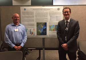
Dr. Neil Weston and Dr. Greg Seroka at the NOAA General
Modeling Meeting and Fair poster session.
This week, members of the Coast Survey Development Lab attended the
NOAA General Modeling Meeting and Fair in College Park, Maryland. The purpose of the event is to bring together not only NOAA line offices to discuss common goals and work, but to also bring perspectives from outside the agency, valuable to advancing the overall scientific and mission goals of the industry. The extensive agenda included talks by senior NOAA leaders, such as Dr. Neil Jacobs, assistant secretary of commerce for environmental observations and prediction, representatives from academia, and partners across NOS including our own
Dr. Greg Seroka, physical scientist from Coastal Marine Modeling Branch, who spoke on behalf of NOS efforts and served on a panel discussion. As part of this event, staff from the U.S. Integrated Ocean Observing System (IOOS), the Center for Operational Oceanographic Products and Services (CO-OPS), and Coast Survey collaborated on
several detailed posters, outlining our work on operational forecast system modeling, storm surge, coupling, and importance of international standards to navigational data models and products. For more information contact
Gregory.Seroka@noaa.gov.
NOAA Ship Thomas Jefferson presents survey work to Puerto Rico south coast stakeholders
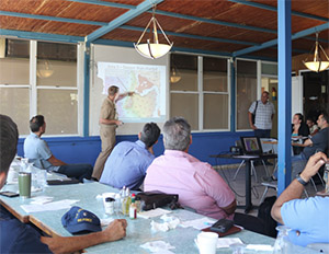
Cmdr. van Westendorp presents preliminary survey results to
the Puerto Rico South Coast Harbor Safety & Security
Committee from Thomas Jefferson’s 2018 hydrographic
survey project in San Juan, Ponce, and vicinities, Puerto Rico.
Almost one year following the passage and destruction of Hurricane Maria, NOAA Ship
Thomas Jefferson returned to Puerto Rico to conduct follow-up hydrographic survey work along the north and south coasts. While anchored in Bahia de Guayanilla, the commanding officer (CO) of the ship, presented at the South Coast Harbor Safety & Security Committee meeting on nautical hydrography, including an outline of the ship’s 2017 post-Maria work, as well as current project plans and preliminary results. Attendees showed particular interest in survey results in and around port areas previously identified by the South Coast Pilots as critical for local and island-wide economies as well as allocation and positioning of survey capabilities in preparation for major storm events in the Puerto Rico/U.S. Virgin Islands region. For more information contact
CO.ThomasJefferson@noaa.gov.
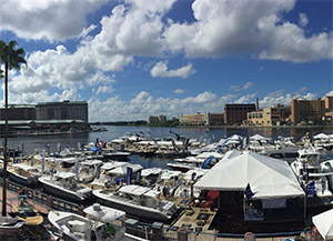
Coast Survey navigational products and services shared at the Tampa Boat Show
Alex Ligon is interviewed by a local television station featuring a
story on NOAA's NRT capabilities.
Tim Osborn, NOAA’s eastern Gulf Coast navigation manager, joined the National Weather Service Tampa Bay Office and National Marine Fisheries Service to represent NOAA at the
Tampa Boat Show. Together, they provided seminars on navigation, marine weather, and local fisheries. The Tampa Boat Show is an annual event that features the latest commercial boating products available, but most importantly for Coast Survey, provides an opportunity for our organization to gain insight into how the public is using our products, what services they are looking for, and how we can better meet their needs. The organizers of the Tampa and Miami boat shows asked if Coast Survey would participate in a day-long educational series that they will introduce at the next Miami Boat Show in February 2019. For more information contact
Tim.Osborn@noaa.gov.
Current meter no match for Deception Pass, Washington
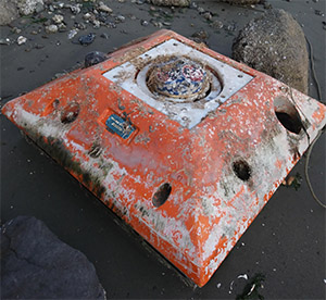
Current meter once deployed in Deception Pass, Washington,
found a few years later on Whidbey Island.
Recently, a CO-OPS current meter thought to be lost to the sea washed ashore on Whidbey Island, Washington, and found by a local citizen. NOAA deployed the current meter in Deception Pass a couple of years ago to measure and model the significant currents in the area. NOAA Ship
Fairweather’s launches acquired multibeam echo sounder (MBES) data there to help CO-OPS determine where to deploy the sensor. Unfortunately, the strong currents that NOAA would like to measure are the very ones that washed the current meter away. The citizen reached out to the sensor's manufacturer who traced it to
Crescent Moegling, NOAA northwest and Pacific Islands navigation manager, via a local notice to mariners. Coast Survey and CO-OPS is looking forward to determining if the MBES data collected will be helpful in updating the current model for Deception Pass. Efforts to retrieve the current meter are underway. For more information contact
Crescent.Moegling@noaa.gov.
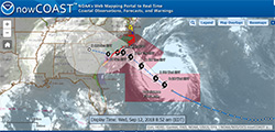
Coast Survey keeping a close eye on Saildrone missions in the Arctic
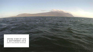
A drone’s view while passing southward through the Bering
Strait during the 2018 Arctic missions with NOAA’s Pacific
Marine Environmental Lab. Credit: Saildrone Inc. Edited by H.
Tabisola (NOAA).
The Pacific Marine Environmental Laboratory (PMEL) and partners entered the final month of a
research mission with Saildrone in the U.S. Arctic. While the focus of their research is to measure carbon dioxide and the abundance of Arctic cod in the Arctic Ocean, Coast Survey is interested in whether Saildrone data can be used to update navigational charts. Coast Survey provided the team with geographic locations for data collection that will later be evaluated for its utility in navigation. To learn more about this project, follow the
Saildrone 2018 blog. For more information on Coast Survey's interest in the project contact
Neeraj.Saraf@noaa.gov.
NOAA Ships, Navigation Response Teams, and Contractor Operations
Weekly Hydro Ship Activity Report - September 2 - 8, 2018
NRT 1 - Preparing sidescan/singlebeam mobile integrated survey team and EchoBoat for Hurricane Florence response deployment. Headquarter personnel to meet NRT1 with Remus-100.
NRT 2 - Breaking from junction survey with National Geodetic Survey's Remote Sensing Division for Hurricane Florence deployment.
NRT 3 - Processing Columbia River data, performing routine maintenance on vessel, and preparing for survey in Columbia River and buoy search in Newport, Oregon.
NRT 4 - Repairing vessel, processing data, and preparing for survey in Flower Gardens Banks National Marine Sanctuary.
NRT 5 - Preparing for Hurricane Florence deployment, vessel to remain in Connecticut.
Bay Hydro II - Preparing for Hurricane Florence deployment.

Staff Updates
Marine Chart Division welcomes
James Moy (ERT). James graduated from the University of Maryland with both an M.S. and B.S. in geospatial information systems (GIS). While earning his degrees, he also worked as a teaching assistant for several GIS courses, and as an intern at NOAA. With his background, James is passionately interested in exploring the potential of GIS, its technology, and how it can be used to better society.
Do you have an Individual Development Plan (IDP) that targets building the skills needed to do your job most effectively? One that reflects your desired career path? Is an IDP more than a list of training? Does the thought of an IDP overwhelm you? Coast Survey employees are invited to a participant-driven IDP training session September 24, 2018, from 9:00 AM - 12:00 p.m. in SSMC3 6836. This opportunity is mandatory for new Coast Survey employees and open to all interested Coast Survey employees in Silver Spring with supervisory approval. (Since this training is interactive, it is not conductive to doing virtually via Google Handouts or Webinar. However, please note that an adapted version of this training will be provided later for OCS employees in the field, so stay tuned for more information to come on that!). Advance registration is required by 9/14/18. Please use the following
Google signup sheet and a Google Calendar meeting invite will be sent to you. If you have questions or concerns please contact the training organizer:
Meredith.Payne@noaa.gov.