Coast Survey releases new extratropical storm surge and tide forecast system for Micronesia.
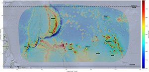
Numerical grid and bathymetry of the ESTOFS-Micronesia
domain. White circles denote locations where high-frequency
(6-min) water level guidance is available.
This week, the new Extratropical Storm Surge and Tide Operational Forecast System (ESTOFS) for the Micronesia region became operational. ESTOFS is one of the numerical ocean prediction products developed and maintained by NOAA's Office of Coast Survey. ESTOFS provides operational guidance on storm surge and tidal water levels for the nation’s coastal regions. Since 2012, the
National Ocean Service has developed and deployed ESTOFS in the Atlantic and Pacific oceans to cover the U.S. east, west, and Gulf coasts, Caribbean, and Hawaii. ESTOFS-Micronesia is the first surge and tide operational model guidance available to forecasters in this vast mid-ocean region. With a dramatic lack of local water level observations in Micronesia, the importance of domain-wide tide and surge forecast guidance is evident. ESTOFS-Micronesia covers Palau, Guam and the Marianas, Federated States of Micronesia, Marshall Islands and Wake Island—a territory that is home for more than half a million people and major U.S. Naval and Air Force bases. Initial implementation provides an unstructured model grid with resolution up to 200 meters at the coast, and upland nodes up to the 10 meter elevation contour to enable coastal inundation guidance. ESTOFS is being run and operated by
NCEP Central Operations on the high-performance Weather and Climate Operational Supercomputing System. Further details are available in our
online announcment. For more information, contact
Edward.Myers@noaa.gov.
The second launching of the first Coast and Geodetic Survey Ship Pathfinder
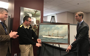
Capt. Skip Theberge (NOAA ret.), Rear Adm. Shepard Smith,
and Rear Adm. Tim Gallaudet (USN ret.), unveil the newly
restored Pathfinder painting.
Last week, the NOAA Central Library
unveiled the newly restored painting,
Pathfinder, painted in 1899 by renowned maritime artist, Antonio Jacobsen. Included as part of the NOAA Central Library Rare Books collection, the painting is the oldest extant painting of a NOAA ancestor ship in the possession of NOAA. At the ceremony,
Rear Adm. Tim Gallaudet (USN ret.), NOAA assistant secretary of commerce for oceans and atmosphere, described the importance of hydrography to the nation, and the importance to preserving NOAA heritage.
Rear Adm. Shep Smith, director of NOAA’s Office of Coast Survey, offered appreciation for the officers on board the
Pathfinder, their mission, and the ship’s legacy. For more information, contact
Kristen.Crossett@noaa.gov.
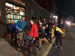
Coast Survey products and services demonstrated to Washington State Ferries and new NOAA leadership
Brandon Elsner, NOAA policy advisor; Polly Hicks, NOAA
Western Regional Center coordinator; LT Rachel Pryor,
NOAA; Doug Stough, WSF Captain; Lt. Cmdr. Olivia Hauser;
Rear Adm. Tim Gallaudet; Bill Torsen, WSF Captain; Bill
Hughes, WSF Captain.
In late January, PHB joined Rear Adm. Tim Gallaudet on a ferry ride with Captain Bill Hughes from Washington State Ferries (WSF). Lt. Cmdr. Olivia Hauser, PHB chief, provided Gallaudet with the history of PHB and the Hydrographic Systems and Technologies Branch (HSTB) and discussed NOAA Ship
Fairweather’s survey of Friday Harbor in support of the WSF system. Discussions among the participants included navigation in Puget Sound, ECDIS display units, and U.S. Coast Guard regulations. Thank you to PHB for demonstrating the value of Coast Survey's products and services to new NOAA leadership and local stakeholders! For more information, contact
Olivia.Hauser@noaa.gov.
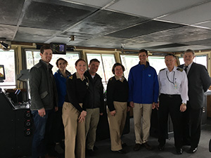
US/Japan Cooperative Program in Natural Resources meets in Honolulu
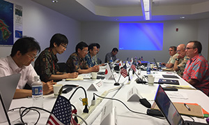
Rear Adm. Shep Smith, Capt. Andy Armstrong (NOAA ret.)
and Capt. Jim Crocker meet with representatives from Japan
at the UJNR Sea Bottom Surveys Panel in Honolulu.
Rear Adm. Shep Smith;
Capt. Andy Armstrong (NOAA ret.) and
Dr. Larry Mayer, co-directors of the NOAA/UNH Joint Hydrographic Center (JHC);
Capt. Jim Crocker, chief, Navigation Services Division (NSD);
Dr. Neil Weston, Coast Survey technical director; and
Jonathan Justi, Coast Survey international affairs specialist, attended the 45th meeting of US/Japan Cooperative Program in Natural Resources (UJNR) Sea Bottom Surveys Panel in Honolulu. In the meeting chaired by Rear Adm. Smith, Coast Survey reported on activities related to autonomous systems, standards, disaster response, and data visualization. This year, much of the focus was on charting and hydrographic surveys with valuable informal discussions on the distribution of ENCs. UJNR provides a continuing forum to promote the development and conservation of natural resources through cooperation in applied science and technology; improve the environment for present and future generations; and increase and enhance the bonds of friendship between the two nations. The Sea Bottom Surveys Panel, which focuses on hydrographic and ocean mapping technology and operations, is one of the most active of the UJNR panels. For more information, contact
Andy.Armstrong@noaa.gov.
Coast Survey helps with another successful NOAA Open House
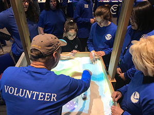
Doug Wood explains how the 3D sandbox works to young
volunteers.
Once again, Coast Survey's 3D sandbox was one of the popular attractions at the NOAA Open House this past Saturday. Coast Survey volunteers
Lorraine Robidoux,
Doug Wood,
Rachel Medley,
Melanie Feliciano,
Allison Witrock and
Lt. Cmdr. Matt Forney guided visitors through the process of creating mountains and making lakes in the sand while explaining the connection to our multibeam sonar technology. A few yards away,
Kristen Crossett,
Noel Dyer,
Heather Gilbert, and
Jesse Murphy explained how the old printing press works. In total, over 1000 people visited the open house, and for many, it was their first time. For more information, contact
Lorraine Robidoux@noaa.gov.
Recreational boating discussed with BoatUS
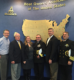
David Kennedy, BoatUS Government Affairs; Rear Adm. Sam
DeBow (NOAA, ret.); Rachel Medley; Rear Adm. Shep Smith;
Chris Edmonston, president of BoatUS Foundation for Boating
Safety and Clean Water; Capt. Jim Crocker.
On January 23, the Coast Survey's
Rear Adm. Shep Smith,
Capt. Jim Crocker,
Rear Adm. Sam Debow (NOAA, ret.), and
Rachel Medley, NSD Customer Affairs Branch chief, met with several representatives from BoatUS and BoatUS Foundation at their Alexandria, Virginia, offices to discuss recreational boating opportunities and challenges. Rear Adm. Smith spoke to the group about the National Charting Plan and re-scheming efforts. Coast Survey agreed provide educational materials to BoatUS Foundation's educational curriculum for its members and articles for the BoatUS magazine publication and social media pages. This will help Coast Survey's outreach efforts to the recreational boathing community to better understand their needs. Currently, BoatUS has over 500,000 recreational boaters members. For more information, contact
Rachel.Medley@noaa.gov.
Annual East Coast Advanced Hydro Training
The Annual East Coast Advanced Hydro Training, organized by HSTB, is currently in progress at the Atlantic Hydrographic Branch (AHB) in Norfolk, Virginia. In attendance are hydrographers from NOAA Ship
Thomas Jefferson, navigation response teams, and AHB staff. The topics covered include CARIS updates, CUBE review, backscatter theory and processing, and vertical datum transformation. For more information, contact
Cmdr. Briana.Welton@noaa.gov.
NOAA Ships
NOAA Ship Ferdinand R. Hassler - Alongside in New Castle, New Hampshire.
NOAA Ship Thomas Jefferson - Alongside in Norfolk, Virginia.
NOAA Ship Fairweather - Alongside in Newport, Oregon.
NOAA Ship Rainier - In Portland, Oregon, for its repair period.
Navigation Response Teams
NRT 1 - Team is in Mobile, Alabama. Boat is survey and response ready.
NRT 2 - Team is in Fernandina Beach. Boat is survey and response ready.
.
NRT 4 - Team is in Galveston, Texas. Boat is survey and response ready.
NRT 5 - Team is in New London, Connecticut. Boat is survey and response ready, prepping for U.S. Coast Guard survey request.
Bay Hydro II - Bay Hydro II is survey and response ready.
Contractor Operations
Leidos - Demobbed, acquisition complete.
Oceaneering - Demobbed, acquisition complete.
David Evans and Associates - Surveys of Mississippi Sound and vicinity completed.

Staff Updates
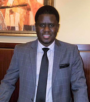
Jafnar Gueye.
Please welcome
Jafnar Gueye, the newest member of the budget team on Coast Survey’s Resource Management Staff. Jafnar is a budget analyst and will be coordinating contracts across the office, digging into some long overdue budget analysis projects, and will be the office’s new property accountability officer. Jafnar obtained his master’s degree in economics at Virginia Commonwealth University, after which he taught economics for several years. After a serving on active duty in the Army as a senior logistician for a special operations unit, he briefly was a financial manager with the Air Force before coming to NOAA. Jafnar comes to us from the Coast Survey Development Lab (CSDL), where he was the division’s administrative officer for close to the past two years. Jafnar is currently working on his MBA.

Scott Sherman.
Scott Sherman started in CSDL as the project and portfolio manager. Scott previously served in this role on detail, and we are happy to have him aboard permanently. Scott is a dedicated public servant with over 13 years in the federal government. He spent four years in Marine Chart Division, and then nine years in NSD where he worked on Coast Pilot as well as the program requirements process. Scott holds a bachelor's degree in geography and computer cartography, with minors in computer science and astronomy. He also has a masters certificate in project management. Scott's primary function will be overseeing the entire Coast Survet project and portfolio management (PPM) process, including the project review board and model advisory board.
Martha Hertzog is detailed as HSD's Operations Branch team lead. Martha is a physical scientist that recently transferred to HSD’s Operations Branch from PHB.
Glen Rice is detailed as HSD’s National Bathy Source team lead at the UNH Center for Coastal and Ocean Mapping (CCOM) Joint Hydrographic Center. Glen is a physical scientist who works for CSDL's HSTB.
Awards and Recognitions
Dr. Larry Mayer.
Congratulations to
Larry Mayer, director of the CCOM and co-director of the NOAA/UNH JHC for his
election to the National Academy of Engineering. Larry is recognized for his development of techniques and technologies for coastal, Arctic, and ocean floor mapping. Election to the National Academy of Engineering is among the highest professional distinctions accorded to an engineer. Academy membership honors those who have made outstanding contributions to "engineering research, practice, or education, including, where appropriate, significant contributions to the engineering literature" and to "the pioneering of new and developing fields of technology, making major advancements in traditional fields of engineering, or developing/implementing innovative approaches to engineering education."