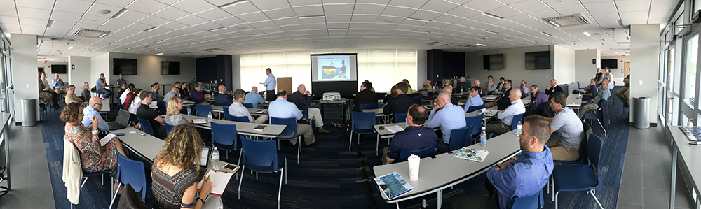
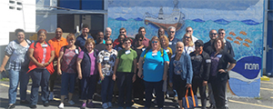
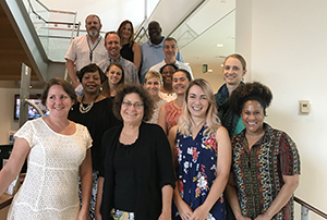
Coast Survey hosts Congressional Staff on Bay Hydro II
Christie Fandel, acting Customer Affairs Branch chief,
explains multibeam sonar to the Delaware-based
Congressional staff.
Coast Survey recently hosted Delaware-based congressional staff from Senator Coons, Senator Carper, and Representative Blunt Rochester on board Bay Hydro II for a tour and demonstration of multibeam sonar on the Delaware Bay. Bay Hydro II crew,
Lt. j.g. Sarah Chappel,
Rob Mowery, and
Mike Davidson (augmenting), educated the visitors about the science and objectives of the Coast Survey mission. Coast Survey HQ staff,
Rachel Medley,
Dr. Erica Towle, and
Christy Fandel, discussed innovative changes to the Coast Survey program, including the National Charting Plan, unmanned systems initiatives, and precision navigation and its value to the U.S. economy. Coast Survey HQ staff also had the opportunity, facilitated by Senator Coons’ staff, to meet with the University of Delaware Robotic Discovery Lab at their Lewes-based campus and learn about the innovative applications and approaches they are taking toward the maturation of unmanned vessel technologies. Coast Survey staff also spoke with graduate and undergraduate students and interns in the robotics lab about career paths and opportunities within NOAA and Coast Survey. . For further information please contact
Erica.Towle@noaa.gov.
Coast Survey Development Lab leads GIS training workshop at UNH
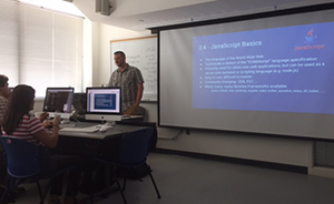
Jason Greenlaw leads training workshop at UNH.
Coast Survey Development Lab’s
Jason Greenlaw developed and ran the National Weather Service (NWS) Web Resiliency Interactive Web Based GIS Training at UNH last week. The purpose of the workshop was to ensure all members of the NWS D20 team have a common GIS web mapping knowledge base from the back-end server infrastructure to the front-end client applications. The NWS D2O team is a group of NWS employees interested in working together to develop a common mapping framework for use across the NWS. The workshop consisted of presentations, discussions, and hands-on software exercises. A variety of topics were covered, including basic GIS web mapping concepts, map service standards/protocols and their usage, back-end system architecture, scalability concepts, JavaScript, source code version control, and data manipulation. For further information please contact
Jason.Greenlaw@noaa.gov.
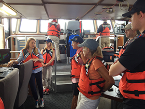
High school educators learn about Coast Survey and the maritime industry
Educators participate in tour of the maritime industry.
Lt. Ryan Wartick, Mid-Atlantic navigation manager, met with high school teachers and counselors on a tour of the maritime industry hosted by SMART (Southeast Maritime and Transportation Center).
Lt. Wartick, along with
Lt. j.g Kristin Johns and
Lt. Joseph Carrier presented Coast Survey's mission along with NOAA Corps and civilian job opportunities. The educators were very interested to learn about Coast Survey and excited about the prospect of having NOAA talk directly to some of their students/classes in the future. For more information contact
Ryan.Wartick@noaa.gov.
Coast Survey team supports NMFS FISHCon
Sample of one of four posters Coast Survey printed for
FISHCon 2017.
Thanks to the efforts of
Jennifer Walden with assistance from
Rick Powell,
Steve Soherr, and
Sean Legeer, National Marine Fisheries Service had four beautifully plotting posters for their training convention, FISHCon 2017.
"The time and effort you put into printing these posters for us - and your attention to detail, including assisting us with formatting and even printing some posters multiple times until they were “just right” – is truly appreciated. Your efforts helped us get our message out to our co-workers across the country about the work done here in Silver Spring and contributed to the overall success of FISHCon. Thank you for supporting “one NOAA!” - Kelly Denit, supervisory fishery management specialist in Domestic Fisheries Division. For more information contact
Jennifer.Walden@noaa.gov.
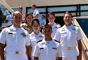
Change of command for NOAA Ship Rainier
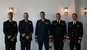
Cmdr. Benjamin Evans, Capt. Jeffery Good (CO USCG Base
Kodiak), Cmdr. Daniel Rogers (XO USCG Base Kodiak),
Cmdr. John Lomnicky, and Cmdr. Michael Levine (CO NOAA
Ship Oscar Dyson), together after the ceremony.
In late July, the crew of NOAA Ship
Rainier hosted a change of command ceremony while at the United States Coast Guard Base Kodiak, Alaska.
Commander Ben Evans accepted command of
Rainier, relieving
Commander John Lomnicky in a ceremony led by
Captain Keith Roberts, commanding officer of NOAA’s Office of Marine and Aviation Operations (OMAO) Marine Operations Center-Pacific. Commander Lomnicky served as Rainier’s executive officer for two years prior to taking command in January 2017. Although Commander Lomnicky led Rainier for only six months, the ship’s crew completed 25 percent of the total survey mileage from the last four years while under his command. Commander Evans reported to
Rainier from Coast Survey’s Pacific Hydrographic Branch in Seattle, Washington, where he led NOAA’s hydrographic data quality review and chart update compilation for the West Coast. Read more on our
blog. For more information contact
Michelle.Levano@noaa.gov.
NOAA participates in the Boy Scouts of America National Jamboree
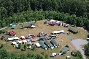
Aerial view of the USCG/NOAA joint exhibit at the
Boys Scouts of America National Jamboree.
The U.S. Coast Guard (USCG) invited NOAA to participate in a joint task force at the Boy Scouts of America National Jamboree. Volunteer representatives from USCG active and reserve, USCG Auxiliary, USCG civilian workforce, and NOAA Corps created a large-scale exhibit to inform young men, young women, and adult leaders about the services that USCG and NOAA provide to the nation. Coast Survey’s
Lt. Matt Forney and National Marine Fisheries Service’s
Lt. Cmdr. Chris Skapin represented NOAA Corps, and
Cmdr. Ed Martin (NOAA ret.) former Coast Survey Customer Affairs Branch chief, represented the USCG Auxillary. The discussions with visiting scouts focused on fisheries management and enforcement; nautical charting, navigation, and buoy deployment; and oil spill response and clean-up. The augmented reality sandbox provided the scouts with an interactive experience while learning the basics of bathymetric surveying. Read more on our
blog. For more information contact
Matthew.Forney@noaa.gov.
Coast Survey takes part in “Applying the Science of Where”
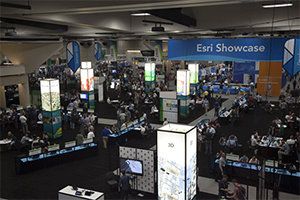
The 2017 Esri Showcase.
Coast Survey Development Lab's
Wil Battle and
Jim Hawks, and Marine Chart Division's
Carson Gray and
Noel Dyer connected with over 16,000 other GIS users at the world's largest GIS conference held in San Diego, CA, July 10-14. Over the 4-day event, Wil took advantage of the many training sessions learning the latest innovations in GIS technology from Esri subject matter experts that will benefit Nautical Chart System II. Jim spent time gaining knowledge on the latest advancements in Esri Server implementation that will support the many products and service Coast Survey provides. Carson and Noel took in the hundreds of unique learning experiences, gaining a better understanding of data reviewer and smart mapping, to user demonstrations and industry presentations in 3D Virtual Reality. Esri has posted the opening plenary sessions and other inspiring stories so that you too can experience “
The Science of Where” in action. For more information contact
James.Hawks@noaa.gov.
NOS Equal Employment Opportunity, Diversity and Inclusion Advisory Council meets to develop action plan
Members of the NOS Equal Employment Opportunity,
Diversity and Inclusion Advisory Council.
Members of the NOS Equal Employment Opportunity, Diversity and Inclusion Advisory Council (NEDAC) met to establish an action plan that will guide the council in its efforts to increase diversity and inclusion within our organization. This meeting marks the first time the council has convened in person since 2014. The council had three main objectives for its meeting: 1) begin to work as an effective team; 2) identify priorities through December 2018; and 3) develop a plan for achieving identified priorities. The action plan aligns with the NOAA and NOS diversity and inclusion plans, which will help streamline efforts throughout the organization. The NEDAC is chaired by Nicole R. LeBoeuf, deputy assistant administrator for the ocean services and co-chaired by Michelle A. Crockett, national program manager, EEO and Diversity. All program offices of NOS are represented by two staff members. Coast Survey representatives are
Justin Adams and
Amanda Phelps. For more information contact
Amanda.Phelps@noaa.gov.
Rear Adm. Shep Smith elected to chair the IHO Council
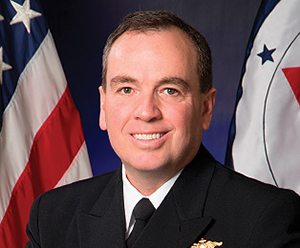
Coast Survey Director and IHO Council Chair, Rear Adm.
Shep Smith.
Coast Survey Director
Rear Adm. Shep Smith was elected to chair the
IHO Council. Established in November 2016, the council is composed of 30 leading IHO member nations and functions much like a corporate board of directors, overseeing performance management and the business side of the IHO. The council will bring regular executive-level focus to the needs of today’s changing global hydrographic environment. By securing this position, NOAA will be able to ensure coordination between U.S. charting and surveying efforts and the global hydrographic mission. Read more on our
blog. For more information contact
Jonathan.Justi@noaa.gov.
National Naval Officers Association (NNOA) symposium, a great mentoring experience
Lt. Ryan Wartick, Rear Adm. Lopez, Lt. j.g Hollis Europe, Lt. j.g
Casey Marwine, Lt. j.g Kristin Raja, and Cmdr. John Crofts at
the National Naval Officers Association 45th annual leadership,
professional development, and training symposium.
Six NOAA Corps officers, including Coast Survey’s Mid-Atlantic navigation manager,
LT Ryan Wartick, attended the 2017
National Naval Officers Association (NNOA) 45th annual leadership, professional development, and training symposium. Some of the nation’s most distinguished leaders, including NOAA’s Admiral Lopez and 22 other flag officers, led discussions on "developing leaders through education, experience, and personal development," which was the theme of this year’s symposium. Discussions also touched on how to best represent our nation’s diversity within the ranks. This year's symposium set itself apart from years past with dedicated mentoring time and events. It was a very rare opportunity to have great mentoring discussions with many very experienced officers, from all the represented branches. For more information contact
Ryan.Wartick@noaa.gov.

NOAA Ships, Navigation Response Teams, and Contractors:
NOAA SHIP FAIRWEATHER
NOAA Ship Fairweather successfully conducted reconnaissance surveys in support of satellite-derived bathymetry products in the western approaches to the Yukon River.
NOAA SHIP RAINIER
NOAA Ship Rainier continues to work in Cold Bay and Deer Passage areas on the southside of the Alaska Peninsula with interspersed in ports in Kodiak, AK. Congrats to Cmdr. Lomnicky for his successful time as CO of the Rainier and welcome to Cmdr. Evans.
NOAA SHIP FERDINAND R. HASSLER
NOAA Ship Ferdinand R. Hassler wrapped up being alongside in Baltimore, MD, for their scheduled repair period. On August 15 Hassler arrived in Norfolk, VA, to start gearing up for the approaches to Jacksonville, FL.
NOAA SHIP THOMAS JEFFERSON
NOAA Ship Thomas Jefferson completed a benthic habitat mapping project in conjunction with the NE Fisheries Science Center on Georges Bank to identify deep water corals. They collected nearly 900 LNM of data with their new EM 710 multibeam echo sounder. The crew enjoyed some needed rest and relaxation in Boston, MA, and are now headed to Savannah, GA, to begin survey work there.
CONTRACTORS
Fugro Pelagos Inc.
Fugro continues hydrographic survey operations in East Penobscot Bay, Maine. They have completed the lidar operations of this project. They are currently making good progress on survey operations while ensuring no entanglement with fishing gear.
Ocean Surveys, Inc.
Ocean Surveys, Inc. continues survey operations near Trinity Shoal in the Gulf of Mexico and Intracoastal City, LA.
Terrasond
Terrasond continues operations in the vicinity of Pavlof Islands in Alaska. They are wrapping up operations this week with demobilization occurring next week.

Staff Updates
LT Bart Buessler joined the Customer Affairs Branch as the Alaska Navigation Manager from NOAA Ship Fairweather. Welcome LT Buessler!
LT David Vejar is the incoming Northeast Navigation Manager and joins the Customer Affairs Branch from NOAA Ship Reuben Lasker. Welcome LT Vejar!
Nia Matsumoto joined HSD Operations Branch for the summer through the Greening Youth Foundation. A student at The Ohio State University, Nia worked on a communications plan for the Hydro Health (HH) model and National Hydrographic Survey Priorities (NHSP), with an eye to both our traditional stakeholders as well as a broader look at other stakeholders we don’t typically message directly to. Nia’s internship ended on 8/4, but she expressed that she had an outstanding time and is already looking forward to working for NOAA again in the future.
Joe Wyllie returns to HSD Operations Branch again this summer, after a very successful internship last year. This year he has been tackling assorted small coding and documentation tasks like how to mask out sensitive wrecks from the data so we don’t have to embargo entire surveys and automated generation of disproval radii around features for the supporting files send to the field units. His main project has been helping to move the HH model from its current functional but still prototype stage into a sustainable production status.
Casey Joseph is a Pathways intern joining HSD Operations Branch for the first time this summer. His projects are mostly tied to validating the initial datasets used for the HH model. He has been working on improving the depth layer (fundamental to risk as an input to determining under keel clearance) and working with Joe Wyllie on pulling the initial survey type from old DRs where metadata doesn’t otherwise exist, a key input for knowing how well we know the seafloor.
Chelsea Proctor is a Pathways intern with HSD Operations Branch for the first time. She is working on defining the extents of major ports, specifically in the context of what area would need resurveying if we said a given port needed to be resurveyed. Previous port layers included non-navigable waters, marshland, and sometimes a buffer on land to incorporate the harbor facilities. To know the level of effort and investment needed to resurvey the major ports of the United States on an appropriate refresh cycle, we need to know how much work each port takes, and how often a given port should be resurveyed. Chelsea’s project directly answers the first, and provides one of the needed datasets for conducting change analysis and assessment for the ports.
Stephen Maldonado is a Joint Institute for the Study of Atmosphere and Ocean (JISAO) summer intern with HSD's Pacific Hydrographic Branch. His project for the last nine weeks was to create a portable wizard that will capture important external source data (ESD) metadata from the source provider and will automatically calculate a rough level of confidence of the data based on the answers provided to the wizard. The wizard operates in Python for future upgradability and will export a machine-readable report for aiding in automating the ESD ingestion process.