Joint Hydrographic Center completes mapping mission in Northwest Hawaiian Islands and adjacent waters
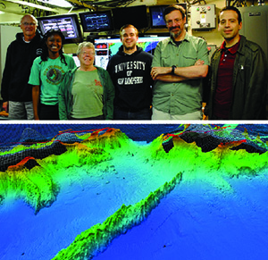
Top image: Andy Armstrong, Tiziana Munene, Joyce Miller,
Brandon Maingot, Brian Calder, and Giuseppe Masetti. Bottom
image: Seafloor structure revealed by multibeam mapping.
Necker Ridge is in the foreground; Necker Island and French
Frigate Shoals (wire frame) are in the background.
This week, a 6-person team from the Joint Hydrographic Center (JHC) and Center for Coastal and Ocean Mapping (CCOM) completed a 37-day ocean mapping mission to the
Papahānaumokuākea Marine National Monument in the
Northwest Hawaiian Islands and adjacent waters southwest of Necker Island (Mokumanamana). The mission aboard the UNOLS research vessel RV
Kilo Moana is in support of the U.S. Extended Continental Shelf Project and in collaboration with the
NOAA Office of Ocean Exploration and Research.
Andy Armstrong is leading the mission as chief scientist, with
Dr. Brian Calder of CCOM/JHC as co-chief scientist.
Dr. Giuseppe Masetti, this year’s NOS Team Member of the Year award recipient, and
Joyce Miller, Hawaii-based multibeam expert and incoming chair of the Hydrographic Services Review Panel, are senior scientists on the team. CCOM/JHC graduate students
Tiziana Munene and
Brandon Maingot are serving as watch standers and data processers.
The survey, which junctioned with earlier CCOM/JHC and Ocean Exploration surveys, completed 8,100 lineal nautical miles of sounding line and 40,050 square nautical miles of full-bottom coverage multibeam mapping, along with continuous high resolution sub-bottom profiles along all the survey lines. The mapping data collected on this project will help establish whether the U.S. has an extended continental shelf in this area, and if so, what the limits of that extended shelf might be. The survey will also provide new high resolution data for the nautical charts, replacing in many areas, soundings and depth contours based solely on sparse track-line soundings.
For more information, contact
Andy.Armstrong@noaa.gov.
Coast Survey visits Stennis, Mississippi, with Rear Adm. Gallaudet
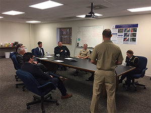
Rear Adm. Gallaudet, Capt. Crocker, Cmdr.
Lomnicky, NRT 1, and NOAA staff, meet with TJ Moran from
Senator Palazzo’s office to discuss the 2017 hurricane
response and future survey plans within the region.
On December 14,
Capt. Jim Crocker, Navigation Services Division (NSD) chief,
Cmdr. Jay Lomnicky, NSD's Navigation Response Branch (NRB) chief, and
Tim Osborn, central Gulf coast navigation manager, traveled to Stennis, Mississippi, to join
Rear Adm. Gallaudet, assistant secretary of commerce for oceans and atmosphere, and meet navigation response team (NRT) 1. The team, led by
Lt. Cmdr. Jonathan French, highlighted their 2017 hurricane response efforts in Corpus Christi and Houston, Texas, Miami and Key West, Florida, and Puerto Rico in response to hurricanes Harvey, Irma, and Maria. In addition, Rear Adm. Gallaudet was briefed on NRB’s mission with the regionally based teams, the mobile integrated survey team, and discussed Coast Survey’s plans to establish an operational autonomous vehicle team within NRT 1. This autonomous vehicle team will utilize autonomous surface vehicles and underwater vehicles like the Remus 100 and 600, to support survey requirements of Coast Survey and NOAA programs. Rear Adm. Gallaudet was highly engaged in the discussion and was impressed and appreciative of the extraordinary response effort by the teams in support of this past historic hurricane season. For more information, contact
James.M.Crocker@noaa.gov.
National Charting Plan presented to stakeholders at the Port of New York/New Jersey
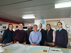
Allison Wittrock, Patrick Chauvet, John Nyberg, captain of the
ship Yang Ming Uniformity, Sandy Hook Pilots captains
Andrew McGovern and Mike Vanek, and Guillaume
Auclert.
During the week of December 4, four members of the Marine Chart Division (MCD), including
John Nyberg, chief,
Allison Wittrock, branch chief of the northeast region for MCD, Patrick Chauvet, and Guillaume Auclert, visited the Port of New York/New Jersey as part of the outreach plan for the upcoming chart re-scheming effort in New York. While visiting the port, the team rode along on a large container ship with the Sandy Hook Pilots, toured the U.S. Coast Guard Command Center and the Vessel Traffic Service Center, and presented the National Charting Plan to the NY/NJ Harbor Operations Steering Committee. Thanks very much to NE Navigation Manager,
Lt. David Vejar, for arranging the visit!
For more information, contact
Allison.Wittrock@noaa.gov.
Advances in data collection and dissemination for navigation products
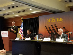
Capt. E.J. Van Den Ameele presents during eNavigation panel.
Capt. E.J. Van Den Ameele, chief of the Coast Survey Development Lab (CSDL),
Heather Gilbert, NOAA
CMTS policy advisor, and
Crescent Moegling, northwest navigation manager, participated in the
eNavigation conference in Seattle. Participants included representatives from regional and national pilots associations, shipping lines, navigation system manufacturers, and other government agencies such as U.S. Coast Guard and the Maritime Administration. The primary topics at the conference focused on automation and autonomy in marine navigation, maritime cyber security, and data and products needed for navigation. Capt. Van Den Ameele participated in a panel entitled, "Advances in Data Collection and Dissemination," where he discussed NOAA's role in supporting precision navigation, and the future of data dissemination in support of navigational requirements. For more information, contact
Edward.J.Vandenameele@noaa.gov.

NOAA Ships
NOAA Ship Ferdinand R. Hassler - Alongside in New Castle, New Hampshire.
NOAA Ship Thomas Jefferson - Alongside in Norfolk, Virginia.
NOAA Ship Fairweather - Alongside in Newport, Oregon.
NOAA Ship Rainier - In Portland, Oregon, for its repair period.
Navigation Response Teams
NRT 1 - Team is in Mobile, Alabama. Operations are suspended until the team's training is complete.
NRT 2 - Team is in Fernandina Beach, Florida. Vessel crossdeck is complete, boat is survey and response ready.
NRT 4 - Team is in Galveston, Texas. Vessel crossdeck is complete, boat is survey and response ready.
NRT 5 - Team is back in New London, Connecticut, after finishing two U.S. Coast Guard requests and is conducting tests with CSDL's Hydrographic Systems and Technology Branch for data improvement.
Bay Hydro II - Bay Hydro II has been hauled out of water for winter maintenance.
Contractor operations
Leidos - Demobbed, acquisition complete.
Oceaneering - Demobbed, acquisition complete.
David Evans and Associates - R/V Preston continues to survey the Mississippi Sound and vicinity.

Staff Updates
Rear Adm. Shepard Smith recently named
Capt. Elizabeth Kretovic as deputy hydrographer of NOAA’s Office of Coast Survey. As deputy hydrographer, Capt. Kretovic will focus on Congressional engagement, strategic planning, stakeholder engagement, and interagency coordination for Coast Survey. Capt. Kretovic comes to Coast Survey from NOAA Ship
Hi’ialakai where she just completed a successful command tour. Previously, she served as the executive officer of the Office of Response and Restoration’s Emergency Response Division, where she led the division through updating their annual operating plan, strategic planning, implementing lessons learned from the Deepwater Horizon oil spill, as well as the interagency and intra-agency coordination of emergency response. A dedicated NOAA Corps officer for nineteen years, Capt. Kretovic recently completed NOAA's Leadership Competencies Development Program (LCDP) in January 2016. While in LCDP, she completed assignments in NOAA's Workforce Management Office, and also as a senior adviser to the deputy undersecretary of operations where much of her focus was on leading organizational change. With over 9 years of sea duty, Capt. Kretovic served two tours aboard NOAA Ship
Ronald H. Brown, and began her seagoing career aboard NOAA Ship
David Starr Jordan.
LT Matthew Forrest joined Hydrographic Surveys Division (HSD) Staff last month and is focusing on HSD’s Hydrographic Training Program and updating the Field Procedures Manual (FPM). LT Forrest comes from NOAA Ship
Thomas Jefferson, where he served as operations officer and, among other work, was directly involved in the deployment of
TJ's Z-Boats (for which he was qualified as pilot), shifting the ship and launches to a fully real-time precise positioning solution, and overseeing integration of two new multibeam echo sounders, two new launches, and a new side scan. Welcome, Matt!
Pearce Hunt is retiring from the MCD after 44 years of service. Pearce worked on nautical charts covering different parts of the country including the Gulf coast, southeast, mid-Atlantic, northeast Atlantic, and Great Lakes. Pearce also worked on MCD production software and helped write associated SOPs, as well as the Total Quality Management manual. Pearce’s ability to stay current with technology over several decades enabled him to teach others. This has been critical to how MCD trains employees.
Dan Black is retiring from the MCD after 27 years of service. Dan created one of the first charts using Microstation: 12280 Chesapeake Bay North and South. This chart is an important part of MCD history, representing the transition from pen and ink to digital cartography. Dan received a group Bronze Medal in 2001 for developing and implementing the weekly Update Service for raster charts and another in 2002 for developing and implementing a radical improvement in navigation information provided to the public. Dan was also instrumental in loading Coast Survey’s electronic navigational charts into the nautical information system database.
Louis Angelos is retiring from the MCD after 27 years of service. Louis started at MCD in 1991 at the Rockville location. Originally hired to perform lithographic and engraving functions, Louis later became a cartographer where he compiled source using the old pen and ink method, and then worked on the transition from manual to automated cartography. He was also involved in making several new charts. In his career in MCD, Louis has been a quiet leader on his team.
View of Anacortes, Washington.
After over 30 years in the federal government as a physical scientist/project manager/supervisor in which he has seen the world with positions in the United States Air Force and Navy, to most recently as the chief of the Geospatial Applications Development Branch the past 8 years, it’s time for
Kurt Nelson to return to the Pacific Northwest. He has accepted a position as the Skagit District Executive with the Boy Scouts of America. He is also in the process of having a home built in Anacortes, Washington, where he and his wife, Nancy, plan on putting down long-term roots in the community. It’s been an exciting journey developing new products and services as part of the Coast Survey Development Laboratory. Thanks for the memories!
Awards
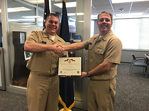
Capt. Crocker (right) presents award to Matt Forney (left).
At this week's senior staff meeting, Capt. Jim Crocker presented
Lt. Cmdr. Matt Forney with a NOAA Corps Achievement Medal. Lt. Cmdr. Forney received this honor for outstanding service and exceptional management as the acting Navigation Manger of Alaska while providing essential continuity of operations to stakeholders and customers both internal and external to NOAA.