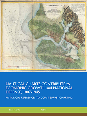
New resource provides Coast Survey charting history through WWII
What was really Coast Survey's first chart? What did the President of the Confederate States of America (in his role as U.S. Senator) say about Coast Survey? How did our charts help protect Alaska's fur seals or aid in the commercial development of California's lumber industry? How did we help prepare a nation for three wars? A new historical resource, "
Nautical Charts Contribute to Economic Growth and National Defense, 1807-1945," is now available on Google Drive. This 80-page collection of historical charting vignettes is a quick introduction to the role your predecessors played in the nation's geopolitical events, and proves the necessity of charts in maintaining U.S. growth and stability. Besides that, it's a fun read for the chart history nerds among us! A tremendous thank you to
Dawn Forsythe who compiled this resource!
Coast Survey plays role in U.S. Coast Guard environmental threats exercise
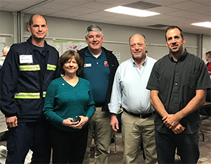
From left to right: LT Ryan Wartick, Aleta Hohn, Director of
NMFS Programs, NOAA Beaufort Laboratory, SE Fisheries
Science Center; Scott Kennedy, meteorologist at NWS
Newport/Morehead City; Frank Csulak, Scientific Support
Coordinator at NOAA; Tom Lonka, meteorologist at NWS
Newport/Morehead City.
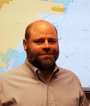
LT Ryan Wartick, Mid-Atlantic navigation manager, recently participated in the U.S. Coast Guard’s remediation of underwater legacy environmental threats (RULET) exercise. The Coast Guard developed RULET as part of their all-hazard response plan to an actual spill. Last year, RULET was a tabletop exercise and this year it was a full functional exercise with a unified command. Lessons learned from this year's experience will be used to develop a full-scale exercise next year with actual field operations and boats in the water. There was great coordination between the Coast Guard and the stakeholders including NOAA Office of Response and Restoration, National Weather Service, Office of National Marine Sanctuaries, National Marine Fisheries Service, and Coast Survey. Other participants included North Carolina Department of Transportation, state underwater archaeology, U.S. Marine Corps emergency response, commercial divers, and others.
Coast Survey participates in U.S. Coast Guard Industry Day in Baltimore
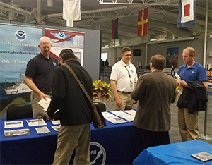
Darren Wright and Steve Soherr staff the NOAA booth at the
U.S. Coast Guard Industry Day in Baltimore.
Earlier this month,
Steve Soherr, Chesapeake and Delaware Bay navigation manager,
Andy Kampia, acting chief of Navigation Services Division’s Customer Affairs Branch, and
Darren Wright, Center for Operational Oceanographic Products and Services, represented NOAA at the U.S. Coast Guard Industry Day in Baltimore. The event was attended by several other federal agencies including Customs and Border Protection, TSA, Immigration and Customs Enforcement, and the Secret Service, with topics based primarily around port security. The Coast Survey team met several local Coast Guard personnel and shared information on NOAA’s products and services as well as the draft
National Charting Plan.
Hydrographic Services Review Panel convenes in Seattle
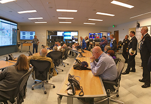
HSRP participants attend a presentation at the Holland
America Operations Center.
Last week, the Hydrographic Services Review Panel (HSRP), met in Seattle for their biannual meeting. Coast Survey heard from both HSRP members and NOAA participants that this was the best HSRP meeting they have attended and enjoyed the opportunity to have more time for dialogue with the NOAA programs. While on a field trip to the U.S. Coast Guard and the Holland America Operations Center, participants saw how a fleet runs for 365 days a year with three years between dry dockings. Additionally, HSRP members were asked to give comments on Coast Survey strategic documents: National Charting Plan, External Source Data (ESD), Autonomous Systems Roadmap, and the Coast Survey Ocean Mapping strategy. HSRP members will provide feedback on the National Charting Plan shortly and thought it was a very comprehensive document. There was also unanimous enthusiasm for the ESD policy of "charting the best available data." While embraced in principle, there was interest to know how that would work in practice. For further information on this panel, recent agenda, and presentations please visit the
HSRP public website.
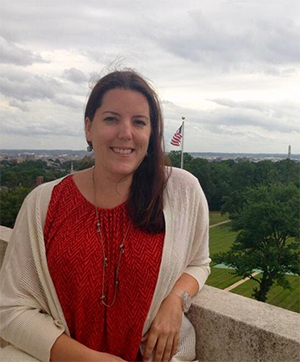
Coast Survey leadership meets with Washington state congressional staff
Capitalizing on their time in downtown Seattle during the HSRP meeting,
RDML Smith,
Crescent Moegling (Pacific Northwest navigation manager), and
Rachel Medley, acting deputy hyrdrographer, met with congressional staffers from both Senator Murray and Senator Cantwell's offices. Both meetings focused on NOAA navigation services in Washington state—highlighting operations and personnel at the Hydrographic Surveys Division's Pacific Hydrographic Branch, relationships with the Port of Seattle/Tacoma, navigation response team 3 homeporting activities, and public/private partnerships with Washington-based maritime businesses. Because of these initial discussions, representatives from Senator Murray’s office attended opening day discussions at the HSRP—excited to learn more from the meetings about NOAA navigation services and the role they plan in safe and effective navigation around the country.
Marine Chart Division’s evaluation of USACE’s eHydro presented at recent conference
Sean Legeer recently attended the
eHydro standard operations meeting in Mobile, Alabama. eHydro is the U.S. Army Corps of Engineers (USACE) project to consolidate all hydrographic survey data being produced by the USACE 22 districts into one geospatial portal. This portal will become the one place the public and stakeholders could go to acquire official USACE survey information. This project standardizes all of the 22 districts survey information. Sean's presentation focused on MCD's testing and evaluation of eHydro. MCD would like to use eHydro for all of the survey information that is required to update charts. Thank you to
Chris LiBeau (MCD’s Army Corps liaison) for preparing the presentation.
NOAA IOCM, USACE, and Coast Guard host 3rd installment of Regional Coastal Mapping Summits in the Great Lakes
The Great Lakes Coastal Mapping Summit was held at the USACE Chicago District in Chicago, IL April 4-6.
Ashley Chappell, coordinator of the
Integrated Ocean and Coastal Mapping Program (IOCM), led a lively and robust three days session with over 100 participants from federal and state agencies, regional/local authorities, academia, the private sector, non-governmental groups, and others to share data needs and explore opportunities for collaboration on coastal mapping data acquisitions and applications in the Great Lakes region.
Sasha Pryborowski, IOCM deputy coordinator, facilitated the many sessions and provided the big picture outlook needed to bring several states together with differing priorities.
Tom Loeper, chief of Coast Survey’s Coast Pilot Branch, gave a presentation on current issues and needs of the region’s maritime industry. Outcomes of particular interest to Coast Survey include work to get Beaver Island data up to IHO standards for application to nautical charts in NE Lake Michigan and the start of a cross-agency conversation between Coast Survey, National Park Service (NPS), and Coast Guard to use recent NPS data to produce a safer channel for Middle Island passage on Isle Royale in Lake Superior. A summary of the Summit and presentations will be made available on the IOCM website.

Staff Updates
Congratulations to
Amanda Phelps and
Justin Adams, who have been selected as Coast Surveys representatives to the NOS Equal Employment Opportunity, Diversity and Inclusion Advisory Council (NEDAC). The NEDAC is a permanent advisory body that provides recommendations to the NOS assistant administrator to sustain the organization’s vision of a safe, welcoming, nurturing, and professionally challenging work environment for our entire workforce and serves as a forum to discuss diversity-related issues, share ideas and information on Equal Employment Opportunity related policies, diversity and inclusion matters, and sponsor and collaborate on diversity and inclusion initiatives.
Justin Adams is stepping up to handle the responsibilities of Acting Chief, Production Branch A (Alaska, and Lakes Superior, Michigan, and Huron) in the Marine Chart Division for all of May and June. He is relieving
Eric Wallner, who filled that role admirably for the last two months.
Awards
Congratulations to LCDR Meghan McGovern for recently receiving the NOAA Corps achievement medal. LCDR McGovern received the honor for unfailing commitment and exemplary customer service to the New England maritime community. She worked with commercial and recreational maritime partners to improve NOAA Coast Survey products and services through stakeholder interaction and superior knowledge of NOAA products. She met the needs and demands of the maritime community with initiative, thorough requirements gathering, and persistence—providing a superior NOAA Coast Survey product to customers.