Coast Survey attends U.S. Hydro 2019 Conference
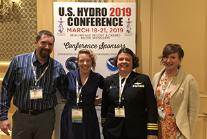
Peter Holmberg, Tyanne Faulkes, Cmdr. Olivia Hauser, and
Annie Raymond at the U.S. Hydro Conference.
Coast Survey had a strong showing at the U.S. Hydro 2019 Conference last week in Biloxi, Mississippi. The following is a list of presentations authored or co-authored by Coast Survey that were given during panel, speaker, lightning round, and poster sessions. Feel free to contact the presenters for further information on their topic(s):
Glen Rice - The National Bathymetry as Data
Kolleen Mortimer - Added Value to NOAA’s Bathymetry Products
Christos Kastisios - On the Effective Validation of Charted Soundings
Tyanne Faulkes - Hydrographic Survey Validation and Chart Adequacy Assessment Using Automated Solutions
Cmdr. Olivia Hauser - Publishing Survey Quality - CATZOC on the ENC - Effects Hydrographic Survey Efforts, Data Partnerships and Review Processes, and Blue Economy in U.S. Ports and Waterways
Noel Dyer - New Approach for Applying Bathymetry to the Chart
Christie Ence - From Pen and Ink Charts to ENC-First: Deriving Raster Products
John Doroba - Variable Resolution Operational Implementation
Julia Powell - Data Standards for Navigation Systems and Beyond – The World of S-100
Lt. Anthony Klemm - Operational use of Lidar Data for Field Hydrography: A Discussion of Challenges, Successes and Workflows
Lt. Cmdr. Nicholas Morgan - Using Historical Hydrographic Smooth Sheets to Assess the Validity of NOAA's Office of Coast Survey's Hydro Health Model Decay Term
Lt. Damian Manda - Pydro and HydrOffice: Open tools for Ocean Mappers
Starla Robinson - Women in Hydrography Social
For more information contact
Lorraine.Robidoux@noaa.gov.
U.S.-Canada Hydrographic Commission meets
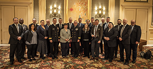
Members of the U.S.-Canada Hydrographic Commission.
Last week,
Rear Adm. Shepard Smith and
Dr. Geneviève Béchard, Director General - Hydrographer General of Canada, co-chaired the 42nd meeting of the
U.S.-Canada Hydrographic Commission (USCHC) together with colleagues from Navy, National Geospatial-Intelligence Agency (NGA), University of New Hampshire, THSOA, Canada Hydrographic Service, Defense Canada, and the
International Hydrographic Organization (IHO). Primary topics of discussion included harmonizing respective electronic navigational charts rescheming plans under which Canada will reduce the number of scales to three and the U.S. to six; coordinating seamless delivery of S-100 based services for transboundary areas; aeronautical and hydrographic surveying; personnel exchange; overall coordination with the technical working groups of the IHO on such matters as crowdsourced bathymetry, Seabed 2030 initiative, and others. The 43rd meeting of the USCHC will be in Quebec City in conjunction with Hydro Canada the week of February 23, 2020.
For more information contact
Jonathan.Justi@noaa.gov.
Women in Hydrography event focuses mentoring and networking
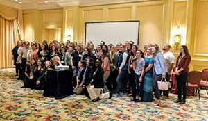
Members of the Women in Hydrography group at the U.S.
Hydro 2019 Conference.
The most recent Women in Hydrography social was held at the U.S. Hydro 2019 Conference. Overall, 70 participants and 17 volunteers attended the event. Women in Hydrography seeks to support and empower the next innovative generation of women in the hydrographic workforce. Through socials, the group raises awareness of the unique challenges women face in the hydrographic industry and the power of mentoring to further women's careers. Thank you to the event sponsors and volunteers that made it possible. For more information or if you are interested in participating contact
Starla.Robinson@noaa.gov.
NOAA furthers partnership with U.S. Coast Guard Sector San Juan in Puerto Rico
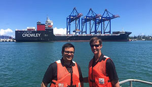
Louis Licate and Rear Adm. Timothy Gallaudet (USN, Ret.) in
San Juan, Puerto Rico.
On March 15, the South Florida, Puerto Rico, and U.S. Virgin Islands Navigation Manager,
Louis Licate, accompanied Assistant Secretary of Commerce for Oceans and Atmosphere,
Rear Adm. Timothy Gallaudet (USN, Ret.), on a visit to the U.S. Coast Guard (USCG) Sector San Juan. The purpose of this visit was to expand the USCG-NOAA partnership. The group discussed updates to NOAA Ship
Thomas Jefferson's response efforts and how NOAA serves the charting needs of Puerto Rico and U.S. Virgin Islands. For more information contact
Louis.Licate@noaa.gov.
Columbia River Pilots visit NOAA to learn about NOAA survey data
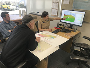
Tim Wilkinson (left) and Lt. j.g. Michelle Levano (right) brief
Capt. Patching.
On March 19, Captain Charles "Chuck" Patching of the
Columbia River Pilots visited with Pacific Hydrographic Branch's
Grant Froelich, Pacific Northwest Navigation Manager
Crescent Moegling, and
Lt. j.g. Michelle Levano and
Timothy Wilkinson of NOAA's navigation response team. During his visit, Captain Patching learned about the life cycle of NOAA's survey data — from field collection and processing to branch review, attribution, and acceptance to publicly available data from
National Centers for Environmental Information (NCEI). The navigation response team discussed the data they collected on the
Columbia River from summer 2018 and their timeline for four more anchorages in 2019. For more information contact
Michelle.Levano@noaa.gov.
Standards for hydrographic surveys discussed in Wollongong, Australia
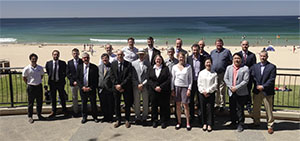
Members of the IHO Project Team on Standards for
Hydrographic Surveys.
Recently, the IHO Project Team on Standards for Hydrographic Surveys (HSPT) met in Wollongong, Australia, to update the
IHO S-44 Standards for Hydrographic Surveys 5th edition (published in February 2008) and to submit a proposal to the Hydrographic Services Standards Committee (HSSC) on whether the project team should continue as a standing working group. The HSSC established the team in December 2016 and they convened two meetings prior to Wollongong. Participants included representatives from international hydrographic offices and industry. The U.S. representatives included NOAA, the National Geospatial-Intelligence Agency, and the Naval Oceanographic Office. Key updates for the 6th edition will be setting the standards so they are sensor independent (i.e. applicable to multibeam, lidar, etc.) and expanding the standards for other disciplines other than safety-of-navigation surveys. The new standards will be conveyed through a matrix which is flexible for tasking and assessment and is expandable for emerging technology. For more information contact
Megan.Greenaway@noaa.gov.
NOAA hosts International Hydrographic Organization's Secretary General
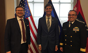
Dr. Mathias Jonas, Rear Adm. Timothy Gallaudet (USN, Ret.),
Rear Adm. Shep Smith.
Last week, IHO’s Secretary General
Dr. Mathias Jonas visited NOAA and Coast Survey headquarters, the
University of New Hampshire/Center for Coastal and Ocean Mapping (UNH/CCOM/JHC), NCEI in Boulder, and delivered one of the keynote addresses at the U.S. Hydro 2019 conference. Dr. Jonas saw firsthand NOAA’s hydrographic and research facilities and met with NOAA staff and leadership to gain a better understanding of NOAA’s capabilities. Dr. Jonas was elected as the IHO secretary general at the first IHO Assembly and took office at the IHO Secretariat in Monaco in September 2017. As secretary general, Dr. Jonas oversees the overall direction of the IHO whose mission is to create a global environment in which states provide adequate and timely hydrographic data, products and services and ensure their widest possible use. For more information contact
Jonathan.Justi@noaa.gov.
BathyGlobe comes to Silver Spring, MD
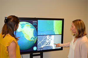
Christine Burns and Kristen Crossett use the new interactive
BathyGlobe located in the Coast Survey front office in Silver
Spring, MD.
Coast Survey’s front office now has BathyGlobe! The interactive touchscreen application, BathyGlobe, was developed by UNH/CCOM/JHC and most recently demonstrated at the UNH booth at the U.S. Hydro 2019 Conference. Upon seeing a demonstration of the BathyGlobe last summer by
Colin Ware, director of the Data Visualization Research Lab at UNH, Coast Survey obtained the software and hardware to establish a network-independent version for our office in Silver Spring, MD. The software allows the user to zoom into any area of the globe to see how much of the ocean has been mapped at that location. Later versions also support 3D views of multibeam data (viewed through virtual reality goggles). A
GEBCO database instance loaded on the computer is the primary feed for the data. Coast Survey is exploring ways to use this application to show visual representations of areas mapped, such as for planning use by the IHO and the
Meso American - Caribbean Sea Hydrographic Commission (MACHC, chaired by our own Katie Ries, deputy director of Coast Survey). Stop by the Coast Survey front office to check it out! For more information contact
Neeraj.Saraf@noaa.gov.