March 29, 2017
Hello Coast Survey,
I asked Captain Rick Brennan to share his thoughts on the U.S. Hydro 2017 Conference.
-Shep
-----------------------------------------------------------
Hi everyone,
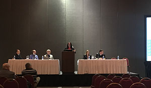
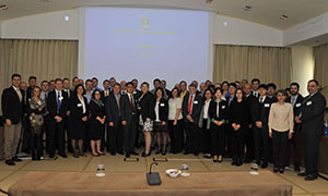
I am just returning from a week at the U.S. Hydro 2017 Conference in Galveston, Texas, where I joined many of our colleagues to present the latest happenings in NOAA hydrography. It was also a great opportunity to learn more about what projects and technologies other organizations and partners are involved in. The timing of this conference could not be better as the start of our hydrographic survey field season is fast approaching, with a planned 2,183 square nautical miles to be surveyed by our NOAA hydrographic fleet and contractors.
What was clear to me at this conference was that NOAA and our contracting partners continue to lead the community in our thinking and innovation. Whether it is the hydro health model, bathymetric database, autonomous survey vessels, chart template tools, laser scanning shoreline, or techniques for identifying geoid errors using Ellipsoidally referenced surveys—NOAA continues to lead the way.
At the conference we projected our vision for the future. RDML Smith presented our plans to participate in the Seabed 2030 initiative that seeks to map the world’s oceans over the next 13 years. We described our risk-based approach to prioritizing surveys and showed innovative ways we are able to produce raster products from our vector data. All of these efforts show a bright future for our program.
We also painted a picture of the process changes underway here in Coast Survey. For instance, the National Chart Plan and the proposed re-scheming of our chart suite—underway in the Marine Chart Division—is uniquely tied to efforts in the Coast Survey Development Lab and the Hydrographic Surveys Division to develop a Marine Spatial Data Infrastructure that includes a bathymetric database which will support this new chart suite with harmonized and consistent bathymetry.
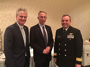
This was an exciting week that highlighted the amazing efforts that Coast Survey is working on. I couldn’t have been more proud of our team that presented in every session and lightning round. Well done!
Captain Rick Brennan
Chief, Hydrographic Surveys Division
CAPT Rick Brennan - Navigating with Precise Navigation Products; NOAA's MSDI Approach for Delivering Information to Mariners; NSPS/THSOA Hydrographer Certification Review
LT Adam Reed - Steps Towards a True Crowd, Collecting Bathymetry via Electronic Navigation Systems
Starla Robinson - Ping Once Use Many Times: NOAA Wilmington NC 2016 Field Season
Katrina Wyllie - NOAA's Arctic Survey Initiatives; Developing a Method to Validate the Navigational Bathymetric Database
Christy Fandel - Hydrographic Health: A National Overview
LTJG Patrick Debroisse - Vessel Mounted Lasers for Shoreline Feature Acquisition
Christie Ence - Vector and Raster Nautical Charting: the Wave of the Future
Guillaume Auclert - Plan to Rescheme NOAA ENC Coverage
Corey Allen - Using Vessels' Calculated Under‐Keel Clearance to Estimate the Appropriate Level of Effort for Hydrographic Surveying
Kurt Nelson - Implementing a Navigational Bathymetric Database within the U.S. Office of Coast Survey
Giusseppe Masetti (UNH/CCOM) presented on behalf of Barry Gallagher - Sound Speed Manager: An Open‐Source Initiative to Streamline the Hydrographic Data Acquisitions Workflow
Matt Wilson - Finding Fliers: New Techniques and Metrics
Jack Riley presented on behalf of Janice Eisenberg - Implementing Variable‐Resolution Gridding Technology for Hydrographic Surveying
Jack Riley - Determination of Possible Errors in Geoid Models via the Ellipsoid‐Referenced Hydrographic Datum
Rob Downs - Activities to Incorporate Unmanned Surface Vehicles into NOAA's Hydrographic Survey Fleet
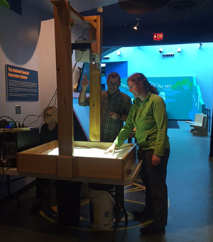
LTJG Kristin Johns, deputy chief of operations, and LCDR Emily Rose, with the Atlantic Marine Operations Center, took this opportunity to display the Atlantic Hydrographic Branch’s new interactive augmented reality (AR) sandbox to the public. Working with Coast Survey IT personnel Mary Little and physical scientists Jeff Marshall and Rita Bowker, the AR sandbox was delivered, configured, and tested the day before the workshop in preparation for the over 500 participants who attended the event. The AR sandbox is a unique educational tool that allows users to create topography models by shaping real sand, which is then augmented in real time by an elevation color map, topographic contour lines, and simulated water flow. The system teaches fundamental geographic, geologic, and hydrologic concepts such as how to read topographic and bathymetric maps in a fun, hands-on manner. This was the group’s first opportunity to share the Sandbox with the general public and based on the extremely positive feedback is sure to be a favorite NOAA outreach tool.
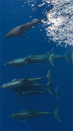
Coast Survey went viral! LT Morgan's mesmerizing dolphin video taken from NOAA Ship Ferdinand Hassler is our best performing post on Facebook ever. The post has reached over 2.3 million Facebook accounts, and has been viewed over 656,000 times. A Coast Survey social media record!
4/3-4/7 - Mississippi River Commission (MRC) High Water Inspection - RDML Smith was appointed to the MRC by President Obama in December 2016
4/18-4/20 - Hydrographic Services Review Panel meeting in Seattle, WA
4/24-4/28 - International Hydrographic Organization assembly meets every three years to provide general guidance on the functioning and work of the organization

