The Inner Harbor Navigation Channel in New Orleans facilitates the transportation of tens of millions of tons of cargo each year. Since the channel was recently closed for repairs, a temporary Chandeleur Sound Alternate Route was established to ensure the flow of commerce between the western and eastern reaches of the Gulf Intracoastal Waterway. NOAA experts assisted with the alternate route development in various ways, collaborating with the U.S. Coast Guard, U.S. Army Corps of Engineers, and the maritime industry.
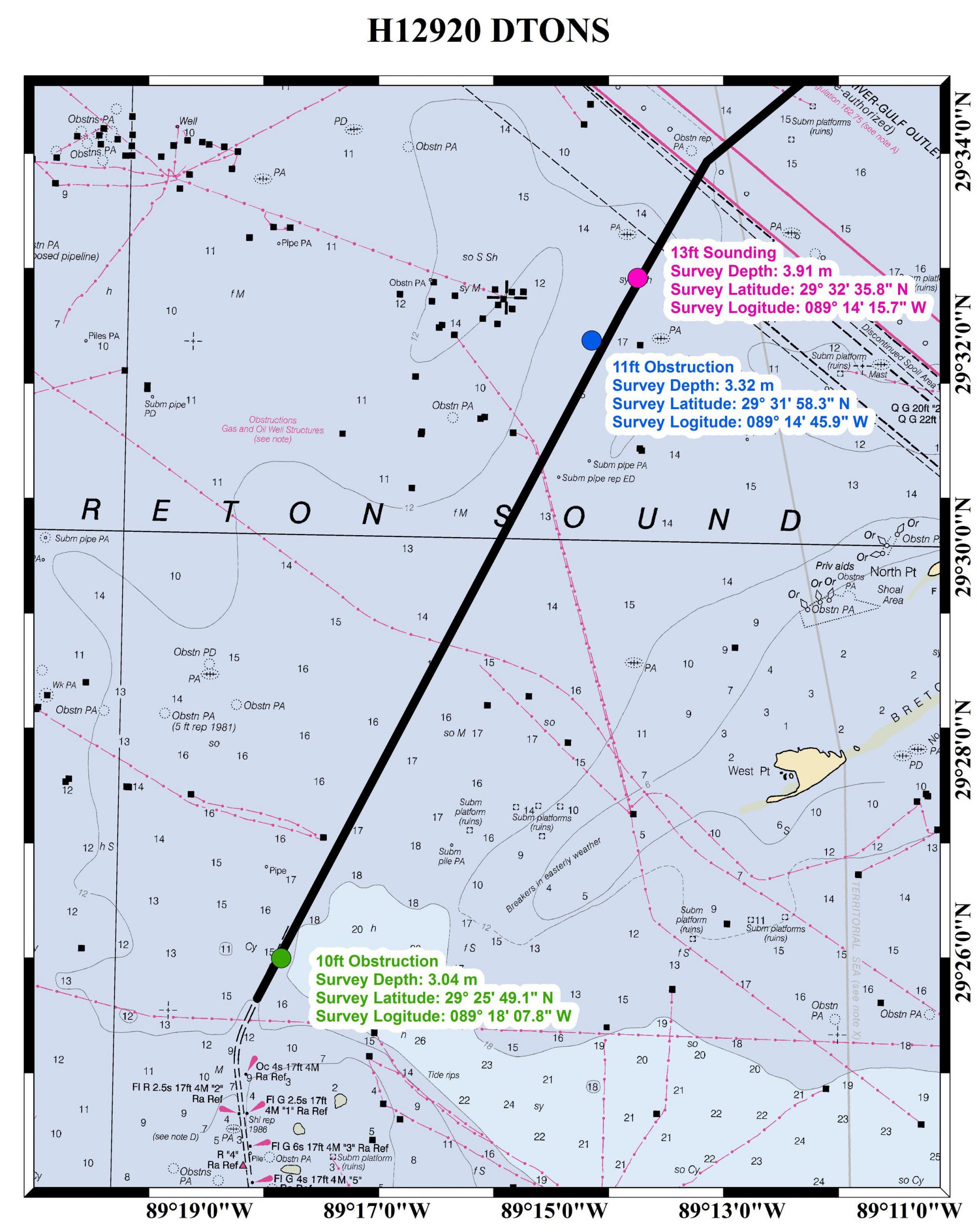
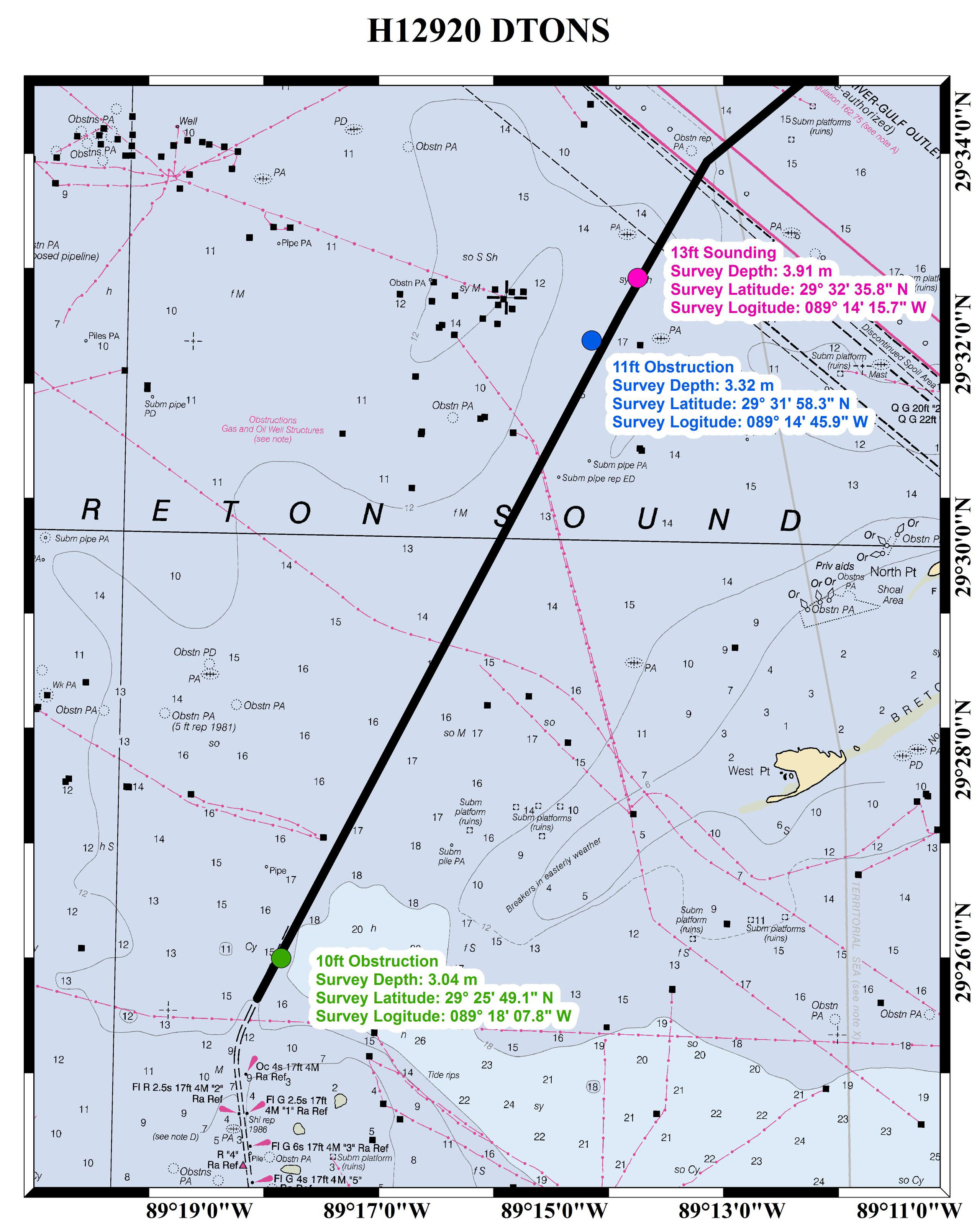
Navigation manager Tim Osborn represented NOAA on the Coast Guard’s weekly conference calls on the alternate route, asking for industry suggestions on how we could assist. Based on these collaborations, Coast Survey updated the nautical charts with the newly installed Aids to Navigation, while the National Weather Service began providing localized weather forecasts and warnings along the route. In addition, Coast Survey contracted David Evans and Associates (DEA) to survey the southern 33 miles of the total 66-mile proposed route. The survey required object detection survey coverage, with DEA submitting all observed soundings or obstructions shoaler than 12 feet as dangers to navigation. DEA found three dangers to navigation, and they were subsequently announced in the Local Notice to Mariners and applied to the applicable nautical charts.

NOAA will continue to support the tow industry using the alternate route by adding new navigation data to the chart as we receive it, as well as by providing specialized weather reports along the route throughout the estimated three-month closure of the Inner Harbor Navigation lock in New Orleans.
News and Updates