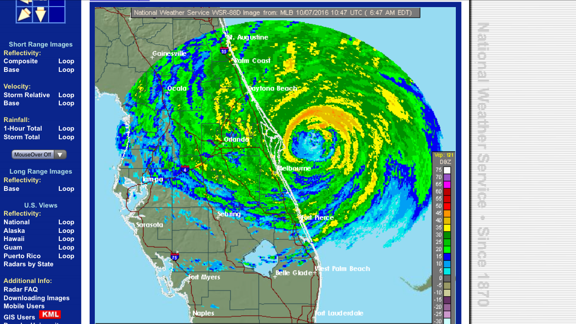
As Hurricane Matthew bore down on Florida, Georgia, and South Carolina, Coast Survey pre-positioned hydrographic survey vessels for immediate deployment, to help speed the reopening of commercial shipping at ports hit by high winds and storm surge.
Currently, our Central Coast Gulf navigation manager, Tim Osborn, embedded in Port Canaveral, Florida, and our Southwest navigation manager, Kyle Ward, are coordinating marine transportation system recovery priorities with the U.S. Coast Guard and port stakeholders in Florida, Georgia, South Carolina, and North Carolina.
Speeding the resumption of commercial vessel traffic has important human and economic considerations. For instance, Port Canaveral experienced winds over 60 knots and wave heights over 30 feet. Cruise ships are awaiting port entry and with about 3,000 passengers per ship, that is over 30,000 passengers (~15,000 crew) waiting for the port to be re-opened.
[wpvideo VcYT25R3]
Video: Port Canaveral experiencing high winds from Hurricane Matthew on October 7, 2016.
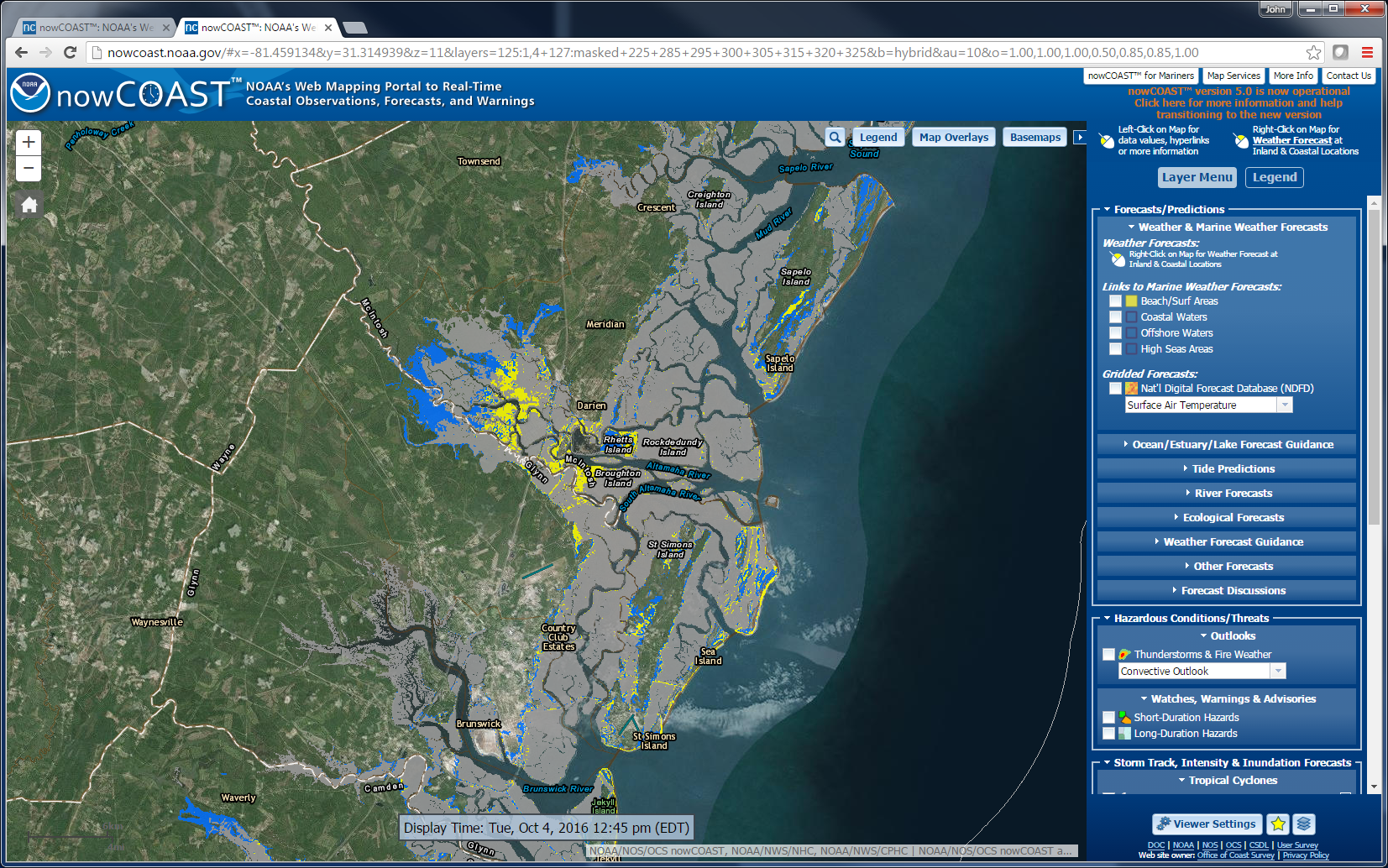
An additional aid in the preparation for a hydrographic survey response is anticipating where and how big the storm surge will be along the coast. Just prior to the arrival of Hurricane Matthew, NOAA’s nowCOAST™ updated its system with the National Hurricane Center’s (NHC) potential storm surge flooding map which depicts the risk associated with coastal storm surge flooding resulting from tropical cyclones.
News and Updates