Maintaining documentation for features depicted on nautical charts is more complicated than you probably imagine. For instance, Coast Survey maintains information on more than 10,000 submerged wrecks and obstructions in U.S. coastal waters – and it just got easier for the public to access that free information.
Coast Survey uses our Automated Wreck and Obstruction Information System (AWOIS) to help plan hydrographic survey operations and to catalog the many reported wrecks and obstructions considered navigational hazards within U.S. coastal waters. The public also has access to this rich information source. Marine archaeologists and historians, fishermen, divers, salvage operators, and others in the marine community find AWOIS valuable as an historical record of selected wrecks and obstructions.
Information contained in the database includes latitude and longitude of each feature, along with brief historic and descriptive details. Until recently, that information was available for download in Microsoft Access MDB and Adobe PDF format. However, these formats were difficult to search.
As of today, AWOIS information will no longer be available in MDB or PDF format. Instead, users can download AWOIS files in the more useful Google Earth Keyhole Markup Language (KML) format. KML is an XML grammar and file format for modeling and storing geographic features such as points, lines, images, polygons, and models for display in Google Earth, Google Maps, and other applications. (KML is an international standard, maintained by Open Geospatial Consortium, Inc.)
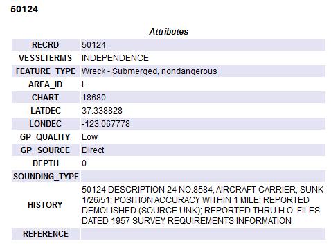
Once you download an AWOIS file, you can open that file directly in a mapping application, such as Google Earth or Google Maps. You can then navigate directly to your area of interest and obtain information about individual features. Clicking on any AWOIS item will bring up additional information, such feature type, position, and history.
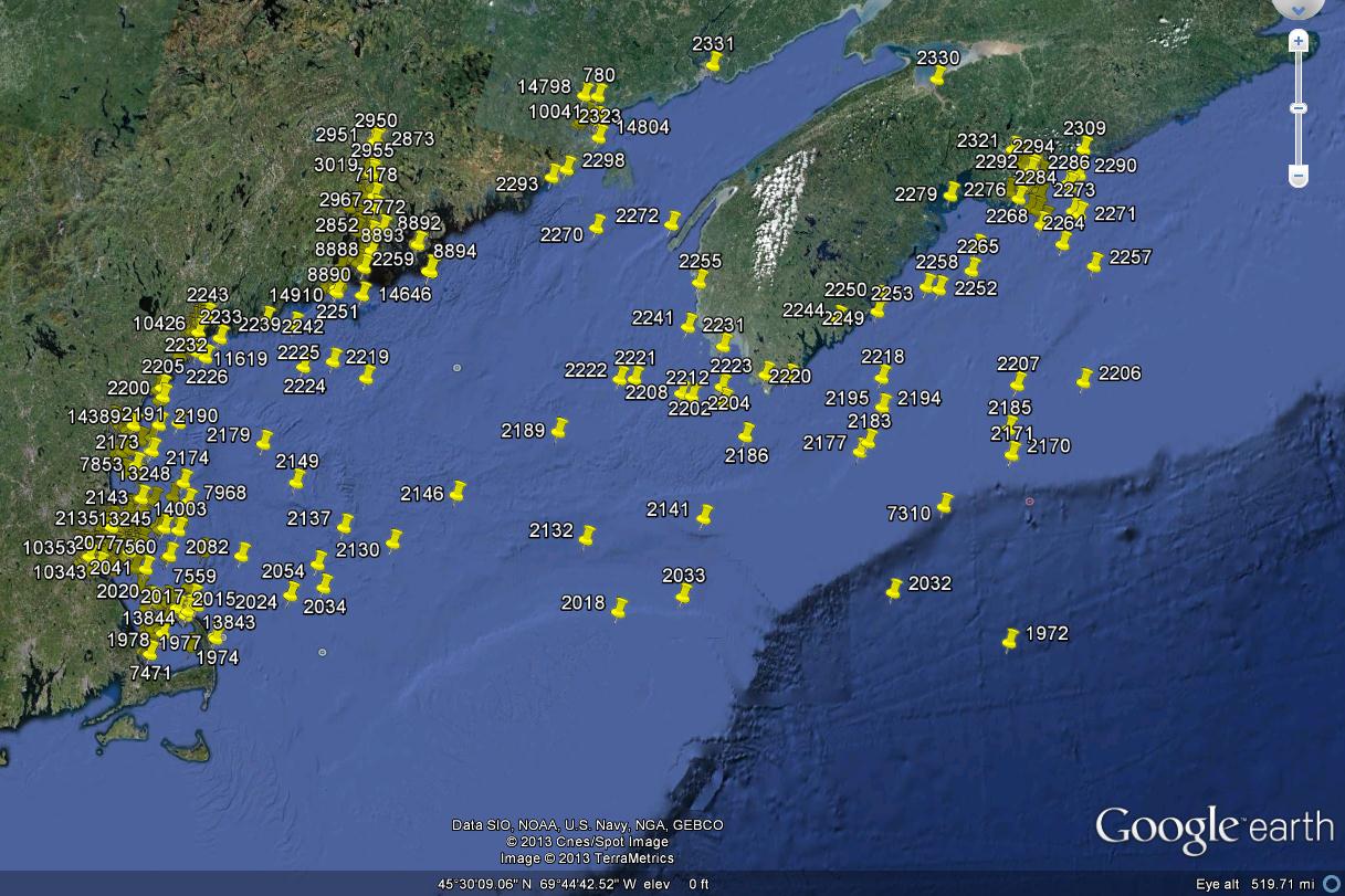
I’ve provided an example, below, of an AWOIS file opened in Google Earth. On the right is an example of the information that will be displayed by clicking on a AWOIS item.
Questions? Just ask them in the comments section or send an email to Coast Survey’s Hydrographic Surveys Division at HSD.Inquiries@noaa.gov.
Coast Survey unveils easier access to wreck information
By Lucy Hick, physical scientist, Hydrographic Surveys Division
Very good idea!
You guys rock!