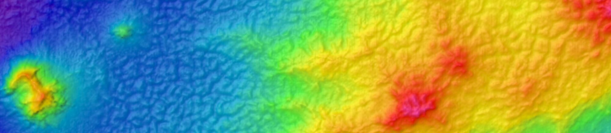

The National Oceanic and Atmospheric Administration (NOAA) is pleased to announce a partnership with the Delaware Department of Natural Resources and Environmental Control and the Delaware Geological Survey for a hydrographic surveying project in southwestern Delaware Bay.
While bathymetry has been updated for major shipping lanes in the center of the bay, additional data is needed for shallower areas between 2 and 10 meters depth that have not been surveyed since the 1970s. This project will provide modern, high-resolution bathymetry, backscatter, and side scan survey data over approximately 16.5 square nautical miles of estuary following its selection for the 2027 solicitation of the Brennan Ocean Mapping Fund.
Updating bathymetry in these shallower areas will provide critical information for coastal managers to better understand and mitigate persistent challenges, including storm-driven waves and coastal inundation, shoreline retreat, infrastructure damage, and benthic habitat change. This survey supports a more comprehensive understanding of estuarine system dynamics for enhanced coastal hazard-mitigation and emergency-response efforts; continued coastal tourism and recreation; and sustainable domestic seafood production. Additionally, it directly supports Coast Survey’s core mission of safe navigation by identifying potential navigational hazards and updating nautical charts.

Delaware Bay is important both economically and ecologically to the region and the nation. Beyond supporting a key navigation waterway and oyster harvesting grounds, the Bay is home to the world’s largest spawning population of horseshoe crabs. Every year in late spring, females lay up to 100,000 eggs each, providing critical nutrients for North America’s second-largest population of migrating shorebirds, including threatened species. Approximately half a million birds stop in Delaware Bay annually to feed on these nutrient-dense eggs, gaining the energy needed for the final leg of their migration to Arctic breeding grounds.
A birder’s paradise, this natural spectacle fuels a thriving regional eco-tourism industry. Changes to horseshoe crab populations and shifts in spawning season, however, can severely impact shorebird migration and breeding success. Collecting high-resolution bathymetry in Delaware Bay will improve benthic habitat characterization and condition assessments, ensuring greater protection for these vital spawning sites and habitats.
The Brennan Ocean Mapping Fund commemorates the vision of NOAA’s Rear Admiral Richard T. Brennan, former Office of Coast Survey Director and former President of the Hydrographic Society of America.
Rear Admiral Brennan was a champion of Coast Survey’s hydrographic knowledge and expertise to fulfill many coastal and ocean mapping needs under the Integrated Ocean and Coastal Mapping (IOCM) banner to “Map Once, Use Many Times.” He understood that knowledge of the seafloor’s depth, shape, and composition has far-reaching benefits—and that mapping the full extent of U.S. coastal, ocean, and Great Lakes waters relies on strategic partnerships to combine resources and expertise.
Under this program, NOAA invites non-Federal entities to partner on jointly-funded mapping projects of mutual interest. Subject to the availability of funds, NOAA will match up to five selected non-Federal partners at a 70:30 NOAA-to-partner ratio for contract mapping projects totaling up to $1,000,000 in U.S. ocean, coastal, and/or Great Lakes waters. Selected partners benefit from this opportunity by leveraging NOAA’s contracting pool of pre-qualified technical experts in surveying and mapping, alongside data management expertise.
Interested in partnering on a FY2028 Brennan Ocean Mapping Fund project? Submit a proposal by emailing your materials to iwgocm.staff@noaa.gov by 5:00pm ET on October 16, 2026.
More information on this opportunity can be found in the Federal Register Notice. Additional information can be found at the Integrated Ocean and Coastal Mapping website. Questions may be directed to iwgocm.staff@noaa.gov.