
by Thomas Loeper, Coast Survey navigation manager for the Great Lakes
Have you ever wondered how scientists make short-term forecast water levels, currents, and water temperature for the Great Lakes? They use the National Ocean Service’s operational forecast systems. There are now five different computer forecast modeling systems running for the Great Lakes — one for each lake. The forecast guidance from these forecast systems supports a variety of activities, including environmental management, emergency response for incidents like hazardous materials spills, homeland security, and search and rescue, as well as safe and efficient navigation of recreational and commercial vessels along the entire Great Lakes system.
The current operational forecast systems have been operational since 2005/2006, and Coast Survey is planning upgrades in the coming years. The original forecast systems were developed in the early 1990s as a collaborative effort between NOAA’s National Ocean Service, the Great Lakes Environmental Research Laboratory, the National Weather Service, and the Ohio State University. They were the first civilian coastal ocean systems to produce regularly scheduled predictions for the U.S.
The new forecast systems will have double the forecast horizon, from 60 to 120 hours, and provide higher horizontal and vertical resolution predictions.

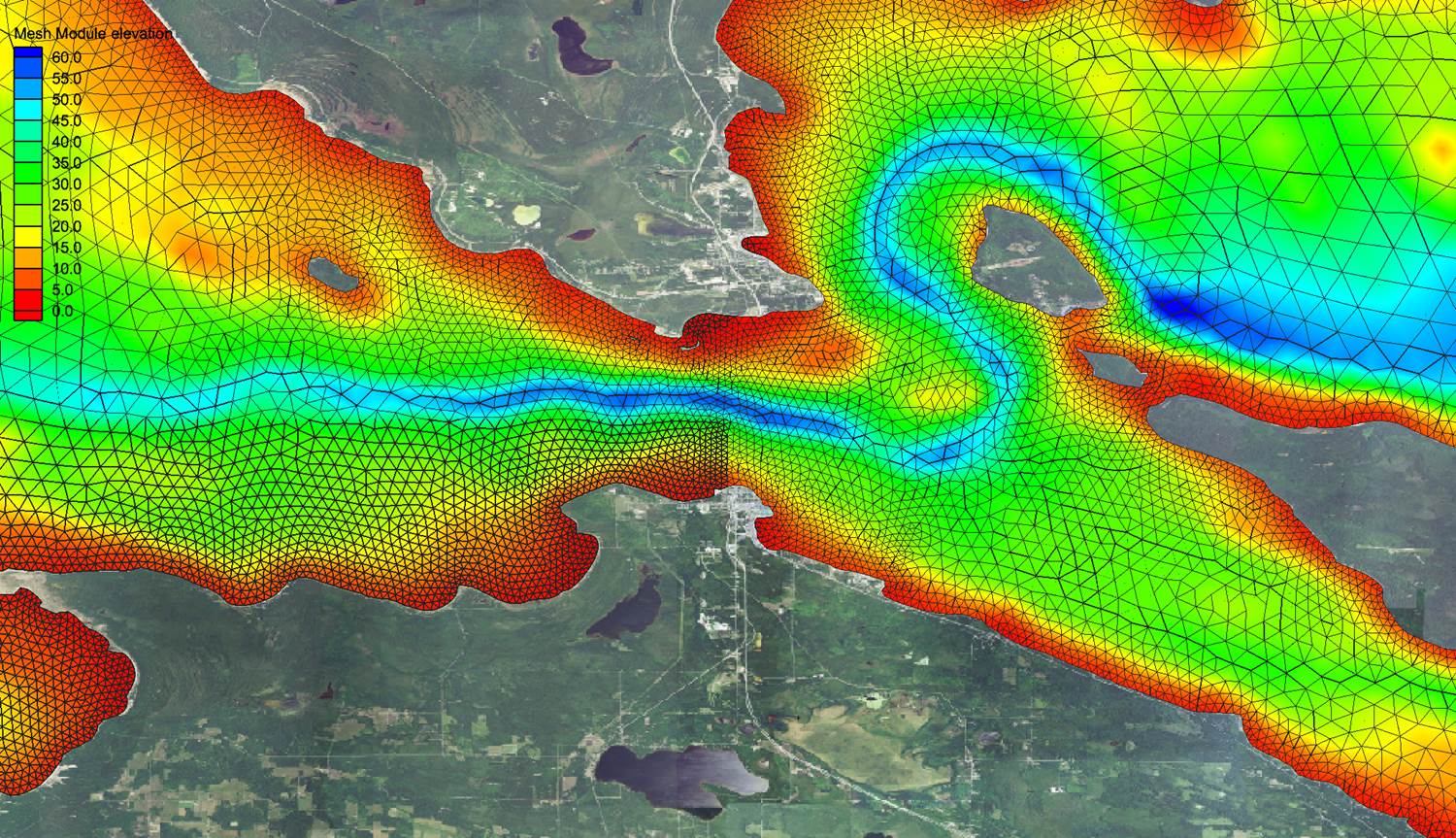
The inputs to the forecast systems include atmospheric forecasts and observations such as surface winds, cloud cover, air temperature, and dew point temperature, along with water levels, water temperatures, and tributary flows along its grid boundaries. To model the lake, scientists use an unstructured 3-D grid of points that extend from the surface to the bottom of the lake. The grid provides more detail in areas of great concern, i.e., in harbors or in chokepoints like the Straits of Mackinac between Lake Michigan and Lake Huron. NOAA feeds this information into a 3-D oceanographic circulation model to generate the forecast guidance.
Upgrades to the Great Lakes operational forecast systems
First, NOAA will update the forecast system for Lake Erie. The Lake Erie Operational Forecast System is expected to be operational by March 2016. By 2017, the upgraded system will help scientists forecast harmful algal bloom. Additionally, NOAA is developing an ice module to incorporate into the forecast systems for all the Great Lakes.

Second, we are developing a new combined forecast system: the Lakes Michigan and Huron Operational Forecast System. This model upgrade combines both lakes since they act — hydraulically — as one giant lake, essentially forming the largest lake in the world by surface area. This system is scheduled for operations sometime in 2018.
Nowcast/forecast graphics are available as map views from the Center for Operational Oceanographic Products and Services (CO-OPS) Operational Forecast System site. To view real-time and forecast conditions as web map services, use the recently upgraded nowCOAST. NowCOAST is a GIS-based webmap service providing more frequently updated observations for coastal and Great Lakes regions along with coastal and marine weather forecasts now available 24 hours a day.
