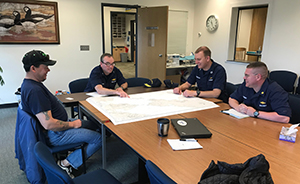
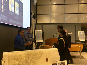
Coast Survey visits Saildrone facilities and ESRI headquarters in California
Neeraj Saraf at the Saildrone facility in Alameda, California.
Last week,
Neeraj Saraf, acting chief of the Coast Survey Development Lab (CSDL), and
Neil Weston, Coast Survey’s technical director, visited the Saildrone facility in Alameda, California, to learn more about how the company produces and operates their autonomous vessls. Saildrone provides autonomous vessel services, and from this, Coast Survey can potentially obtain data to update navigational charts. Later in the week,
Patrick Keown, geospatial data program manager, and
Julia Powell, deputy chief of CSDL, joined the Coast Survey team at ESRI headquarters in Redlands. The team gained in-depth knowledge of ESRI’s future cloud computing, machine learning, and new product developments. For more information contact
Neeraj.Saraf@noaa.gov.
U.S. Coast Guard awards NOAA personnel on the Port Access Route Study team
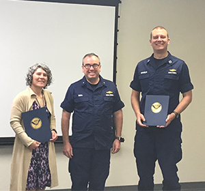
Rear Adm. Smith presents the award to two recipients, Amy
Holman and Lt. Bart Buesseler.
The U.S. Coast Guard (USCG) awarded the Coast Guard Meritorious Team Commendation to NOAA personnel involved with the Bering Sea and Bering Strait Port Access Route Study from January 2008 to April 2018. Awardees include
Capt. David Zezula,
Lt. Cmdr. Michael Gonsalves,
Lt. Cmdr. Matthew Forney,
Lt. Bart Buesseler,
Lt. Tim Smith,
Steve Soherr,
Rachel Medley,
Amy Holman, and
Katrina Wyllie. The team studied vessel traffic patterns and gathered indigenous nation input to develop an efficient and resilience Arctic routing system. The team surveyed 3,200 square nautical miles, an area larger than the states of Delaware and Rhode Island combined. For more information contact
Matthew.Forney@noaa.gov.
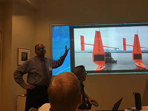
NOAA participates in hackathon
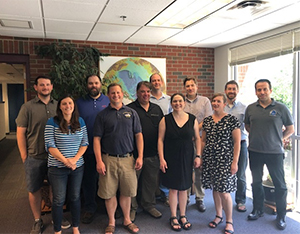
Attendees (clockwise from upper left): Jason Greenlaw,
CMMB, Tim MacLaughlin, OCS IT, Mike Smith (center),
USACE, Barry Gallagher, HSTB, Jack Riley, HSTB, Sam
Baldwin, USACE, Giuseppe Masetti, CCOM/JHC, Annie
Raymond, OCS HSD, Juliet Kinney, JHC, Glen Rice, HSTB,
Erin Nagel, CMMB.
Representatives from the U.S. Army Corps of Engineers (USACE) Remote Sensing GIS Center of Expertise joined a group of Coast Survey programmers and representatives from CSDL, Hydrographic Surveys Division (HSD), and the Center for Coastal and University of New Hampshire Center for Coastal and Ocean Mapping/Joint Hydrographic Center (
UNH CCOM/JHC), in a three-day hackathon-style meetup at the JHC. The event focused on exploring how open source and cloud based architecture solutions as utilized by the USACE/National Geospatial-Intelligence Agency GRiD (Geospatial Repository and Data Management System) could possibly be leveraged for the National Bathymetric Source and nowCOAST projects. It provided a forum to learn about and test various open-source tools and processes as they could apply to the projects, while also serving as an opening for future collaborations among the various groups. For more information contact
Annemieke.Raymond@noaa.gov.
NOAA evaluates hurricane response capacity in Pacific Region Table Top Exercise
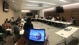
Participants of the Pacific Region Table Top Exercise discuss
response strategy.
Crescent Moegling, regional navigation manager for the northwest and pacific islands, attended a NOAA Pacific Region Table Top Exercise from July 24-26 in Honolulu, Hawaii, to step through a simulated internal NOAA response to a Category 4 hurricane hitting Honolulu. The majority of commerce for the entire Hawaiian islands comes via ship to Honolulu, so the exercise’s hurricane, Hurricane Tua, would be a very serious event that requires nimbleness in Coast Survey’s ability to respond given the lack of dedicated survey assets in the region. The third day was open to all relevant stakeholders and representatives from the U.S. Coast Guard, Navy, and city and county emergency response officials. Coast Survey and NOAA’s Disaster Response Center plan to formulate a similar exercise for the Pacific Northwest for the future. For more information contact
Crescent.Moegling@noaa.gov.
NOAA hosts 2018 Chart Adequacy Workshop
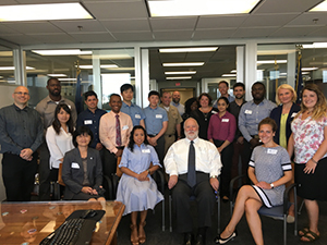
Participants and instructors of the 2018 Chart Adequacy
Workshop.
Coast Survey hosted a three-day Chart Adequacy Workshop that included participants from 13 countries. The participants received an overview of Coast Survey datasets, processes, and requirements for nautical charts. They also learned about preprocessing hydrographic data, such as loading charts, uploading imagery, and applying electronic navigation charts (ENCs) and AIS point data. Through a series of lab units, the attendees practiced performing the concepts they learned. Unlike previous years (
2017,
2016,
2015), the focus of this class was on networking and support for the upcoming International Cartographic Association (ICA)
Working Group on Marine Cartography meeting held on July 26 and in preparation for next year’s International Cartographic Conference (ICC). For more information read our
blog story or contact
Shachak.Peeri@noaa.gov.
NOAA welcomes local and international attendees at 2018 Nautical Cartography Open House
Coast Survey employees speak with Rear Adm. Gallaudet
(Navy, Ret.) about cartographic processes before computers.
NOAA welcomed approximately 170 attendees representing 17 countries to the
2018 Nautical Cartography Open House. This
one-day event featured posters, presentations, tours, and exhibits centered on cartography. The event included informational stations on historic pen and ink cartographic processes, as well as modern cartographic techniques and displays. Attendees also joined tours of NOAA Science on the Sphere® to see cartographic visualizations of oceanic and atmospheric data. The open house provided the opportunity for international colleagues in marine cartography to network and share ideas. For more information contact
Shachak.Peeri@noaa.gov.
NOAA researches autonomous survey system in the U.S. Arctic
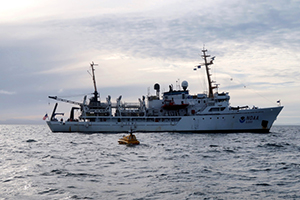
The unmanned surface vehicle, BEN, launched from NOAA
Ship Fairweather. Credit: Christina Belton, NOAA
On Saturday, July 28, NOAA Ship
Fairweather made the first successful launch of an
unmanned surface vehicle for an operational hydrographic survey from a NOAA vessel in the Arctic. A team composed of research engineers and a graduate student from UNH CCOM/JHC and personnel from Coast Survey aboard NOAA Ship
Fairweather tested UNH’s BEN (Bathymetric Explorer and Navigator) USV. BEN is manufactured by ASV Global and is larger, has a much longer endurance, and is faster than the small USVs operated from other NOAA hydrographic survey vessels. Coast Survey will use the data BEN collects to contribute to
Fairweather’s
Point Hope survey project. For more information read our
blog story or contact
Rob.Downs@noaa.gov.
Coast Survey streamlines cartographic compilation processes
HSD and the Marine Chart Division (MCD) coordinated closely over the last eight months to streamline survey deliverables for charting. For more than 13 years, HSD has been delivering a product called the HCell to MCD. An HCell is a chart scale representation of a hydrographic survey. On August 1, HSD transmitted the first hydrographic survey to MCD in the new, non-HCell format. The new deliverables process will shift the cartographic compilation of hydrographic data from HSD compilers to MCD cartographers. This shift is designed to streamline cartographic compilation processes, and also allow HSD personnel to devote increased resources to developing and populating a National Bathymetric Source database; seeking out, evaluating, and providing survey deliverables for external source data; and providing hydrographic expertise to NOAA and non-NOAA organizations in need of assistance. The new, non-HCell deliverables specification and process involved many personnel from HSD and MCD working closely together over the course of months to determine the fine details and implications of this shift in long-standing processes and workflows as well as the most efficient method for conveying hydrographic data to cartographers. Congratulations to both MCD and HSD for executing the new deliverables successfully. For more information contact
Lorraine.Robidoux@noaa.gov.
Bay Hydro II hosts congressional staffers

Congressional staffers enjoyed learning about Coast Survey
and CO-OPS on board Bay Hydro II.
Coast Survey hosted congressional staffers aboard the
Bay Hydro II on Friday, July 27, out of Annapolis, Maryland. The crew of
Bay Hydro II demoed the USV Echo Boat as a method of surveying nearshore areas that were previously inaccessible due to draft restrictions. The trip concluded at the Center for Operational Oceanographic Products and Services’ (CO-OPS) Hendrix Lab where the visitors were joined by
Brent Ache,
Artara Johnson, and
Mike Michalski. The CO-OPS group talked about their suite of products and services, including the National Water Level Observation Network (NWLON), the Physical Oceanographic Real-Time System (PORTS), and the National Current Observation Program (NCOP). Staff also observed the NWLON station in situ. The congressional staff were engaged and asked a lot of questions about how NOAA acquires data, how that data is incorporated onto our NOAA charts, and how the echo buoy and other survey tools worked. NOAA staff on the
Bay Hydro II included,
Nicole LeBoeuf,
Brandon Eisner,
Mike Jarvis,
Capt. Liz Kretovic, and
Rachel Medley. For more information contact
Elizabeth.Kretovic@noaa.gov.
NOAA Ships, Navigation Response Teams, and Contractor Operations
Weekly Hydro Ship Activity Report - Week of August 5, 2018
NRT 1 - Team is performing vehicle and trailer maintenance as well as maintenance and testing of Z-Boat unmanned systems.
NRT 2 - Team is processing data from Miami, Beaufort, and Sand Shoal Inlet, Virginia, surveys.
NRT 3 - Team is surveying Columbia River.
NRT 4 - Team is repairing boat and installing a new computer.
NRT 5 - Team is processing data from the Hudson River Survey.
Bay Hydro II -
Bay Hydro II is processing data from Crisfield and Vicinity, Maryland/Virginia, and Baltimore Inner Harbor surveys.

Staff Updates
MCD welcomes
Nathan Leveling. A Texas native, Nate earned a bachelor of science degree in geography from the University of Maryland, College Park, in 2013. His degree concentrated in GIS and computer cartography. Post undergrad, Nathan garnered nautical cartography experience as an intern in MCD’s Production Branch B (PBB) (Eastern Gulf of Mexico and Southeast), and later as a contractor for NOAA. While in PBB, Nathan also performed extensive work on the CATZOC project, allowing mariners to determine data quality through defined zones of confidence. Nathan also has experience with land-based cartography through the development of military installation maps for the U.S. Marine Corps. Nathan is looking forward to applying his acquired cartographic and analysis skills to promote the mission of NOAA and the Office of Coast Survey. In his spare time, Nathan enjoys going to the gym and playing sports.
MCD welcomes
Sarah Phillips. Sarah joins NOAA as a cartographer in the Pathways Recent Graduate program. She graduated from Old Dominion University with a bachelor of science degree in geography/GIS in 2016. Since graduating, she has studied abroad in both Germany and Austria, interned with NASA DEVELOP (LaRC), and worked for the National Park Service. She is a Virginia native and enjoys outdoor adventures, Sudoku, genealogy research, and dubstep.