June 19, 2019
Hi Coast Survey,
This week we mark another World Hydrography Day on Friday. This is a very exciting time for our field and for Coast Survey in particular, and I wanted to take a few minutes to reflect on where we are:
First, our work is more important than ever. Our charts continue to form the core of marine navigation for all boats and ships on the water. In addition, the authoritative information contained in our charts and maintained in our databases is a key part of the U.S. Marine Spatial Data Infrastructure. Our surveys are not just used for charting, but also to support fisheries habitat, marine geology, modeling, and now with integral backscatter, our surveys are more valuable than ever.
We are constantly improving our services. We are building the next generation of electronic navigational charts at larger scales, with better attribution, and they are more easily updated. With the national bathymetric source, our data will be more readily accessible to all our users and will support the new charts. We will distribute our hydrodynamic models this year for ship navigation, improving fuel economy, and safety at sea. We have a new suite of improved navigation services in ports, supporting Precision Navigation that will help make U.S. ports cutting edge in the world.
We are embarking on new ventures as well. The world’s hydrographic offices have banded together with the marine scientific community on an ambitious project to map the world’s oceans by 2030, aptly called Seabed 2030. Coast Survey will return to the big blue Pacific when NOAA Ship Rainier heads south to Hawaii in a few weeks. For us, this is not just a new geography, but also a new set of partners, since our work will be tightly integrated with NOAA Fisheries.
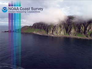
To help communicate our hydrographic capabilities we recently released the document, NOAA Coast Survey Ocean Mapping Capabilities. Coast Survey’s seafloor mapping program comprises a comprehensive set of capabilities that when combined, provide our nation with a valuable asset. These range from not just data collection, but rigorous quality control, an expert workforce, and ability to collaborate widely. Thank you to those who contributed to this document, especially Rick Powell, Nautical Publications Branch, for providing the terrific layout.
We should all feel very proud to be in this field, and particularly to work in one of the world’s premier hydrographic offices.
Rear Admiral Shepard M. Smith
Director, Office of Coast Survey