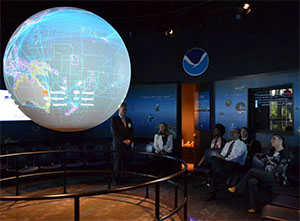
National Ocean Service completes major update to its hurricane surge forecast system
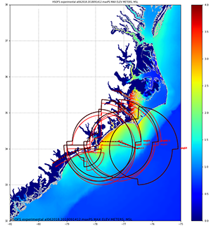
HSOFS ensemble tracks and predicted maximal water
levels during Hurricane Florence, 2018.
The Hurricane Surge On-Demand Forecast System (HSOFS) is one of the numerical ocean prediction models developed by
Sergey Vinogradov and
Yuji Funakoshi at CSDL. Since its first implementation in 2016, NOAA’s
National Hurricane Center (NHC) has been using HSOFS in major storm events in the Atlantic, Gulf coast, and Puerto Rico, during and after their landfall. The model computes coastal flooding due to storm surge and tide, based on the official NHC analysis of winds and atmospheric pressure. HSOFS runs several ensembles with slight perturbations to parameters that define the wind field (e.g. storm size, track, transition speed, and maximal wind speed) to account for uncertainty in atmospheric forcing. The upgrade brings two new major improvements. One is a greater flexibility in ensemble perturbations. NHC can now customize wind parameters on the spot, depending on a current situation. Another great new feature is assimilation of water level data. Model bias is now greatly reduced by the use of real-time coastal tide gauge observations. The upgrade is expected to become operational this month, to support NHC during the Atlantic hurricane season which officially started June 1 and ends on November 30. For more information contact
Sergey.Vinogradov@noaa.gov.
Precision Navigation team meets with Georgia Port Authority and Savannah Pilots Association
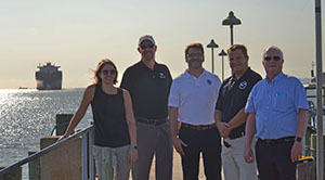
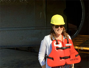
Christine Burns, Darren Wright, Christopher Diveglio, Kyle
Ward, and Sam DeBow at the Savannah River. Credit: Capt.
Elizabeth Kretovic
Recently,
Kyle Ward, southeast navigation manager, and members of the
Precision Navigation team traveled to Savannah, GA, for a meeting with representatives from the Georgia Port Authority and the Savannah Pilots Association. Savannah is undergoing a major harbor expansion project. The team learned about the work being done throughout the port complex and discussed Savannah’s navigation challenges to gain a better understanding of how NOAA may support their needs once the expansion project is complete.
For more information contact
Elizabeth.Kretovic@noaa.gov.
NOAA participates in the annual hurricane preparedness meeting in Gulfport, MS
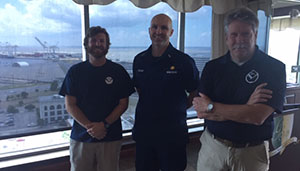
Alex Ligon, Lt. j.g. Collin Walker, and Tim Osborn at the Port
of Gulfport 2019 Hurricane Season and Maritime Area Security
Meeting.
Tim Osborn, eastern Gulf coast navigation manager, and
Alex Ligon and
Lt. j.g. Collin Walker of
navigation response team (NRT) – Stennis, participated in the Port of Gulfport 2019 Hurricane Season and Maritime Area Security Meeting on May 29, 2019. Tim presented and led a discussion on navigation response issues in the area and introduced the members of NRT-Stennis. Also at the meeting, the National Weather Service presented on the Atlantic hurricane season outlook and the U.S. Coast Guard and local authorities spoke on port conditions and severe weather plans. For more information contact
Tim.Osborn@noaa.gov.
NOAA senior advisor provides update to Transportation Research Board
NOAA Senior Advisor to the U.S. Committee on the Marine
Transportation System Heather Gilbert.
NOAA Senior Advisor to the U.S. Committee on the Marine Transportation System (CMTS)
Heather Gilbert attended the Transportation Research Board's
Marine Board Meeting and the 91st Meeting of the
Inland Waterways Users Board (IWUB) from May 14-16 and May 23-23 in Paducah, KY, and New Orleans, LA, respectively. Both meetings focused on the Inland Waterways System with a tour of the Kentucky Lock and the Olmsted Lock and Dam, along with a trip out to Bayou Sorrell Lock in Louisiana. As the NOAA sponsor to the Marine Board and the federal observer to the IWUB board, Heather highlighted NOAA’s Precision Navigation program, Center for Operational Oceanographic Products and Services Inundation Dashboard, and National Geodetic Survey’s National Spatial Reference System, and realated NOAA’s work to the Inland Waterway System. For more information contact
Heather.Gilbert@noaa.gov.
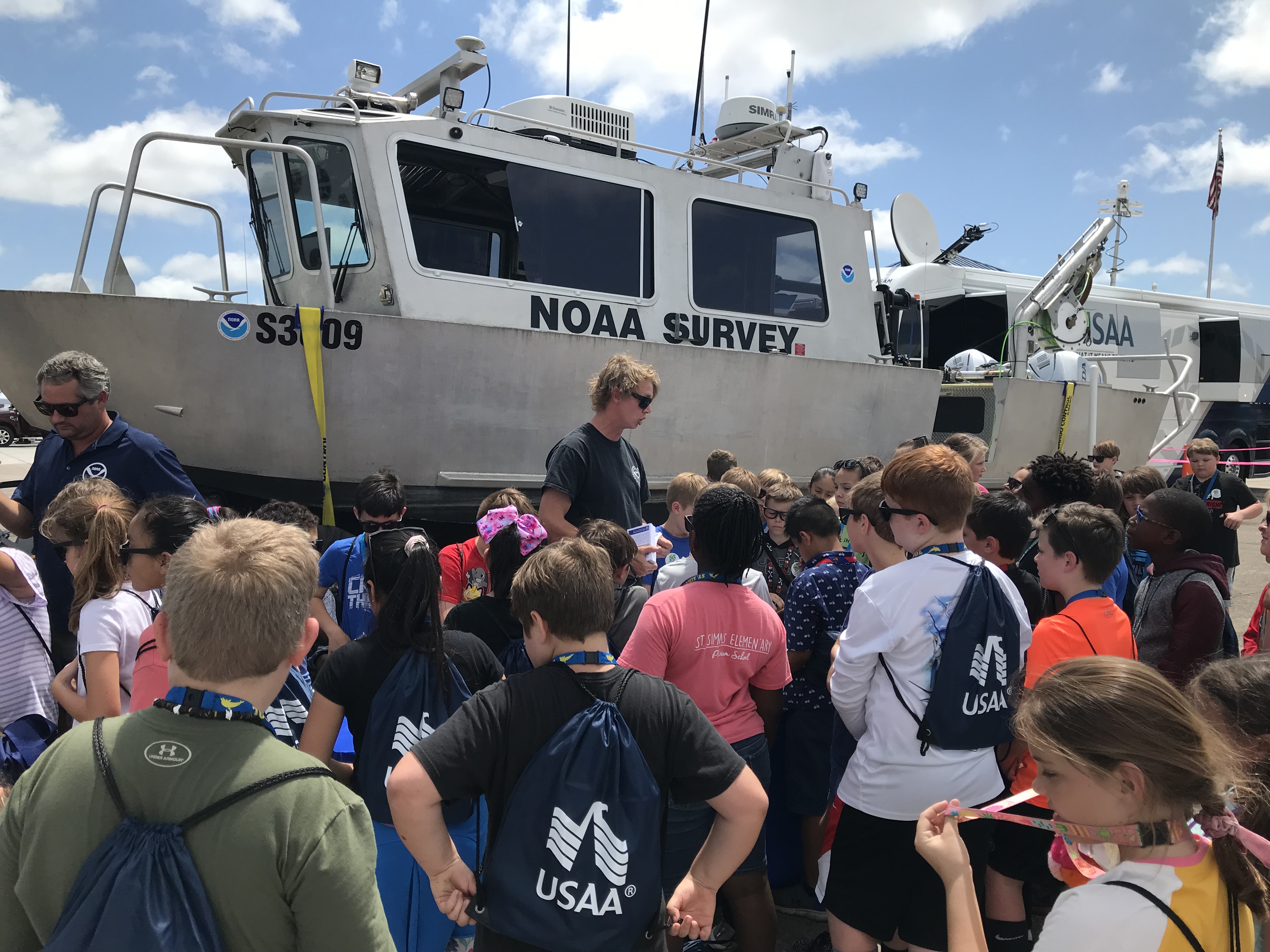
Navigation response team highlighted at NOAA's Hurricane Awareness Tour
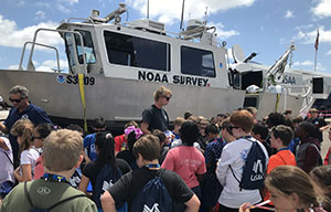
James Kirkpatrick and Howard Meyers host a group of
children at their navigation response vessel during the
Hurricane Awareness Tour.
On May 10,
Kyle Ward, southeast navigation manager, and
James Kirkpatrick and
Howard Meyers from NRT-Fernandina Beach, participated in the
2019 NOAA Hurricane Awareness Tour in Brunswick, Georgia. The team shared navigation response information with dozens of children and other attendees. Additionally, James was
interviewed via FaceBook Live by the National Hurricane Center Director, Ken Graham, where he provided a tour if the response vessel and shared Coast Survey’s navigation response mission. For more information contact
Kyle.Ward@noaa.gov.
Navigation response team activities
NRT-Stennis - The team is attending a pre-hurricane coordination meeting in Gulfport, MS.
NRT-Fernandina Beach - The team is preparing for a NOAA Marine Operations Center-Atlantic requested survey of Port Canaveral, FL.
NRT-Seattle - The team is traveling to survey Columbia River anchorages. Augmented with a U.S. Navy hydrographer.
NRT-Galveston - The team planned to survey in Galveston Bay, TX, but is hampered by weather.
NRT-New London - The team is traveling for U.S. Coast Guard requested surveys in southern Long Island, NY.
Bay Hydro II - The team is installing and patch testing a replacement multibeam echo sounder.

Staff Updates
Martha Herzog assumed the role of NOAA team lead on May 28. Martha coordinates the Coast Survey hydrographic survey operations on NOAA vessels. Martha has a long tenure in the Hydrographic Surveys Division serving at the Pacific Hydrographic Branch (PHB) before detailing to the Operations Branch in 2018.
Christy Fandel returned to NOAA from the National Geospatial-Intelligence Agency on May 28 to assume the role of contract team lead. Christy oversees the award of task orders for acquisition of hydrographic survey by our contract partners.
PHB welcomed Lillian Dinkins on June 3. Lillian is an undergraduate at Tuskegee University in Tuskegee, Alabama. She joined NOAA as a summer intern through the Greening Youth Foundation. Lillian is assisting with hydrographic survey reviews for the NBS project.
Awards
Lt. Cmdr. Wartick was awarded the Coast Guard Achievement Medal for his superior performance while serving as a member of the Marine Transportation System Recovery Unit at the Sector North Carolina Incident Command Post, Goldsboro, NC, September 16 to 22, 2018, in response to Hurricane Florence. Congratulations Lt. Cmdr Wartick!