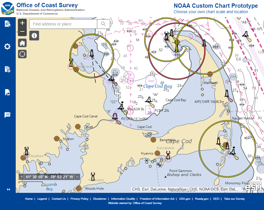
Explore the refreshed ENC-based NOAA Custom Chart Tool
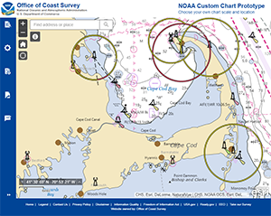
NOAA Custom Chart prototype application.
Coast Survey released an improved user interface for the
NOAA Custom Chart (NCC) prototype web application this past week. In this refreshed version, NCC settings are simplified and more logically organized, appropriate default values for depth contour labels, depth shades, and compass roses are set, and the NOAA color palette from traditional NOAA paper charts is implemented. Over the coming months, Coast Survey will improve the prototype further by incorporating traditional NOAA paper chart symbology for buoys, beacons, and lights, adding survey quality diagrams, improving chart note management and presentation, and also improving compass rose placement. Coast Survey considered many comments submitted during the public comment period following the initial release of the prototype when developing this latest version. Thank you to the team:
Craig Winn,
Christie Ence,
Colby Harmon,
Leland Snyder,
Noel Dyer,
Jeremey Wetzel, and
Nusrat Meghna for getting the new version of NOAA Custom Chart launched. For more information contact
Craig.Winn@noaa.gov.
UNH Geodetic Survey Lab develops creative remote lessons
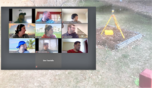
Lab participants “look” towards the GNSS receiver.
Top (L-R): Tion Uriam (Kiribati), Semme Dijkstra (UNH),
Ryosuke Nagasawa (Japan); Middle row (L-R):
Carol Lavagnino (Brazil), Danai Lampridou (Greece),
Adam Smyth (US); Bottom row (L-R): Diego Billings (Jamaica),
Bryan McAnally (U.S.), Simitrio Morales (Mexico).
Ocean mapping students at the
Center for Coastal and Ocean Mapping/NOAA-UNH Joint Hydrographic Center (CCOM/JHC) recently completed the geodetic survey lab online from their homes. In this lab, led by
Semme Dijkstra, the students remotely operated a GNSS receiver located in Semme’s back yard. The exercise familiarized the students with configuring a GNSS receiver for base station use, as well as providing hands-on experience interacting with the National Geodetic Survey
OPUS and
CORS services. The lab took advantage of the receiver’s web interface, allowing the students to control the instrument from the comfort of their homes. The receiver is one of three new multi-constellation (GPS, GLONASS, BEIDOU, Galileo, QZSS, IRNSS) units recently acquired by CCOM/JHC to replace an older set of GPS receivers with serial communications only.
Dan Tauriello (CCOM/JHC), supported Semme in testing the internet connectivity with the receiver from the Dijkstra home network to the outside world. Semme reports that, beside some internet service provider issues, the biggest challenge was to make the students pretend to look at the receiver at the same time (no, no, the OTHER left!) The lab was followed up by a guest lecture on the OPUS service by Coast Survey Technical Director
Neil Weston. For more information contact
Andy.Armstrong@noaa.gov.
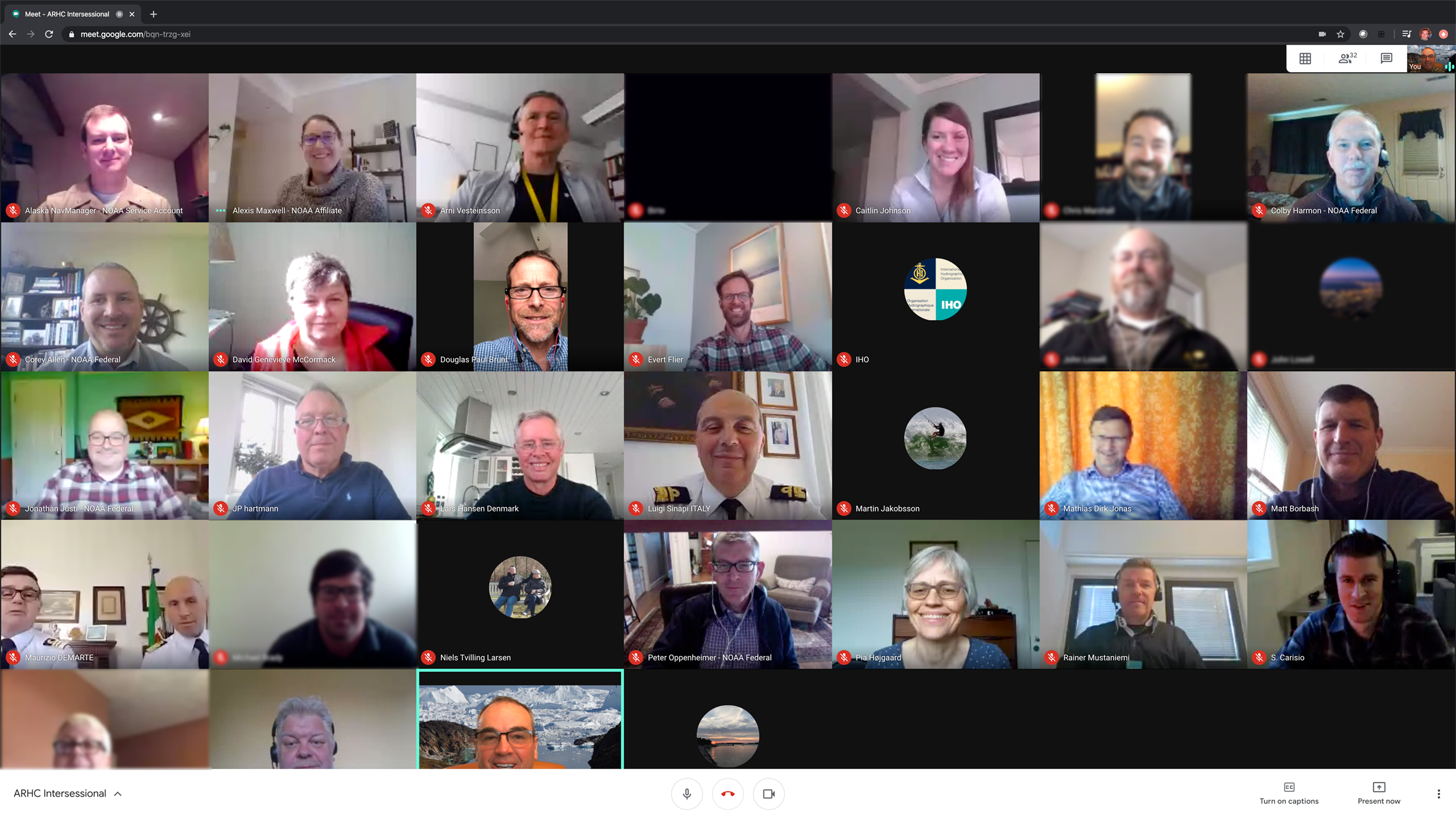
U.S. convenes virtual Arctic Regional Hydrographic Commission Intersessional
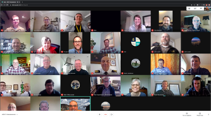
The ARHC members met virtually for an Intersessional.
The Arctic Regional Hydrographic Commission (ARHC), chaired by
Rear Adm. Shep Smith, met virtually for an Intersessional on Wednesday, April 29, 2020. The Intersessional gathered more than 30 participants including representatives from Canada, Denmark, Finland, Italy, Iceland, Norway, the IHO Secretariat, and Seabed 2030 leadership. The virtual Intersessional was a timely opportunity to discuss certain issues pertaining to hydrography in the Arctic. The meeting participants discussed ARHC developments since ARHC-9 in 2019,
Protection of the Arctic Marine Environment (PAME)’s 1st Arctic Shipping Status Report and
Arctic Ship Traffic Data (ASTD) System, the successful signing of a Protection of the Arctic Marine Environment (PAME) MOU, the UN Decade of Ocean Science, Crowd Sourced Bathymetry and Seabed 2030, and updates on the upcoming ARHC-10. To share recent and upcoming hydrographic activities happening in the Arctic with a wide audience, the U.S. created a draft
ARHC Year in Review product. The U.S. hopes that an annual product such as this will help to bring broader perspective to hydrographic activities in the Arctic, and raise awareness of exciting and interesting things happening among ARHC membership. For more information on the Intersessional, the final agenda, participants list, and all additional meeting materials can be found on the
IHO webpage. For more information contact
Jonathan.Justi@noaa.gov.
Navigation response teams continue to engage with Coast Survey partners
On May 6, 2020,
Lt. j.g. Michelle Levano, from NRT-Seattle, virtually presented to more than 75 members of the
Transportation Club of Seattle as part of the club's "Lunch and Learn" series. The presentation focused on how NOAA collects bathymetric data, and on how advancements in nautical charting impact local port authorities and the industries maritime transportation supports. Attendees represented a variety of stakeholder industries such as trucking, aviation, stevedore organizations, and port logistics. This served as an excellent opportunity to spread the word of NOAA's charting mission. For more information contact Lt. j.g.
Michelle.Levano@noaa.gov.
Environmental Data Management Workshop call for abstracts
The 2020
Environmental Data Management Workshop organizers and the
Integrated Ocean and Coastal Mapping (IOCM) team are encouraging abstract submissions on the meeting theme - Data to Decisions: Putting NOAA data to work. The meeting will be held virtually in mid-August. Specifically, the IOCM team has joined forces with Ocean Exploration Research (OER) and National Centers for Environmental Information (NCEI) to propose a session titled, "Coordinating Data to Decisions: Ocean Mapping, Exploration, and Characterization Strategies for the Next Ten Years." This session will introduce the national ocean mapping, exploration, and characterization (MEC) strategy, led by NOAA, resulting from the
2019 Presidential Memorandum on Ocean Mapping of the United States Exclusive Economic Zone and the Shoreline and Nearshore of Alaska. This will set-up discussions for how decisions about conducting MEC activities are informed by data, including remote sensing (e.g. bathymetry, backscatter, water column) and in-situ observations (e.g. imagery, samples, eDNA). In addition, the session will discuss the current ingest, discovery and access of these data, anticipated data volumes, and future end-to-end data management needs to enable U.S. MEC goals over the next 10 years. Participants will come away with an understanding of the big picture efforts across NOAA to address the goals of the ocean mapping, exploration, and characterization strategy.
Submit abstracts for 15 minute talks and demonstrations by
May 27. For more information contact
Meredith.Westington@noaa.gov.


Staff Updates
Congratulations to
Quentin Stubbs, NOAA's Texas regional navigation manager, who published his first scientific article,
Assessment of Wetland Change on the Delmarva Peninsula from 1984 to 2010, in the Journal of Coastal Research. One of the key components of the article and Stubbs' dissertation work was data from
NOAA's C-CAP Regional Land Cover and Change.
Ariel Colby
The Hydrographic Surveys Division (HSD) welcomes new ERT contractor,
Ariel Colby, who joined Atlantic Hydrographic Branch (AHB) on May 4. Ariel received a bachelor's degree in meteorology with a minor in mathematics from the University of South Alabama. After graduation, Ariel worked at the Naval Oceanographic Office in the Hydrographic Branch where she performed quality control and contouring of bathymetric data. In her free time, Ariel enjoys spending time with her husband and dog, finding new and fun restaurants to try, and playing tennis.
Gena Manic
Gena Manic recently joined the Marine Chart Division's (MCD) Production Branch G as a cartographer. She transitioned to a federal employee after working as a contractor for more than two and a half years for IIC Technologies. As a NOAA contractor, she focused her efforts on the ENC rescheme. She holds a master’s degree in GIS from University of Maryland, Baltimore County, and a bachelor’s degree in environmental geography with a minor in GIS from Penn State. A native of the DMV, she enjoys playing hockey, hiking, photography, and spending time with her family.
Kayla Maurer
MCD welcomes
Kayla Maurer on as a cartographer in Product Branch C. Prior to becoming a cartagropher, Kayla worked for the past year and a half as an IIC Technologies contractor for MCD. She received her bachelor of science degree in environmental science and certificate in geographic information systems from the University of Pittsburgh. Her previous work experience includes working as a Heinz Summer Water Fellow at the University of Pittsburgh conducting multi-criteria spatial analyses focused on stormwater runoff in Pittsburgh. In her free time, Kayla enjoys hiking, baking, and volunteering at the National Zoo. Her favorite quarantine activities include watercolor painting and spending time with family.

Petros Melake
The Integrated Ocean and Coastal Mapping (IOCM) team welcomes
Petros Melake. Petros has worked as a full stack software developer in the development of Java-based applications, including database programming and testing for multiple companies within the DC metropolitan area. He has some familiarity with software development life cycle; strong data domain experience in analysis, finding trends, and management. He has a master's of science in spatial planning from the University of Università Iuav di Venezia located in Italy. He is currently working in the IOCM team as a crowd-source bathymetric module analyst.
Members of the Coast Survey team saying "hello" from home.