NOAA is initiating a five-year process to end all traditional paper nautical chart production and is seeking the public’s feedback via a Federal Register Notice published on November 15, 2019. Chart users, companies that provide products and services based on NOAA raster and electronic navigational chart (NOAA ENC®) products, and other stakeholders can help shape the manner and timing in which the product sunsetting process will proceed. Comments may be submitted through NOAA’s online ASSIST feedback tool.

A long tradition in transition
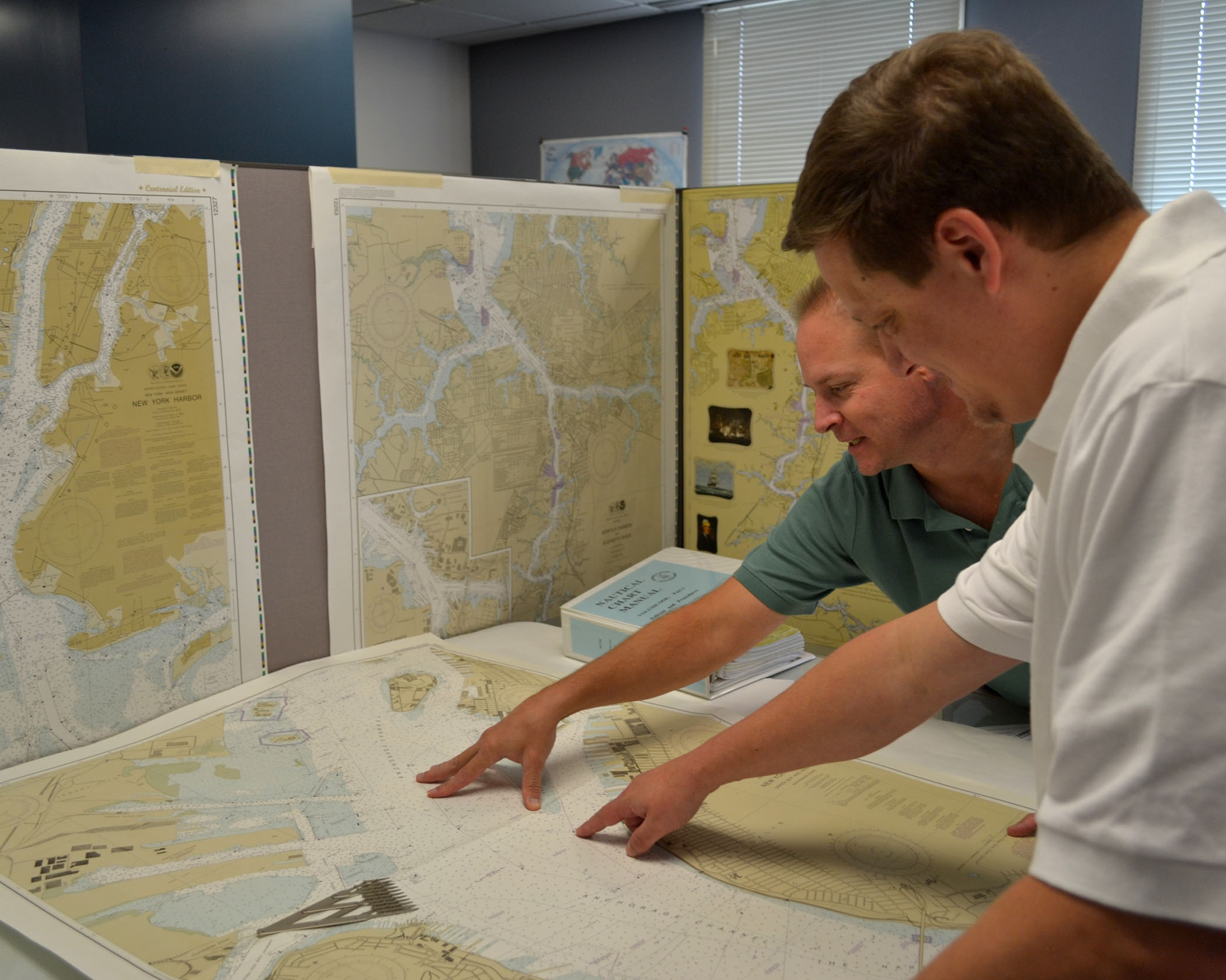
For nearly 200 years, NOAA’s Office of Coast Survey has produced traditional paper nautical chart products. Originally, this took the singular form of hard copy paper charts, today, there are several raster digital chart formats available to download or print through a NOAA certified agent. Similar to the transition from road atlases to GPS navigation systems that we have witnessed in this digital era, we are also seeing the increased reliance on NOAA electronic navigational charts (ENC) as the primary navigational product and the decreased use of traditional raster chart products. Since 2008, ENC sales have increased by 425%, while sales of paper charts have dropped by half.
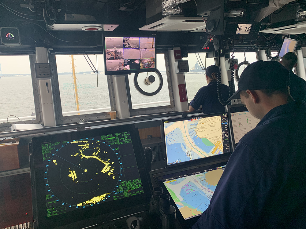
The International Maritime Organization now mandates that all large commercial vessels on international voyages use ENCs. In 2016, the U.S. Coast Guard started allowing regulated commercial vessels on domestic voyages to use ENCs in lieu of paper charts. Recreational boaters are also increasingly using electronic chart displays.
NOAA is in the midst of a multi-year program to improve its ENC coverage by replacing over 1,200 irregularly shaped ENC cells, compiled in over 130 different scales, with a standard gridded layout of ENCs, compiled in just a dozen standard scales. This will increase the number of ENC cells to about 9,000 and significantly improve the level of detail and consistency among ENCs. More information about improvements being made is in Transforming the NOAA ENC®.

Another option for paper nautical charts
Ultimately, production will be shut down for all raster chart products and services associated with traditional NOAA paper nautical charts, including:
- Print-on-demand (POD) paper nautical charts
- Full-size chart PDFs
- NOAA raster navigational charts (NOAA RNC®)
- BookletChart™ PDFs
- NOAA RNC tile service
- Online RNC viewer
Cancellation of these product and services will start in mid to late 2020 and be completed by January 2025. More detailed information regarding this transition is explained in the document Sunsetting Traditional NOAA Paper Charts: End of Paper and Raster Nautical Chart Production and Introduction of NOAA Custom Charts. Over the next five years, NOAA will work to ease the transition to ENC-based products while continuing to support safe navigation. NOAA will focus on improving data consistency and providing larger scale coverage of NOAA ENC, as well as providing access to paper chart products based on ENC data, either through the NOAA Custom Chart prototype or third-party commercial data providers.
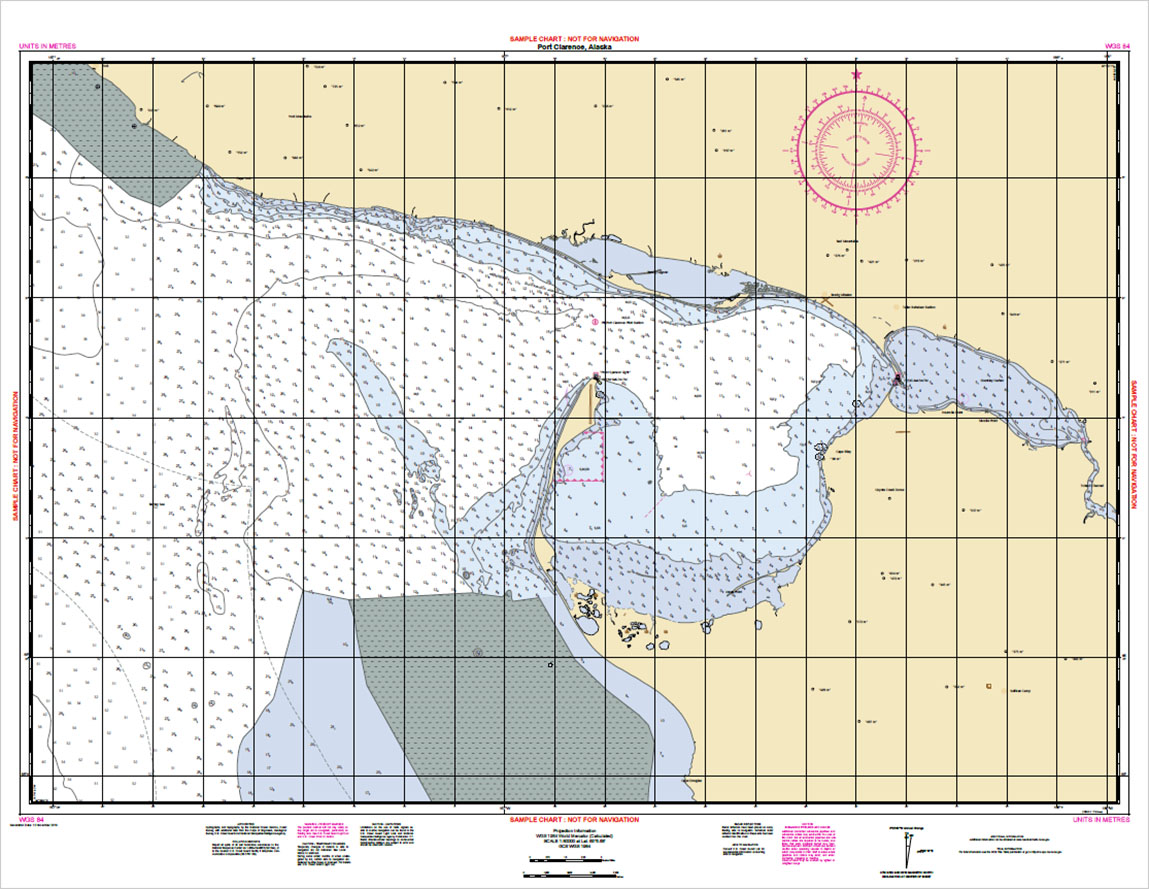
The online NOAA Custom Chart (NCC) application enables users to create their own charts from the latest NOAA ENC data. Users may define the scale and paper size of custom-made nautical charts centered on a position of their choosing. NCC then creates a geospatially referenced Portable Document Format (GeoPDF) image of a nautical chart. Chart notes and other marginalia are placed on a separate PDF page. Users may then download, view, and print the output. NCC is an easy way to create a paper or digital backup for electronic chart systems or other Global Positioning System (GPS) enabled chart displays.
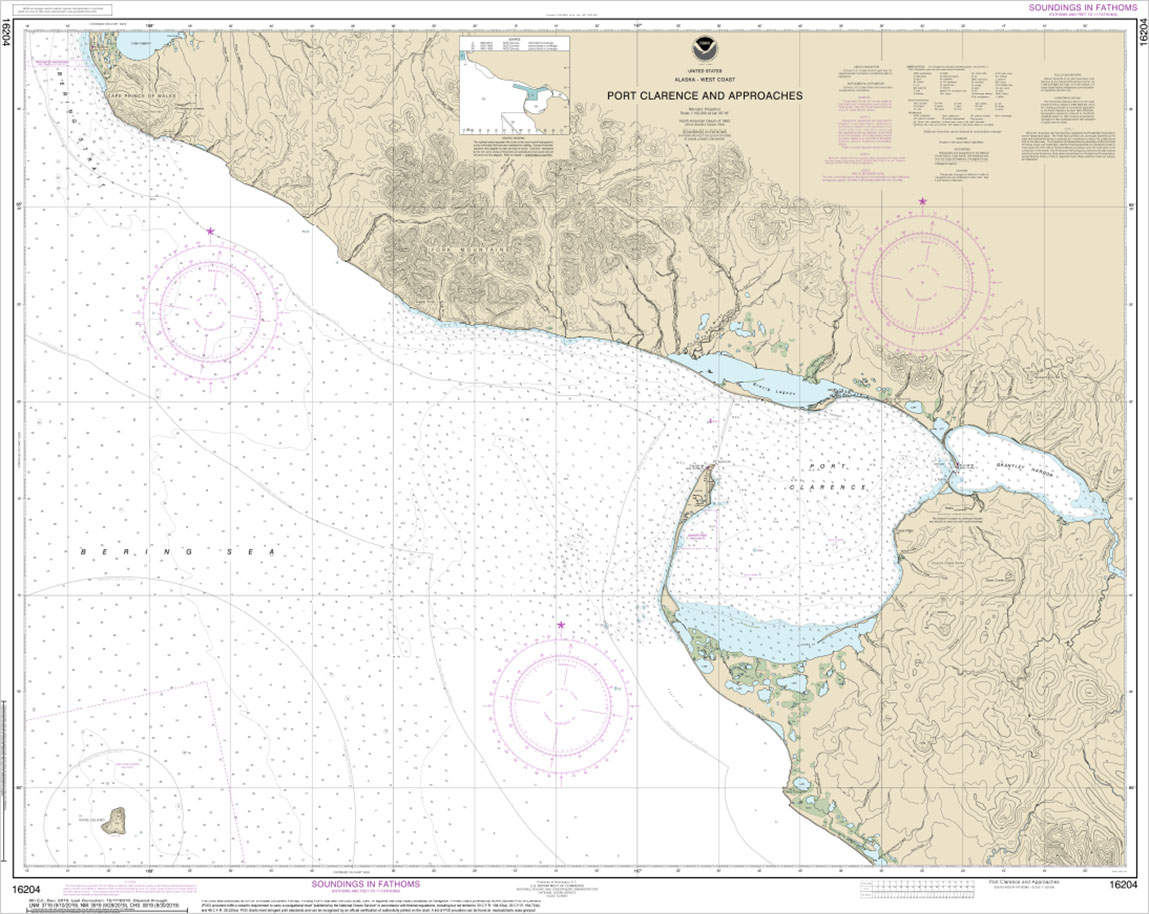
A comparison of NOAA Chart 16204 and the corresponding NOAA Custom Chart is shown below. Although it looks a bit different from a traditional NOAA chart, NCCs show the latest data as compiled in the NOAA ENCs. The prototype is in the early phases of development and many improvements are needed to make NCC a viable replacement for traditional paper nautical charts. We hope you will try out the NOAA Custom Chart prototype and tell us what you think through NOAA’s online ASSIST feedback tool.


Historical editions of nautical charts – suitable for framing – back to the mid-1800s, may also be downloaded for free from the Coast Survey Historical Map & Chart Collection website.


How is the coast guard and navy responding to this change.
How does this change affect the thousands of students in colleges and military accademys around the world.
Lastly how does this change affect the civilian licensing schools around the country and their OUPV classes.
I do not support the elimination of paper charts. Especially with the internet connectivity of chart plotter displays increasing the vulnerability to hacking. I don’t believe that marine hardware manufacturers are as prepared as automakers, and their vehicles are know to be vulnerable to hacking.
There is also the difference between gps navigation on land and water. Failure on land is an inconvenience on the water it can be life threatening. Having a paper backup for WHEN the electronics fail is important!
In my opinion paper charts are a necessity for any serious sailor as they cannot fail you when you power is interrupted or when your gps is interfered with. You need to always be prepared with accurate fixes and course lines to ensure you are in safe waters.
Firmly and staunchly opposed to the elimination of NOAA paper charts. Since I started sailing , I have always kept paper aboard. Since I cross into Canada , where it is still ( to the best of my knowledge ) a requirement to have paper charts aboard , I carry the complement for areas to be sailed. Yes , I use ENC’s , Chart Plotters , etc. and have more than once sailed off the end of the world according to the devices. POD is great if you have someone local who can do the scaled printing and on correct paper weight. Thank you for asking.
I also do not support the elimination of paper charts. Having sailed around the Atlantic basin and Caribbean for the last 30 years I have always relied on paper charts for navigation along with a GPS when they became available. Only 2 years ago did I purchase a chart plotter which is nice but I still have the paper chart out for marking and thinking ahead. I suspect the art of navigating will likely be lost when the paper charts are gone. Want to teach someone how to navigate, nothing beats paper. I suggest keeping them around for another 20 or so by which time I will likely be gone and not care.
Lets keep the paper!
I always carry paper charts even with a chart plotter, two tablets and two cell phones with navigation apps, and both raster and enc chart files. I’ve worked in electronics for several decades and learned never to place all my trust in them. I sail Puget Sound and the Canadian Gulf islands. I use both electronic and traditional means of navigation. I am not concerned if NOAA shuts down raster production as long as pdf or other printable enc options continue to be available. I’ll buy a pen plotter and print my own charts.
In this day of electronics I believe people tend to rely far too much upon the GPS both on the water and on land. If this continues, I feel the Coast Guard, as well as our first responders on land, are going to be even more busy than is presently the case. Electronics fail all the time and their failure is often due to human error. It would be irresponsible for blue water sailors to embark on an extended cruise without paper charts and expect electronics to get them to their destination and back.
Sailing puts us frail humans in a hostile environment. Its harsher on electronics. We need paper charts for safety at sea. I regard the provision of paper chart data as an essential government service. It is one with a long history. The reasons for that service remain valid today. At times of greatest need, paper charts provide basic information. That printed information relies on publicly-funded agencies that gather, store, and distribute it. This is a crucial service.
I think paper charts should perpetually be available at every ship chandler and marina. I plot my courses on paper charts with traditional tools and mark them with graphite pencils. Every fix gets plotted to make course corrections. I only use LORAN or GPS to confirm my own findings.
If NOAA wants to stop publishing ink-on-paper charts, then license the data to private companies but keep producing and updating the data.
Keep the paper please, when the lights go out, you need to find your way home. Thank you!
When I try to open the ENC version of the PortClarence chart my MAC, I get a message that says “Blocked Plug-in.” Safari no longer supports most web plug-ins. Safari is optimized for content that uses the HTML5 web standard, which doesn’t require a plug-in. To be able to open items like this ENC chart, I have to download an extension that matches what I want to open. What kind of extension do I need to open the ENC chart ? If the charts aren’t easily accessible, I am not in favor of this change.
I would never go offshore or anywhere without paper charts. You lose your electronics and what do you do?? The sea is not kind to electronics and too many people follow a line on a screen instead of looking out of the boat and reading the ocean. PAPER charts if you study them before you go show the whole picture. Vesta wouldn’t have run aground if the navigator had been looking at a paper chart with the whole picture before him. KEEP PAPER CHARTS!!! PLEASE Trisha
Completely agree with all the comments. The dangers of eliminating them far outweigh the costs of keeping them available and yes, required on board regardless of other navigation equipment. Eliminating them sounds like suggesting we don’t need to carry life jackets because the boat floats.
This will cause an unnecessary hazard to all mariners. What do our tax dollars pay for? I have seen electronic equipment fail countless times. The only surefire way to safely navigate is by paper.
Not sure about all these comments. You can still generate files for a paper chart and have it printed. In fact with the custom chart tool you can optimize the files for your travels.