An
official website of the United States government.
Here's how you know we're official.
An
official website of the United States government.
Here's how you know we're official.
An
official website of the United States government.
Here's how you know we're official.
An
official website of the United States government.
Here's how you know we're official.
Simulating Complex Systems
Office of Coast Survey develops, tests, and evaluates numerical oceanographic modeling systems to support coastal resilience, safe and efficient marine navigation, provide forecast guidance for coastal inundation assessment, and support software to integrate bathymetric, topographic elevation and tide data.
Modeling Applications
NOAA's VDatum
Software that allows coastal users to vertically transform geospatial data (such as water levels and
positioning) among different reference systems.
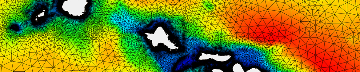
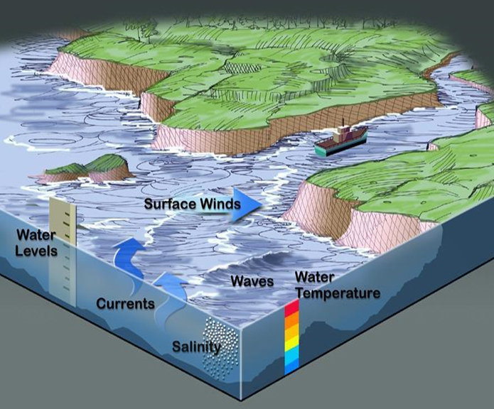
Operational Forecast Systems (OFS)
Layered (3D) numerical ocean forecast modeling systems that provide short range forecast guidance of
oceanographic conditions. Some of these models also include salinity and temperature, in addition to
water levels and currents.
Product Dissemination
Coast Survey also provides multiple platforms to disseminate the coastal and ocean products based on the end users:
Coast Survey's Modeling Program
Coast Survey is the primary developer for both OFS and surge models, developing new model forecast systems based on community software and internal models, and vetting third-party models developed by the academic community before they become operational. Coast Survey is also the primary interface for the National Ocean Service's (NOS) high-resolution, high-fidelity storm surge models used in operations by NOAA's National Weather Service (NWS). The success of Coast Survey's coastal and ocean modeling work is credited for close collaboration with our partners across NOAA's NOS, NWS, OAR, and NESDIS, and with our partners in other government agencies and academia.
Coast Survey works closely with academic and industry partners to test, develop, and implement new technologies critical to next-generation operational capabilities. Examples include using data assimilation techniques to integrate model results with satellite and in-situ observations, developing coupling mechanisms to link coastal models with other NOAA models (National Water Model, WAVEWATCH III®, ice, atmospheric, etc.), and integrating NOS' coastal models into NOAA's Unified Forecast System. Coast Survey embraces a community framework to provide a Research to Operations / Operations to Research (R2O/O2R) infrastructure for accelerating improvements to NOAA modeling, and follows a strategy to use this philosophy towards world-class modeling techniques that are driven by user requirements.
Vision
Goals
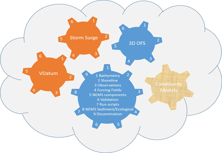
Modeling Framework
Coast Survey's modeling strategy is developing a standard framework for models to get the information they need to be set up and implemented and to then share that information in a community environment. By building the models to take advantage of streamlined standard procedures and datasets, the resulting system can act more as a machine whose interconnected components provide more summative robustness than if treated as separate parts. The workflow for this system, Coastal Ocean Guidance System (COGS), to reflect how cogs on interconnected wheels can provide the optimal torque to move the whole system forward. We are currently migrating the COGS workflow into the cloud. Key sources that are used for boundary and forcing conditions include: bathymetry, shoreline, observations and wind models. OCS' National Bathymetry Source framework and OCS/NGS shoreline database are used to automatically generate a coastal ocean model grid that represents the bathymetry and topography. The ocean model grid, observations and the wind models are used to force and constraint the boundary conditions of the coastal and ocean models.