 An
official website of the United States government.
Here's how you know we're official.
An
official website of the United States government.
Here's how you know we're official.
An
official website of the United States government.
Here's how you know we're official.
An
official website of the United States government.
Here's how you know we're official.
NOAA Custom Chart is a web-based application that can be used to generate a customized paper nautical chart. The custom charts are created directly from the latest official data available within NOAA's electronic navigational charts (NOAA ENC®). The application outputs a geospatially referenced portable document format (PDF) file, which may then be printed and used to augment navigation using actual NOAA ENCs.
This webinar describes the use of the new version of NOAA Custom Chart and includes a walkthrough of creating a custom chart.
Comments may be submitted through NOAA's ASSIST feedback tool.
Presentation
Slides
Recorded
Session
Transcript
Webinar questions and answers
Additional
Information

Christie Ence is the chief of the Chart Standards Group in NOAA Office of Coast Survey's Marine Chart Division.

Colby Harmon is a cartographer and project manager in NOAA Office of Coast Survey's Marine Chart Division.
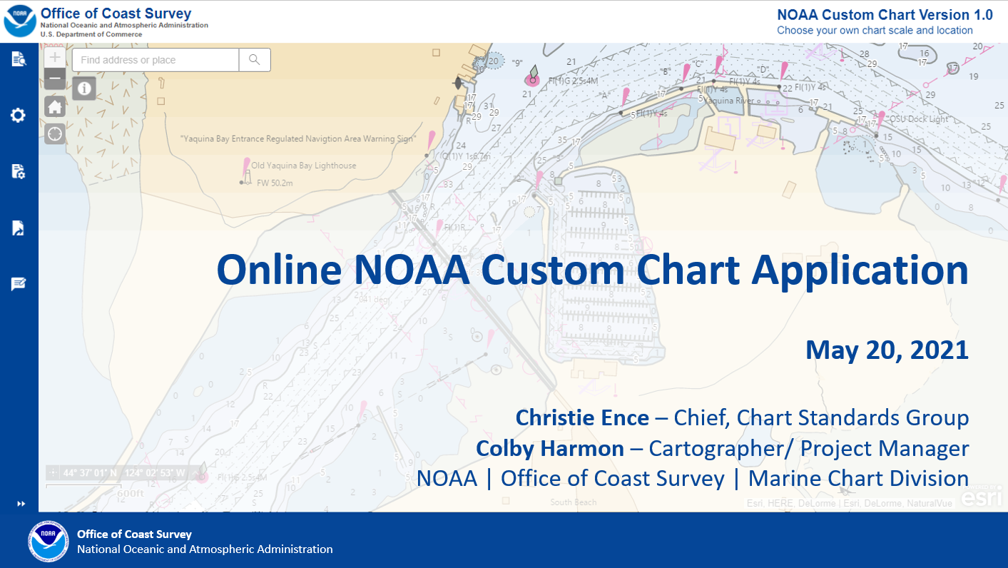
On April 1, 2021, NOAA's Office of Coast Survey released NOAA Custom Chart version 1.0, a dynamic map tool which enables users to create their own paper and PDF nautical charts derived from the official NOAA electronic navigational chart (NOAA ENC®), NOAA's premier nautical chart product. The online tool uses official NOAA ENC data to create nautical charts with customized scale and extent, which can then be downloaded as PDF files.
This webinar provides an background on the development of the NOAA Custom Chart. It includes a discussion of the various settings, a demonstration on how to make a chart with the application, and a review of some of the components of the NOAA Custom Chart output.
Comments may be submitted through NOAA's ASSIST feedback tool.
Presentation
Slides
Recorded
Session
Transcript
Additional Information

Christie Ence is the chief of the Chart Standards Group in NOAA Office of Coast Survey's Marine Chart Division.

Colby Harmon is a cartographer and project manager in NOAA Office of Coast Survey's Marine Chart Division.

Recently, NOAA announced the start of a five-year process to end traditional paper nautical chart production.
This webcast provides an overview of the raster chart cancellation process including timelines, considerations for cancelling individual charts, the process for notifying the public of pending chart cancellations, and other impacts. Improvements to NOAA Chart Products, such as the NOAA Custom Chart are also discussed.
Comments may be submitted through NOAA's ASSIST feedback tool.

Capt. E.J. Van Den Ameele is the chief of NOAA Office of Coast Survey's Marine Chart Division.

Julia Powell is the chief of NOAA Office of Coast Survey's Navigation Services Division.

Colby Harmon is a cartographer and project manager in NOAA Office of Coast Survey's Marine Chart Division.

Recently, NOAA announced the start of a five-year process to end traditional paper nautical chart production. While NOAA is sunsetting its traditional nautical chart products, it is undertaking a major effort to improve the data consistency and provide larger scale coverage within its electronic navigational chart (NOAA ENC®) product suite. Over the next five years, NOAA will work to ease the transition to ENC-based products, such as providing access to paper chart products based on ENC data. The online NOAA Custom Chart prototype application enables users to create their own charts from the latest NOAA ENC data. Users may define the scale and paper size of custom-made nautical charts centered on a position of their choosing. Users may then download, view, and print the output. The application is an easy way to create a paper or digital backup for electronic chart systems.
This webcast provides an overview of the sunsetting process and a live demonstration of the NOAA Custom Chart prototype, including a discussion of the improvements that are planned for the prototype. Comments may be submitted through NOAA's ASSIST feedback tool.

Capt. Chris van Westendorp is the chief of NOAA Office of Coast Survey's Navigation Services Division.

Colby Harmon is a cartographer and project manager in NOAA Office of Coast Survey's Marine Chart Division.

This presentation describes the S-100 Universal Hydrographic Data Model and what navigation system developers need to know in order to implement various S-100 based product specifications. It also focuses on what NOAA is specifically working on in the S-100 product development space for S-111 surface currents. The key areas that are addressed include:
Presentation
Slides
Recorded
Session (includes Q&A)
Transcript

Julia Powell is the deputy director of NOAA's Coast
Survey Development Lab and the chair of the International
Hydrographic
Organization's S-100 Working Group.
julia.powell@noaa.gov

Dr. Neil Weston is the technical director for NOAA's
Office of Coast Survey.
neil.d.weston@noaa.gov