Coast Survey collaborates with other federal agencies in the Waterway Harmonization Project
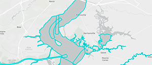
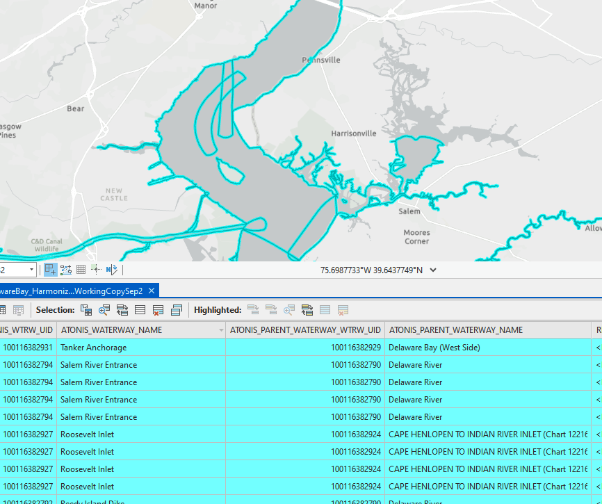
Display of newly created polygons designating areas on the
Delaware River
Coast Survey is currently in the process of transitioning away from raster navigational charts, which involves charts being moved into last edition status and eventually not being available as an updated navigational product. This process will eventually lead to chart references in publications outside NOAA being incorrect. The goal of the Waterway Harmonization Project is to develop an authoritative database consisting of waterway names and polygons to aid in the reporting of maritime information by the U.S. Coast Guard and to replace the current mechanism that reports this information by NOAA raster chart number and limit. Coast Survey is working with the U.S. Coast Guard, U.S. Army Corps of Engineers, National Geospatial-Intelligence Agency, and the Department of Transportation to develop polygons for various waterways across the United States. These polygons will be used to define a spatial component for areas that historically were referenced to raster navigational charts on public products, like the U.S. Coast Guard’s Light List and Local Notice to Mariners. The project team members are using the Light List for waterway names and using various data sets to define polygons. For more information contact
Sean.Legeer@noaa.gov.
Texas navigation manager participates in two STEM related events
Texas Navigation Manager Quentin Stubbs, Ph.D., recently participated in two events to contribute to NOAA’s ongoing initiatives of science, technology, engineering, and math (STEM) recruitment, education, diversity and inclusion. On September 22, Quentin served on a NOAA panel during the Federally Employed Women's Virtual STEM Day, discussing engineering, aviation safety, and coastal navigation. The panel also consisted of LCDR Rebecca Shaw (Office of Marine and Aviation Operations) and Michael Teninty, an aviation safety program manager in the Office of Marine and Aviation Operations. On September 9, Quentin served as the host for the National Association of Black Geoscientists (NABG), 2021 Virtual Conference – Looking into the Future. The conference included poster presentations and networking with exhibitors like the U.S. Geological Survey and the Cooperative Institute for Research in Environmental Sciences. He hosted panel discussions on preparing for graduate school, navigating through various jobs, and looking into the future for minorities in STEM research and leadership. The NABG supports students pursuing degrees in geology, geophysics, earth and planetary science. For more information contact Quentin.Stubbs@noaa.gov.
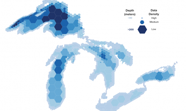
Mapping update given by Great Lakes Navigation Manager at Lakebed 2030 Conference

Great Lakes lakebed hex map with key.
Coast Survey provided a mapping update at the
Lakebed 2030 Conference, which took place from September 29 to October 1. The presentation, given by
LCDR Charles J. Wisotzkey, Great Lakes navigation manager, discussed raster transition, ENC rescheming, Precision Marine Navigation, HSD plans, NRB activities in Lake Michigan, uncrewed systems collaboration and Coast Survey contributions to the Lakebed/Seabed effort. Lakebed 2030 is a regional grass-roots initiative to align mapping efforts in the Great Lakes region with Seabed 2030 efforts and ensure that the region is represented within the context of larger mapping initiatives such as the National Ocean Mapping, Exploration, and Characterization strategy. While many maps show the shape and depth of the lake floor, they were mostly created using decades-old data. The Lakebed 2030 initiative continues to gain momentum and this year's conference was quite well attended by representatives from academia, industry, and government. The conference was hosted by NOAA’s Integrated Ocean and Coastal Mapping team and Office for Coastal Management, along with the Great Lakes Observing System, Northwestern Michigan College, the Hydrographic Society of America, and private sector sponsors. Many thanks to Coast Survey’s
Amber Butler, who worked behind the scenes on coordination in support of the conference. For more information contact
Greatlakes.Navmanager@noaa.gov.
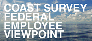
Federal Employee Viewpoint Survey results follow-up
Coast Survey leadership wants your feedback on the 2020 Federal Employee Viewpoint Survey recommendations for improvement. Please do so using this
feedback survey by Friday, October 22. The survey will not collect your email addresses, so there will be no way for us to associate your responses back to you. For more information contact
Amanda.Phelps@noaa.gov.


Staff Updates
LCDR Charles Wisotzkey
Navigation Services Division recently underwent a change in navigation managers for the Great Lakes.
LCDR Charles Wisotzkey reported to Stennis Space Center to take over as the Navigation Response Branch team coordinator from LCDR John Kidd. LCDR Wisotzkey joins NRB after spending the last couple years in the Customer Affairs Branch serving as the navigation manager for the Great Lakes region. He is responsible for the day to day management of the uncrewed team and the boat team.
Tom Loeper
NSD management requested that
Tom Loeper take over the role as the Great Lakes navigation manager. He will be splitting time between that role and Chief of Nautical Publications Branch. On January 1, 2022, he will become the full time navigation manager for the Great Lakes. Tom is a natural fit for this position as he acted as the Great Lakes navigation manager on a part time basis for seven years prior to LCDR Wisotzkey.
Thank-you to LCDR Wistokey for his excellent work in the Great Lakes and welcome to Navigation Response Operations and welcome back to Tom Loeper as a navigation manager.
Opportunities
Coast Survey's Navigation Services Division is seeking a qualified individual for a four to six month detail in the Nautical Publications Branch.
Please see this link for more detail.
Coast Survey’s Marine Chart Division is seeking a cartographer for a long-term detail as an IC-ENC validator in the Chart Standards Group. The position is open to a Cartographer (ZP-3).
Please see this link for more detail. If you are interested, please discuss it with your supervisor and send a short resume and statement of interest to
Christie Ence and
CAPT E.J. Van Den Ameele by COB October 22, 2021.