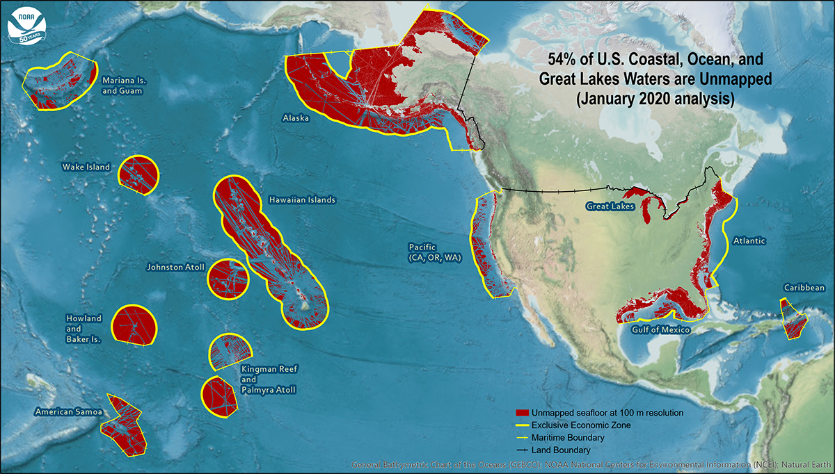
NOAA announces new progress report on mapping U.S. ocean, coastal, and Great Lakes waters
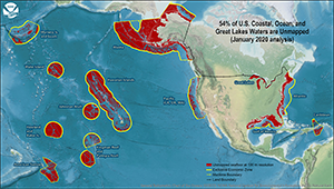
Geographic distribution and extent of the unmapped areas
within U.S. ocean, coastal, and Great Lakes waters. Analysis
conducted in January 2020.
NOAA released the first annual report on the progress made in mapping U.S. ocean, coastal, and Great Lakes waters. The depth, shape, and composition of the seafloor are foundational data elements that we need to understand in order to explore, sustainably develop, conserve, and manage our coastal and offshore ocean resources. The 2019
Presidential Memorandum on Ocean Mapping of the United States Exclusive Economic Zone and the Shoreline and Nearshore of Alaska and the global
Seabed 2030 initiative make comprehensive ocean mapping a priority for the coming decade. The
Unmapped U.S. Waters report tracks progress toward these important goals. For more information visit our
blog and contact
Meredith.Westington@noaa.gov.
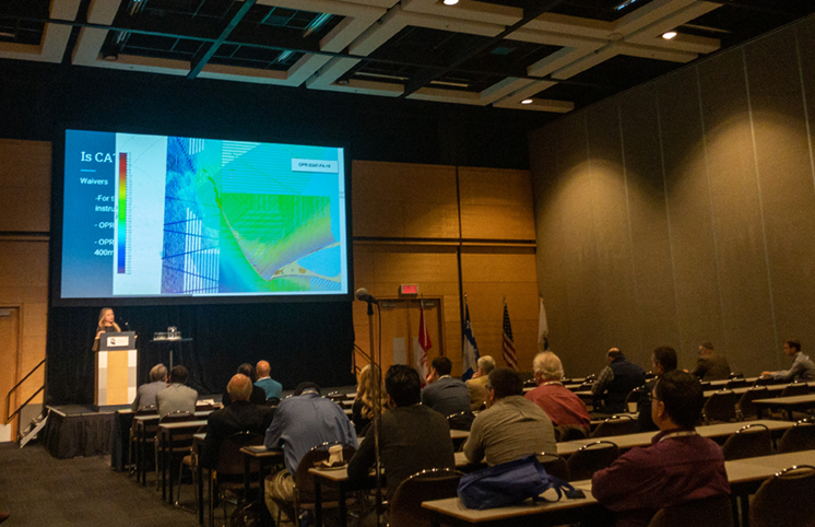
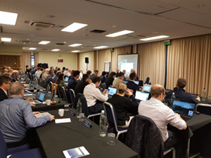
Information exchange at the Canadian Hydrographic Conference
Ali Johnson presents on Arctic surveys at the Canadian
Hydrographic Conference.
Representatives from Coast Survey presented at the Canadian Hydrographic Conference held in Quebec from February 24 – 27, 2020. The Canadian Hydrographic Association (CHA) hosts this biennial conference, which provides important networking and information exchange opportunities.
Rear Adm. Shep Smith gave opening remarks while
Glen Rice (NBS team lead, Hydrographic Systems and Technology Branch (HSTB)),
Lt. Cmdr. Damian Manda (chief, HSTB),
Lt Cmdr. Charles Wisotzkey (Great Lakes navigation manager), and
Ali Johnson (chief survey technician on NOAA Ship
Fairweather) presented on a variety of topics from NBS updates to Arctic surveys on the NOAA Ship
Fairweather. For more information contact Lt. Cmdr.
Damian.Manda@noaa.gov.
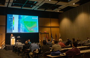
Coast Survey leads the S-100 working group
S-100 working group meeting attendees.
Julia Powell (deputy chief, Coast Survey Development Lab) chaired the 5th S-100 Working Group meeting in Taunton, United Kingdom, hosted by the United Kingdom Hydrographic Office from March 3-6, 2020. More than 60 participants attended the meeting representing member states, industry, and academic organizations.
Craig Winn (HD charting portfolio manager, Marine Chart Division) represnted NOAA at the meeting. Key items under consideration were the next edition of S-100 and topics of strategic importance including the operational readiness of S-101 and dual fuel ECDIS and type approval. For more information contact
Julia.Powell@noaa.gov.
Follow along with Coast Survey's chart improvements using new web map service
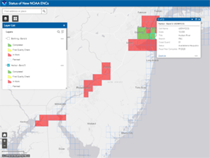
New Jersey and surrounding area displayed in the new web
map service.
Coast Survey released a new and improved
web map service featuring the status of NOAA Electronic Navigational Charts (NOAA ENC®) as they undergo major improvements. The current ENC scheme is based on the extents of the paper nautical charts from which ENCs were originally digitized. Improvements to the ENC suite involve replacing this puzzle-piece layout with a rectangular grid of ENCs (referred to as rescheming), often providing larger scale and more detailed coverage than the existing paper charts. The public can now view ENC project status from the planning and creation stages all the way to completion, keeping them better informed of when these enhanced navigational charts will be available. This process was first announced in the
National Charting Plan and explained in more detail in the
Transforming the NOAA ENC®. For more information contact
Colby.Harmon@noaa.gov.
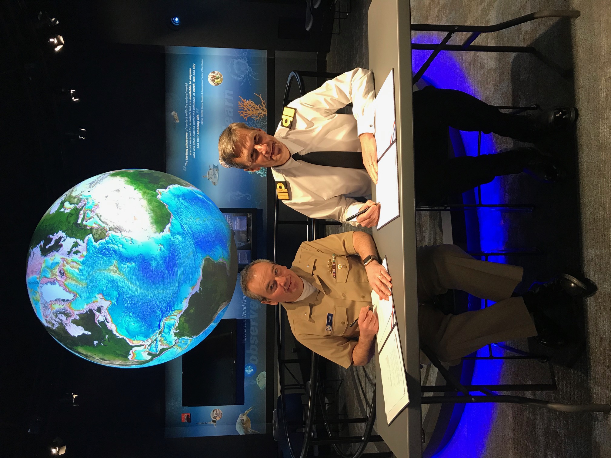
UK National Hydrographer visits Coast Survey
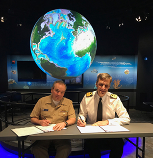
Rear Adm. Smith and Rear Adm. Sparks signed two
agreements last week.
On Tuesday, March 10, Coast Survey welcomed the new UK Hydrographic Office (UKHO) National Hydrographer and Deputy Chief Executive, Rear Adm. Peter Sparkes, to the NOAA Silver Spring campus. The courtesy visit focused on the new responsibilities of Sparkes, and built on the strong existing relationship between Coast Survey and the UKHO. The visit provided an opportunity to discuss topics such as NOAA’s experience with hydrographic autonomous operations, the future of the S-100 hydrographic model in supporting navigation, preparation for the International Hydrographic Organization (IHO) Second Assembly (Monaco, April 2020,
now postponed), a demonstration of NOAA Science on a Sphere, and other recent developments. Two agreements, one facilitating data exchange with the UKHO and one on the international distribution and validation of NOAA ENC, were signed by Rear Adm. Shepard Smith and Sparkes during the visit. For more information contact
Jonathan.Justi@noaa.gov.


Staff Updates

Justin Collett
Justin Collett is a new hire with NOAA and the Navigation Response Team in Fernandina, Florida. He grew up fishing the North Carolina coast which led to his interest to study Marine Biology at the University of North Carolina Wilmington. Later on, he attended Cape Fear Community College which honed his practical skills of working in the marine environment. Through that program Justin attended research-based cruises aboard the R/V
Cape Hatteras. After schooling, Justin worked aboard the sister ship of his alma mater, the R/V
Point Sur in the Gulf of Mexico as chief mate. While there, he had the fortunate experience of working with many scientists and engineers on various research projects from biological surveys to deploying a multitude of sensors on the seafloor. For the past four years, Justin worked in the dredging industry as a surveyor/engineer/boat captain which led to more experience working in the marine industry and a captain's license. Justin is very happy to join a team that promotes relief efforts in affected areas of hurricanes and also the lifestyle change of having a home base.
Julia Powell
The Navigation Services Division (NSD) welcomes
Julia Powell as the new chief of NSD (effective May 2020). Julia was reassigned from her previous position as the deputy chief of CSDL and will overlap with Capt. van Westendorp in May. NSD has significant changes coming in the years ahead, such as taking over the leadership of Precision Navigation and eventually all dissemination for Coast Survey. Julia's experience and passion for next generation navigation services and S-100 services makes her a great fit for these challenges facing NSD.
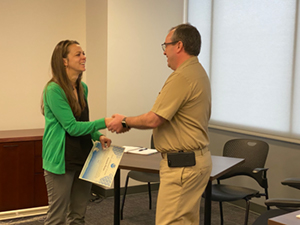
Amanda Phelps recieves the Silver Sherman Award.
Amanda Phelps recieved the 2019 Silver Sherman Award last week. The NOAA Silver Sherman Award was created in 2016 to recognize individuals who have made an exceptional contribution to NOAA's mission. Amanda recieved this award for "outstanding leadership of Coast Survey's strategic communications and budget formulation work. Amanda jumps into the most complex and daunting challenges with confidence and calm, marshaling the best thinking across Coast Survey and communicating them succinctly and persuasively. Trusted and respected by all, she is the MVP of many ad hoc teams."
Opportunities
Detail Annoucement: Deputy Chief of the Coast Survey Development Lab
Detail duration: Up to 120 days
Location: NOS/OCS/Coast Survey Development Laboratory - Silver Spring, Maryland
Approximate expected start date: Mid-April 2020
Who may apply: Current NOAA federal employees at the ZP-04 or ZP-05 level
For more information see the position description.
Contact Julia.Powell@noaa.gov with questions.