September 25, 2019
Hello Coast Survey,
On September 13, I was in Hawaii attending a planning event for NOAA Ship Rainier’s 2020 field season. The year 2020 will be unique as it will demonstrate an amazing level of collaboration among the Office of Coast Survey, the National Centers for Coastal and Ocean Science, the National Geodetic Survey (NGS), the NOAA Coral Reef Conservation Program, the National Marine Fisheries Service, and the Office of Marine and Aviation Operations. At this meeting, the team developed a strategy to map the waters from shore out to 1000 meters around Guam, Saipan, Rota, Tinian, and potentially other islands in the northern part of the Commonwealth of the Mariana Islands. Within this depth range, the team will map bathymetry and backscatter, and characterize habitat, while simultaneously performing coral reef assessment dives and collecting other oceanographic observations.
We are working with NGS to outfit Rainier with a gravimeter to improve our geodetic modeling of the island chain as well as deploy drones to map the nearshore region. We will work with our partners in NCCOS to use the drone imagery to create structure from motion models of the bathymetry within the nearshore regions. This will help to assess habitat and provide valuable data for the nautical chart in an area of coastline that is notoriously dangerous and hard to acquire. In addition to divers, we also plan to test unmanned underwater systems abilities to characterize the reefs from video.
So what does this have to do with nautical charts? Well, I see this collaboration as a way for Coast Survey to broaden our ocean mapping skills to support a diverse scientific community both inside and outside of NOAA. It opens opportunities for us to provide new and valuable products from the hydrographic surveys we routinely acquire in support of nautical charting. But the biggest value this, and all collaborations have, is providing us with more experience. If we don’t practice our craft, whether that be hydrography, geodesy, cartography, navigation, or ship driving, we will lose those skills. Budgets are shrinking and our time underway on NOAA vessels is continually decreasing. Many of our ships are funded to sail half the days they were sailing when I was an ensign — this is unsustainable.
Collaboration is an excellent way to fully utilize our ships and personnel and allows us to further our science in new and exciting ways. What I find most exciting is witnessing how our expertise contributes to another programs’ science in innovative ways, while we, in turn, learn about their valuable science. This is an new era in Coast Survey where our skills are in demand not just for nautical charting, but also for a broad array of science which will ultimately make us stronger, smarter, more agile, and make Coast Survey a more interesting place to work.
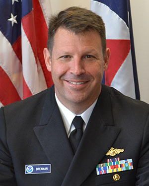
Capt. Rick Brennan
Acting Director, Office of Coast Survey
Chief, Hydrographic Surveys Division
