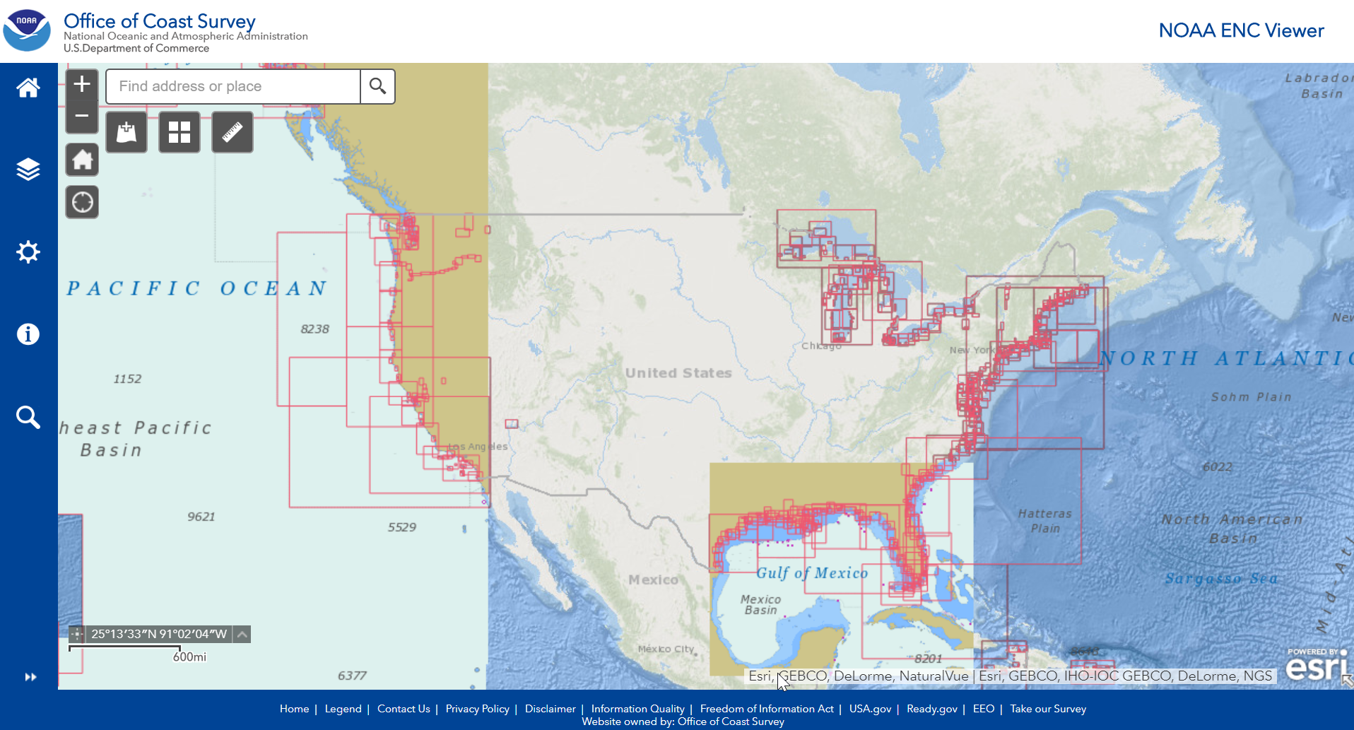
On July 20, 2019, NOAA’s Office of Coast Survey unveiled two new GIS viewers — NOAA ENC® viewer and NOAA RNC® viewer — allowing users to seamlessly interact with NOAA’s various chart products.
In 2013, Coast Survey originally released NOAA ENC Online, a continuous viewer for NOAA’s electronic navigational charts (NOAA ENC®). This gave users the ability to click on the web map and zoom to selected features or locations, to see the information contained in more than a thousand electronic charts of NOAA-charted waters. As the user zoomed in and out, ENC features became visible or invisible allowing for a seamless look at up-to-date chart data.
The new NOAA ENC viewer utilizes the NOAA ENC Online REST service, part of Esri’s ArcGIS for Maritime, which allows users to not only interact with the ENC data in this viewer, but also use the REST end point in their own web viewers and applications. Overall, the functionality of the viewer has not changed but one thing to note is the REST service URL for the ENC service has changed. Users that have the service URL built into their applications or web maps will need to change it to the new URL listed below.
New ENC service URL: https://gis.charttools.noaa.gov/arcgis/rest/services/MCS/ENCOnline/MapServer/exts/MaritimeChartService
Below is a list of features of the NOAA ENC viewer:
Generic features
- Displays data using S-52 presentation library specification edition 3.4.
- Provides indexing for the S-57 attribute object name
- Provides access to S-57 attribute information
- Links external files to S-57 attributes
- Allows for the best scale data to be displayed similar to how an Electronic Chart Display and Information System displays best scale data based on the map scale as a user zooms in and out of the display
Web application features
- Search service by object name (OBJNAM), national object name (NOBJNM) and dataset names
- Identify features and display their attributes in a pick list
- Zoom to selected features
- Change basemaps
- Measure area and distance, get coordinates
- Set safety, shallow and deep depth contours
- Switch between simplified and traditional symbols
- Display light sectors, safe soundings
- Displays feature symbology based on date dependency range
- Change the background colors of the display
- Turn off certain features or adjust transparency
In addition to the new ENC viewer, Coast Survey is also unveiling an updated version of the RNC viewer. This viewer provides a seamless look at NOAA raster navigational chart products and information that is traditionally located on a paper chart product. Ultimately, this allows mariners to take their traditional chart products with them anywhere they have an internet connection, including on their mobile devices!
The RNC viewer utilizes the NOAA RNC tile service which provides standardized nautical chart tilesets for the public, eliminating the need for application developers to regularly undergo the cumbersome process of transforming NOAA BSB files into tilesets. It provides geo-referenced charts compatible with the Web Map Tile Specifications (WMTS) and Tile Map Service Specification (TMS). All tilesets are published on a weekly basis.
NOAA ENC and RNC viewers are not certified for navigation. They do NOT fulfill chart carriage requirements for regulated commercial vessels under Titles 33 and 46 of the Code of Federal Regulations.


I used to be able to casually look at NOAA charts using Chart Viewer.
Now I can not even find out how to start Chart Viewer. But I can find a lot about how wonderful the product is. Effectively to me this means that Chart Viewer is a discontinued product.
Howdy
I am unable to use the ENC viewer online. I receive the following error – The layer, ENC, cannot be added to the map.
I am left with a map and no chart data.
When I open the layer list, it is empty
Maritime Display Properties – This map has no Maritime Chart Service Layer
Please let me now how to correct this problem
I have the same issue. This may be a great tool, once there is a user manual.
Your products are targeted to viewers who are maritime professional navigators. It’s way too hard to find what an average boater is looking for. Please reconsider how you present your available products so average boaters can easily use them. After all, it’s the average boater that we want consulting the charts.
Is there a PC, Mac, or Tablet chart viewer? Some of the products are available as PDF, but some are only ENC objects.
There are now two ways to view ENC data online. The current ENC Viewer that renders ENC data with IHO S-52 ECDIS symbology and the new NOAA Chart Display Service Viewer prototype that renders ENC data with traditional “paper chart” symbology. If you miss the RNC Viewer, you might want to try out the NCDS Viewer. Both viewers can be accessed from the Coast Survey homepage.
How do I view these ENC charts on my GPS?
Here is a link that may be helpful.
https://nauticalcharts.noaa.gov/data/gis-data-and-services.html#enc-display-services
In the process of updating navigational aids that are on the websites chart but not on the most recent OpenCPN or I Nav X charts. How do you get the Lat and Lo of a nav aid on these charts. Pushing the scope icon (lowest icon on the left under home icon) does nothing. Also interesting why the USACE site which the charts refer you to, presents the KML files as KMZ which you can’t overlay onto these charts (you can on Google Earth).