Unmanned aerial system mission updates Coast Pilot® 6 and supports shoreline data collection

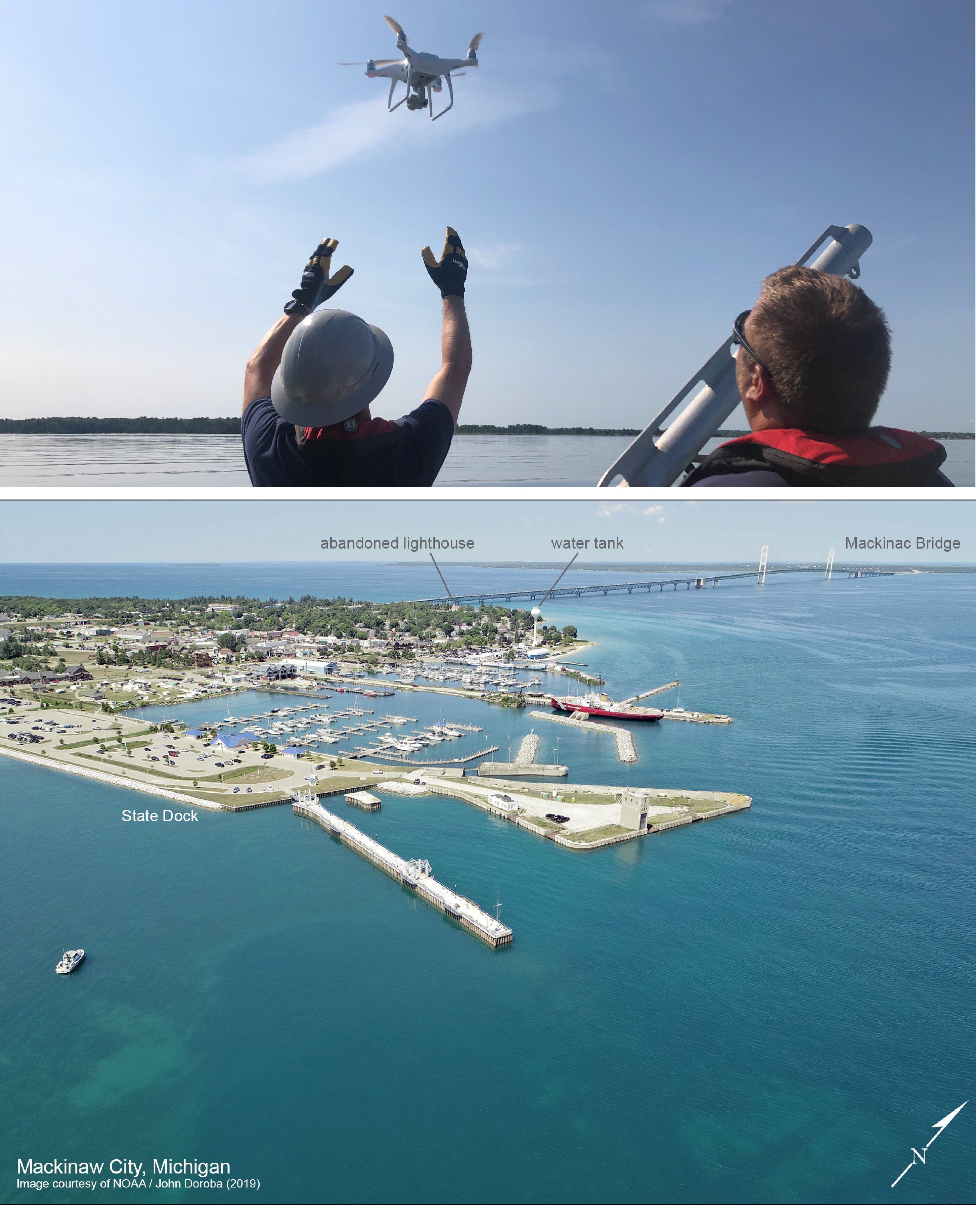
Top image: Lt. j.g. Matt Shar (left) and John Doroba (right)
launch an UAS over Lake Huron. Bottom image: Aeriel view
taken by the UAS of Mackinaw City, Mich., as found in the
updated Coast Pilot® 6.
The week of July 29,
Lt. j.g. Matt Sharr (mission commander) and
John Doroba (pilot in command) of Coast Survey Development Lab's (CSDL) Hydrographic Systems and Technologies Branch (HSTB) joined Coast Survey’s navigation response team (NRT) from New London for the start of their South Channel project, in Cheboygan, Mich. Using only Coast Survey assets, the goal of the project was to plan, execute, and incorporate unmanned aerial system (UAS) data into survey workflows. The team conducted operations from both shore and while underway with the NRT, in order to explore various methods for UAS operations. They completed 16 flights and acquired thousands of images along the shoreline of Cheboygan and along Duncan Bay, which will be used to create DEMs and orthomosaics using structure from motion (SfM). Optimal weather conditions and water clarity allowed charted ruins and wrecks visible through the water column. John and Matt also captured images of Cheboygan Harbor and Mackinaw City that they quickly incorporated to update Coast Pilot® 6. Overall, the mission successfully explored UAS capabilities in supporting shoreline data collection, Coast Pilot updates, and collecting imagery that can be used by field teams for safe and efficient nearshore operations. For more information contact
hstb.ocs.chief@noaa.gov.
2019 Internships in Marine Geography Program concludes with career workshop
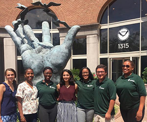
Amanda Phelps (NOAA), Christine Louis-Jacques (Greening
Youth Foundation), Lillian Dinkins, Nidhi Mehta, Maya
Garrison, Justin Pinero, Adrienne Byrd (Greening Youth
Foundation).
Last week, Coast Survey sponsored a career workshop for the Internships in Marine Geography, a 10-week program aiming to provided meaningful work experiences to youth of under-represented demographics. The 2019 class worked on projects ranging from whale-based educational outreach programs with primarily Puerto Rican students, to developing a survey outline tool which generates polygons from acquired hydrographic data. Interns had the opportunity to share their projects with their peers and supervisors, paddled at
Mallows Bay-Potomac River National Marine Sanctuary, the newest of the national marine sanctuaries, and discussed a variety of career paths available at NOAA.
Get your project descriptions ready for next year's interns. A call will come out in November! For more information contact
Amanda.Phelps@noaa.gov.
Coast Survey visits hydrographic survey partners in Michigan

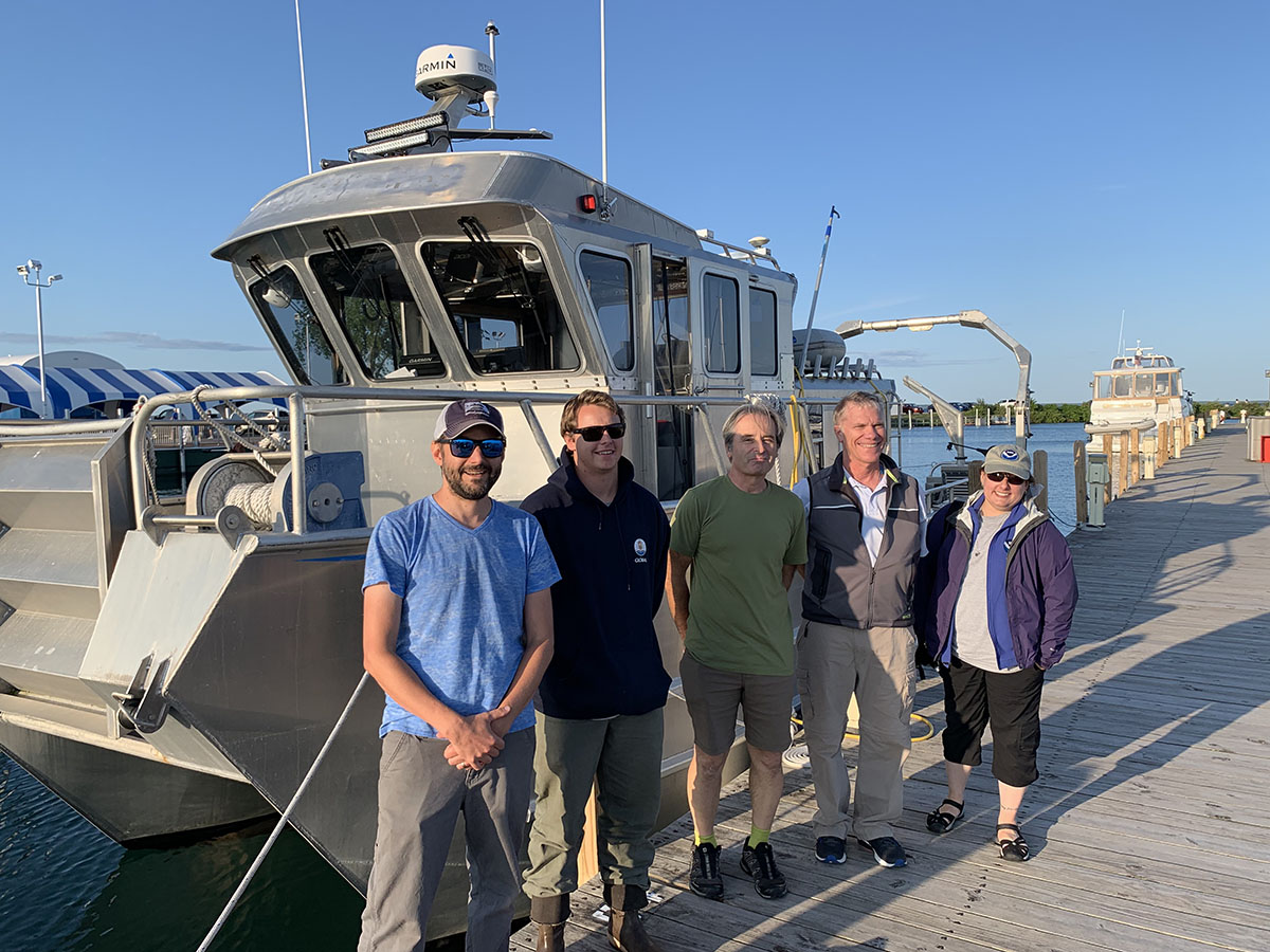
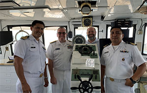
David Neff, Ryan O’Boyle, and Gerhard Skerbinek from
eTrac, Inc. with Tom Loeper, and Meredith Payne.
On July 22-24, Hydrographic Surveys Division's (HSD) Project Manager,
Meredith Payne, and Great Lakes Navigation Manager,
Thomas Loeper, traveled to Michigan to visit with survey partners. They met staff at the
Thunder Bay National Marine Sanctuary (TBNMS) in Alpena, Mich., to discuss TBNMS projects and possible future collaborations with Coast Survey. Next, they traveled north to the Straits of Mackinac region, where they conducted a site visit with contractor eTrac, Inc., who is currently conducting hydrographic survey work for NOAA HSD in the heavily trafficked corridor that joins Lake Huron and Lake Michigan. Meredith and Tom were able to ride along on eTrac's survey vessel
Endeavor and observe multibeam sonar data collection from both the main survey vessel, and next-generation technology ASVs known as WAM-V (wave adapted modular vessel). For more information contact
Meredith.Payne@noaa.gov.
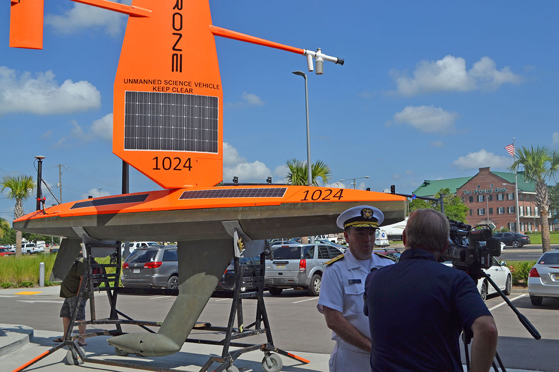
Press event highlights collaboration and Saildrone launch in the Gulf of Mexico

Rear Adm. Shepard M. Smith is interviewed by a local
Gulfport area television reporter.
Coast Survey, the University of Southern Mississippi (USM), and Saildrone held a joint press event at USM’s Hydrographic Science Research Center in Gulfport, Miss. The event promoted the research and testing of the first Saildrone — a wind-driven and solar-powered unmanned surface vehicle (USV) — equipped with multibeam echo sounder technology in the Gulf of Mexico. NOAA anticipates the success of this mission and technical achievement will lead to mapping projects in the Arctic. Staff from Rep. Palazzo and and Senator Wicker’s offices, local and regional stakeholders, and local media attended the event. For more information about the event contact
Kristen.Crossett@noaa.gov.
Visit to Mexico results in the start of bilateral agreement on data and technology exchange
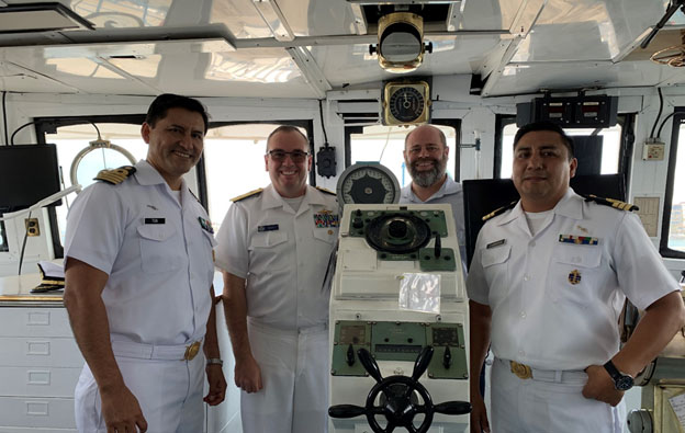
Captain Leonardo Tun Humbert, Rear Adm. Shep Smith,
John Nyberg, and Captain Fragata Cabrera on board SEMAR
Ship Rio Tuxpan.
Rear Adm. Shep Smith and
John Nyberg visited Mexico’s Secretaíra de Marina (SEMAR) July 29 and 30 in Mexico City and Veracruz. In Mexico City, they met with Vice Adm. Julio César Pescina Avila, director of research and development, to exchange information on charting, survey, and technology. The two agencies agreed to begin work on a bilateral agreement to help facilitate the exchange of data and technology. In Veracruz, Captain Leonardo Tun Humbert hosted Smith and Nyberg for a visit to SEMAR’s Hydrogaphic Office where they exchanged in-depth presentations on the future of charting and hydrography. They were also welcomed aboard the SEMAR Ship
Rio Tuxpan, formally the NOAA Ship
Whiting, to tour the ship and spend time discussing ship operations with the crew. For more information contact
John.Nyberg@noaa.gov.
Navigation response team activities
NRT-Stennis - The team is processing survey data and preparing for their next survey. Lt. j.g. Collin Walker from the team is with the Navy's Fleet Survey Team on a mission in Micronesia.
NRT-Fernandina Beach - The team is on leave.
NRT-Seattle - The team is processing survey data.
NRT-Galveston - The team is processing survey data and repairing the vessel.
NRT-New London - The team is in Cheboygan, Mich., for survey in Lake Huron and testing of the aerial drone with HSTB.
Bay Hydro II - The team is surveying in Delaware Bay.

Staff Updates
HSD’s Operations Branch welcomes Alexandra "Alex" Dawson. Alex is a graduate of the College of Charleston and was an active participant in their BEnthic Acoustic Mapping and Surveying Program (BEAMS) while completing her undergraduate studies. Alex joins us from the Atlantic Hydrographic Branch where she worked as an ERT contractor for the last 6 months, focusing her effort on survey acceptance reviews.
Marine Chart Division welcomes Courtney Brock. Courtney is cartographer for the Mid-Atlantic Production Branch. Before coming to NOAA, she was a Pathways intern in Albuquerque, N.M., for the U.S. Geological Survey’s New Mexico Water Science Center. While there, she converted hydrology data into GIS shapefiles and assisted with the network data infrastructure. She finished her master's degree in geographic information science from the University of New Mexico in 2018. Her research focused on GIS analysis of stray animal ecosystems throughout Albuquerque's city-scape. Before college, she was active duty in the United States Air Force in the field of cyber systems operations stationed in Tucson, Ariz.
In Memoriam
We are saddened to share the news that Rear Adm. James Austin Yeager, retired NOAA Commissioned Corps officer and former director of the Office of Charting and Geodetic Services at NOAA passed away on July 22, 2019. Yeager joined the Corps in 1959 and his ship service included NOAA ships Pioneer, Hodgson, Peirce, McArthur, and Mt. Mitchell. He commanded the latter three. As director of the Office of Charting and Geodetic Services, he managed the production of the nation's nautical and aeronautical charts as well as geodetic products and services. The full obituary honoring him is available online.