
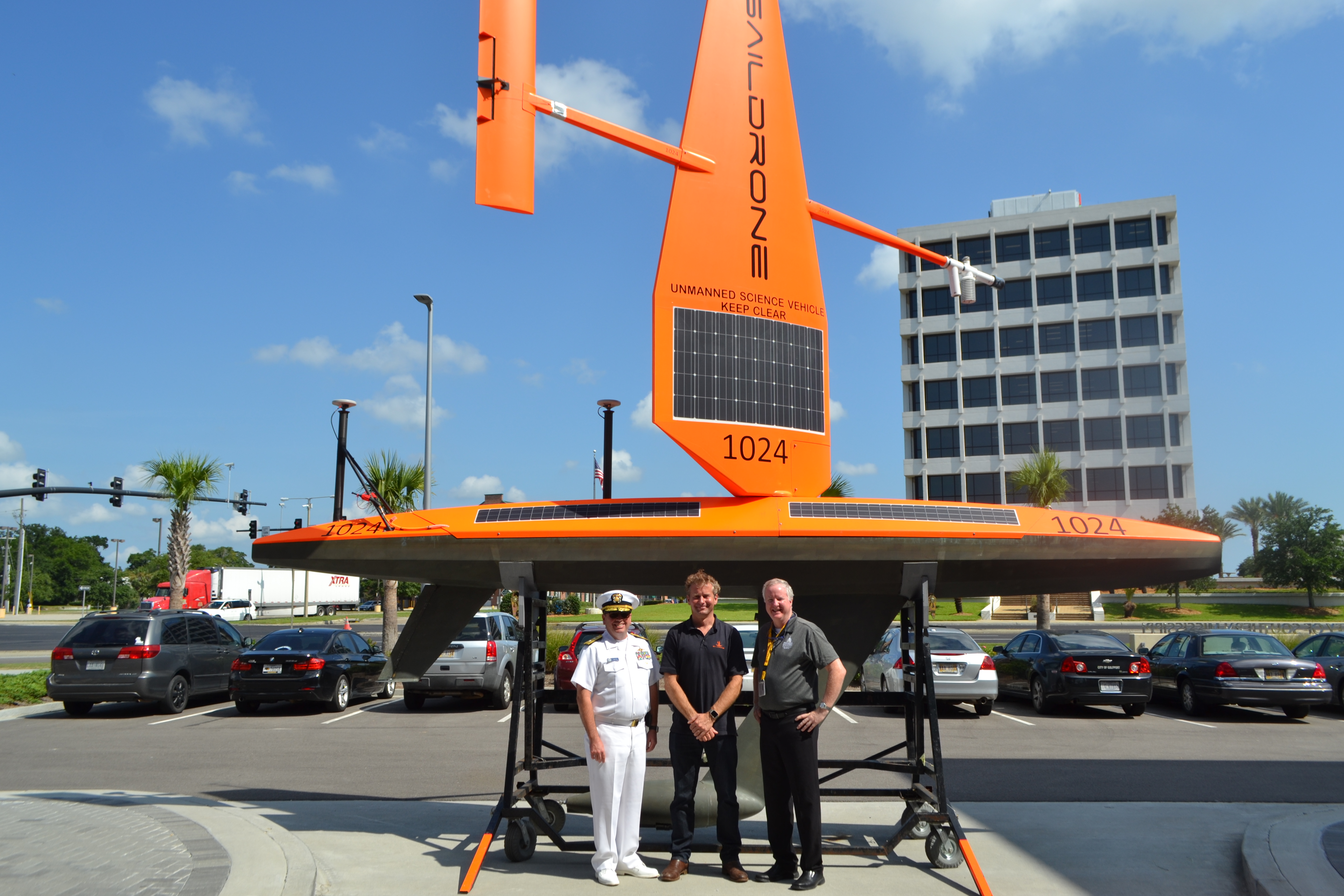
NOAA’s Office of Coast Survey, the University of Southern Mississippi (USM), and Saildrone accomplished a key milestone in the research and testing of unmanned technology that can lead to enhanced seafloor mapping capabilities with the launch of the first Saildrone — a wind-driven and solar-powered unmanned surface vehicle (USV) — equipped with multibeam echo sounder technology in the Gulf of Mexico. NOAA anticipates the success of this mission and technical achievement will lead to mapping projects in the Arctic.
“The operational deployment of multibeam technology on a Saildrone in the Gulf of Mexico and subsequent data output puts us closer toward the use of autonomous systems to map critical areas such as the Arctic,” said Rear Adm. Shepard M. Smith, director of NOAA’s Office of Coast Survey, “the potential for ocean mapping is extraordinary.”
The Saildrone USV was deployed into the Gulf on June 25 for its initial data collection mission and ran for 8 days. After evaluating the data collected by the USV and making some software improvements, USM launched the vehicle again on July 19 and recovered on July 22.
“These two missions provided great insight into the potential for this technology for ocean mapping, said Brian Connon, director of USM’s Hydrographic Science Research Center, “success of these missions and advancements in this technology are due to collaboration among government, academia, and the private sector.”
Launching the first Saildrone USV mapping mission using multibeam echo sounder technology was not without its challenges. The mission achieved three primary technological advancements in the areas of power management, communication, and automation; all critical for a mission in the Arctic where operational resources are not readily available.
Hydrographic survey systems were originally designed to run from larger ships that have power resources. On a long-duration unmanned vehicle power is limited, and in this case, harnessed from the sun. This creates limitations in data collection. Saildrone worked with Norbit, the multibeam sonar manufacturer, to create an efficient system that is capable of high resolution data collection on a tight power budget.
Communication can also pose an issue on long-duration USVs. Sending the USV commands, whether to change navigation patterns or adjust the sonar, is conducted via satellite. The challenge is understanding what the sonar is doing while out at sea. It is a complex instrument and coding for it remotely has proven possible on these missions.
Finally, determining data quality is a challenge. It is not possible for the system to send the data in its entirety back to the operator via satellite for real-time evaluation. So data quality must be determined another way while it is operating remotely. This is an evolving area of remote operation and one that automation and the ability of the sonar to “self-correct” will play a critical role.
Over all, autonomous solutions can be far more efficient than traditional methods of hydrographic surveys. Unmanned vehicles can be deployed from almost anywhere. Their state of the art guidance systems speed survey progress, and reduce the need for infill lines. Autonomous systems can access areas that are either too hazardous or too difficult for conventional vessels to get to, expanding the extent of survey coverage and enabling safer operations.
“Unmanned systems such as Saildrone, paired with multibeam technologies, are the future of exploration in remote or difficult to reach areas and provides a more efficient survey option,” said Richard Jenkins, CEO of Saildrone.
USM and Saildrone collaborated to configure the USV for this mission under a grant provided by NOAA’s Office of Coast Survey. Saildrone develops and manufactures autonomous sailing drones, with a wide range of capabilities including providing high quality oceanic and atmospheric observations. NOAA partners with Saildrone in other capacities such as data collection for fisheries management and weather/climate forecasting. The Hydrographic Science Research Center here at the University of Southern Mississippi works to expand the use of autonomy technology in seabed mapping and ocean cartography. The center performs research funded by grants through the Northern Gulf Institute.