By ENS Cullen Hauck
NOAA Ship Fairweather went farther north than ever before for the U.S. Coast Guard’s Port Access Route Study, a multi-year effort to establish new maritime traffic routes, safety zones, and use areas in the U.S. Arctic waters.

News and Updates

By ENS Cullen Hauck
NOAA Ship Fairweather went farther north than ever before for the U.S. Coast Guard’s Port Access Route Study, a multi-year effort to establish new maritime traffic routes, safety zones, and use areas in the U.S. Arctic waters.

“Since 1807, Coast Survey has been keeping mariners safe and maritime commerce flowing. It’s an honor to be a small part of its history.” – Neil Jacobs, Ph.D., NOAA Administrator and Under Secretary of Commerce for Oceans and Atmosphere
This January, NOAA staff, partners, and friends gathered to witness the change of command and assumption of the 32nd Director of the Office of Coast Survey.
NOAA Corps Rear Admiral (lower half) Chris van Westendorp accepted command of the Office of Coast Survey, relieving Rear Admiral (lower half) Benjamin K. Evans.
Continue reading “Coast Survey Change of Command: Welcoming Rear Admiral (lower half) van Westendorp, the 32nd Director of Coast Survey”
NOAA Ship Rainier charts volatile, glacially active waters in Glacier Bay National Park
By ENS P. Giamportone and ENS N. Greenlaw
In August 2025, NOAA Ship Rainier pulled into Lituya (lih-TOO-yuh) Bay, an inlet tucked within the outer edge of Glacier Bay National Park. The name is of Tlingit origin, meaning “lake within the point,” and the Bay has long been a source of sustenance and shelter. The entrance is narrow and turbulent, and the glacial walls make it vulnerable to rockslides and their following waves.
Continue reading “The latest expedition in Lituya Bay: NOAA and National Park Service collaborate to update nautical charts”
The winter months represent an end to NOAA’s active survey season. During this period, hydrographic survey ships, navigation response team survey vessels, and contractor teams and vessels undergo maintenance and repair in anticipation of the upcoming survey season. NOAA’s 2025 survey season will begin soon as planned survey projects go through the planning and development process and begin to filter to the forefront of each field party’s focus. The ships and survey vessels collect bathymetric data (i.e. map the seafloor) to support nautical charting, modeling, and research, but also collect other environmental data to support a variety of ecosystem sciences. NOAA considers hydrographic survey requests from stakeholders such as marine pilots, local port authorities, the Coast Guard, and the boating community, and also considers other hydrographic and NOAA science priorities in determining where to survey and when. Visit our “living” ArcGIS StoryMap to find out more about our mapping projects and if a hydrographic vessel will be in your area this year!
Continue reading “NOAA’s 2025 hydrographic survey season is gearing up and will be underway soon”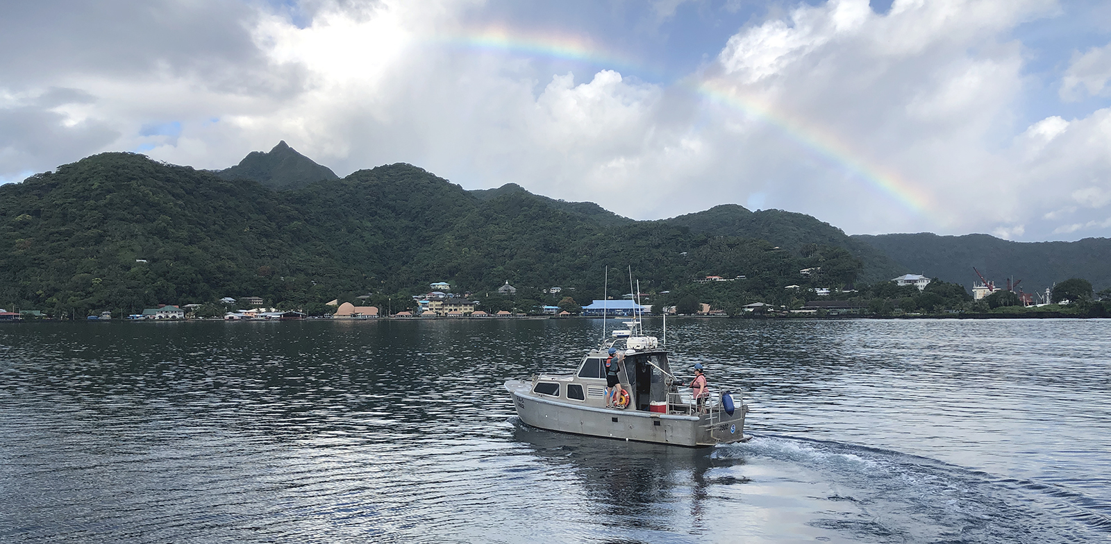
The National Oceanic and Atmospheric Administration’s 2024 hydrographic survey season is ramping up and will be in full swing before too long. For the past few months, NOAA hydrographic survey ships, navigation response teams, and contractors have been diligently preparing for the upcoming field season. The ships and survey vessels collect bathymetric data to support nautical charting, modeling, and research, but also collect other environmental data to support a variety of ecosystem sciences. NOAA considers hydrographic survey requests from stakeholders such as marine pilots, local port authorities, the Coast Guard, and the boating community, and also considers other hydrographic and NOAA science priorities in determining where to survey and when. Visit our “living” ArcGIS StoryMap to find out more about our mapping projects and if a hydrographic vessel will be in your area this year!
Continue reading “NOAA’s 2024 hydrographic survey season is underway”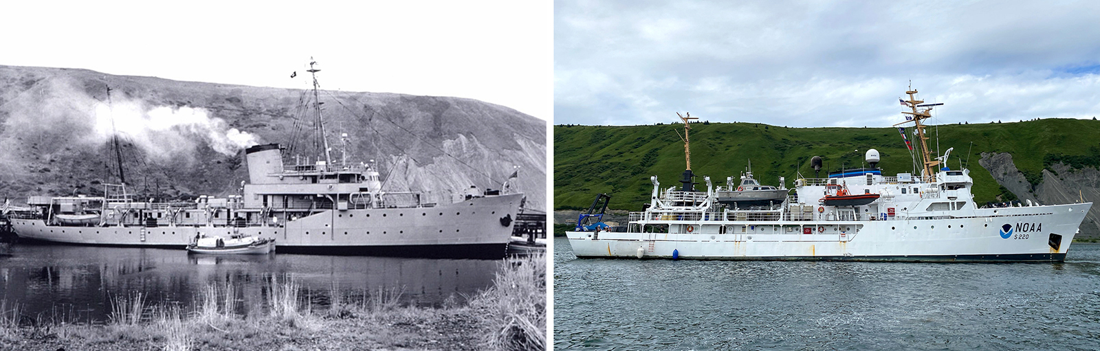
In the 1950s, U.S. Coast and Geodetic Survey (USC&GS) Pathfinder surveyed the Pribilof Islands with the latest technologies to chart previously unsurveyed waters and bring the islands into a common datum with the mainland. Fast forward 71 years and NOAA Ship Fairweather continues this work. Despite the decades and technologies that separate the two ships, they share many commonalities in their mission and their surveying techniques.
Continue reading “Surveying the Pribilof Islands, from Pathfinder to Fairweather”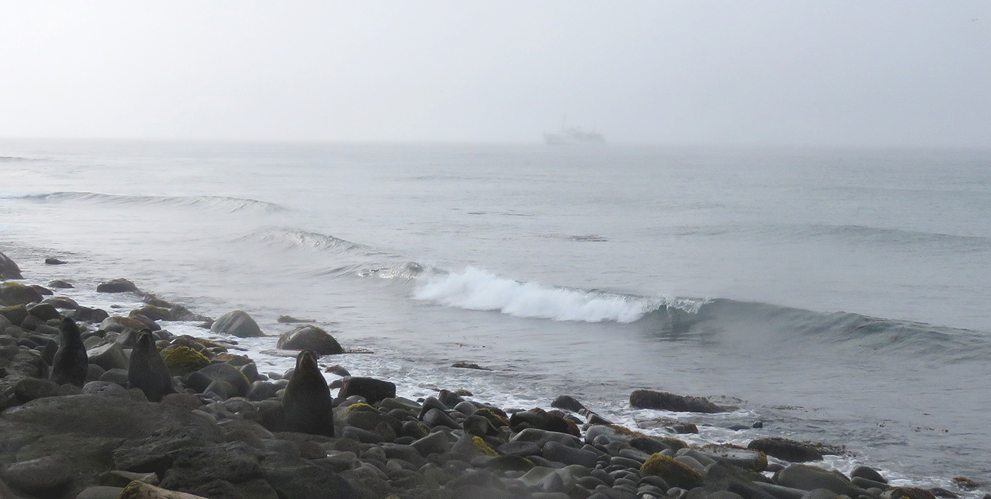
The Pribilof Islands are remote and isolated, located in the Bering Sea roughly 280 nautical miles north of Dutch Harbor Alaska. The economy and community are reliant on the surrounding ocean, while the islands themselves provide shelter for vessels working in the Bering Sea. Accurate nautical charts are not only integral to safe navigation and delivery of goods and services for the community, but also to commercial fishing and crabbing. The last major survey of the area was conducted from 1951 to 1954 by the U.S. Coast and Geodetic Survey vessel Pathfinder. However, much of the shoreline around St. George remained uncharted. The Fairweather’s surveys of the islands will provide modern bathymetric data for updating NOAA’s charting products in support of navigation safety.
Continue reading “NOAA Ship Fairweather surveys the remote Pribilof Islands”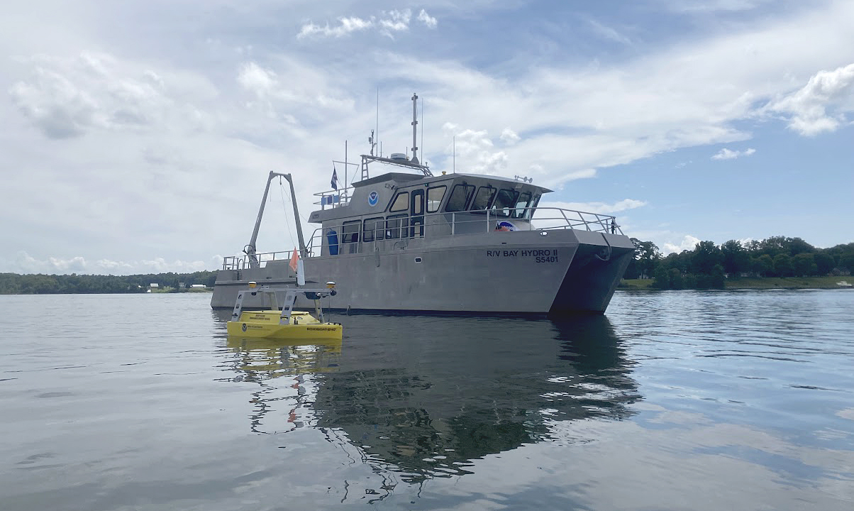
In November 1633, the Ark and the Dove set sail from the Isle of Wight—an island off the south coast of England—carrying English and Irish settlers bound for the new colony of Maryland. By January 1634, both vessels arrived at the Island of Barbados and began heading for the colony of Maryland. These settlers sailed into the Chesapeake Bay, the Potomac River, and eventually, the St. Mary’s River. They stopped roughly 12 miles (19 km) northwest from Point Lookout, where the Potomac River enters the Chesapeake Bay. This group of settlers would go on to found Maryland’s first European settlement and future provincial capital, St. Mary’s City.
Continue reading “Historical Hydrography on the St. Mary’s River”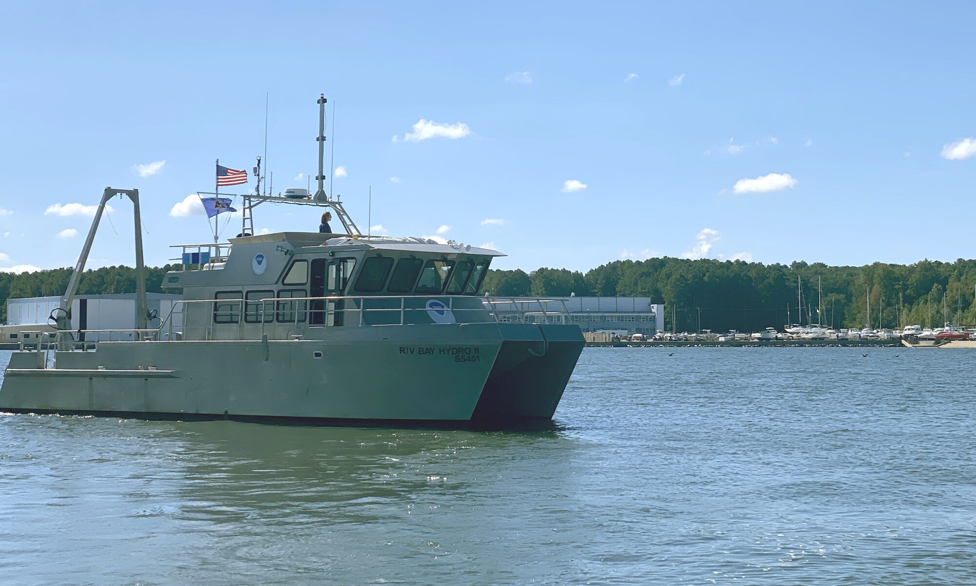
Situated on the east side of the Chesapeake Bay, 162 nautical miles above the Virginia Capes, Elk River is the western approach to the Chesapeake and Delaware Canal. The canal is one of the busiest waterways in the country. It connects the Chesapeake and Delaware Bays, servicing the ports of Baltimore, Wilmington, and Philadelphia. The U.S. Army Corps of Engineers regularly surveys the dredged channels in the approaches and in the canal, but they are not responsible for the remaining waters of the Elk River. The Elk River was last surveyed in the early 1900s, making depths on the nautical chart close to 100 years old! As a result, NOAA R/V Bay Hydro II was tasked to conduct a modern hydrographic survey of Elk River in Spring 2023.
Continue reading “Research vessel Bay Hydro II makes history on Mayland’s Elk River”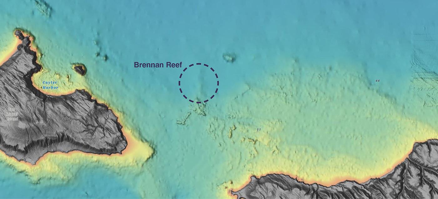
NOAA Corps Rear Adm. Richard T. “Rick” Brennan, recent director of NOAA’s Office of Coast Survey, was deeply dedicated to NOAA’s mission and was an integral part of building connections across NOAA programs to benefit coastal communities around the United States. One example of Rick’s leadership was the Southern California Seafloor Mapping Initiative, a partnership between Coast Survey, Office of National Marine Sanctuaries (ONMS), National Centers for Coastal Ocean Science (NCCOS) and National Marine Fisheries Service (NMFS). Among many important accomplishments of this coordinated mapping effort was the survey of a previously uncharted reef in Channel Islands National Marine Sanctuary. Through legislative action led by U.S. Congressman Salud Carbajal of California’s 24th District, this reef has been officially designated as “Brennan Reef.”
Continue reading “Naming Brennan Reef, a previously uncharted pinnacle in Channel Islands National Marine Sanctuary”