
By Lt. Taylor Krabiel
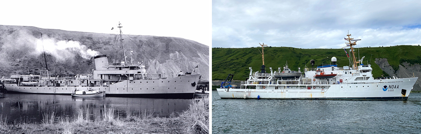
In the 1950s, U.S. Coast and Geodetic Survey (USC&GS) Pathfinder surveyed the Pribilof Islands with the latest technologies to chart previously unsurveyed waters and bring the islands into a common datum with the mainland. Fast forward 71 years and NOAA Ship Fairweather continues this work. Despite the decades and technologies that separate the two ships, they share many commonalities in their mission and their surveying techniques.
USC&GS Pathfinder
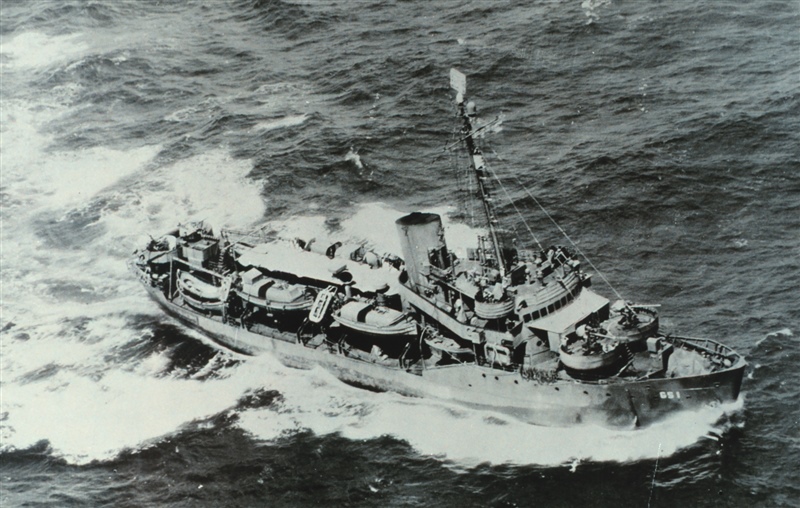
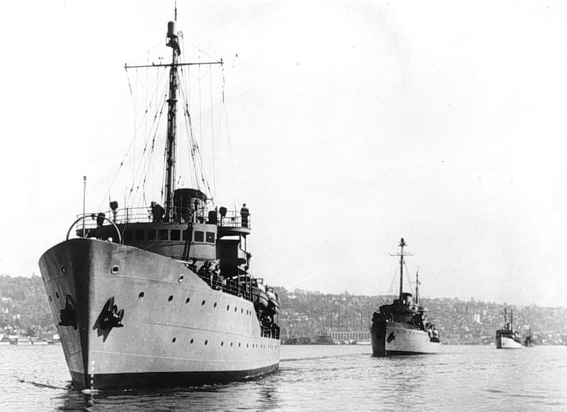
Pathfinder was launched on 11 January 1942, christened by the granddaughter of the President of the United States, Eleanor Roosevelt Boettinger. The ship was originally built as a replacement for the previous Pathfinder for the US Coast and Geodetic Survey, the oldest scientific organization in the United States and predecessor to NOAA. Instead, she was transferred and commissioned to the U.S. Navy on 31 August 1942, to support the war effort in the Pacific during WWII. Throughout WWII, she charted the course for the U.S. Pacific fleet, enduring over 50 bombing raids as well as a kamikaze attack at Okinawa, Japan. She was not only equipped with the latest hydrographic and geodetic technology, but also had a full printing press aboard, making her a ‘one stop shop’ for nautical charting and the first U.S. ship to publish charts for the fleet it supported. The ship earned the saying ‘the Road to Tokyo was paved with Pathfinder charts.‘ After WWII, the ship returned to the US Coast and Geodetic Survey and spent 25 years surveying in the North Pacific Ocean, Bering Sea, throughout Alaska, and the Hawaiian Islands, before she was deactivated and retired in 1971.
| Pathfinder | Fairweather | |
| Year built | 1942 | 1968 |
| Length, beam, draft (feet) | 229, 39, 16 | 231, 41, 15.5 |
| Top speed (knots) | 14 | 13 |
| Crew size | 158 | ~35 (originally >60) |
| Sonars used | Single ping fathometer; the acoustic sensor of the Dorsey Fathometer (model 808) | Multibeam sonar; Kongsberg EM2040 and EM712 |
| Services | USC&GS 1941-42 US Navy 1942-46 USC&GS 1946-1971 | USC&GS 1963-1970 NOAA 1970-89 Decommissioned 1989-2004 NOAA 2004-present |
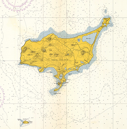
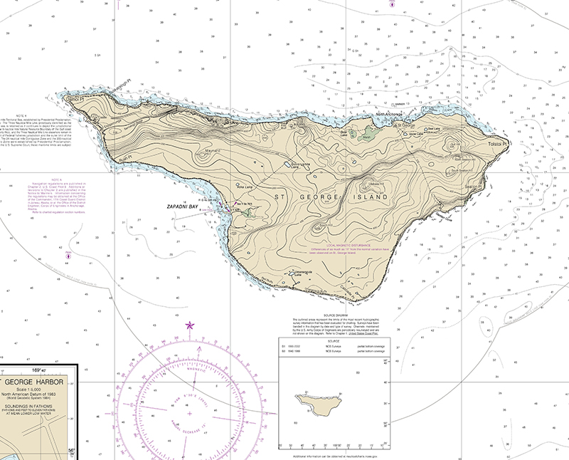
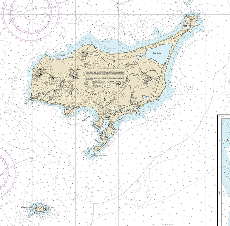
Surveying the Pribilofs
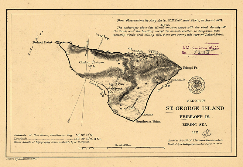
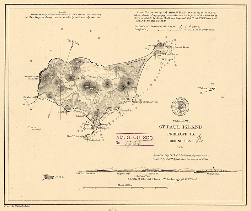
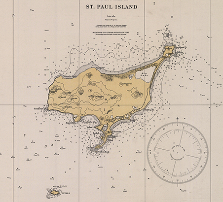
In 1951, Pathfinder arrived in the Pribilof Islands with only blank charts of St. George and St. Paul Islands from the 19th century. From 1951 to 1954, Pathfinder led a three-survey ship mission in the Bering Sea and Pribilof Islands to chart soundings on blank charts and bring the region into a common datum with the mainland. To accomplish this, Pathfinder was equipped with the latest in custom-built equipment—a fathometer. The ship would often anchor in protected areas and deploy its small boats to survey near shore and uncharted areas. Further offshore and in between the islands, the ship was utilized to conduct surveys, as this was deeper and safe enough for the ship. The Pathfinder would deploy several shore parties before ever producing a single sounding in order to create tidal references, geodetic datums, and land and sea-based references for the ship and launches. All of this required significant time and effort and is partly why Pathfinder carried a complement of over 100 crew members.
“When working on a combined project where ship and launches were programmed to do hydrography, a survey ship such as PATHFINDER would anchor in a protected area as close to the general working area as possible. Launch and other small boat parties would then be dispatched to work ashore or close to shore. The ship might then weigh anchor and do hydrography at the outer limits of the project, returning to pick up the small boat parties.”
—Pathfinder: Recollections of Those Who Served 1942-1971
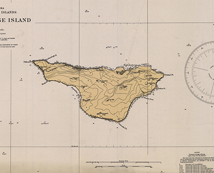
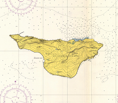
By the end of 1954, the ship had successfully brought the islands into a modern bathymetric and geodetic era. This data would be used for safe navigation by thousands of vessels for fishing and transit for decades to come. The next time a platform would survey the islands was in the early 2000’s by light detection and ranging (LIDAR) which only covered a small fraction of what the Pathfinder surveyed, and a limited survey of St. George Island’s Zapadni Bay in 2013. The Pathfinder would go on to be retired in 1971, being replaced by multiple new builds including NOAA Ship Fairweather.
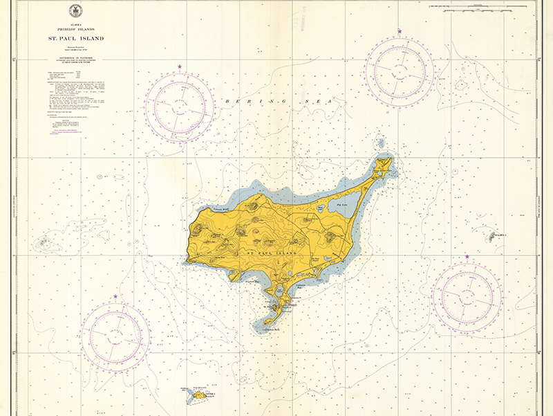
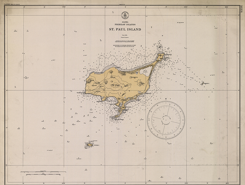
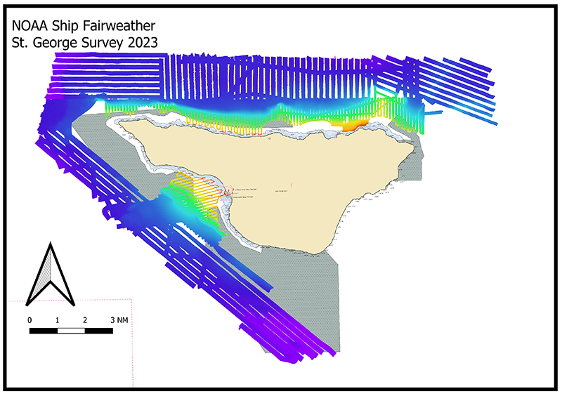
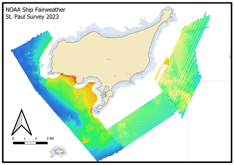
Fast Forward to 2023, when NOAA Ship Fairweather would return to the Pribilofs to update and continue the work of Pathfinder. The Fairweather brought to the Pribilof Islands the latest in multibeam sonar technology to create the highest resolution bathymetric data possible. Over the course of three months, the ship and its launches surveyed 1,600 linear nautical miles, or 106 square nautical miles. This included 16 square nautical miles of uncharted waters that Pathfinder was unable to survey due to thick fog1.
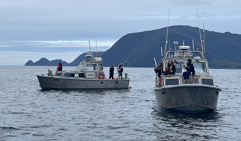
Just like the Pathfinder before it, Fairweather anchored in protected waters and deployed its four launches to collect near shore data and utilized the ship for deeper waters. The soundings that Fairweather relied upon for safe navigation are the very soundings that Pathfinder surveyed and charted. Thanks to advances in technology such as GPS and multibeam sonar, Fairweather was able to continue surveying despite the thick fog that still persists around St. George.
- In the 1950’s, Pathfinder utilized a surveying technique known as a three-point fix to horizontally position each sounding. A three-point fix required four people: left-sextant, right-sextant, fathometer, and plotter. At a regular interval (determined by the depth and distance to shore) a sounding was taken, and the left and right sextant users would take an angle between three targets. These three angles would be plotted on a sheet as the left angle and right angle and the intersection would be the sounding position. This sounding would then be adjusted using tidal data measured by the shore party. For a three-point fix to work, a crew had to have visual contact with a well surveyed station on land, or sometimes at sea. Due to the foggy conditions often encountered at St. George, these fixes would at times be impossible, leaving some of the surrounding waters unsurveyed until Fairweather arrived in 2023. ↩︎