By ENS Cullen Hauck
NOAA Ship Fairweather went farther north than ever before for the U.S. Coast Guard’s Port Access Route Study, a multi-year effort to establish new maritime traffic routes, safety zones, and use areas in the U.S. Arctic waters.

News and Updates

By ENS Cullen Hauck
NOAA Ship Fairweather went farther north than ever before for the U.S. Coast Guard’s Port Access Route Study, a multi-year effort to establish new maritime traffic routes, safety zones, and use areas in the U.S. Arctic waters.

The winter months represent an end to NOAA’s active survey season. During this period, hydrographic survey ships, navigation response team survey vessels, and contractor teams and vessels undergo maintenance and repair in anticipation of the upcoming survey season. NOAA’s 2025 survey season will begin soon as planned survey projects go through the planning and development process and begin to filter to the forefront of each field party’s focus. The ships and survey vessels collect bathymetric data (i.e. map the seafloor) to support nautical charting, modeling, and research, but also collect other environmental data to support a variety of ecosystem sciences. NOAA considers hydrographic survey requests from stakeholders such as marine pilots, local port authorities, the Coast Guard, and the boating community, and also considers other hydrographic and NOAA science priorities in determining where to survey and when. Visit our “living” ArcGIS StoryMap to find out more about our mapping projects and if a hydrographic vessel will be in your area this year!
Continue reading “NOAA’s 2025 hydrographic survey season is gearing up and will be underway soon”
As we look ahead to continued progress in 2025, NOAA’s Office of Coast Survey is proud to share some highlights of the past year with you. We mounted successful emergency responses to reopen ports quickly and safely after hurricanes and a bridge collapse; completed a five-year process to transition to fully electronic navigational chart production; provided hands-on learning experiences for students aboard NOAA Ship Nancy Foster; and much more, all in service of delivering authoritative ocean and lakebed mapping information as the nation’s chartmaker.
Continue reading “Office of Coast Survey 2024 Year in Review”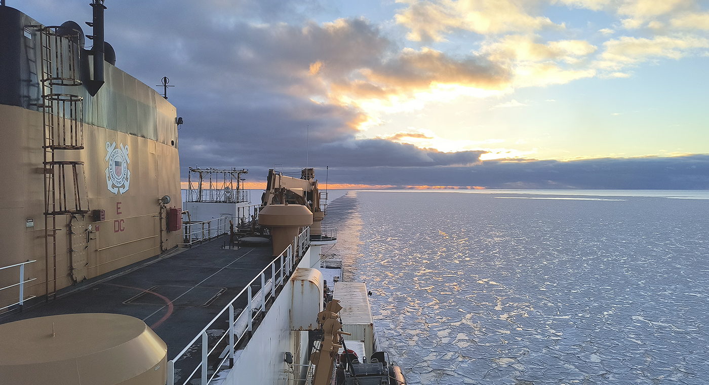
In October through early November 2024, NOAA’s Office of Coast Survey, the University of New Hampshire, U.S. National Science Foundation, and U.S. Coast Guard partnered to complete a coordinated mapping mission along the north slope of Alaska aboard the U.S. Coast Guard Cutter Healy. Advancing the 2020 National Strategy on Ocean Mapping, Exploring, and Characterizing the U.S. Exclusive Economic Zone, the mission acquired depth data in uncharted waters along the Coast Guard-proposed Arctic shipping route, deployed a series of oceanographic buoys, and provided at sea training on interdisciplinary scientific expeditions for junior scientists. The mission capitalized on a rare opportunity to maximize data observations within a data-starved region in support of Seascape Alaska, a regional mapping campaign.
The National Oceanic and Atmospheric Administration’s 2024 hydrographic survey season is ramping up and will be in full swing before too long. For the past few months, NOAA hydrographic survey ships, navigation response teams, and contractors have been diligently preparing for the upcoming field season. The ships and survey vessels collect bathymetric data to support nautical charting, modeling, and research, but also collect other environmental data to support a variety of ecosystem sciences. NOAA considers hydrographic survey requests from stakeholders such as marine pilots, local port authorities, the Coast Guard, and the boating community, and also considers other hydrographic and NOAA science priorities in determining where to survey and when. Visit our “living” ArcGIS StoryMap to find out more about our mapping projects and if a hydrographic vessel will be in your area this year!
Continue reading “NOAA’s 2024 hydrographic survey season is underway”
NOAA’s Office of Coast Survey is reflecting on a successful and remarkable 2023! We completed many significant activities with meaningful impacts. As we look ahead to more progress in 2024, we are proud to share some highlights of the past year in our Coast Survey Year in Review ArcGIS StoryMap.
Continue reading “A look back at 2023 and the Office of Coast Survey’s significant activities throughout the year”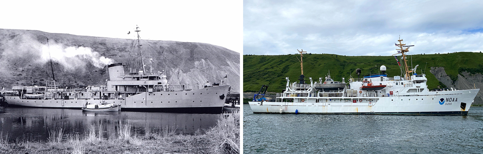
In the 1950s, U.S. Coast and Geodetic Survey (USC&GS) Pathfinder surveyed the Pribilof Islands with the latest technologies to chart previously unsurveyed waters and bring the islands into a common datum with the mainland. Fast forward 71 years and NOAA Ship Fairweather continues this work. Despite the decades and technologies that separate the two ships, they share many commonalities in their mission and their surveying techniques.
Continue reading “Surveying the Pribilof Islands, from Pathfinder to Fairweather”
The Pribilof Islands are remote and isolated, located in the Bering Sea roughly 280 nautical miles north of Dutch Harbor Alaska. The economy and community are reliant on the surrounding ocean, while the islands themselves provide shelter for vessels working in the Bering Sea. Accurate nautical charts are not only integral to safe navigation and delivery of goods and services for the community, but also to commercial fishing and crabbing. The last major survey of the area was conducted from 1951 to 1954 by the U.S. Coast and Geodetic Survey vessel Pathfinder. However, much of the shoreline around St. George remained uncharted. The Fairweather’s surveys of the islands will provide modern bathymetric data for updating NOAA’s charting products in support of navigation safety.
Continue reading “NOAA Ship Fairweather surveys the remote Pribilof Islands”
Congratulations to Seascape Alaska! The Intergovernmental Oceanographic Commission of the United Nations Educational, Scientific and Cultural Organization recently endorsed this important regional mapping campaign as part of the UN Decade of Ocean Science for Sustainable Development 2021-2030 (Ocean Decade), in part for its contributions to The Nippon Foundation-GEBCO Seabed 2030 Project.
Continue reading “United Nations Ocean Decade endorses Seascape Alaska”
Integrated Ocean and Coastal Mapping (IOCM) is the practice of planning, acquiring, integrating, and sharing ocean and coastal data and related products so that people who need the data can find it and use it easily. NOAA’s IOCM program also aims to make the most of limited resources, with a goal to map once, use many times. The IOCM program is happy to share that the U.S. Geological Survey (USGS) and NOAA have entered into a cost-sharing agreement to conduct mapping activities off Kodiak Island, Alaska in support of Seascape Alaska, a regional mapping campaign. This multiyear study is funded primarily by the USGS on the survey vessel, NOAA Ship Fairweather. NOAA’s Coast Survey is also providing project management, environmental compliance evaluation, data acquisition and processing, and quality assurance. The data will be archived at NOAA’s National Centers for Environmental Information, so that other users can access as well.
Continue reading “Planned data collection for Southern Alaska highlights agency partnership”