

By Lt. Taylor Krabiel
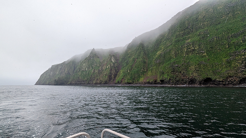
The Pribilof Islands are remote and isolated, located in the Bering Sea roughly 280 nautical miles north of Dutch Harbor Alaska. The economy and community are reliant on the surrounding ocean, while the islands themselves provide shelter for vessels working in the Bering Sea. Accurate nautical charts are not only integral to safe navigation and delivery of goods and services for the community, but also to commercial fishing and crabbing. The last major survey of the area was conducted from 1951 to 1954 by the U.S. Coast and Geodetic Survey vessel Pathfinder. However, much of the shoreline around St. George remained uncharted. The Fairweather’s surveys of the islands will provide modern bathymetric data for updating NOAA’s charting products in support of navigation safety.
The Pribilof Islands
The Pribilof Islands are a group of five young volcanic islands in the Bering Sea. The two principal islands are Saint Paul and Saint George, home to residential Unangan communities. Although commonly referred to as Aleut, their own name is Unangan, which means “the coast” or “the seashore.” Their history and culture are both unique and also incredibly complex. Native Unangans were taken from their homes on the Aleutian chain to the (then) uninhabited Pribilof Islands to hunt seals, first for Russia, and later for the United States after the purchase of Alaska in 1867. The last commercial seal harvest took place in 1985, although sealing on the Pribilofs occurs today for subsistence purposes. Since the mid-1960’s, the native Unangan have gained full rights as American citizens. Today, the villages of St. Paul and St. George are home to the largest remaining Unangan communities in the world, with a population of approximately 500 people in St. Paul and a smaller community in St. George.
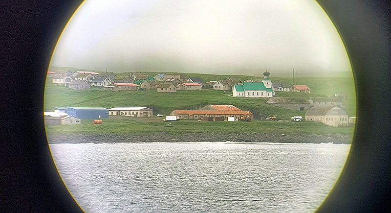
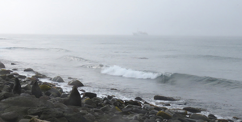
Since transitioning to a fishery-based economy, the halibut and crab industries now employ most residents of the islands, with St. Paul Harbor serving over 230 transient vessels during crab season. St. George is frequented by fishing vessels looking for shelter from harsh weather in the Bering Sea. Tourists and birders also frequently travel to both islands to observe the 270 bird species seen there, including 75 percent of the world’s Red-legged kittiwakes. The two islands are also home to some of the greatest concentration of Northern fur seals in the world.

Challenges and Survey Techniques
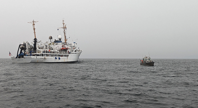
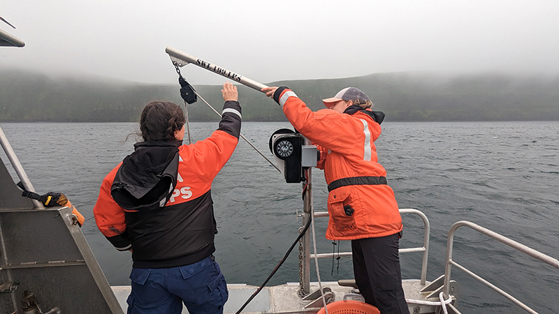
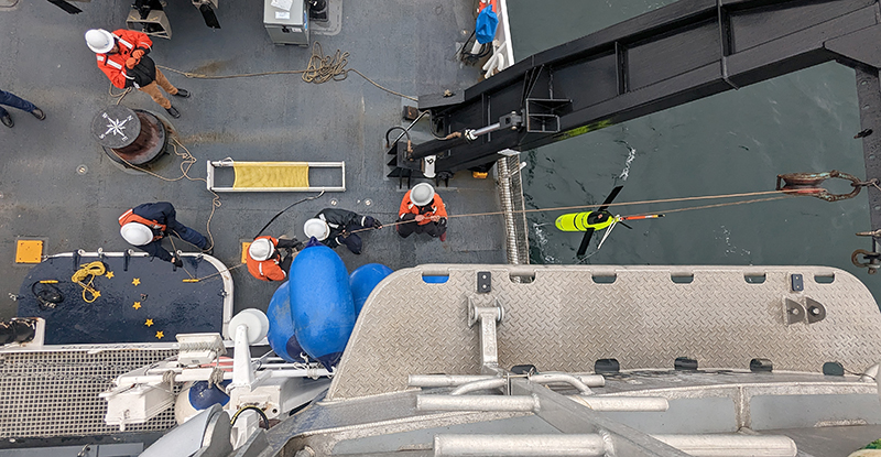
Fairweather’s primary survey paradigm for nearshore hydrographic operations is to anchor in a protected location and utilize its four survey launches, each equipped with multibeam EM2040 sonars, to map the shallow water and uncharted hazardous approaches. The ship is also equipped with an EM712 sonar and can conduct mapping on its own as needed.
However, the Pribilof Islands are subjected to dense fog and harsh weather for much of the year. These challenges forced Fairweather to constantly adapt to the ever-changing weather conditions in order to maximize efficiency. In the rare event of fair conditions, Fairweather anchored in St. Paul Harbor, Zapadni Bay, St. George, or off the northern coast of St. George to conduct launch survey operations. When the weather conditions became too rough for small boat operations, which was often, the ship weighed anchor to conduct survey operations.
Due to limited prior data available for the Pribilofs, Fairweather utilized track line multibeam data from the R/V Thomas G. Thompson to help predict the general depths in the uncharted project area. This, combined with historical data, allowed for a more comprehensive approach in surveying this remote part of Alaska.
Results
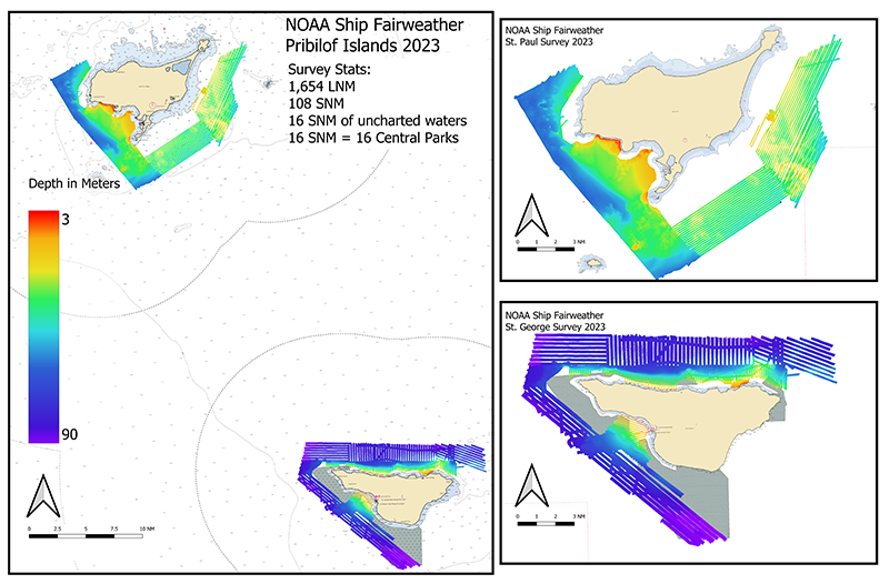
Fairweather was able to survey 1,654 linear nautical miles, or 108 square nautical miles, resulting in high resolution bathymetric data off of both St. George and St. Paul Islands. This included 16 square nautical miles of previously uncharted waters off St. George, roughly the equivalent of 16 Central Parks!
In addition to surveying around the Pribilofs, on 6 July 2023, Fairweather diverted from its survey to recover an Oculus Glider for NOAA’s Pacific Marine Environmental Lab, ensuring that critical repairs can be completed in Seattle before returning it to service in the Bering Sea. The Oculus Glider combines autonomous uncrewed technology with oceanographic data collection, providing high-resolution sampling to provide a better understanding of remote locations such as the Bering Sea.
The Pribilof Islands survey was a very challenging project but a resounding success nonetheless due to the dedicated crew of Fairweather and its shoreside support team. This project will not only provide critical navigational data, but also provide valuable insight for the continuing needs of surveys in this area and ones like it in the future.