By ENS Cullen Hauck
NOAA Ship Fairweather went farther north than ever before for the U.S. Coast Guard’s Port Access Route Study, a multi-year effort to establish new maritime traffic routes, safety zones, and use areas in the U.S. Arctic waters.

News and Updates

By ENS Cullen Hauck
NOAA Ship Fairweather went farther north than ever before for the U.S. Coast Guard’s Port Access Route Study, a multi-year effort to establish new maritime traffic routes, safety zones, and use areas in the U.S. Arctic waters.

NOAA Ship Rainier charts volatile, glacially active waters in Glacier Bay National Park
By ENS P. Giamportone and ENS N. Greenlaw
In August 2025, NOAA Ship Rainier pulled into Lituya (lih-TOO-yuh) Bay, an inlet tucked within the outer edge of Glacier Bay National Park. The name is of Tlingit origin, meaning “lake within the point,” and the Bay has long been a source of sustenance and shelter. The entrance is narrow and turbulent, and the glacial walls make it vulnerable to rockslides and their following waves.
Continue reading “The latest expedition in Lituya Bay: NOAA and National Park Service collaborate to update nautical charts”
NOAA’s Office of Coast Survey just released major updates to the official navigational charts of the Yukon River—a vital waterway serving many interior communities of Alaska. The Yukon is frozen more than half the year, limiting the window for barges to deliver the fuel, building materials, heavy equipment, and other supplies that cannot be transported by air. NOAA has developed a new process for updating the Yukon charts with the most current shoreline information, which is expected to improve safety and efficiency of navigation on the river and make delivery of vital supplies more reliable.
Continue reading “Charting the Yukon River as it freezes and thaws”
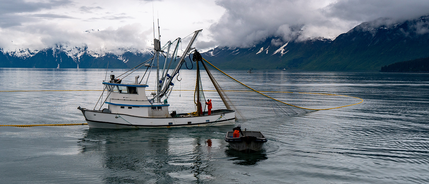
Alaska’s Kuskokwim River is both unpredictable and essential. Shifting sandbars, variable tides, and seasonal ice dramatically reshape the waterway, requiring frequent updates to the navigational channel. It remains a lifeline for communities like Bethel, Alaska. NOAA’s Coast Pilot describes the waterway as a “maze of shifting sandbars…and blind channels” with navigation conditions that can change daily.
Currently, the U.S. Coast Guard maintains over 50 aids to navigation, or ATONs, along the river to guide vessels. Mariners use these ATONs to travel safely through the channels. The Coast Guard Cutter Aspen requested support from NOAA to provide updated bathymetric data to help them to validate and adjust ATONs–a mission critical function to ensure safe navigation for vessels traversing one of the state’s most dynamic and economically vital waterways.
Continue reading “Surveying the Kuskokwim River, Alaska’s Most Dynamic Waterway”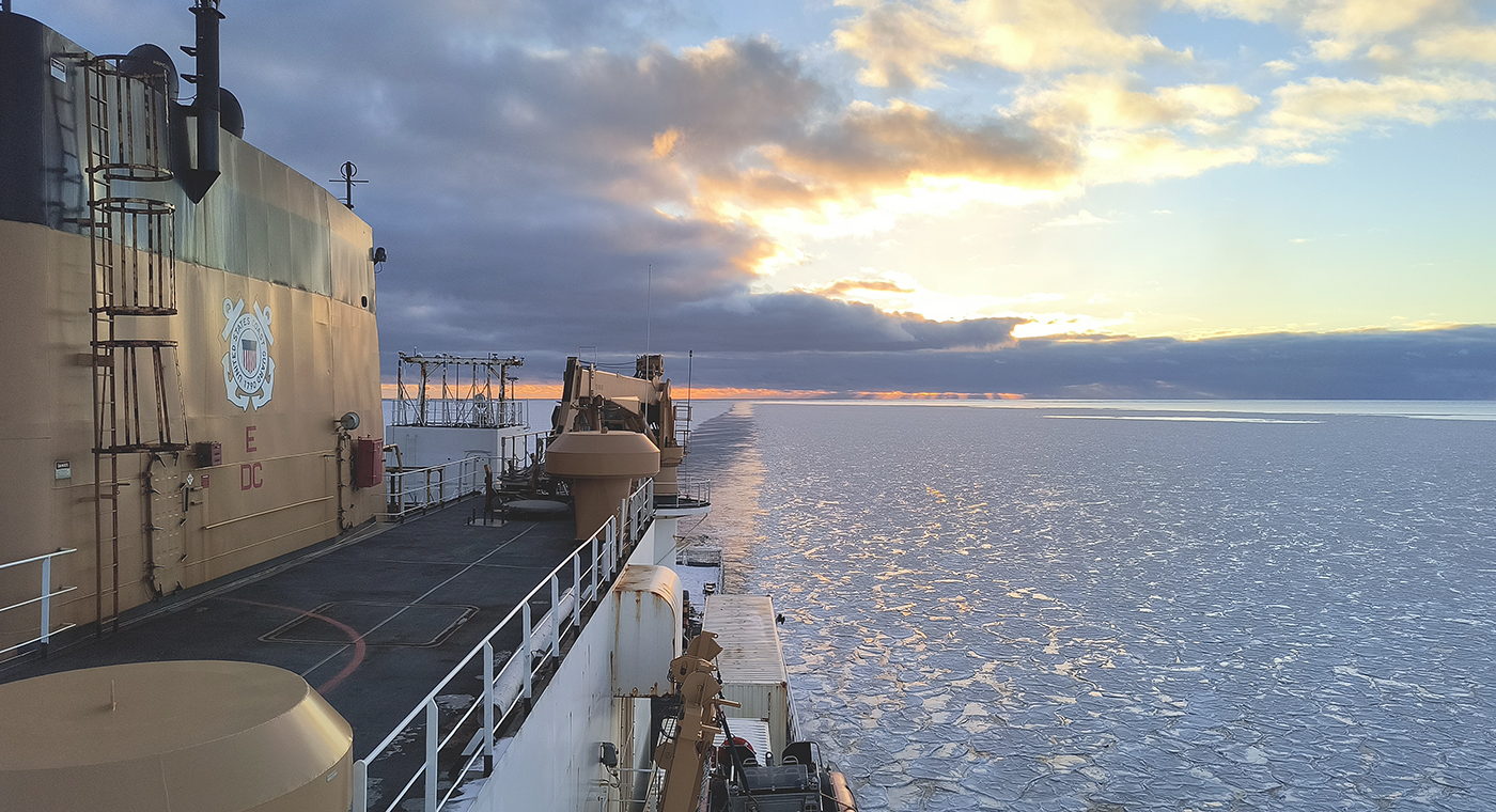
In October through early November 2024, NOAA’s Office of Coast Survey, the University of New Hampshire, U.S. National Science Foundation, and U.S. Coast Guard partnered to complete a coordinated mapping mission along the north slope of Alaska aboard the U.S. Coast Guard Cutter Healy. Advancing the 2020 National Strategy on Ocean Mapping, Exploring, and Characterizing the U.S. Exclusive Economic Zone, the mission acquired depth data in uncharted waters along the Coast Guard-proposed Arctic shipping route, deployed a series of oceanographic buoys, and provided at sea training on interdisciplinary scientific expeditions for junior scientists. The mission capitalized on a rare opportunity to maximize data observations within a data-starved region in support of Seascape Alaska, a regional mapping campaign.
The National Oceanic and Atmospheric Administration is pleased to announce a partnership with the City of Valdez for a hydrographic surveying project in Port Valdez. This project was selected for the Brennan Matching Fund from last year’s round of applicants and is slated to occur in 2025. The project will provide high resolution bathymetry and backscatter data over approximately 32.5 square nautical miles, and supply a contemporary baseline to help city emergency managers understand and prepare for potential impacts of submarine landslides.
NOAA’s Office of Coast Survey is reflecting on a successful and remarkable 2023! We completed many significant activities with meaningful impacts. As we look ahead to more progress in 2024, we are proud to share some highlights of the past year in our Coast Survey Year in Review ArcGIS StoryMap.
Continue reading “A look back at 2023 and the Office of Coast Survey’s significant activities throughout the year”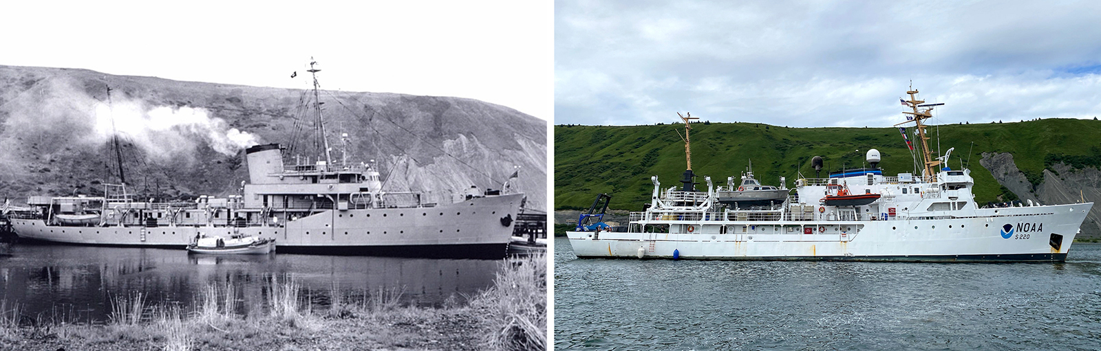
In the 1950s, U.S. Coast and Geodetic Survey (USC&GS) Pathfinder surveyed the Pribilof Islands with the latest technologies to chart previously unsurveyed waters and bring the islands into a common datum with the mainland. Fast forward 71 years and NOAA Ship Fairweather continues this work. Despite the decades and technologies that separate the two ships, they share many commonalities in their mission and their surveying techniques.
Continue reading “Surveying the Pribilof Islands, from Pathfinder to Fairweather”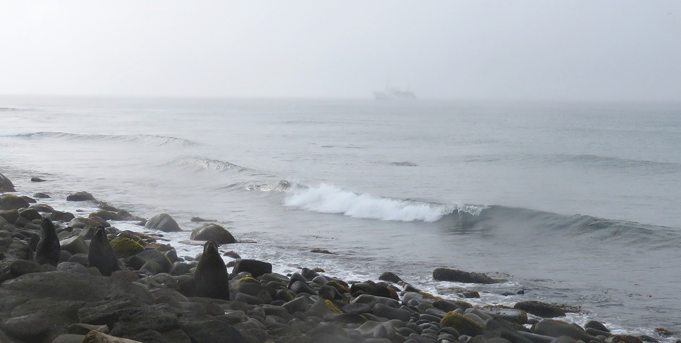
The Pribilof Islands are remote and isolated, located in the Bering Sea roughly 280 nautical miles north of Dutch Harbor Alaska. The economy and community are reliant on the surrounding ocean, while the islands themselves provide shelter for vessels working in the Bering Sea. Accurate nautical charts are not only integral to safe navigation and delivery of goods and services for the community, but also to commercial fishing and crabbing. The last major survey of the area was conducted from 1951 to 1954 by the U.S. Coast and Geodetic Survey vessel Pathfinder. However, much of the shoreline around St. George remained uncharted. The Fairweather’s surveys of the islands will provide modern bathymetric data for updating NOAA’s charting products in support of navigation safety.
Continue reading “NOAA Ship Fairweather surveys the remote Pribilof Islands”
Congratulations to Seascape Alaska! The Intergovernmental Oceanographic Commission of the United Nations Educational, Scientific and Cultural Organization recently endorsed this important regional mapping campaign as part of the UN Decade of Ocean Science for Sustainable Development 2021-2030 (Ocean Decade), in part for its contributions to The Nippon Foundation-GEBCO Seabed 2030 Project.
Continue reading “United Nations Ocean Decade endorses Seascape Alaska”