The National Oceanic and Atmospheric Administration is pleased to announce a partnership with the City of Valdez for a hydrographic surveying project in Port Valdez. This project was selected for the Brennan Matching Fund from last year’s round of applicants and is slated to occur in 2025. The project will provide high resolution bathymetry and backscatter data over approximately 32.5 square nautical miles, and supply a contemporary baseline to help city emergency managers understand and prepare for potential impacts of submarine landslides.
Surveying the Pribilof Islands, from Pathfinder to Fairweather
By Lt. Taylor Krabiel
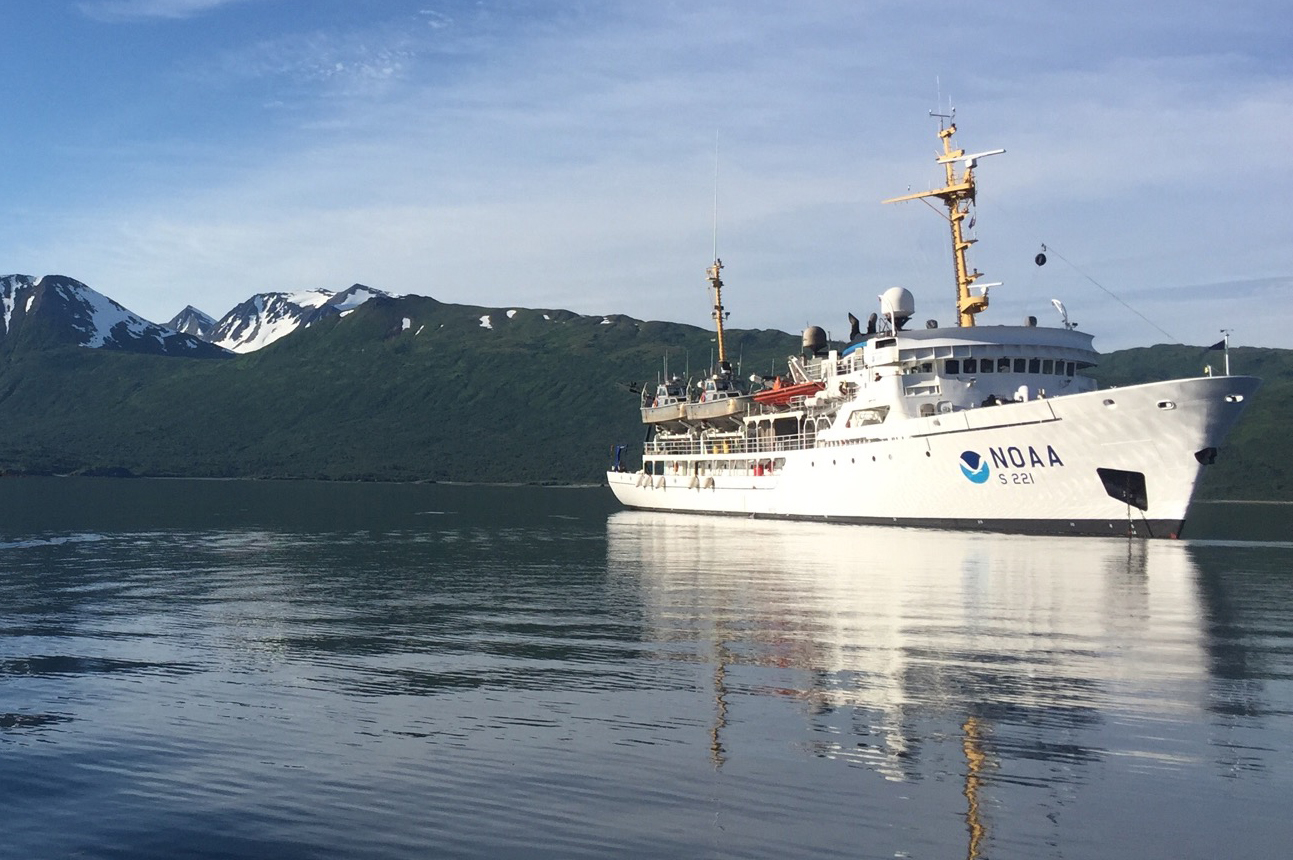
In the 1950s, U.S. Coast and Geodetic Survey (USC&GS) Pathfinder surveyed the Pribilof Islands with the latest technologies to chart previously unsurveyed waters and bring the islands into a common datum with the mainland. Fast forward 71 years and NOAA Ship Fairweather continues this work. Despite the decades and technologies that separate the two ships, they share many commonalities in their mission and their surveying techniques.
Continue reading “Surveying the Pribilof Islands, from Pathfinder to Fairweather”NOAA Ship Fairweather surveys the remote Pribilof Islands
By Lt. Taylor Krabiel
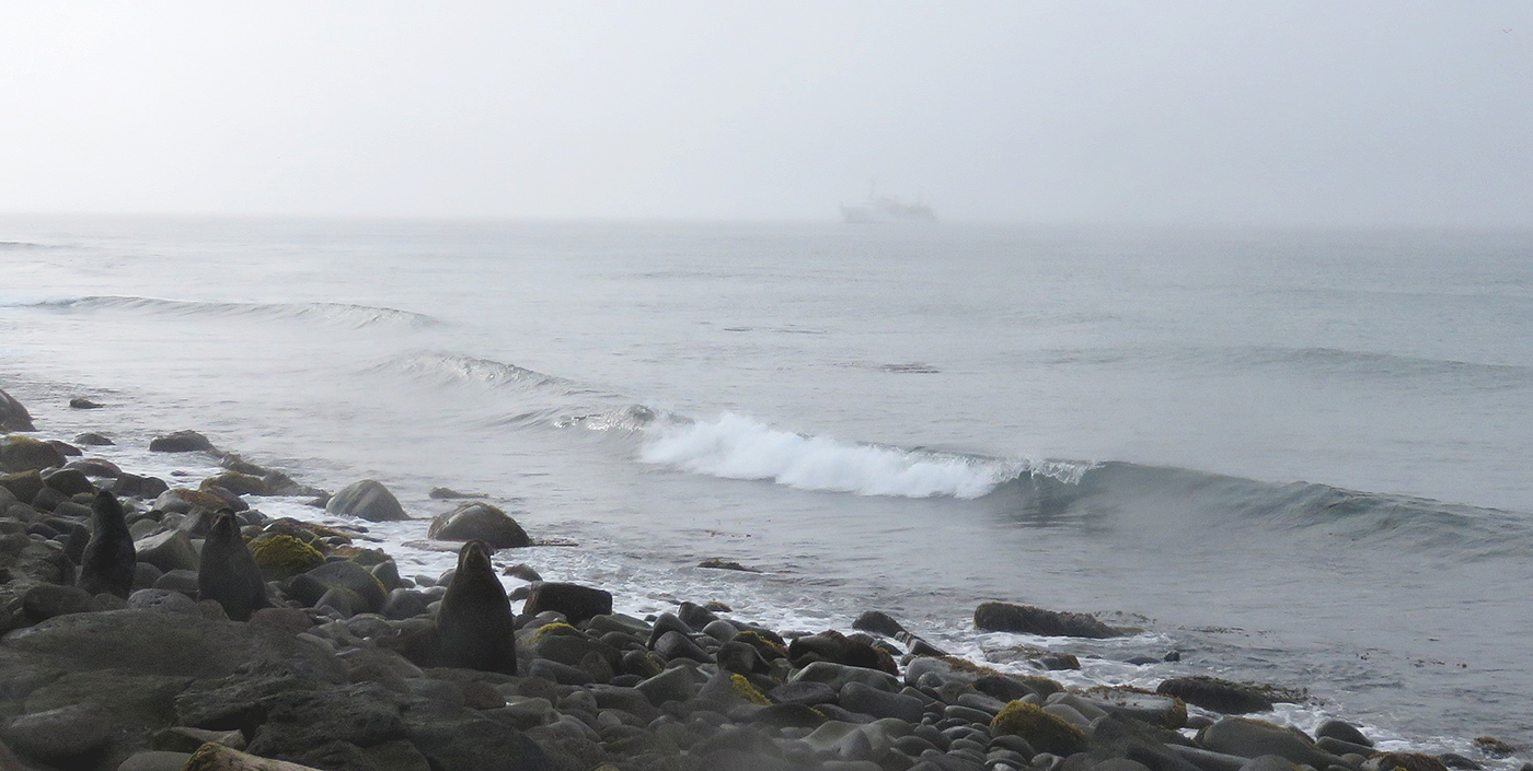
The Pribilof Islands are remote and isolated, located in the Bering Sea roughly 280 nautical miles north of Dutch Harbor Alaska. The economy and community are reliant on the surrounding ocean, while the islands themselves provide shelter for vessels working in the Bering Sea. Accurate nautical charts are not only integral to safe navigation and delivery of goods and services for the community, but also to commercial fishing and crabbing. The last major survey of the area was conducted from 1951 to 1954 by the U.S. Coast and Geodetic Survey vessel Pathfinder. However, much of the shoreline around St. George remained uncharted. The Fairweather’s surveys of the islands will provide modern bathymetric data for updating NOAA’s charting products in support of navigation safety.
Continue reading “NOAA Ship Fairweather surveys the remote Pribilof Islands”United Nations Ocean Decade endorses Seascape Alaska
Congratulations to Seascape Alaska! The Intergovernmental Oceanographic Commission of the United Nations Educational, Scientific and Cultural Organization recently endorsed this important regional mapping campaign as part of the UN Decade of Ocean Science for Sustainable Development 2021-2030 (Ocean Decade), in part for its contributions to The Nippon Foundation-GEBCO Seabed 2030 Project.
Continue reading “United Nations Ocean Decade endorses Seascape Alaska”NOAA Ship Rainier surveys Uganik Bay
By Ensign Michelle Levano
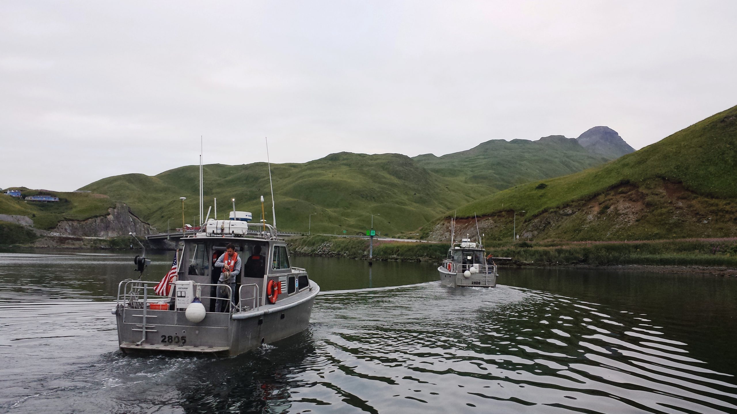
NOAA Ship Rainier recently arrived in Uganik Bay, off of northwest Kodiak Island, to complete hydrographic survey operations in Uganik Passage and Uganik Bay, including the Northeast Arm, North Arm, and South Arm. Rainier has spent 2013 through 2016 surveying areas around North Kodiak Island, including Kizhuyak Bay, Whale and Afognak Passes, Kupreanof Strait, and Viekoda and Terror Bays. The ship will remain in Uganik Bay until the end of October.

Continue reading “NOAA Ship Rainier surveys Uganik Bay”
NOAA Ship Fairweather begins multi-mission projects in Alaska
In a unique deployment of resources, last week NOAA Ship Fairweather split its scientific team and vessels to tackle two distinct projects in Alaska. Coast Survey physical scientist Katrina Wyllie and Lt.j.g. Bart Buesseler report on the multi-mission projects.
***
On August 9, NOAA Ship Fairweather departed Dutch Harbor, Alaska, for a FISHPAC project, led by Dr. Bob McConnaughey from NOAA’s Alaska Fisheries Science Center. This project’s primary mission is to statistically associate acoustic backscatter returns with the abundances of fish and crabs that frequent the Bering Sea seafloor. The science team accomplishes this with acoustic data from multibeam, single beam, and side scan sonars. Understanding the value of acoustic backscatter as a habitat-defining character will help scientists understand where fish live and the importance of different habitats. The acoustic data will also be used to correct for differences in the performance of research bottom trawls on different seafloor types, so that stock assessments and fishery management can be improved. To make sure the scientists understand what the acoustic data are showing, each day the ship will stop and collect physical bottom samples of the seafloor to see, touch, and interpret their findings. Further increasing the effectiveness of this mission, all of the multibeam bathymetry data acquired will directly support NOAA’s Office of Coast Survey as the data will be used to update soundings on the nautical charts for the eastern Bering Sea where the ship will be operating.
Continue reading “NOAA Ship Fairweather begins multi-mission projects in Alaska”
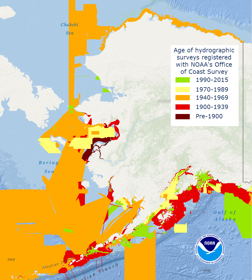
What does the age of the survey mean for nautical charts?
Alaska’s nautical charts need to be updated — we all know that. The diagram below shows the vintage of survey data currently used for today’s charts in Alaska. The graphic includes all surveys done by NOAA’s Office of Coast Survey (and its predecessors), and some limited data acquired by other agencies, i.e., the U.S. Coast Guard. Areas that are not colored in have never been surveyed or have data acquired by another source — from Russia or Japan, for instance — before the U.S. was responsible for charting in that area.
Continue reading “What does the age of the survey mean for nautical charts?”
Coast Survey announces plans for 2015 NOAA survey projects
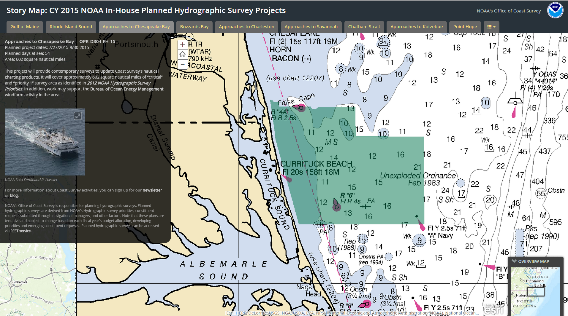
In 2015, NOAA survey ships Thomas Jefferson and Ferdinand R. Hassler are scheduled to survey nearly 1,800 square nautical miles in the U.S. coastal waters of the lower 48 states, collecting data that will update nautical charts for navigation and other uses. In Alaska, NOAA ships Fairweather and Rainier will increase their Arctic operations, planning to acquire 12,000 nautical miles of “trackline” depth measurements of the U.S. Coast Guard’s proposed shipping route. (See this NOAA article.) The ships will also conduct several “full bottom” hydrographic survey projects, acquiring data from over 2,800 square nautical miles in survey areas along the Alaskan coastline.
We are also planning several projects for our contractual private sector survey partners, and those projects will be announced after work orders are finalized.
Continue reading “Coast Survey announces plans for 2015 NOAA survey projects”
Survey helps ensure safe “parking” for deep-draft vessel in SF
In preparation for the M/V TERN’s anticipated arrival this week in San Francisco Bay, the Coast Guard and Port of San Francisco asked Coast Survey for a bathymetric survey of the proposed anchorage site. TERN is a semi-submersible vessel with a 60-foot draft, and the proposed anchorage site has charted depths of 62 feet and 63 feet ‒ leaving no room for error, to say the least. The question was whether there are any spots shoaler than 62 feet.
This isn’t your everyday anchorage.
Continue reading “Survey helps ensure safe “parking” for deep-draft vessel in SF”
Lt. Smith shows us the beauty of Gambell Alaska

This summer, the Bering Sea Alliance hosted a private-public summit in Gambell, Alaska, to discuss Arctic resource development and infrastructure. (See page 10 in this edition of the Nome Nugget for a good summary of the meeting.) Lt. Tim Smith, NOAA Coast Survey’s regional manager for Alaska, updated the participants on the status of Arctic nautical charts and described NOAA’s Arctic Nautical Charting Plan. He also outlined the preliminary 2015 survey plans to acquire hydrographic data around Point Hope, Point Barrow, Port Clarence, and Kotzebue Sound, as NOAA strives to ensure the navigational safety of the increasing ship traffic through Arctic waters.
Continue reading “Lt. Smith shows us the beauty of Gambell Alaska”

