
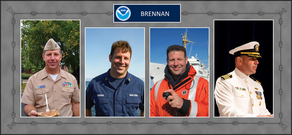
NOAA Corps Rear Adm. Richard T. “Rick” Brennan, recent director of NOAA’s Office of Coast Survey, was deeply dedicated to NOAA’s mission and was an integral part of building connections across NOAA programs to benefit coastal communities around the United States. One example of Rick’s leadership was the Southern California Seafloor Mapping Initiative, a partnership between Coast Survey, Office of National Marine Sanctuaries (ONMS), National Centers for Coastal Ocean Science (NCCOS) and National Marine Fisheries Service (NMFS). Among many important accomplishments of this coordinated mapping effort was the survey of a previously uncharted reef in Channel Islands National Marine Sanctuary. Through legislative action led by U.S. Congressman Salud Carbajal of California’s 24th District, this reef has been officially designated as “Brennan Reef.”
Rick will be remembered as a loyal and deeply empathetic leader. He served in the NOAA Commissioned Officer Corps and nautical charting community for nearly three decades, serving on nearly every hydrographic ship in NOAA’s fleet. Rick will be remembered as a role model for countless employees, as a talented and knowledgeable hydrographer, and as a man dedicated to family and friendship. Despite his short tenure at the helm of Coast Survey, his vision was clear. He committed to continue Coast Survey’s path towards a more equitable, diverse, and inclusive organization. He led by example by treating everyone with respect and dignity, supporting both professional development and personal well being. Rick firmly believed that another one of his most important leadership roles was to communicate and cultivate passion and excitement about the “why” of hydrography and its importance to the nation and the world, in order to provide clarity and focus about how the work is done.
The goal of the Southern California Seafloor Mapping Initiative — a collaboration among Coast Survey, ONMS, NCCOS, and NMFS — was to map coastal waters of Southern California to meet the needs and missions of multiple state, federal, academic, and non-governmental organization partners. It catalyzed the development of new techniques for mapping the seafloor and new protocols for backscatter data collection on hydrographic vessels. Rick’s collaborative approach was critical to the initiative’s success, which helped to identify multiple new hazards to navigation, new coral gardens and even a new species of snail in Southern California. Subsequently, this initiative grew into a broader, multi-agency seafloor mapping campaign called Expanding Pacific Research and Exploration of Submerged Systems. This multi-agency effort continues to this day, coordinating federal mapping efforts across NOAA, Bureau of Ocean Energy Management, and United States Geological Survey from California to Alaska.
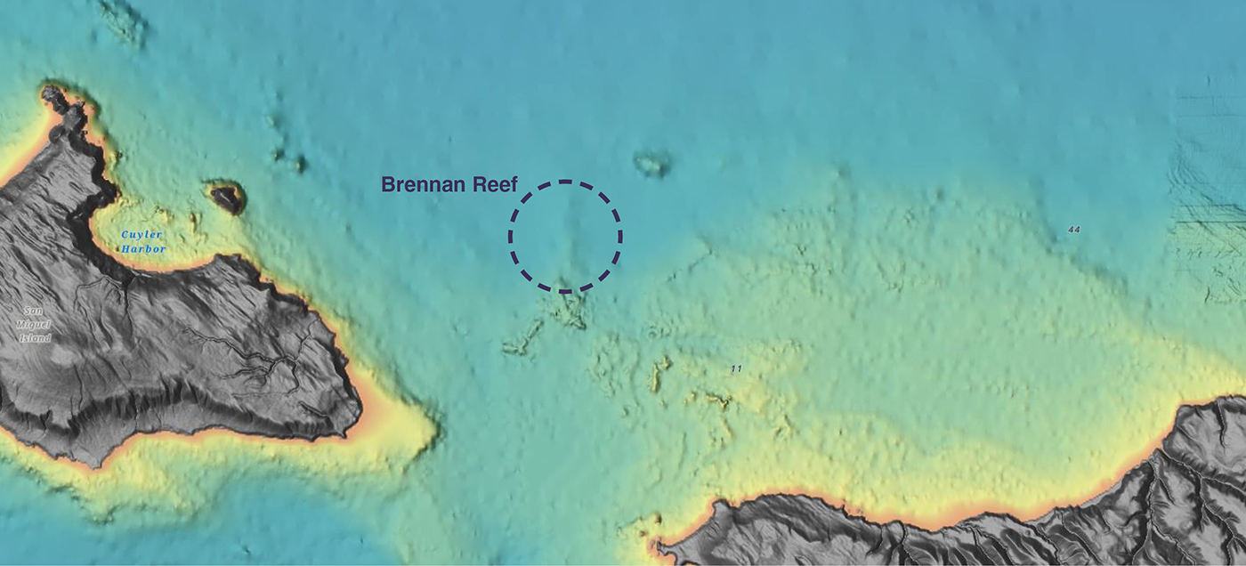
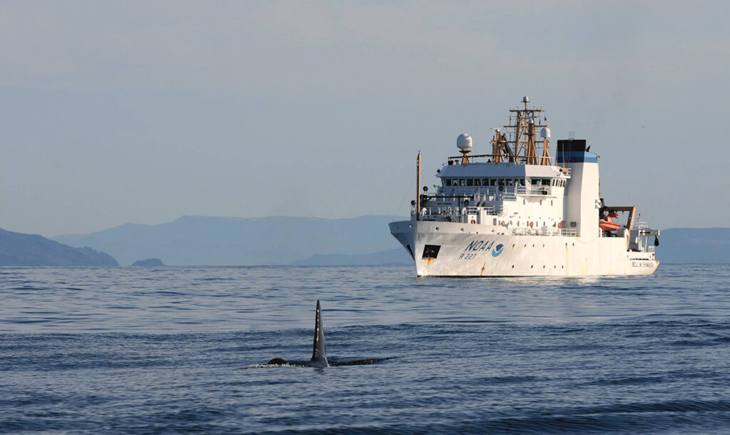
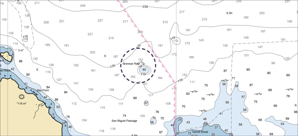
To honor Rick’s tireless efforts in Southern California, ONMS, NCCOS, and Coast Survey in partnership with the Office of Marine and Aviation Operations, proposed to name a previously uncharted reef after Rick that was observed during coordinated mapping efforts in Channel Islands National Marine Sanctuary. This reef was surveyed by NOAA Ship Bell M. Shimada north of Santa Rosa Island in 2015. The reef sits approximately 60 feet (18 meters) below the water line, rising up over 100 feet (30 meters) from the surrounding seafloor. Its location and size make it a striking topographic feature, and plans are being made to deploy a remotely operated vehicle to explore and document its geology, benthic habitats, and associated species.
Through legislative action led by U.S. Congressman Salud Carbajal of California’s 24th District, this reef has been officially designated as “Brennan Reef” in honor of Rick. Brennan Reef is now reflected on NOAA nautical charts.
Rick was a strong champion of the Southern California Seafloor Mapping Initiative and its partners. The naming of this reef is a fitting tribute to the man who believed in building partnerships across agencies to better serve the American public.
Thank you for honoring my brother, Rick Brennan with Brennan reef. He truly loved his work and would be grinning with pride with this honor. The world is a better place thanks to my brother!
how wonderful Ricks work is recognized. he truly loved his hydrography work. he would be so proud.