
By Riley O’Connor
In November 1633, the Ark and the Dove set sail from the Isle of Wight—an island off the south coast of England—carrying English and Irish settlers bound for the new colony of Maryland. By January 1634, both vessels arrived at the Island of Barbados and began heading for the colony of Maryland. These settlers sailed into the Chesapeake Bay, the Potomac River, and eventually, the St. Mary’s River. They stopped roughly 12 miles (19 km) northwest from Point Lookout, where the Potomac River enters the Chesapeake Bay. This group of settlers would go on to found Maryland’s first European settlement and future provincial capital, St. Mary’s City.
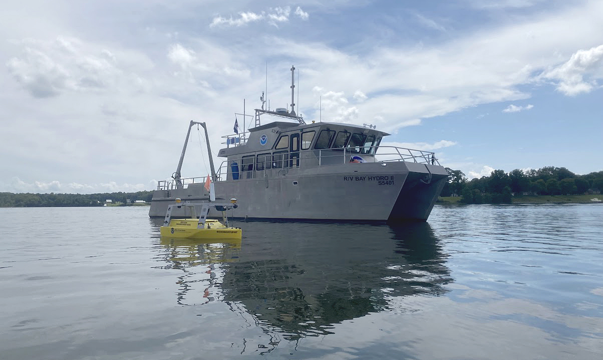
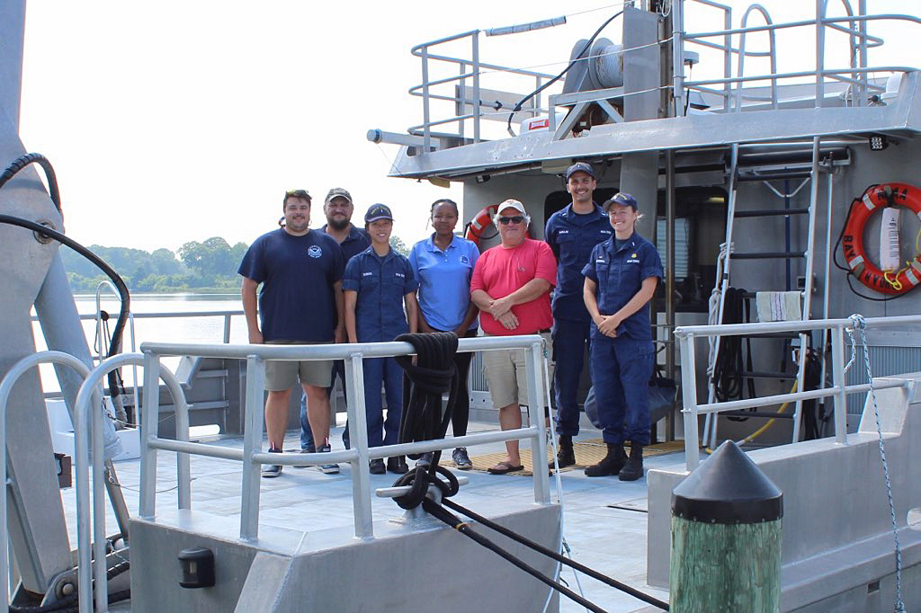
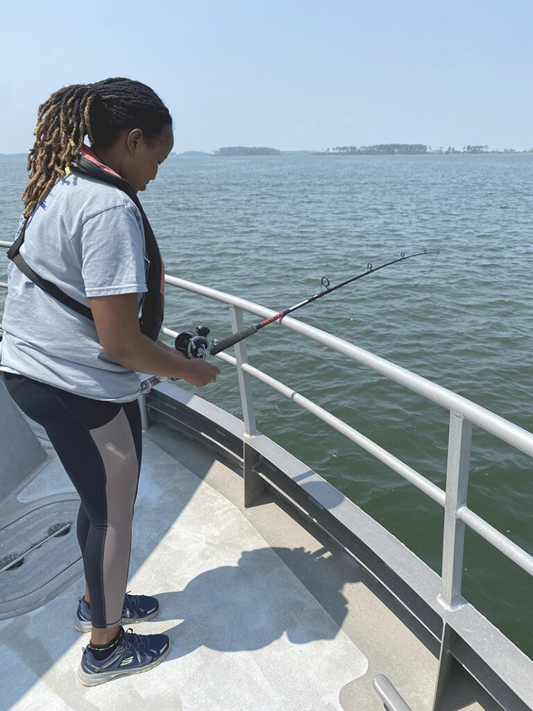
Much like the Ark and the Dove, two NOAA vessels undertook a historic mission of their own this summer. The NOAA R/V Bay Hydro II, crewed by Officer in Charge Lt. j.g. Jane Saunders, Junior Officer in Charge Lt. j.g. Carly Robbins, and Physical Scientist Technician Robert Mowery, were accompanied by three crew members of the navigation response teams and the uncrewed surface vehicle, Echoboat 240, operated by Lt. j.g. Collin McMillan, Physical Science Technician Joshua Bergeron, and Physical Science Technician Riley O’Connor. The teams were also joined by Daina Mathai, a Nippon Foundation/GEBCO scholar and participant of the International Hydrographic Organization’s Empowering Women in Hydrography program.
The NOAA R/V Bay Hydro II departed the historic settlement of St. Mary’s City to conduct the first major hydrographic survey of the St. Mary’s River since 1974. The data collected from this project will serve a variety of purposes. Primarily, the data will be used to update NOAA’s nautical charts and products as well as to support the Bipartisan Infrastructure Law efforts to address climate risks and coastal resilience. Forecasters at NOAA’s National Water Center will use the bathymetric data for hydrodynamic modeling to improve our understanding of the timing and the impact of rapid river stage increases and decreases, the duration of high water, and flood inundation or drought.
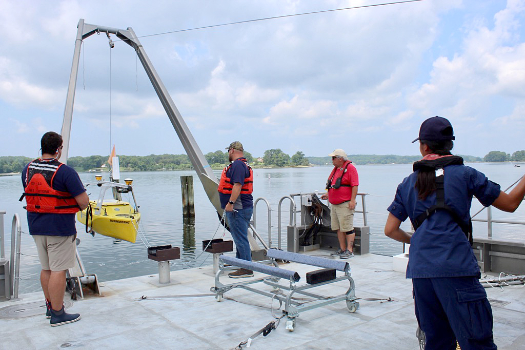
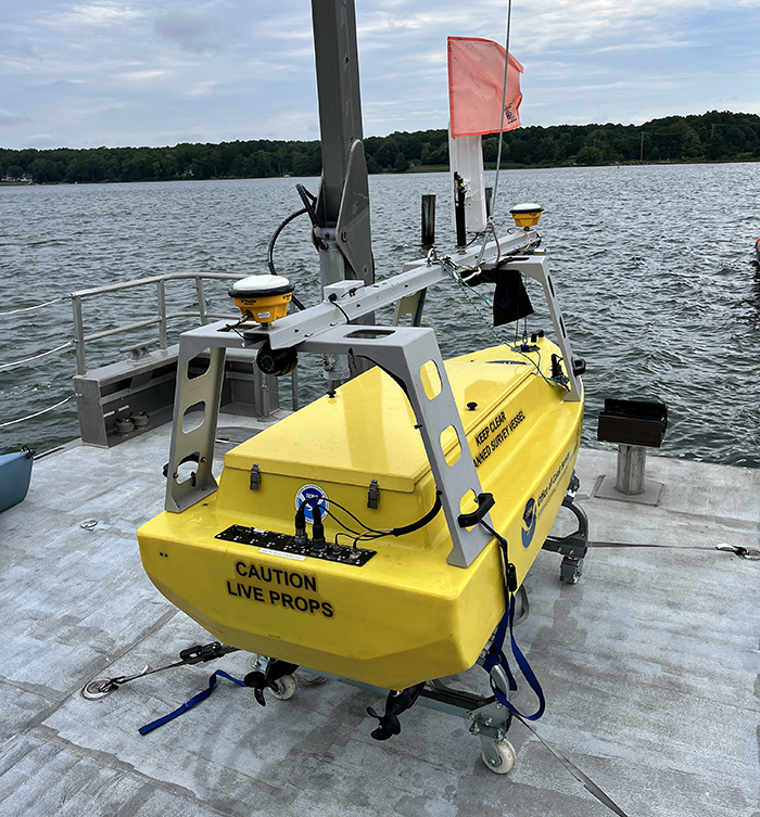
The Bay Hydro II, the primary survey platform, conducted the majority of the hydrographic survey on the St. Mary’s River. The Echoboat 240, the smaller of the two platforms, was used for shallow water data collection. Being an uncrewed surface vehicle, the Echoboat was launched daily from Bay Hydro II to conduct automated survey missions as the crew kept a close eye. For additional support, a team member was deployed on a kayak to monitor the Echoboat. This project marks the first time in over two years that Bay Hydro II has been utilized in the launch and recovery of an uncrewed surface vehicle. Additionally, this project is the first major project completed by the Echoboat 240 since it was used during response and recovery for Hurricane Ian in October of 2022.
Daina Mathai, a Nippon Foundation/GEBCO scholar and participant of the International Hydrographic Organization’s Empowering Women in Hydrography program, joined the crew for this survey of the St. Mary’s River. Daina received her European joint master’s degree in water and coastal management from the University of Bologna and just completed her Category A hydrographer qualification from the University of New Hampshire prior to sailing on the Bay Hydro II. Daina was involved in every aspect of the project, from data collection to data processing and was also included in Echoboat operations. Daina shared her experience on this survey and how it expanded upon her recently completed FIG/IHO/ICA category ‘A’ program:
“The opportunity to be aboard NOAA’s Bay Hydro II vessel was offered to me as a GEBCO scholar through the coordination between the University of New Hampshire Center for Coastal and Ocean Mapping/Joint Hydrographic Center under the Empowering Women in Hydrography initiative. The timing was ideal since it was scheduled just when I was completing my one-year FIG/IHO/ICA category ‘A’ program that included a hands-on summer hydrographic field course enabling me to put all that I had learned into action. The efficient coordination between the Center and NOAA’s Office of Coast Survey allowed me to get all the required clearances to be part of the survey team. The Officer in Charge of Bay Hydro II, Lt. j.g. Jane Saunders was of great help with the logistics of getting to St. Mary’s City, Maryland and settling in prior to joining the survey activities.” Daina also added, “My one-week visit was short but helped me get a better grasp of hydrographic surveys outside the training realm.”
Expanding on her experience aboard Bay Hydro II and working with the crew, Daina shared:
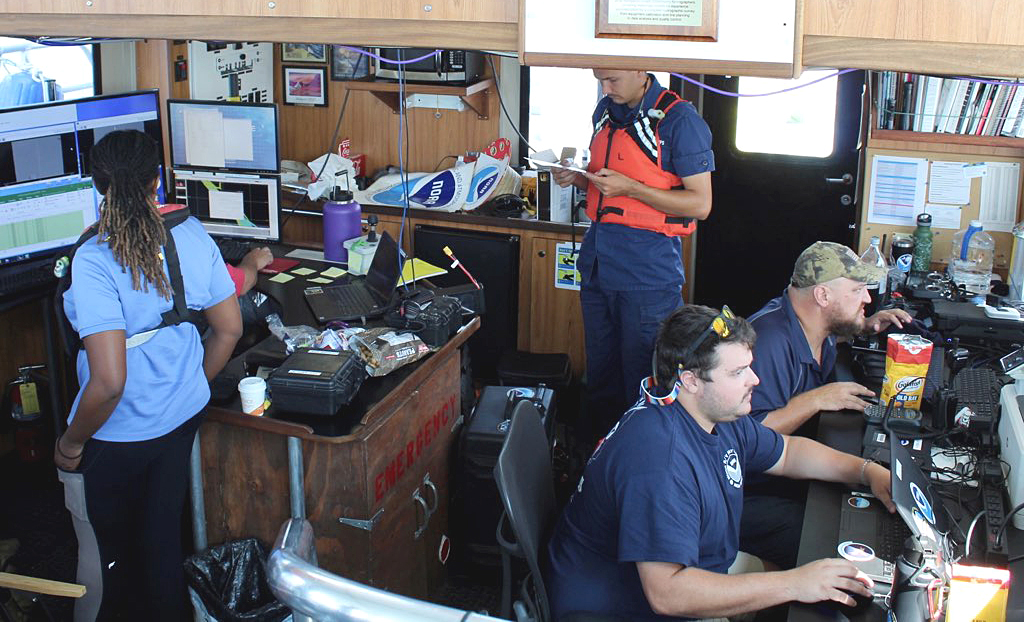
“I was pleasantly surprised by how similar the Bay Hydro II vessel was to the University of New Hampshire’s R/V Gulf Surveyor that is used for student field training which enabled me to settle in quickly. Aboard Bay Hydro II, there were different but familiar equipment and systems used for the bathymetric survey of the Potomac River. The survey team was well versed in their tasks which commenced the daily surveying just under half an hour of boarding. Equipped with the knowledge and skills from GEBCO training, I was able to ask questions, satisfy my curiosities, and get clarifications including a detailed safety brief on the location of emergency and protective gear aboard Bay Hydro II. The data management procedure of the acquisition data stood out, which made it very effective when the acquisition station was being manned by multiple people.”
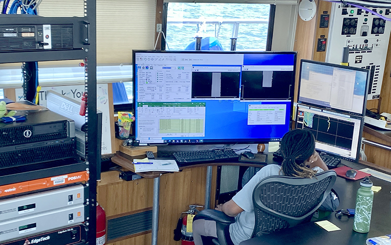
“I was greatly impressed by the efficiency and output of very small team-operated surveys. At the end of each day, all the necessary data from both Bay Hydro II and response teams were compiled, and a coverage map produced and the plan for the next day discussed. The communication between the officers in charge of both the Bay Hydro II and uncrewed systems team was timely and efficient which led to the accomplishment of tasks.”
Daina also shared her experiences working with the uncrewed surface vehicle the navigation response team brought onto the project:
“It was impressive to see how shallow the vehicle was able to survey with the mounted side scan and multibeam making it an ideal vehicle for very shallow coastal areas. The mounted side scan data and cameras provided real-time data for object detection. I participated in deploying and recovering the vehicle, monitoring the streaming videos, and marking targets on side scan data on CARIS for further investigation.”
Through this field season, the NOAA R/V Bay Hydro II and staff were able to survey seven square nautical miles (composed of approximately 500 linear nautical miles of data) of the St Mary’s River which largely had not been surveyed since 1974. The data will primarily be used to update NOAA’s nautical charts in addition to being used for hydrodynamic modeling.
In addition to surveying, the navigation response team was able to showcase the Echoboat 240 to the 2023 Brendan Sailing Camp, a camp founded in 2005 helping children with learning differences to realize success through instruction in the concepts of sailing, paddle sports, and power boating. The navigation response team taught the campers about the Echoboat 240’s capabilities and described to the students the different parts of the boat and how they work together to map the ocean floor. They also showed the students how the data collected by the Echoboat 240 in the St. Mary’s River will be used in order to help produce nautical charts, aiding mariners to safely navigate waterways.
In a final note on this field season, Daina Mathai added, “All in all, I send my gratitude to Bay Hydro II—Jane, Carly, and Robb—and the uncrewed systems team, Collin, Joshua, and Riley. If you find yourself in St. Mary’s City, be sure to grab the Old Bay Goldfish crackers, they are delicious and addictive.”