NOAA’s Office of Coast Survey maintains the nautical charts and publications for U.S. coasts and the Great Lakes. This is over a thousand charts covering 95,000 miles of shoreline and 3.4 million square nautical miles of waters. Measuring depths and determining new dangers to navigation in this large area is a monumental job given the seafloor is constantly changing.
One of NOAA Coast Survey’s biggest tasks during the winter months is to plan hydrographic survey projects for the coming field season. Survey planners consider requests from stakeholders such as marine pilots, local port authorities, the Coast Guard, and the boating community, and also consider other hydrographic priorities in determining where to survey and when. Continue reading “NOAA releases 2017 hydrographic survey season plans”
Change of command for NOAA Ship Rainier
The crew of NOAA Ship Rainier (S-221) hosted a change of command on January 12 while moored in its homeport of Newport, Oregon.
Cmdr. John Lomnicky accepted command of Rainer, replacing Capt. Edward Van Den Ameele in a ceremony with crew and guests in attendance, including Rear Adm. Shepard Smith, director of NOAA’s Office of Coast Survey; Capt. Todd Bridgeman, director of Marine Operations, OMAO; Mayor Sandra Roumagoux, Newport, Oregon; and Cmdr. Brian Parker, commanding officer of Pacific Marine Operations Center. Continue reading “Change of command for NOAA Ship Rainier”
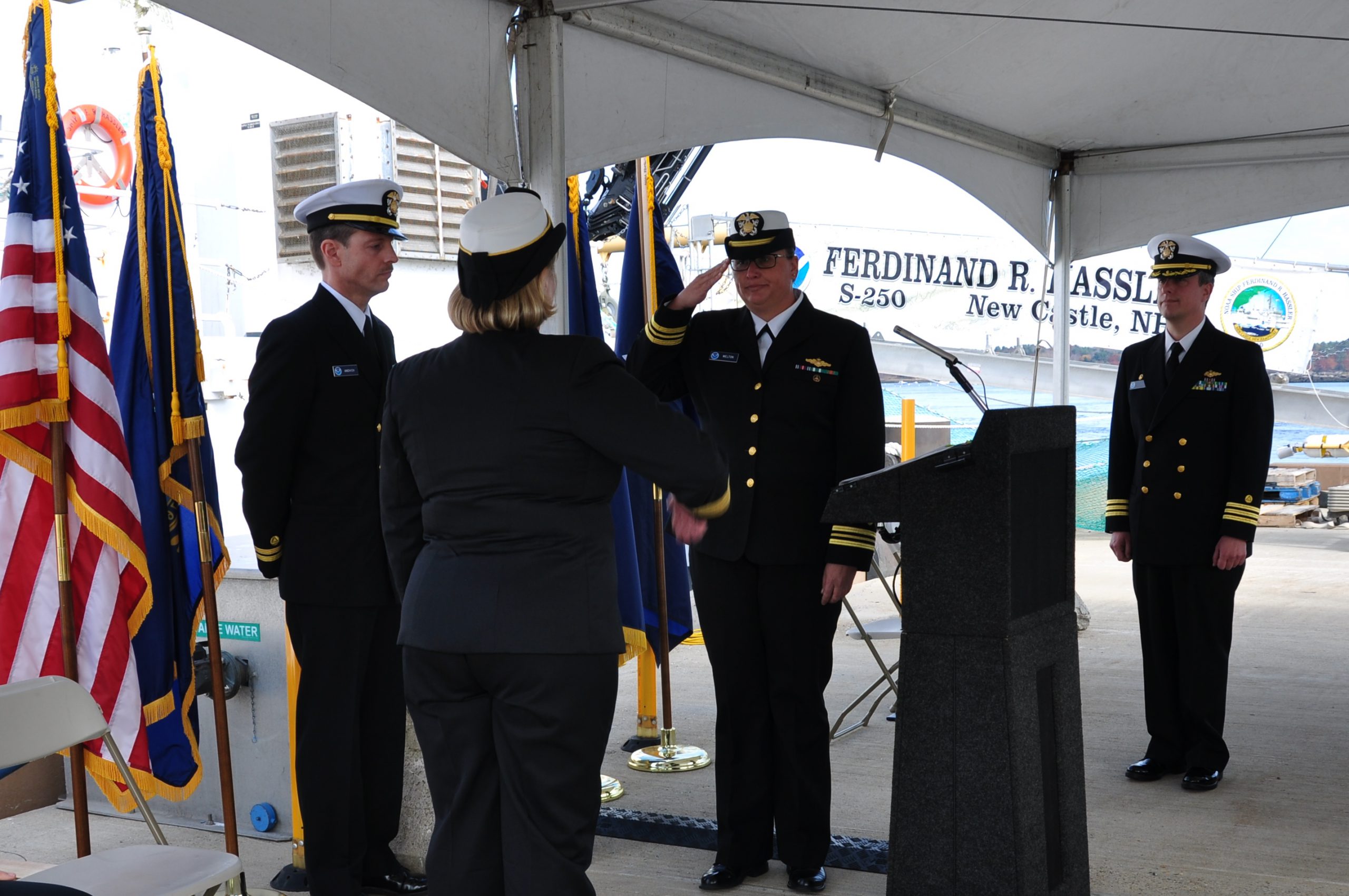
Change of command for NOAA Ship Ferdinand Hassler
The crew of the NOAA Ship Ferdinand R. Hassler (S-250) hosted a change of command on November 5, while moored at its homeport in New Castle, New Hampshire.
In front of the crew and guests – including Rear Adm. Gerd Glang, director of the Office of Coast Survey, and Capt. Anne Lynch, commanding officer of the Atlantic Marine Operations Center – Lt. Cmdr. Briana Welton accepted command of Hassler, replacing Cmdr. Marc Moser.
Welton is the new survey ship’s third commanding officer.
Continue reading “Change of command for NOAA Ship Ferdinand Hassler”
NOAA hydro officers honored
Each year, the NOAA Association of Commissioned Officers recognizes NOAA Corps officers for their extraordinary accomplishments and contributions. This year, three of the four awards went to officers supporting Coast Survey’s hydrographic program. Congratulations to the officers honored with Junior Officer of the Year, Engineering, and Science awards. Coast Survey applauds your accomplishments!
Continue reading “NOAA hydro officers honored”
NOAA observes World Hydrography Day by honoring lost crew members of the Robert J. Walker
Today, June 21, is World Hydrography Day. Hydrographic offices in over 80 maritime nations observe this day every year, since 2005. It is our special day to tell the public what hydrography is, and how it is employed to make navigation safer. Simply, hydrography is the science we use to obtain the data needed to create nautical charts. NOAA’s 200-year history is proof positive that those charts – and therefore hydrography – are a national investment that pays off daily with navigation safety, efficiency, and coastal protection from accidents at sea.
But today’s observation of World Hydrography Day is more profound. It is personal to every person who works in or supports hydrography in the United States.
Continue reading “NOAA observes World Hydrography Day by honoring lost crew members of the Robert J. Walker”
A nation pays final tribute to Civil War sailors interred at Arlington National Cemetery
Last week we blogged about the Civil War sailors whose remains were being interred at Arlington National Cemetery on March 8. The funeral, for unknown sailors who were lost when the USS Monitor capsized, was solemn and stirring, and reflected the nation’s great esteem for our fallen patriots. The unknown sailors were lost along with 14 of their shipmates when Monitor sank off Cape Hatteras, N.C., on Dec. 31, 1862.
All 16 sailors will be memorialized on a group marker in section 46 of the cemetery, which is between the amphitheater and the USS Maine Mast memorial.
Rear Admiral Gerd Glang, Coast Survey’s director, was honored to represent NOAA in the officer escort for the caissons. Glang and Rear Admiral Anthony Kurta (USN) served as Escort Commanders, and were joined by Capt. Gary Clore (Navy Chaplain) and Cmdr. Nathaniel Standquist (U.S. Navy Ceremonial Guard), as the nation paid a final tribute.
Continue reading “A nation pays final tribute to Civil War sailors interred at Arlington National Cemetery”
NOAA Coast Survey director to escort caissons for USS Monitor sailors’ interment at Arlington
On Friday, March 8, a NOAA Corps admiral will have the honor of doing something extraordinary. Coast Survey’s director, Rear Admiral Gerd Glang, will be the NOAA Escort Flag Officer for the full honors funeral of two unknown sailors who went down with the Civil War ironclad USS Monitor in 1862. Rear Adm. Glang will join Rear Adm. Anthony Kurta, U.S. Navy, as the two officers escort the caissons during the somber event at Arlington National Cemetery.
The interment will be open to the public.

The Monitor sank southeast of Cape Hatteras, North Carolina, during a New Year’s Eve storm, carrying 16 crew members to their deaths.
The wreck was discovered in 1973, and confirmed in 1974 by John Newton and a team from Duke University. The ironclad was lying upside down with the turret separated from the hull, resting in 230 feet of water approximately 16 miles off Cape Hatteras. In the late 1990s through 2002, experts recovered iconic Monitor artifacts, which are now conserved at the Mariners’ Museum in Newport News, Virginia. Two skeletons were discovered in 2002 when the turret was raised from the seafloor, and efforts to identify the remains have been unsuccessful so far.
Continue reading “NOAA Coast Survey director to escort caissons for USS Monitor sailors’ interment at Arlington”


