Surveying south of Cape Cod, Massachusetts in transit to the Great Lakes

NOAA Ship Thomas Jefferson underway in the Chesapeake Bay performing pre-season testing.

By Hydrographic Assistant Survey Technician Sarah Thompson

April 10, 2022 marked the beginning of NOAA Ship Thomas Jefferson and her crew’s field season and transit up through the St. Lawrence River, Lake Ontario, and into Lake Erie. This field season, Thomas Jefferson’s base of operations will be in Cleveland, Ohio and has the distinction of being the first NOAA ship to survey the Great Lakes in over 30 years. On the way, Thomas Jefferson had the opportunity to respond to a U.S. Coast Guard request to survey and obtain modern bathymetry on Pollock Rip Channel off the Massachusetts coast.

Continue reading “Surveying south of Cape Cod, Massachusetts in transit to the Great Lakes”

NOAA focuses on the Great Lakes for the 2022 field season

NOAA Ship Thomas Jefferson shown from the bridge wing of a passing ship outside of Montreal, Quebec.

In 2022, NOAA and NOAA contractors will survey U.S. coastal waters and beyond, including multiple missions in the Great Lakes. As the volume, value and size of marine vessels in U.S. waters continues to grow, it is essential that NOAA increase the accuracy and frequency of surveys. A great amount of data on nautical charts of the Great Lakes is more than 50 years old, and only about 5 to 15 percent of the Great Lakes are mapped to modern standards using remote sensing methods such as light detection and ranging and sound navigation and ranging.

Continue reading “NOAA focuses on the Great Lakes for the 2022 field season”

Coast Survey’s mobile integrated survey team goes to Antarctica

An image of the United States Coast Guard cutter Polar Star docked at McMurdo Station ice pier on a relatively ice free day for Winter Quarters Bay.
By, Annie Raymond

In 1959, following the International Geophysical Year of 1957-58, scientists from twelve nations conducting active research in Antarctica came together and signed the Antarctic Treaty. In the years following, 42 additional countries acceded to the treaty. The treaty preserves the entire continent and surrounding waters solely for purposes of peaceful scientific collaboration and bans resource extraction and military activity. McMurdo Station on Ross Island, operated by the United States through the United States Antarctic Program, a branch of the National Science Foundation (NSF), has emerged as the largest year-round station and primary logistics hub for the region. The first U.S. Operation Deep Freeze happened prior to and in support of the International Geophysical Year of 1957-58. Since then, Operation Deep Freeze has continued annually and has become the name for supply sealift missions to McMurdo, delivering fuel, food, and supplies to scientists in Antarctica.

Continue reading “Coast Survey’s mobile integrated survey team goes to Antarctica”

NOAA ocean mapping and reef surveys in the Mariana Islands

NOAA Ship Rainier alongside Ford Island in Pearl Harbor, Hawaii. on a sunny day with white clouds in the sky.

On March 26, NOAA Ship Rainier  set sail from Honolulu, Hawaii on a 3,307-nautical mile expedition to the Western Pacific. Originally planned for 2020, this will be the ship’s first multidisciplinary expedition to Guam and the Commonwealth of the Northern Mariana Islands. This collaborative mission between NOAA’s National Ocean Service and National Marine Fisheries Service will deliver high‐quality data, data products, and tools to the region including a seamless map linking hilltops to underwater depths and integrated data on the surrounding coral reef ecosystems. These data can provide information for countless users to make critical management decisions within disciplines such as habitat management and restoration, tsunami modeling, monitoring, and marine resource management.

Continue reading “NOAA ocean mapping and reef surveys in the Mariana Islands”

NOAA releases 2022 hydrographic survey season plans

NOAA Ship Fairweather in College Fiord, Alaska

NOAA hydrographic survey ships and contractors are preparing for the 2022 hydrographic survey season in U.S. coastal waters and beyond. The ships collect bathymetric data (i.e. map the seafloor) to support nautical charting, modeling, and research, but also collect other environmental data to support a variety of ecosystem sciences. NOAA considers hydrographic survey requests from stakeholders such as marine pilots, local port authorities, the Coast Guard, and the boating community, and also considers other hydrographic and NOAA science priorities in determining where to survey and when. Visit our “living” story map to find out more about our mapping projects and if a hydrographic vessel will be in your area this year!

Continue reading “NOAA releases 2022 hydrographic survey season plans”

Underway from Alaska to California encountering a new phenomenon, cellular service

Image showing NOAA Ship Fairweather turning towards the Golden Gate at the end of the project.
By ACHST Simon Swart, Operations Officer Lt. Shelley Devereaux, and HST Adriana Varchetta

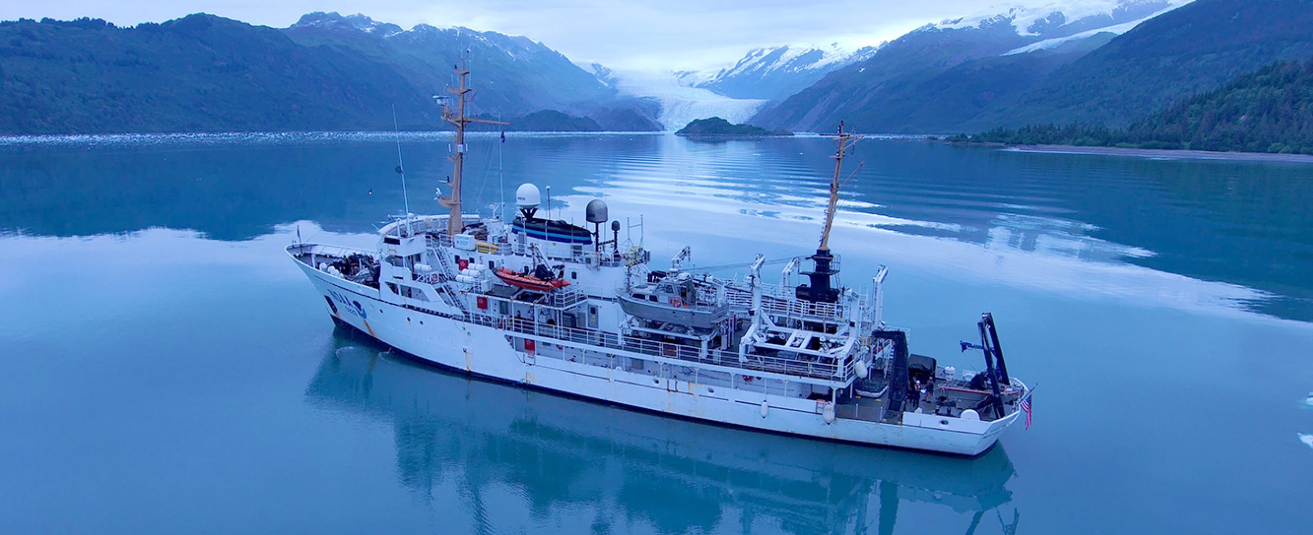
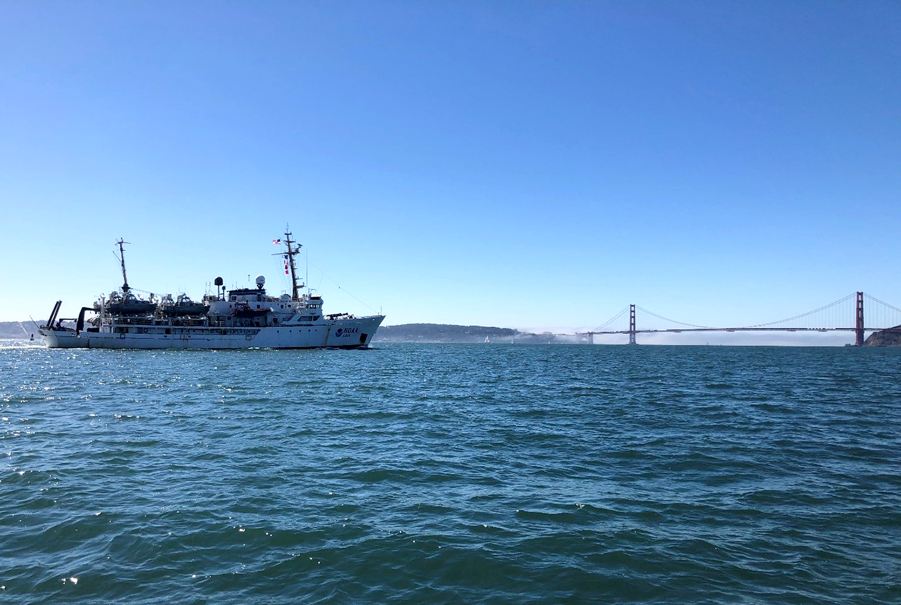
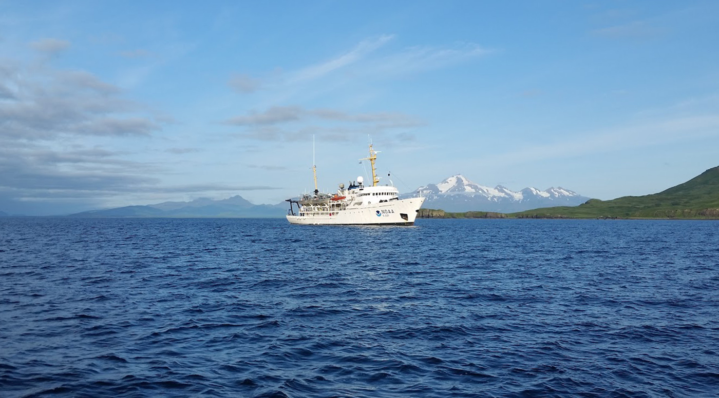
After six months of surveying in Alaska, NOAA Ship Fairweather was ready to point the bow south and set sail for San Francisco Bay. However, an unforeseen circumstance stymied the planned underway date. Although we eagerly anticipated the warmer waters of San Francisco Bay, this delay was well received by the hydrographers in the survey department and amongst the NOAA Corps officers. Our work had begun stacking up due to an extremely busy season, coupled with the fact that for most of us, this was our first time working on hydrographic project sheets. Therefore, we happily used this week of “down-time” to complete previous project sheets and plan for the upcoming survey. Those of us as sheet managers focused on cleaning multibeam data, processing backscatter mosaics, attributing features, conducting quality control checks, and writing descriptive reports. This process was greatly assisted with the help of augmenting physical scientists Pete Holmberg and Janet Hsiao. In the end, we were able to finish processing a number of sheets and reach a comfortable place on all the others. After a week of long hours, we were finally ready to toss lines and say “see you next year Alaska.”

Continue reading “Underway from Alaska to California encountering a new phenomenon, cellular service”

Captain Benjamin Evans selected as next Coast Survey Director

Image of NOAA Ship Rainier

We are pleased to announce that Capt. Benjamin Evans has been selected to serve as the next Director of the Office of Coast Survey. In this capacity, Capt. Evans will lead NOAA’s ocean mapping and nautical charting program, continuing the transformation of the agency’s navigation services to meet the needs of twenty first century mariners and apply Coast Survey’s technical expertise to meet a broad range of requirements for authoritative ocean mapping data. The Director of the Office of Coast Survey also represents NOAA and the United States as the “National Hydrographer” on interagency and international engagements.

Continue reading “Captain Benjamin Evans selected as next Coast Survey Director”

The Kodiak archipelago – whales, foxes, and bears, oh my!

An image showing the mountainous shoreline of Kodiak Island
By Simon Swart and Adriana Varchetta

Between April and August of 2021, NOAA Ship Fairweather visited the southern part of the Kodiak archipelago to survey and provide updated bathymetry for a remote, yet important area that sorely needed new chart data. Early in the year, abundant wildlife and the sparse population meant the ship’s crew only had to contend with spritely weather patterns. But as spring turned to summer and the weather improved, the village of Akhiok became a hive of activity. Many types of fishing vessels began plying the waters around Alitak Bay, dropping crab pots and casting nets as they went. The increase in sunlight also transformed the landscape from brown, barren hills into a lush green canvas. Quick waves hello and calls from locals to not run over their crab pots, kept the importance of the mission at the forefront of the crews mind, with an occasional aircraft sighting jolting them back to the 21st century. 

Continue reading “The Kodiak archipelago – whales, foxes, and bears, oh my!”

Alaska to Greenland via the Northwest Passage

Coast Guard Cutter Healy conducts Arctic patrol in support of the Office of Naval Research
By Lt. Patrick Debroisse

In August and September 2021, the U.S. Coast Guard Cutter Healy transited through the Northwest Passage, from Alaska to Greenland. This voyage provided members of the University of New Hampshire’s Center for Coastal and Ocean Mapping/Joint Hydrographic Center (CCOM/JHC) the opportunity to collect data, helping to fill gaps in current hydrographic coverage in the passage and in the U.S. Exclusive Economic Zone (EEZ). Data in the Arctic where sea ice impedes ships is sparse. This is concerning as the Arctic nations, especially the United States, Canada, and Greenland evaluate both extended continental shelf claims and the potential for shipping routes through the Northwest Passage.

Continue reading “Alaska to Greenland via the Northwest Passage”

Surveying in the Strait of Juan de Fuca during a global pandemic

By Ensign Jessie Spruill and Hydrographic Senior Survey Technician Simon Swart, NOAA Ship Fairweather

Last Thanksgiving, the crew of NOAA Ship Fairweather were busy surveying in one of the country’s busiest waterways. A global maritime entryway to the Pacific Northwest, the Strait of Juan de Fuca sees over 8,000 transits of deep-draft container ships, cargo and chemical carriers, oil tankers, and barges coming to and from Puget Sound and Canada. In addition to industrial shipping, the Strait of Juan de Fuca also supports over 200,000 transits of recreational vessels and Washington State Ferries. Located north of the Olympic Peninsula, the Strait forms the northwestern most border between the contiguous U.S. and Canada. On the American side, the region is home to eight million people including 50 First Nation communities with centuries old cultural ties to traditional fishing.

Continue reading “Surveying in the Strait of Juan de Fuca during a global pandemic”