By Hydrographic Assistant Survey Technician Sophia Tigges
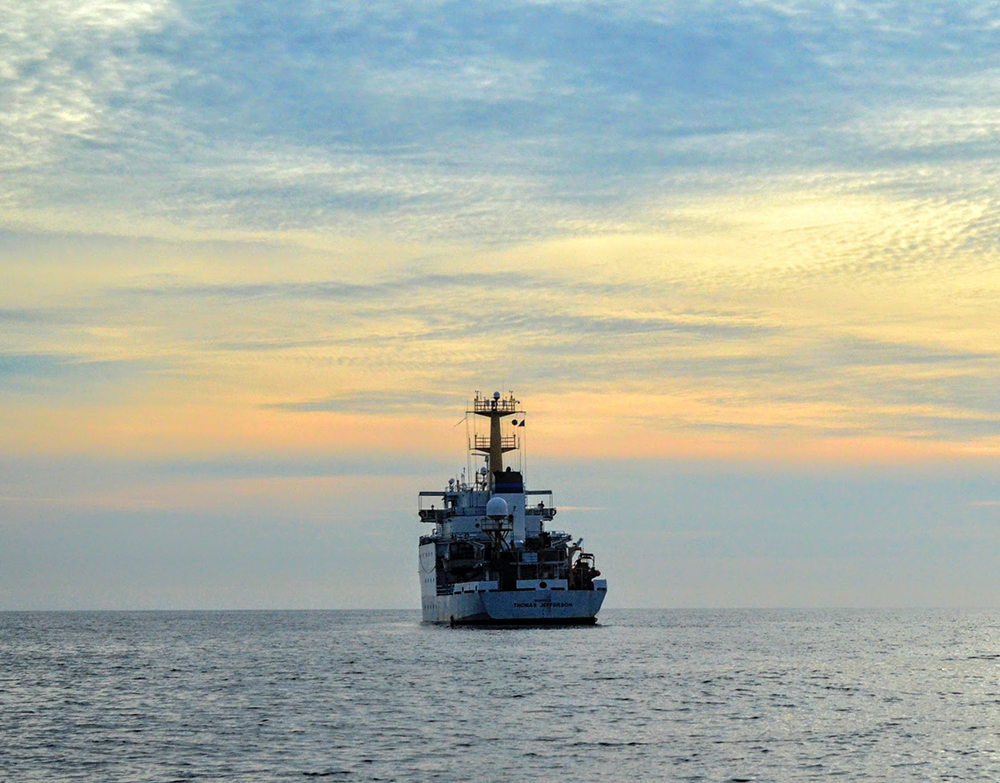
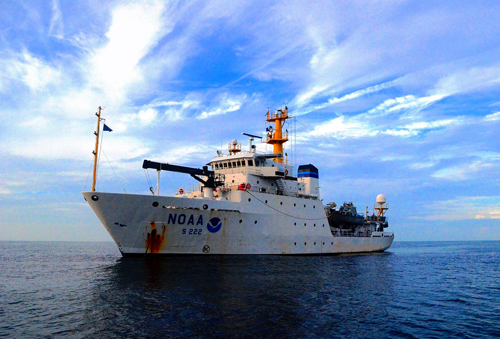
For the first portion of the 2020 field season, NOAA Ship Thomas Jefferson surveyed approaches to Chesapeake Bay. Thomas Jefferson’s 2020 field season consisted of two 45-day “bubble” periods. A “bubble period” is the time a ship closes to personnel transfer while they shelter in place for seven days and undergo COVID-19 testing per NOAA’s Office of Marine and Aviation Operation’s COVID-19 protocol to mitigate exposure. The ship spent the entire first bubble working off the coast of North Carolina and Virginia for this project. These surveys served as a continuation of the ship’s work in the area in the 2019 season. (To learn more about Thomas Jefferson’s work in this area last year, read the 2019 post titled, “NOAA Ship Thomas Jefferson tests innovative DriX unmanned surface vehicle.”
Project Overview
These surveys are part of an ongoing, multi-year project to collect hydrographic data to support vessels entering and exiting Chesapeake Bay. The data that Thomas Jefferson collected will supersede data from partial bottom coverage surveys that date from the 1880s to the 1940s. In the time since those previous data sets were collected, the seabed has changed in response to storms and hurricanes that have occurred over the last century, perhaps resulting in shoaling that could pose a hazard to the vessels of today. Bottom samples taken during the 2020 field season show that the seafloor in this region is composed of a mixture of sand and shells, supporting this concern for potential shoal formation. Additionally, data from these surveys can be used for applications that monitor the habitats and the environmental health of the offshore Chesapeake region.
Supporting Commerce and Safe Shipping
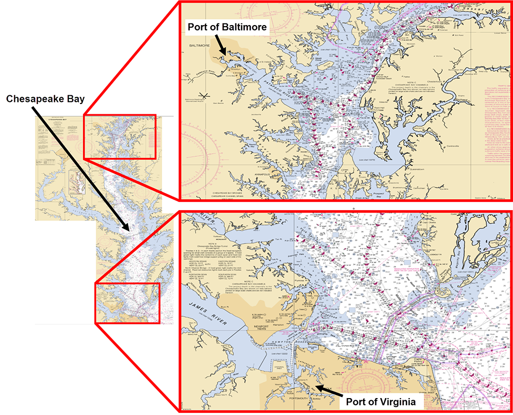
The Port of Virginia and Baltimore, Maryland, are two of the five major ports of the North Atlantic (Solyst 2020), as well as two of the top twenty ports in the United States. Located in Chesapeake Bay, these two ports see more than 116 million tons of imports and exports pass through annually (U.S. Army Corps of Engineers 2018). While these ports can update their infrastructure and dredge channels to accommodate newer and larger vessels, the ports still depend on these vessels to be able to safely navigate their way into the bay from offshore.
Survey Methods
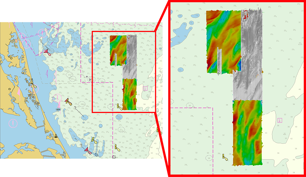
To update the previous partial bottom coverage obtained in the area, Thomas Jefferson conducted complete coverage surveys using two different techniques. For the first technique, the crew used the ship’s multibeam echo sounder (MBES) to collect detailed bathymetric data in the form of closely spaced depth measurements, or soundings. This dense collection of soundings can be used to generate an estimate of the location of the seafloor. This MBES technique has limited efficiency in shallow water.
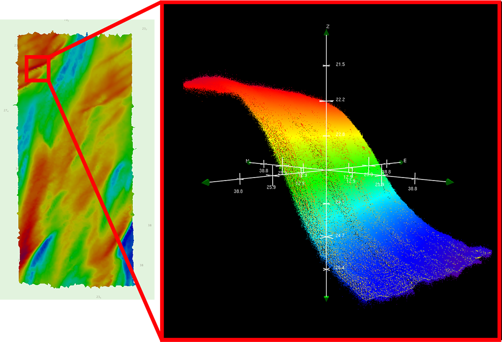
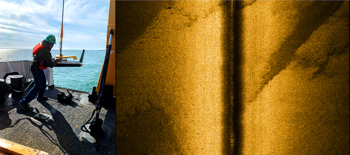
To survey in the shallower regions within the offshore Chesapeake project, Thomas Jefferson used side scan sonar (SSS). Rather than taking soundings, this second technique provides acoustic imagery of the seafloor in which hazards can be identified. The side scan sonar is a towed system that is lowered into the water and kept at a controlled altitude of eight to 20 meters above the seafloor. While logging side scan data, multibeam data must also be acquired simultaneously to provide bathymetric information and to obtain coverage in the small area directly below the side scan sonar system, which the side scan sonar cannot see.
Project Challenges and Accomplishments
The oceanographic properties of the offshore Chesapeake region give rise to challenges for survey operations. Multibeam echo sounders calculate the distance to the seafloor by using the travel time of an acoustic signal in combination with an observed sound speed profile of the water column. The speed of sound through seawater depends on temperature, salinity, and depth, which can be measured and transmitted to the sonar systems during operations. The crew of the Thomas Jefferson typically uses a Moving Vessel Profiler (MVP) to take casts that measure these sound speed profiles, which are a critical component of hydrographic data acquisition. The highly changeable sound speed conditions in the waters of the project area resulted in the need for the sound speed cast frequency to be increased from once an hour to once every ten to fifteen minutes.
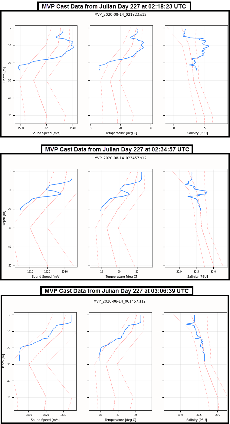
Sound speed conditions also affect side scan sonar systems due to refraction. While side scan systems do not need to receive sound speed information in order to operate, the system must be towed below the thermocline, or the layer of water in which the temperature changes dramatically with depth. Otherwise, as the sound waves travel through the thermocline, they bend as they encounter sections of the water column with different temperatures and thus different densities. This effect is much like the one illustrated by looking at a straw through a glass of water. Refraction can obscure the acoustic imagery produced by the side scan, decreasing the likelihood of identifying hazards in the data. Because these sound speed difficulties are caused by the characteristics of the region, they cannot be avoided. The Thomas Jefferson crew remained flexible and diligent in order to survey in these conditions, acquiring data that met the Office of Coast Survey’s rigorous specifications in spite of this challenge.
Overall, Thomas Jefferson surveyed more than 5,000 linear nautical miles and almost 200 square nautical miles for this project. When reviewing the data for submission, survey technicians performed a chart comparison to find any differences between charted soundings and surveyed soundings. These data can now be used to update NOAA charts to reflect the shoaling that has occurred during the last century, allowing vessels to transit safely and confidently through these waters.
Environmental Contributions
Although hydrography is Thomas Jefferson’s primary mission, the ship collects other observations for a variety of programs, including weather and marine mammal reports. For this project, the crew tested their skills for spotting turtles. The ship reported nine sea turtle sightings for the month of July and 35 for the month of August, bringing the grand total to 44 sightings.
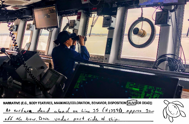
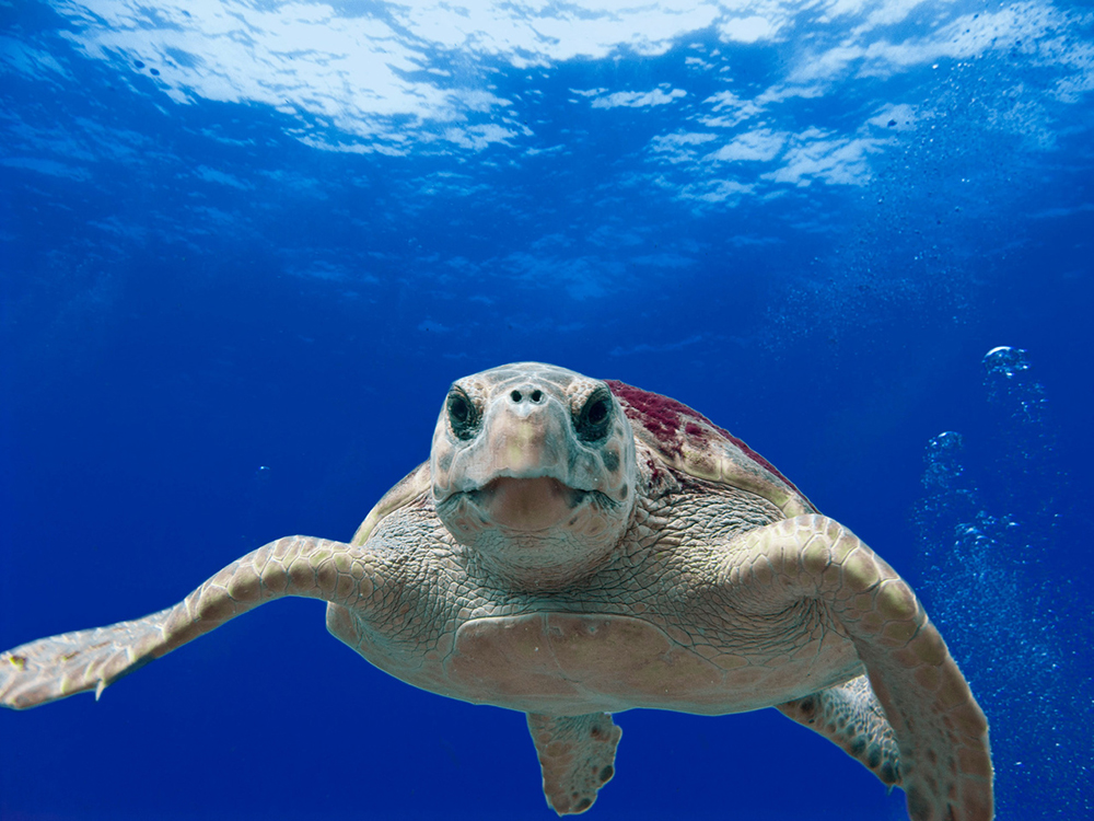
Of all the logged sea turtle sightings, nine were identified as loggerhead sea turtles. Behavioral observations of these turtles included swimming or resting at the surface, appearing to wave a flipper at the observer, and diving as the ship approached. Loggerheads are the most common species of sea turtle in Chesapeake Bay. Juvenile loggerheads feed in the bay starting in late spring, eating horseshoe crabs, blue crabs, sea grasses, whelks, and fish (Virginia Institute of Marine Science 2020). Loggerheads are considered a keystone species, or a highly significant species within the ecosystems that they inhabit. The shells of the invertebrates that loggerheads consume subsequently become nutrient sources, and loggerheads can host more than 100 species of organisms on their own shells (Chesapeake Bay Program 2020). One Thomas Jefferson observer noted the barnacles and algae present on a loggerhead’s shell before it dove from sight.
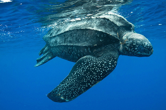
The most sighted species was the leatherback, which was recorded 28 times by the Thomas Jefferson crew. Similar to the loggerheads, these leatherback turtles were mostly observed swimming or resting at the surface and diving as the ship neared. Leatherbacks are the third most common species of sea turtle in the Chesapeake. They are also the largest, most migratory, and deepest diving species of sea turtle (Virginia Institute of Marine Science 2020). They are known to dive up to 4,000 feet to feed. They eat soft-bodied prey like salps and jellyfish, and their mouths and throats are lined with spines that point backward to prevent prey from escaping after it is swallowed. Leatherbacks are named for their lack of a hard shell. Instead, a leatherback’s carapace is made up of leathery, oily connective tissue that covers dermal bones. (NOAA Fisheries).
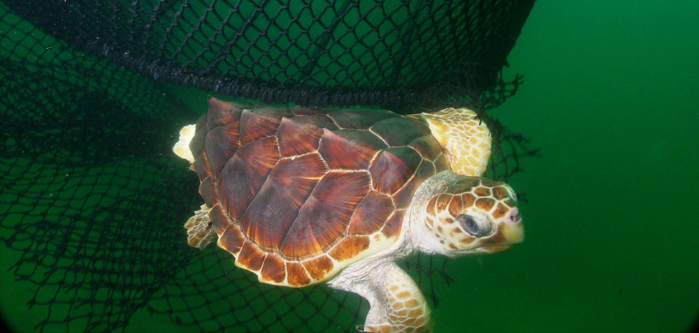
In the United States, sea turtles are protected under the Endangered Species Act of 1973. The U.S. Fish and Wildlife Service (USFWS) is responsible for sea turtle conservation on nesting beaches, while NOAA Fisheries is in charge of conservation at sea. Threats to sea turtles include entanglement in marine debris, accidental capture, habitat damage, and ship strikes (NOAA 2019). Observations from Thomas Jefferson are sent to a contact at the National Marine Fisheries Service (NMFS), and records are also submitted to the Environmental Compliance Coordinator at the Office of Coast Survey. These logged sightings support the Endangered Species Act and contribute to the protection of sea turtles in the project area.
Thomas Jefferson’s work during this 2020 field season will be added to the surveys of this offshore Chesapeake region that were completed by NOAA ships Ferdinand Hassler and Thomas Jefferson in recent years. The crew is excited to contribute to such important hydrographic work so close to their ship’s homeport.