
By Ensign Jessie Spruill and Hydrographic Senior Survey Technician Simon Swart, NOAA Ship Fairweather
Last Thanksgiving, the crew of NOAA Ship Fairweather were busy surveying in one of the country’s busiest waterways. A global maritime entryway to the Pacific Northwest, the Strait of Juan de Fuca sees over 8,000 transits of deep-draft container ships, cargo and chemical carriers, oil tankers, and barges coming to and from Puget Sound and Canada. In addition to industrial shipping, the Strait of Juan de Fuca also supports over 200,000 transits of recreational vessels and Washington State Ferries. Located north of the Olympic Peninsula, the Strait forms the northwestern most border between the contiguous U.S. and Canada. On the American side, the region is home to eight million people including 50 First Nation communities with centuries old cultural ties to traditional fishing.

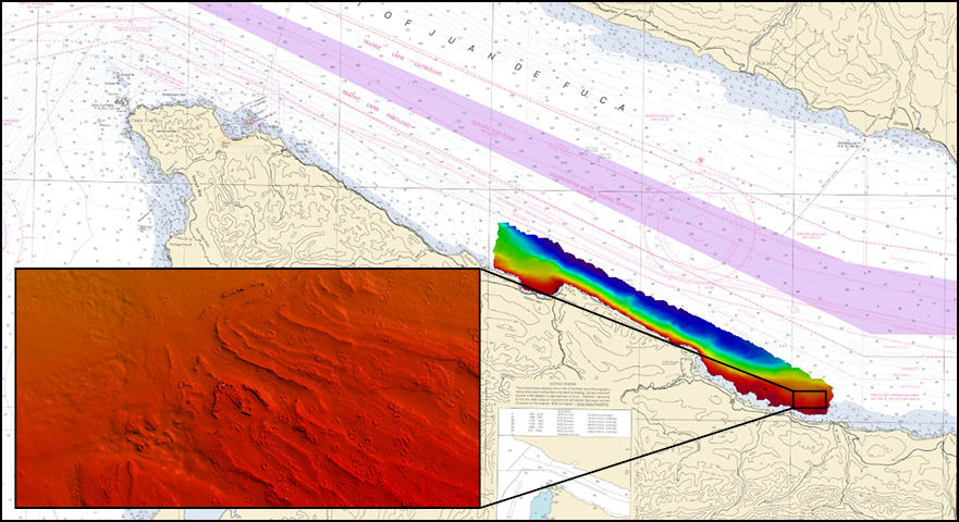
In November 2020, Fairweather was tasked with surveying 61 square nautical miles of seabed along the southern coast of the Strait of Juan de Fuca, from Cape Flattery to approximately five miles east of Pillar Point. Both a culturally and environmentally significant area, portions of the project are within the Makah Tribe Usual and Accustomed Fishing Area, Neah Bay, and the Olympic Coast National Marine Sanctuary. Fairweather coordinated with the Makah Tribe on a weekly basis informing them of weekly operational plans and sending them updated maps of survey progress. Most of this area was last surveyed in the 1940s and 1960s, with Neah Bay last surveyed in 2001. The goal of this modern bathymetric survey was to update National Ocean Service nautical charting products to improve navigational safety in this busy region, as well as support the global mapping initiative, Seabed 2030.
Surveying during a pandemic
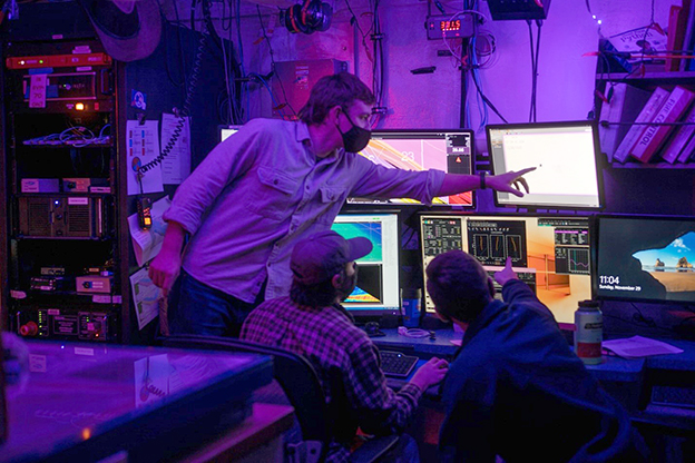
After seven months fraught with uncertainty as the world came to grips with the realities of living and working during a global pandemic, and after a shorter than usual warm-up stint in Alaska, Fairweather was able to complete a busy 13 days of hydrographic survey acquisition on the project. In a workplace that already requires extreme adaptability, the COVID-19 pandemic added yet more hurdles that we had to overcome in order to execute our mission. Given the newsworthy examples of cruise ships and fishing trawlers becoming a highly transmissible environment for the virus, the Office of Marine and Aviation Operations put in place several different methods of protection so that the ships and their crews could get back to doing what they do best. Dual tests during a strict seven-day shelter-in-place was the required regimen to get underway. Though we had a few false starts, extended hotel stays, and some uncooperative equipment to test the crew’s mettle, once we got a taste for uninterrupted survey operations we found our rhythm and began collecting data at our usual clip. In hindsight, the project was really preparing us for the longer operations forecasted for 2021, while still maintaining our level of COVID precautions.
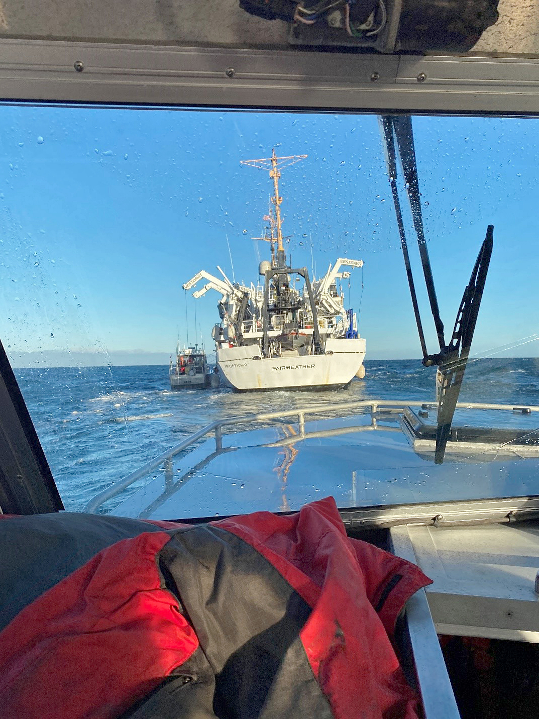
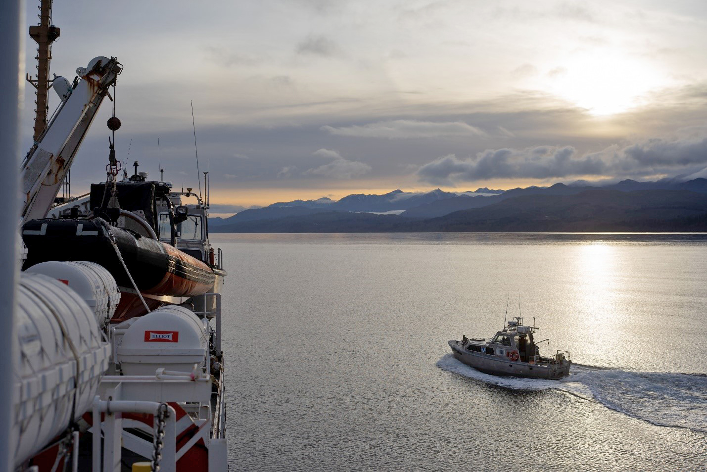
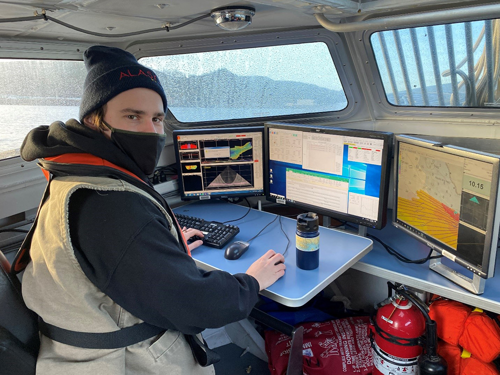
The normally weather whipped strait laid down for all but one day of acquisition, allowing the Fairweather’s smaller workboats and their crews to push in right along the coastlines. Dense kelp and large swells kept the boats at bay in some areas, but in others the shoreline was little more than an arm’s reach away. While unusual for Fairweather, the project area contained a port survey in Neah Bay. This area was of particular concern to the United States Army Corps of Engineers and a separate data submission was put together specifically for them. Approaching this aspect of the project required special considerations from the survey technicians and coxswains, as surveys in the more barren and remote regions of Alaska do little to prepare you for a port survey of any size. We may be used to rock pinnacles jumping up at you from 100 to zero meters in the blink of an eye, but manmade obstructions are a bit of an adjustment. As survey technicians furiously scribbled notes and took positions on the plethora of buoys, piers, rotting piles, and even an enormous section of a former bridge, coxswains expertly maneuvered the 28-foot workboats to cover the entire bay in multibeam bathymetry. We hope that our efforts can continue to aid mariners in the area and provide safe navigation for years to come.
Strange seafloor features
While processing bathymetric data from this survey, Fairweather personnel discovered some strange seafloor features in a shallow area near the southeastern edge of the survey limits. Near the mouth of West Twin River, were what can only be described as small craters about 15 meters wide and no more than a meter high, scattered along the seafloor bed. Although not confirmed, it is suspected that these features may be subterranean methane seeps. However, without additional data and outside expertise, the jury is still out on what these unique features may reveal about the seabed in this area.
Saying goodbye to one Commanding Officer and welcoming another
This project also marked Fairweather’s final outing with Capt. Marc Moser as Commanding Officer (CO). Over his two-and-a-half-year tenure as CO, Capt. Moser took the Fairweather all over Alaska and the west of coast of the United States. Notable projects included surveying at the extent of Fairweather’s range for USGS offshore fault mapping, ensonifying the entirety of the coast surrounding Santa Cruz Island in California’s Channel Islands, and filling in the expansive white space on the charts around Cape Newenham in Bristol Bay, Alaska. Not captured in these projects are the two extensive winter repair periods Capt. Moser oversaw to make sure the ship could continue to sail safely and effectively in the years to come. The Fairweather wishes Capt. Moser well at his next billet in Hawaii and welcomes Cmdr. Jay Lomnicky as her new CO.
I enjoyed and learned from your blog posts. I think you’re incredibly smart and knowledgeable. Your article is brilliant.