
September 16, 2020
Greetings from Alaska,
I’m currently serving as the navigation manager for Alaska where I get to share all of the great work Coast Survey does with the local maritime community here in Alaska. It’s an awesome assignment that has opened my eyes to how impactful our work is, especially in a state that has just about as much coastline as all of the lower 48 combined. With few roads and vast distances, maritime commerce is absolutely critical to Alaska’s economy.
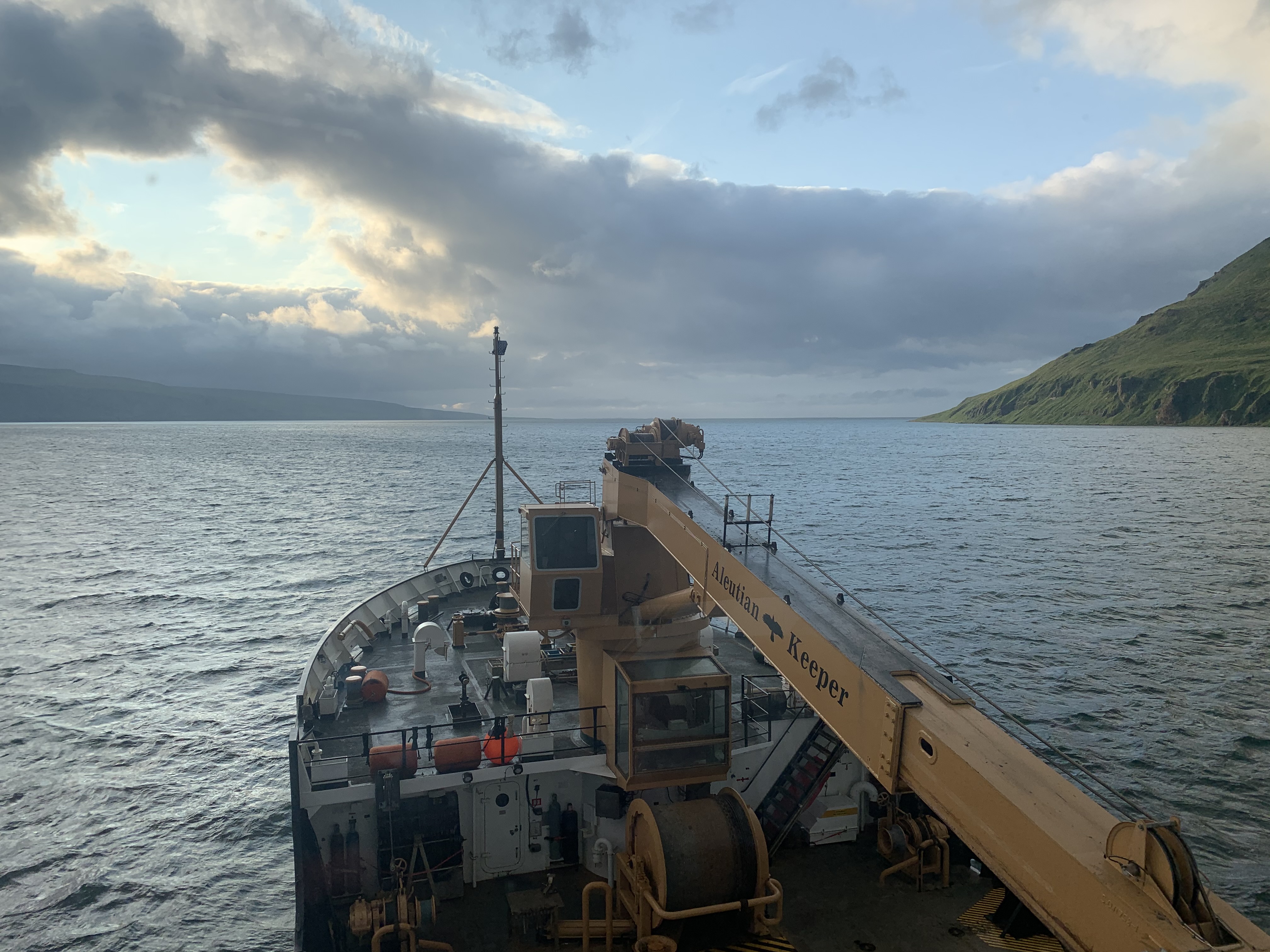
A great example of this importance is False Pass, a small and dynamic waterway 50 nautical miles east of Unimak Pass that runs through Bechevin Bay connecting the Bering Sea to the Pacific Ocean. This route represents a considerable shortcut for vessels small enough to transit through, such as the vessels supporting the billion-dollar Bristol Bay salmon fishery.
To keep this route safe, the U.S. Coast Guard Cutter SPAR deploys annually to verify that the Aids to Navigation (ATONs) are on station and marking the safest water. As SPAR is substantially larger than most vessels transiting the pass, with a draft roughly equal to the controlling depth, SPAR’s mission in Bechevin Bay includes the unique aspect of limited hydrographic surveys as part of their operations.
To assist SPAR’s survey efforts, Coast Survey has provided a variety of support over the years including a highly successful mission in 2019 with Lt. Dylan Kosten. When SPAR sent a last minute request for support, I was the only one able to assist. I happily broke free from my (home) office, made sure I followed all the appropriate USCG and NOAA Covid-19 protocols, and joined SPAR in Homer, Alaska, to start the mission in Bechevin Bay.
Surveying on SPAR consisted of using the crowdsourced bathymetry (CSB) configuration Lt. Kosten and SPAR’s crew had developed the year prior. This worked great for providing the data needed to ensure SPAR’s safe transit across the bars within the bay. This super simplified surveying approach was illuminating, as it demonstrated a real world application of CSB. While I wouldn’t chart the data we acquired, it reinforced my belief in the potential CSB presents to verify the accuracy, and resulting safety, of charted depths. Even though what we observed this year highlighted the need for a higher quality survey in the future (i.e. a mobile integrated survey team deployment), it was remarkable to see what we could accomplish with little more than National Marine Electronic Association strings and tidal predictions.
Overall, this trip highlighted the incredible trust mariners place in our hydrographic and cartographic expertise. Being able to represent that expertise on a USCG vessel on behalf of Coast Survey was a great honor. Best of all, it was also just a great time in a beautiful place. I can’t wait to see how this relationship between Coast Survey and USCG will continue to grow as new technology and automation enables even more collaboration moving forward.
Stay safe out there,
Lt. Cmdr. Bart Buesseler, NOAA
Alaska Regional Navigation Manager
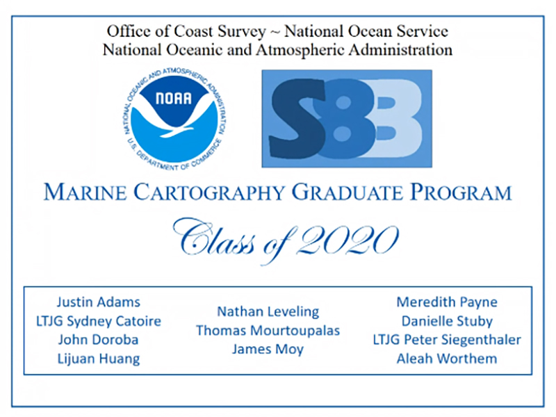
Justin Adams, Marine Chart Dividsion (MCD)
Lt. j.g. Sydney Catoire, MCD
John Doroba, MCS
Lijuan Huang, National Geodetic Survey (NGS)
Nathan Leveling, MCD
Thomas Mourtoupalas, MCD
James Moy, MCD
Meredith Payne, Hydrographic Surveys Division (HSD)
Danielle Stuby, NGS
Lt. j.g. Peter Siegenthaler, NGS
Aleah Worthem, MCD
For more information contact: Colby.Harmon@noaa.gov.

9/23 and 9/24 - HSRP Public Meeting
9/30 and 10/1 - Precision Marine Navigation Industry Workshop
10/6 and 10/7 - Standard Ocean Mapping Protocol Symposium
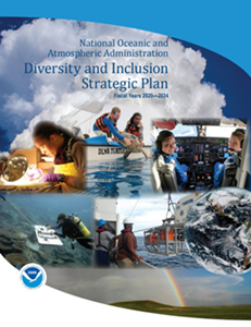
On August 28, NOAA released its new Diversity and Inclusion Strategic Plan 2020-2024. In Dr. Jacobs’ D&I Policy Statement, he emphasizes the significance of diversity and inclusion as vital components of organizational success. NOAA’s efforts to create and sustain an inclusive workplace which is free of discrimination, harassment, and reprisal are aligned around three distinct goals:
Strategic Goal #1 – Workforce Diversity: Recruit and attract a diverse, highly-capable workforce
Strategic Goal #2 – Workplace Inclusion: Build a work environment that promotes inclusion
Strategic Goal #3 – Sustainability: Build sustained and adaptive leadership commitment to a diverse and inclusive NOAA through accountability, data and education
NOAA is currently developing a D&I Action Plan with elements derived specifically from feedback received from the workforce during recent NOAA Town Hall listening sessions and the NOAA email suggestion box.
September 15 - October 15 is National Hispanic Heritage Month
Hispanic Heritage Month recognizes and celebrates the contributions Americans tracing their roots to Spain, Mexico, Central America, South American and the Spanish-speaking nations of the Caribbean have made to American society and culture.
Coast Survey Summer/Fall Diversity and Inclusion Training Sheet

