
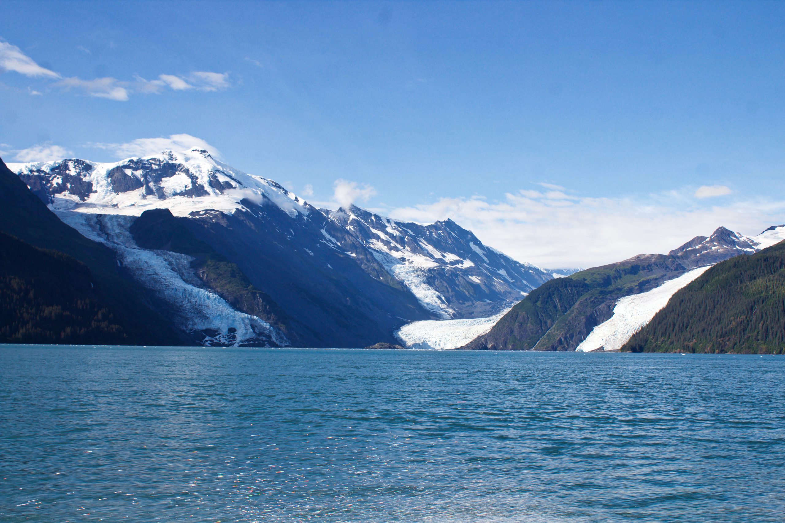
In May of 2020, local geologists identified a steep, unstable slope that has the potential to become a tsunami-generating landslide in Barry Arm, a glacial fjord 60 miles east of Anchorage, Alaska. With documented cases of tsunami-generating landslides in Alaska including Lituya Bay in 1958 and Taan Fjord in 2015, this new hazard immediately caught the attention of state and federal partners who quickly joined forces to quantify the risk to those living and boating in Alaska’s Prince William Sound, specifically the communities of Whittier, Valdez, Cordova, Tatitlek, and Chenega.
One critical piece of missing information was water depth at the base of the slope. As this seafloor was recently exposed due to the retreat of Barry Glacier, there was no data available for modeling. This data is needed by the U.S. Geological Survey (USGS) and the State of Alaska Division of Geological & Geophysical Surveys (DGGS) to determine the underwater structure of the slope, and by the NOAA/NWS National Tsunami Warning Center (NTWC) to calculate how much water a landslide might displace and where it would go. Two essential questions for determining the risk within Prince William Sound.
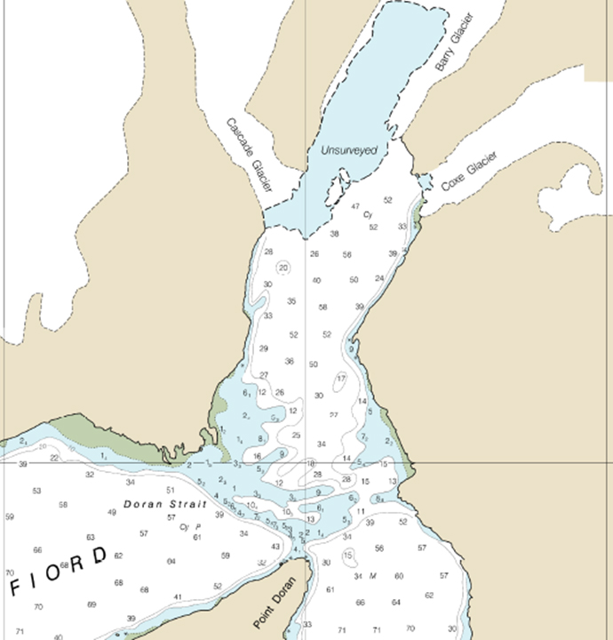
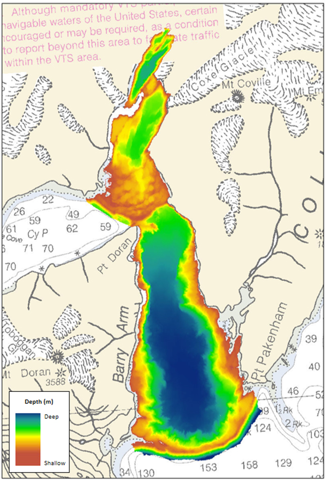
Given the importance of this foundational data, USGS worked collaboratively with Coast Survey to fund a bathymetric survey and expedited processing of data for Barry Arm. An area of 17 square nautical miles was defined for high-resolution complete coverage multibeam data, extending from the base of the potential landslide to the terminal moraine at the southern extent of Barry Arm. This provides the best possible data needed to support accurate modeling and decision support.
“This multi-agency collaboration will help scientists and officials prepare for this potential hazard and work to keep our mariners and communities safe,” said Rear Adm. Shepard Smith, director of the Office of Coast Survey, “I am also very pleased that we were able to establish a hydrographic survey contract so quickly and work with eTrac to collect this critical bathymetric data.”
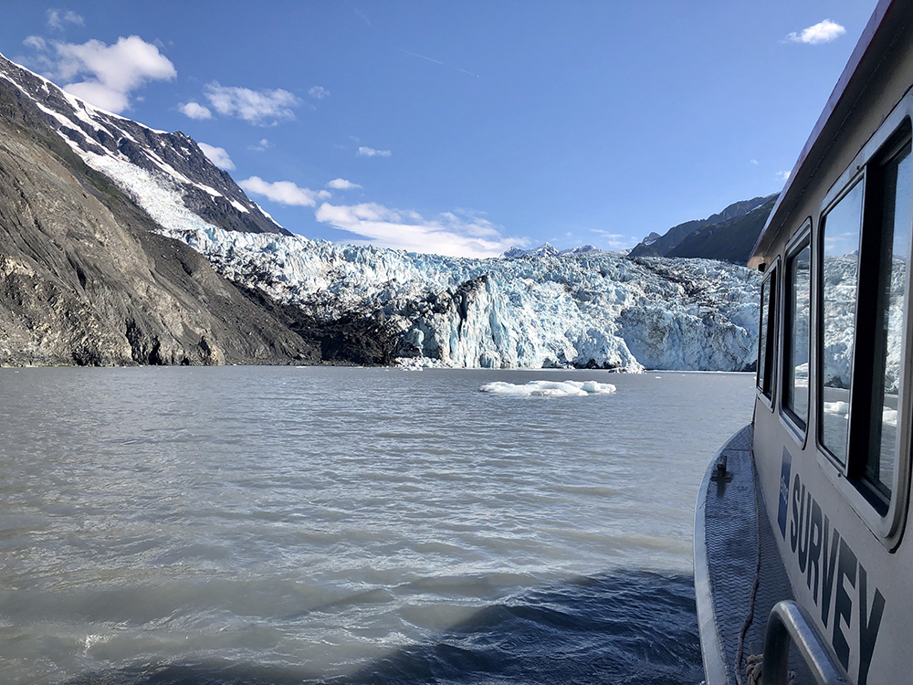
Acquisition of this data fell to Coast Survey’s hydrographic surveying contractor eTrac, who was able to rapidly mobilize and complete data acquisition in August. Their preliminary data will be available to USGS and NOAA scientists by the end of September, with the final dataset expected to become publicly available in summer 2021.
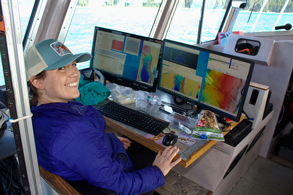
“eTrac was thrilled to be a part of this spectacular project in such a remote and beautiful place,” said Dave Neff, hydrographer with eTrac. “It was enlightening to experience USGS and NOAA working in concert to achieve multi-interest bathymetry in the Prince William Sound.”
This bathymetric data will join other data sets such as high resolution LIDAR data of the slope and surrounding hillsides acquired by DGGS, and satellite based radar from USGS to help scientists determine what movement, if any, is taking place. While scientists cannot forecast when a landslide might occur, all of this data supports scientists and emergency managers as they determine the best course of action in preparing for this hazard.
“Understanding the depth and shape of the Barry Arm fjord means the National Tsunami Warning Center will have a better grasp of the tsunami risk if and when a landslide occurs,” said Dr. James Gridley, director of the NOAA National Tsunami Warning Center. “ We could not have improved our mission confidence for the Barry Arm threat without this critical data set.”
“The bathymetric data is a critical foundational element of a multi-agency assessment of the coastal marine hazard and tsunami threat in Barry Arm and the nearby coastal communities” said Aimee Devaris, USGS Alaska regional director. “Expedited access to the data will enable USGS and the Alaska Division of Geological and Geophysical Surveys to accurately map the Barry Arm Landslide above and below the water in order to evaluate the hazard and aid in the development of a surveillance strategy.”
Updates and details from all state and federal partners are available at the Barry Arm landslide and tsunami hazard website hosted by the State of Alaska at: http://dggs.alaska.gov/hazards/barry-arm-landslide.html
One of the big questions in my mind is how the moraines and bathymetry in the vicinity of the potential landslide will impact the wave that could be produced. Hopefully, with the survey data and a detailed model representation we will have a much better understanding…hence more specific efforts at mitigating the threat to not only Whittier, but other communities and user groups around the Sound.
What was the nature of the event in College Fjord that caused the disaster at Valdez? Does a subsurface landslide at Barry Arm compare at all?