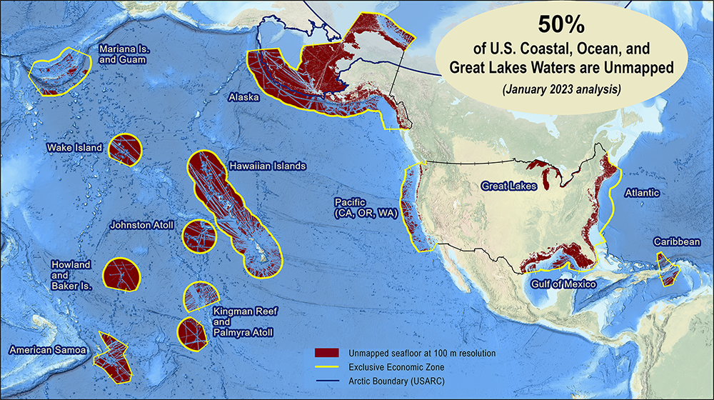
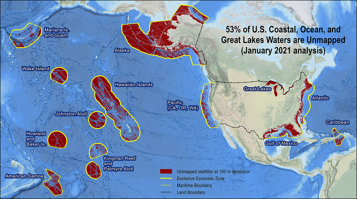
The federal Interagency Working Group on Ocean and Coastal Mapping recently released the sixth annual report on progress made in mapping U.S. ocean, coastal, and Great Lakes waters. To safeguard our national security and economic prosperity, ocean mapping, exploration, and characterization is foundational to maritime commerce, domestic energy and seafood production, tourism and recreation, and understanding of our natural resources, among other interests. The 2020 National Strategy for Mapping, Exploring, and Characterizing the United States Exclusive Economic Zone (NOMEC) makes comprehensive ocean mapping a priority for the coming decade. The Unmapped U.S. Waters report tracks progress toward these important goals.
Continue reading “The Interagency Working Group on Ocean and Coastal Mapping announces progress on mapping U.S. ocean, coastal, and Great Lakes waters”The Interagency Working Group on Ocean and Coastal Mapping announces progress report on mapping U.S. ocean, coastal, and Great Lakes waters
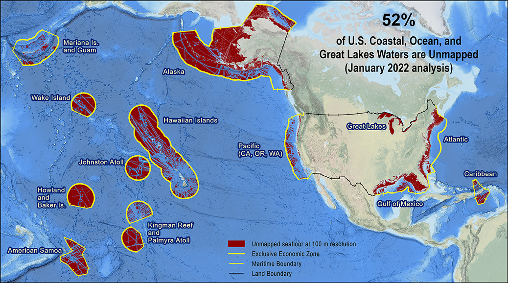
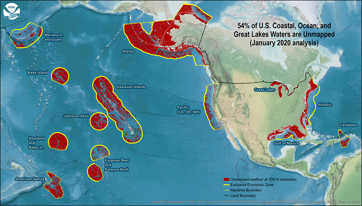
The federal Interagency Working Group on Ocean and Coastal Mapping (IWG-OCM) has released the fourth annual report on progress made in mapping U.S. ocean, coastal, and Great Lakes waters. Knowledge of the depth, shape, and composition of the seafloor has far-reaching benefits, including safer navigation, hazard mitigation for coastal resilience, preservation of marine habitats and heritage, and a deeper understanding of natural resources for sustainable ocean economies. The 2020 National Strategy for Mapping, Exploring, and Characterizing the United States Exclusive Economic Zone (NOMEC) and the Nippon Foundation-GEBCO Seabed 2030 Project make comprehensive ocean mapping a priority for the coming decade. The Unmapped U.S. Waters report tracks progress toward these important goals.
Continue reading “The Interagency Working Group on Ocean and Coastal Mapping announces progress report on mapping U.S. ocean, coastal, and Great Lakes waters”NOAA focuses on the Great Lakes for the 2022 field season
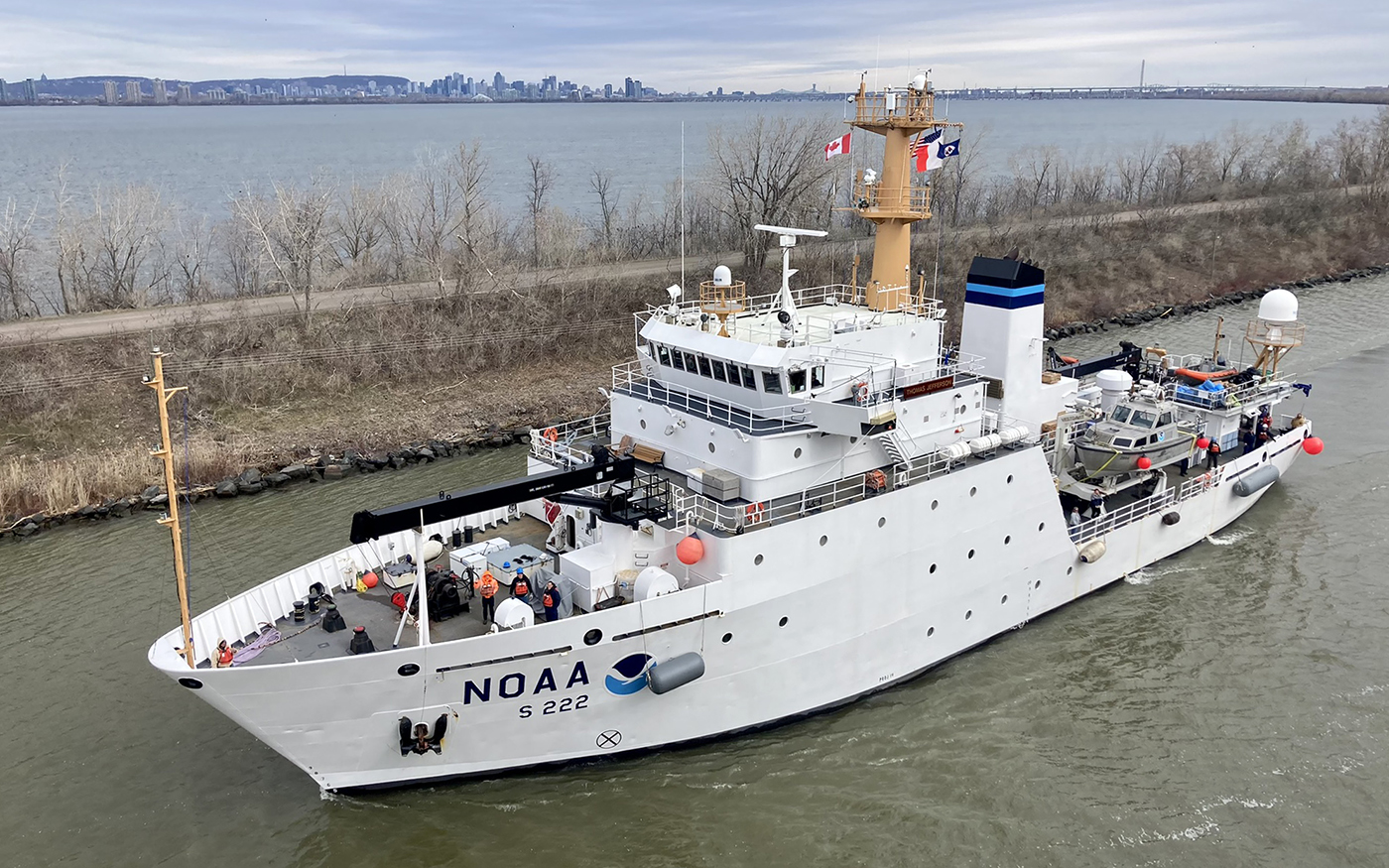
In 2022, NOAA and NOAA contractors will survey U.S. coastal waters and beyond, including multiple missions in the Great Lakes. As the volume, value and size of marine vessels in U.S. waters continues to grow, it is essential that NOAA increase the accuracy and frequency of surveys. A great amount of data on nautical charts of the Great Lakes is more than 50 years old, and only about 5 to 15 percent of the Great Lakes are mapped to modern standards using remote sensing methods such as light detection and ranging and sound navigation and ranging.
Continue reading “NOAA focuses on the Great Lakes for the 2022 field season”The Interagency Working Group on Ocean and Coastal Mapping announces progress report on mapping U.S. ocean, coastal, and Great Lakes waters
The Interagency Working Group on Ocean and Coastal Mapping (IWG-OCM) has released the third annual report on the progress made in mapping U.S. ocean, coastal, and Great Lakes waters. Knowledge of the depth, shape, and composition of the seafloor has far-reaching benefits, including safer navigation, hazard mitigation for coastal resilience, preservation of marine habitats and heritage, and a deeper understanding of natural resources for sustainable ocean economies. The 2020 National Strategy for Mapping, Exploring, and Characterizing the United States Exclusive Economic Zone and the global Seabed 2030 initiative make comprehensive ocean mapping a priority for the coming decade. The Unmapped U.S. Waters report tracks progress toward these important goals.
The Interagency Working Group on Ocean and Coastal Mapping announces progress report on mapping U.S. ocean, coastal, and Great Lakes waters
The Interagency Working Group on Ocean and Coastal Mapping (IWG-OCM) released the second annual report on the progress made in mapping U.S. ocean, coastal, and Great Lakes waters. The depth, shape, and composition of the seafloor are foundational data elements that we need to understand in order to explore, sustainably develop, conserve, and manage our coastal and offshore ocean resources. The 2020 National Strategy for Mapping, Exploring, and Characterizing the United States Exclusive Economic Zone and the global Seabed 2030 initiative make comprehensive ocean mapping a priority for the coming decade. The Unmapped U.S. Waters report tracks progress toward these important goals.
Continue reading “The Interagency Working Group on Ocean and Coastal Mapping announces progress report on mapping U.S. ocean, coastal, and Great Lakes waters”NOAA bathymetric data helps scientists more accurately model tsunami risk within Barry Arm
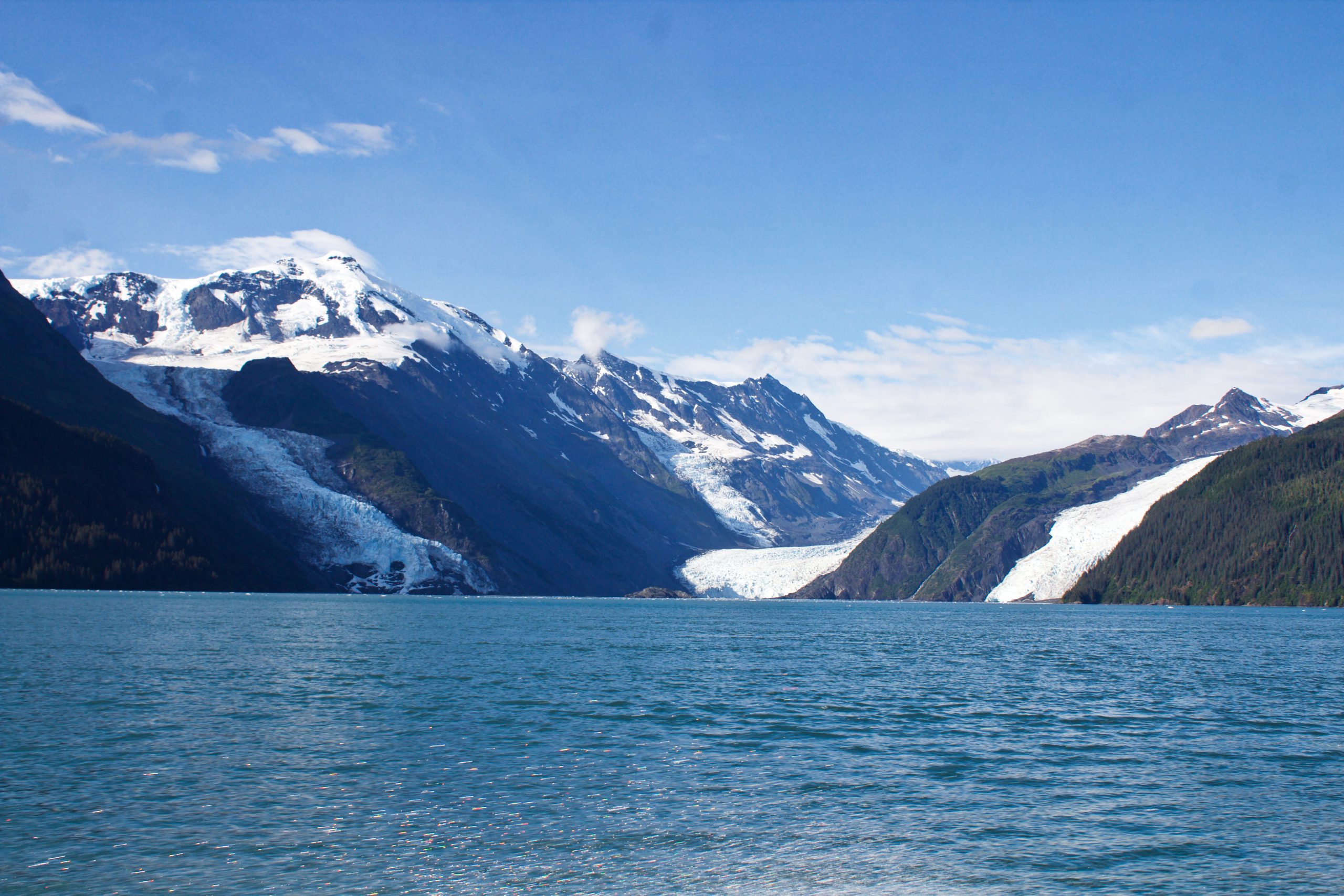
In May of 2020, local geologists identified a steep, unstable slope that has the potential to become a tsunami-generating landslide in Barry Arm, a glacial fjord 60 miles east of Anchorage, Alaska. With documented cases of tsunami-generating landslides in Alaska including Lituya Bay in 1958 and Taan Fjord in 2015, this new hazard immediately caught the attention of state and federal partners who quickly joined forces to quantify the risk to those living and boating in Alaska’s Prince William Sound, specifically the communities of Whittier, Valdez, Cordova, Tatitlek, and Chenega.
Continue reading “NOAA bathymetric data helps scientists more accurately model tsunami risk within Barry Arm”NOAA Coast Survey’s new strategy supports charting mandates and broader seafloor mapping
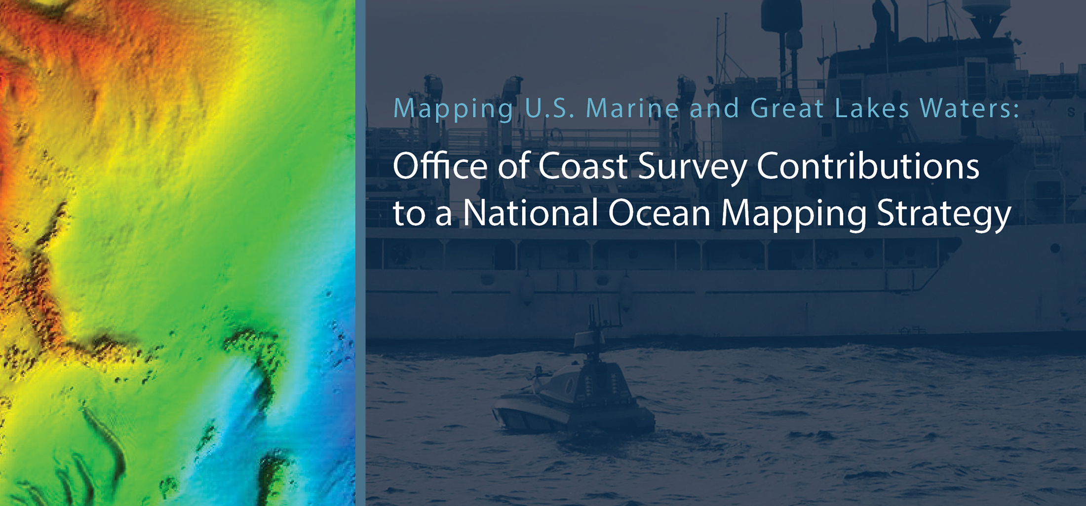
This week, NOAA’s Office of Coast Survey released the Mapping U.S. Marine and Great Lakes Waters: Office of Coast Survey Contributions to a National Ocean Mapping Strategy. This report is part of NOAA’s ongoing commitment to meet core surveying and nautical charting mandates while supporting broader needs to fill gaps in seafloor mapping and environmental sciences.
Continue reading “NOAA Coast Survey’s new strategy supports charting mandates and broader seafloor mapping”NOAA announces new progress report on mapping U.S. ocean, coastal, and Great Lakes waters
NOAA released the first annual report on the progress made in mapping U.S. ocean, coastal, and Great Lakes waters. The depth, shape, and composition of the seafloor are foundational data elements that we need to understand in order to explore, sustainably develop, conserve, and manage our coastal and offshore ocean resources. The 2019 Presidential Memorandum on Ocean Mapping of the United States Exclusive Economic Zone and the Shoreline and Nearshore of Alaska and the global Seabed 2030 initiative make comprehensive ocean mapping a priority for the coming decade. The Unmapped U.S. Waters report tracks progress toward these important goals.
Continue reading “NOAA announces new progress report on mapping U.S. ocean, coastal, and Great Lakes waters”NOAA hosts Navigation Industry Day 2018
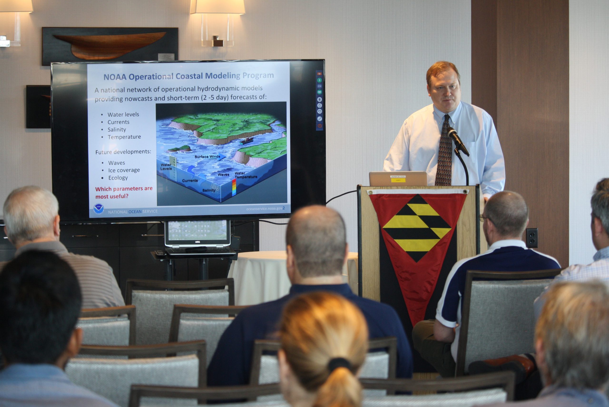
NOAA recently hosted its fourth NOAA Navigation Industry Day at the Annapolis Yacht Club adjacent to this year’s Annapolis Boat Show. This annual event welcomed maritime application and navigation system developers interested in learning about the latest freely-available navigation-related data streams, models, and products that NOAA offers. Continue reading “NOAA hosts Navigation Industry Day 2018”
NOAA quickly updates nautical chart, allowing large ships to dock with confidence in Port Everglades
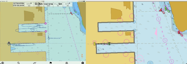
NOAA’s Office of Coast Survey quickly updated NOAA electronic navigational charts (NOAA ENC®) to accurately reflect the 225 foot expansion of a slip in Port Everglades, Florida. Now at a total length of 1,125 feet, the elongated slip allows larger ships to dock with confidence. The Port Everglades Pilots – maritime pilots who maneuver ships through crowded harbors and confined waters – requested the chart update. With ENCs that accurately reflect the slip expansion in their hands, pilots can easily communicate to vessel captains that it is safe to dock their vessels in the slip.
Port Everglades is one of the top three cruise ports in the world, and is among the most active cargo ports in the United States. Every slip is kept in high use, and Coast Survey used a new data process that allowed the most critical and valuable information to be applied quickly and made available to the end user. Continue reading “NOAA quickly updates nautical chart, allowing large ships to dock with confidence in Port Everglades”

