August 19, 2021
Harbor safety committee requests updated rating in federal channel
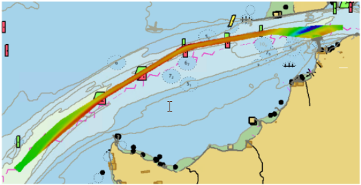
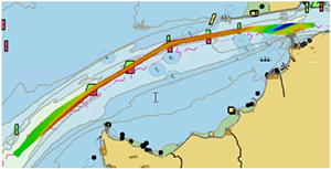 The San Francisco Bay Harbor Safety Committee’s Dredge Issues Working Group recently requested an improved zone of confidence rating (CATZOC) in Pinole Shoal Channel in San Pablo Bay, from B to A1. An A1 rating signifies that survey depths meet the highest level of accuracy, with full bottom coverage obtained and all significant seafloor features found. In the request, the working group described the B rating as requiring an additional 5% under keel clearance, when compared to an A1 rating. This 5% increase on a tanker with a 10 meter draft, is 5,000 metric tons of product, worth almost $2 million. Two years ago, Coast Survey worked with the U.S. Army Corps of Engineers (USACE) to improve the zone of confidence rating in Pinole Shoal Channel with an A1 rating. Coast Survey policy states that a zone of confidence rating of a USACE survey is only good for two years and this rating was due to expire on August 19, 2021. The Pacific Hydrographic Branch obtained the latest USACE survey conducted in May, 2021. After careful review of the data, the branch determined that the A1 zone of confidence rating should be renewed for another two years, ensuring the continued safe and efficient transit of tankers through the Bay. For more information contact Jeffrey.Ferguson@noaa.gov.
Navigation response branch assists in buoy recovery
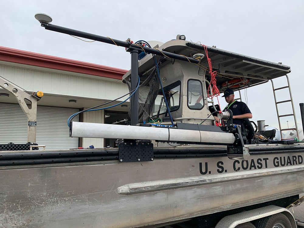
 In early August, United States Coast Guard (USCG) Sector New York requested survey support from Northeast Navigation Manager Colleen Roche after a navigational buoy was struck by a tug and barge, and was reported sunk immediately following the strike. The sunken buoy was a potential danger to navigation as it was in the vicinity of special anchorage 10, between the East River and Flushing Bay, an area frequented by fuel barges servicing the LaGuardia Airport fuel pier. Physical Science Technician Michael Bloom and LTJG Nick Azzopardi of Navigation Response Team-New London were joined by Navigation Response Branch Technical Advisor Mike Annis to deploy the Mobile Integrated Survey Team (MIST) kit on a USCG aids to navigation boat out of Bayonne, New Jersey. For this survey, the team and USCG determined an appropriate search area and assembled the kit for multibeam in order to search for the buoy and ensure that the channel was safe for navigation. The collected data appeared to show that the vessel had dragged the buoy and anchor block for approximately 600 feet before it finally sank. The buoy was removed from the channel three days later by Coast Guard Cutter Katherine Walker, clearing the Flushing Bay entrance channel of the obstruction. For more information, check out the blog post or contact Nicholas.Azzopardi@noaa.gov or Colleen.Roche@noaa.gov.


Staff Updates
 ENS Collin McMillan reported to Navigation Response Team-Stennis, autonomous systems. He completed his first sea tour aboard NOAA Ship Nancy Foster, a multi-mission platform supporting Coast Survey projects. He is new to the field of hydrography and autonomous systems and is excited to learn the ropes and help develop the new team into a versatile response asset. Prior to joining NOAA, ENS McMillan worked as a project leader for a trim carpentry company and managed a custom furniture shop he founded in 2012. He graduated from Duke University in 2017 with a Bachelor of Science in Neuroscience with a focus on cellular and molecular neurobiology. Having spent the majority of his time on the East Coast, he is looking forward to exploring the bayous of the Gulf Coast. In his free time he plans on fishing, cooking local cuisine, and getting a woodworking shop up and running.
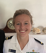 ENS Jane Saunders recently reported as the junior officer in charge on Bay Hydro II, previously serving aboard NOAA Ship Pisces. She is a 2017 graduate of Washington College in Chestertown, Maryland. She earned a Bachelor of Science in Environmental Science after completing senior capstone research in feasibility of implementing wave conversion technology along the Delaware coast. While completing undergraduate studies, Jane enlisted as a marine science technician in the U.S. Coast Guard Reserve and served for three and a half years. In 2018, she was brought on active duty for Hurricane Florence relief response. Jane is excited to learn survey and detection skills in support of Coast Survey’s mission to provide navigational products for safety of those transiting in U.S. waters.
coming up

8/24 – Coping With Change in Uncertain Times. This webinar will help you understand how change affects you.
9/1-9/2 – Hydrographic Services Review Panel Fall virtual public meeting. Meeting materials and registration information
9/29-10/1 – Lakebed 2030 conference "Lets all Dive In". Call for presentations and registration

