March 24, 2021
Hi everyone,
In this opening note, we honor Women’s History Month. The National Ocean Service recently shared an article highlighting notable women in ocean science, including Maria Mitchell, the first woman to work for the U.S. Coast Survey, NOAA Corps Captain Maureen Kenny, the first woman officer on the NOAA Ship Davidson, and Marie Tharp, who was responsible for one of the most significant bathymetric discoveries ever made. Women also play an important role in the NOAA Commissioned Officer Corps, highlighted in this historical documentary put together by Coast Survey’s Crescent Moegling.
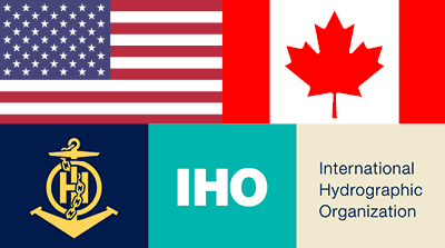
There is a recent wave of actions and initiatives in the world of hydrography geared at increasing representation of women in the field and awareness of the benefit of having gender-diverse teams at all levels of hydrographic organizations. For example, the International Hydrographic Organization (IHO) just adopted a capacity building initiative in 2020 titled Empowering Women in Hydrography
, which seeks to increase the representation of women at higher echelons, as subject matter experts and in policy-making processes of the IHO. Coast Survey will provide in-kind support to this effort by hosting women on NOAA vessels to gain hydrographic survey experience.
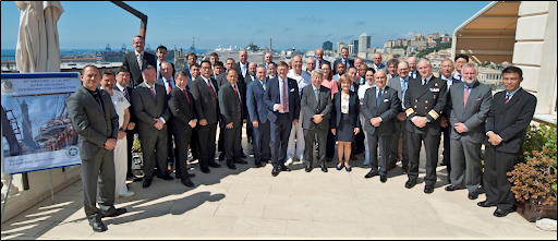
I just recently finished serving a two-year term as the first woman to Chair the Meso American-Caribbean Sea Hydrographic Commission (MACHC). The MACHC also now has three women leading the principal MACHC activities for integrated charting, capacity building and Seabed2030. The Commission has never before had this many women in leadership positions. These changes are a big step for the representation of women that I expect will continue and change the gender composition of traditional photos taken at IHO meetings like the one above.
There are many incredible women throughout the Coast Survey organization, across NOAA, and in the international hydrographic community. I look forward to seeing their numbers and impressive accomplishments grow!
Katie RiesDeputy Director, Office of Coast Survey

Advancing the Marine Transportation System through Automation and Autonomous Technologies: Trends, Applications and Challenges,showcased current and emerging innovative science and technologies related to maritime transportation. RDML Shepard Smith was on the opening plenary panel discussing maritime public agency stewardship perspectives, with other leaders from USACE, USCG, Navy, and DOT. Navigation Services Division Chief Julia Powell gave a presentation on the NOAA Precision Marine Navigation Program, and the Hydrographic Systems and Technologies Branch Chief CDR Damian Manda gave a presentation on Coast Survey's utilization of unmanned vessels for hydrographic survey. CMTS Deputy Director Heather Gilbert, and NOAA Senior Advisor/Lynker Vice President Sam DeBow (NOAA Corps ret.), moderated panels on use of point data to understand MTS operations and maritime data access. For more information contact Heather.Gilbert@noaa.gov.

National Surveyors Week is celebrated annually during the week in March that begins with the third Sunday of the month. This year, March 21 through March 27 are the designated dates of National Surveyors Week. In Coast Survey, there is an entire division with a wealth of knowledge dedicated to hydrographic surveying. For a bit of interesting information on hydrographic survey equipment, check out Coast Survey's social media post for National Surveyors Week!
3/21-3/27 – National Surveyors Week
3/30 – Manatee Appreciation Day
3/30 – Coastal inundation workshops
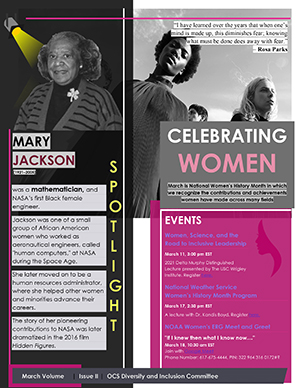
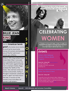
The second and third week of National Women's Month feature two women to celebrate. The spotlights are on Mary Jackson, NASA's very first Black female engineer and Billie Jean King, an American tennis legend, LGBTQ+ advocate, and trailblazer for gender equality in sports. King was the inspiration behind Elton John's Philadelphia Freedom.
Be sure to check out Spotlight Issue 2 and Spotlight Issue 3 for more inspiration and events to celebrate!
Oprah Winfrey (another admirable woman) once said, Passion is the log that keeps the fire of purpose blazing.
I hope everyone can have the chance to get outside, enjoy the transitioning weather, and reflect on our passions that drive us to make a difference at NOAA.
The Latinos@NOAA ERG We are NOAA Project is looking to highlight the wide variety of career tracks performed by Latinos at NOAA, which will ultimately increase the recruitment of quality individuals in the Latino community. For more information, send an email to Brittany.Struck@noaa.gov indicating your interest in participating, and your career track/field within NOAA.
Veteran's ERG March Muster – Come meet other Veterans in NOAA and learn more about each other and how NOAA can support you!
Date: Thursday, March 25, 2021
Time: 3:00 p.m. (EST)
Where: Join with Google Meet.

