
September 30, 2020
Hello Coast Survey,
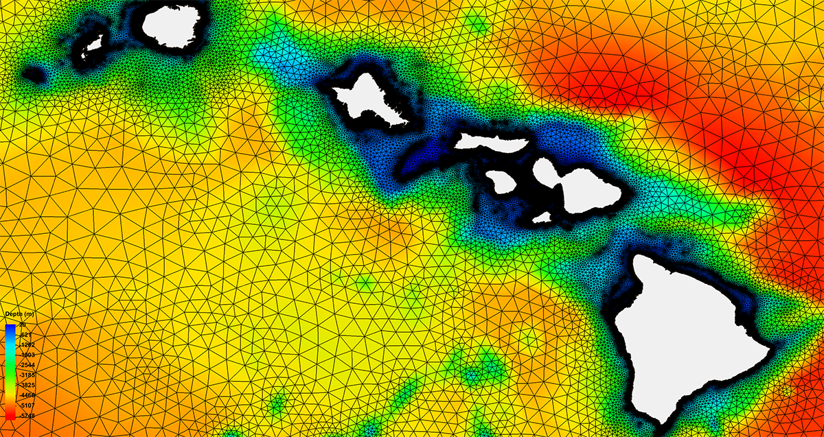
Today is the last day of Fiscal Year 2020 and it has been a unique year to say the least. I’m very proud of the work we have accomplished, from completing the development and upgrade of the Global Extratropical Surge & Tide Operational Forecast System (G-ESTOFS) and completing the the National Bathymetry foundational dataset for New England, to continued work on modernizing our charting products, releasing Coast Survey’s Ocean Mapping Strategy, as well as releasing the prototype surface current forecast data for industry testing. And these are just a few.
However, I would like to bring to your attention some other accomplishments this fiscal year. Accomplishments that are sometimes not advertised as widely:
Navigation Services Division
Responding to natural disasters can be complicated and stressful. Add a global pandemic to the response equation and difficulties can seem unsurmountable. With mitigation plans put in place to ensure the safety of Coast Survey employees, the navigation response teams (NRT) and navigation managers were able to respond to hurricanes Laura and Sally. Providing survey data to the U.S. Coast Guard opening waterways and ensuring safe navigation for commercial and recreational marine traffic.
Hydrographic Surveys Division
Also, with unique requirements to incorporate COVID mitigation strategies, HSD issued seven primary task order contracts, two emerging projects (Saildrone, Barry Arm), and one emergency contract for hydrographic surveying following Hurricane Sally. They also delivered 197 surveys to the Marine Chart Division (MCD) (131 internally sourced Data and 66 externally sourced data) covering 18,500 square nautical miles.
Marine Chart Division
Since MCD staff began working remotely in mid-March, there has been a roughly 20% increase in the application of new source data to our ENCs, from an average of 221 new applications or source data per week to an average of 266 per week. It is amazing to see this increase in productivity in a new working environment.
Coast Survey Development Lab
The Coast Survey Development Lab stepped up to the plate for all operational needs while working under COVID-19 restrictions. IT Service Branch (ITSB) facilitated 100% telework for all Coast Survey employees (in addition to onboard OMAO NOAA Corps and summer interns). This 100% telework transition includes: support deployed equipment, provisioned VPN accounts, and property passes. The Coastal Marine Modeling Branch (CMMB) deployed the first global NOAA surge models that can support navigation products. In addition, CMMB is now working to transition the Gulf of Mexico and West Coast regional operational forecast system models. Hydrographic Systems and Technology Branch advanced unmanned aerial and marine systems and automating hydrographic workflows.
Also, don't forget to scroll down to our Diversity and Inclusion section to review some of the activities our D&I committee hosted and participated in during FY20. I would like to offer my thanks and appreciation for all of your hard work. It is amazing to see all that is accomplished in challenging times.
Director, Office of Coast Survey
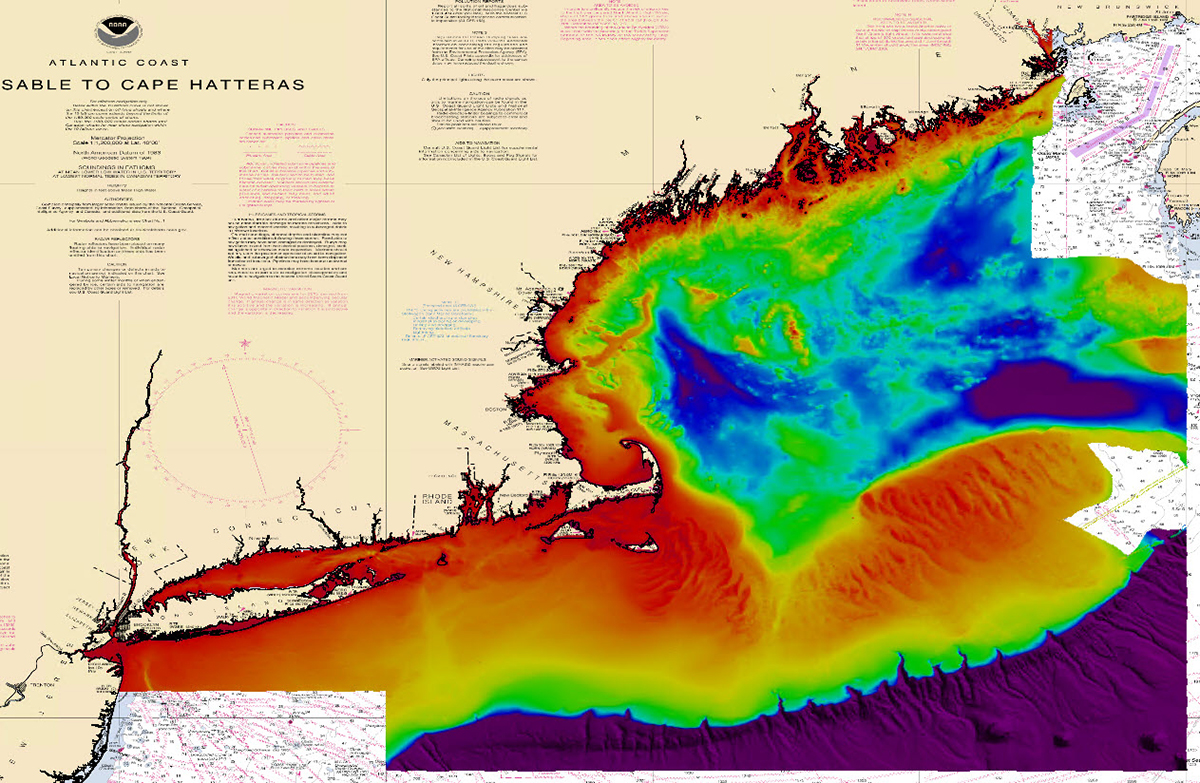
Hydrographic Survey Division's Atlantic and Pacific hydrographic branches, with support from the National Bathymetric Source (NBS) team, held a four-day workshop from September 14-17. The workshop was designed to be both educational and transformative, examining how to streamline and update data review processes to support data going into the National Bathymetric Database. The NBS project creates and maintains high-resolution bathymetry composed of the best available data. This project enables the creation of next-generation nautical charts while also providing support for modeling, industry, science, regulation, and public curiosity. For more information contact: Olivia.Hauser@noaa.gov or Meghan.Mcgovern@noaa.gov.
Opportunities
The Coast Survey Development Laboratory posted the deputy chief position.
The MAP announcement for 1 Supervisory Program Manager, ZA-0340-5 , will close on 10/2/20.
Job Announcement # (MAP): NOS-OCS-2020-0022: https://www.usajobs.gov/GetJob/ViewDetails/579544100
9/30 and 10/1 - Precision Marine Navigation Industry Workshop
10/3 - NOAA 50th Anniversary
10/6 and 10/7 - Standard Ocean Mapping Protocol Symposium

Despite 2020 being an unusual year and not holding our usual activities, the OCS Diversity and Inclusion Committee and members of the Coast Survey staff worked on ways to enhance employee morale, inclusion, increase knowledge and understanding, and provide student opportunities with an eye on diversity. 2020 D&I Committee Highlights

In observance of Hispanic Heritage Month, the Office of Civil Rights invites you to attend “This is My Story,” a virtual presentation on October 15 from 12:00-1:00 p.m. (EDT), where you’ll hear extraordinary stories of Hispanic employees and Hispanic advocates, on perseverance, grit, and overcoming adversity.
2020 Federal Employee Viewpoint Survey is LIVE. Federal employees - please check your email for your individual link to complete the survey. The results are reviewed and discussed by NOAA, NOS, and Coast Survey Leadership. Your voice matters!
Coast Survey Summer/Fall Diversity and Inclusion Training Sheet

