
August 19, 2020
Hi everyone,
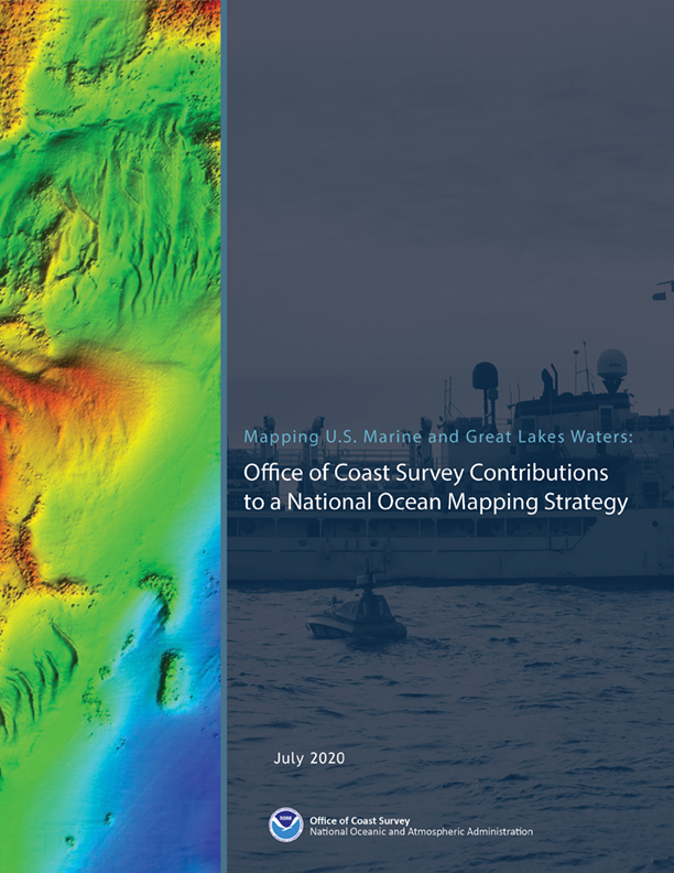
I am pleased to announce the release of Coast Survey’s Mapping U.S. Marine and Great Lakes Waters: Office of Coast Survey Contributions to a National Ocean Mapping Strategy. The plan aligns with the recently-released National Strategy for Mapping, Exploring, and Characterizing the United States Exclusive Economic Zone (NOMEC), as well as Seabed2030, our new chart suite, and our next generation S-100 precision navigation services. This document is part of our commitment to meet core surveying and nautical charting mandates while supporting broader needs to fill gaps in seafloor mapping and environmental sciences.
We presents two overarching goals in this plan
Goal I – Optimize the safety and utility of the nation’s marine highway infrastructure
Objectives:
- Enable Precision Marine Navigation in top U.S. ports and waterways to decrease risk to life and property and to optimize cargo loading.
- Use a model-based approach to determine annual survey priorities for navigation safety.
- Resolve unverified charted features to improve confidence in the nautical chart.
- Build out the National Bathymetric Source Database .
Goal II – Map the full extent of the U.S. waters to modern standards
Objectives:
- Lead the coordination of integrated mapping of U.S. waters to optimize NOAA and partner priorities and resources for ocean and coastal mapping efficiencies.
- Maximize the use of Coast Survey mapping expertise to acquire best available data in poorly surveyed and gap areas.
- Leverage leading-edge survey technology to force-multiply data acquisitions.
We have an exciting and challenging decade ahead and it’s a great time to be a part of the nation’s primary marine mapping program. Interest has never been higher in seafloor mapping and many are increasingly recognizing the value and the need to understand the basic contours of the seafloor and marine environment. I encourage you all to become familiar with this document as it will guide our mapping efforts moving forward. Thank you to everyone in Coast Survey who contributed to its development. This strategy was a long time coming and I am proud that it is now publicly available.
Director, Office of Coast Survey