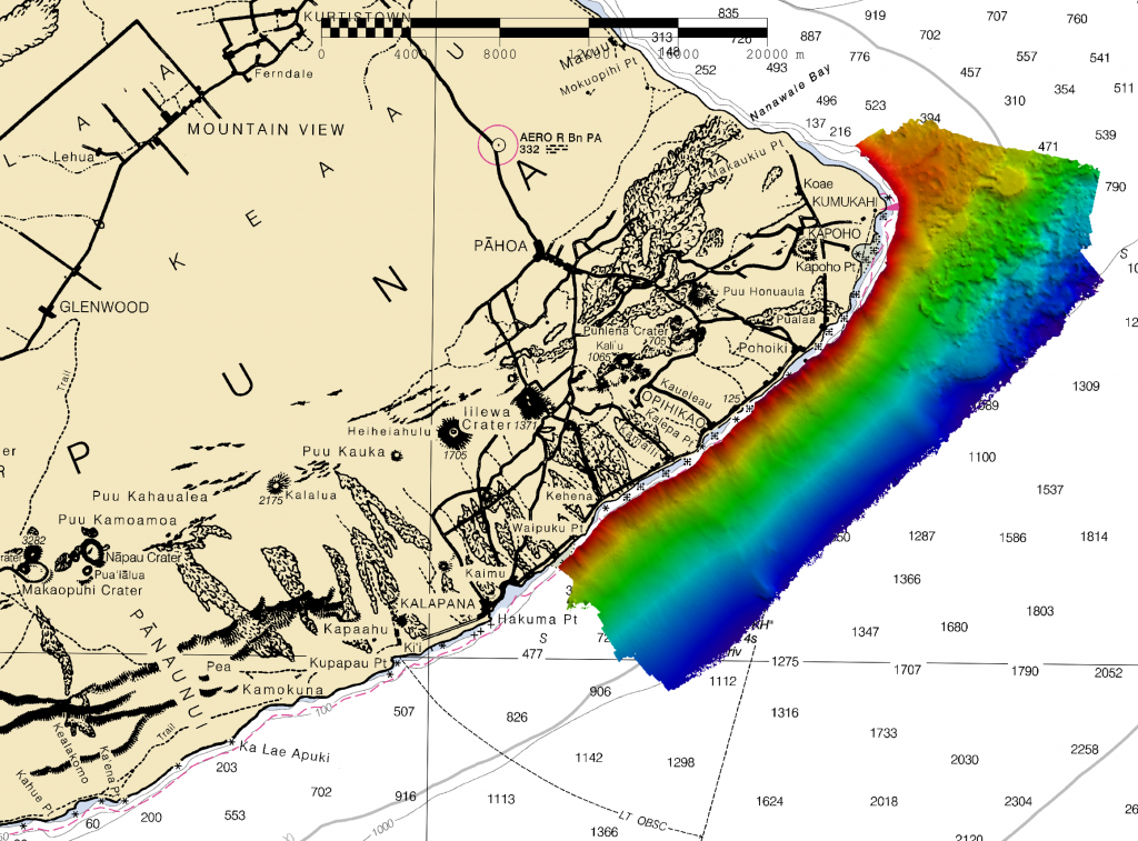
NOAA Ship Rainier returns to survey the Hawaiian coast, provides update on lava flow development
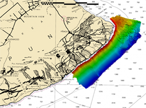
Bathymetric data from Rainier's survey along the Puna Coast
After a mid-season move from Alaska to Hawaii, the NOAA Ship
Rainier took on a diverse set of projects including surveying the Puna Coast along the Big Island. The lava spillway associated with the Kīlauea volcano that infamously erupted in 2018 is located here. The Kīlauea eruption, like many past eruptions, resulted in a devastating lava flow that ran across the Puna Coast, reshaping the coastline and seabed. The E/V
Nautilus surveyed immediately after eruption. Even though the eruption had ceased, the geologic structures had only begun forming. With
Rainier fortuitously in the area a year later, there was a unique opportunity to collect another multibeam dataset focused on a short-term phase in geologic development that is often difficult to capture. In addition to updating nautical charts,
Rainier’s work will provide scientists from the
United States Geological Survey and other researchers with a high-resolution bathymetric model of a sparsely studied lava flow. Learn more about this project in the
blog post contributed by
Ens. Harper Umfress who can be reached at
Samuel.Umfress@noaa.gov.
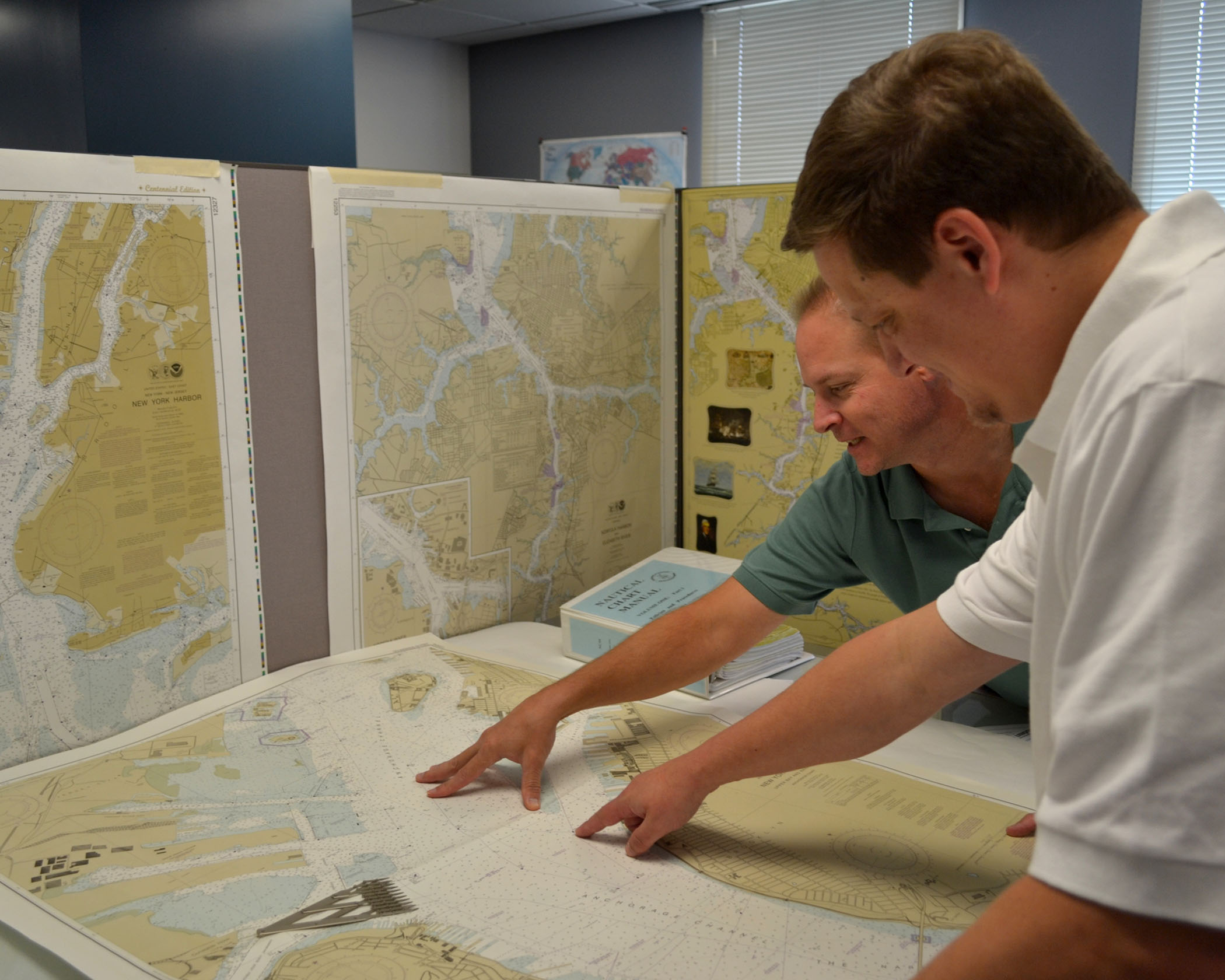
Coast Survey heads back to school for GIS Day
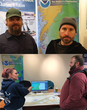
Top: John Whiddon and Paul Gionis represent Coast
Survey at their Montgomery College Rockville campus.
Bottom: Megan Bartlett speaking with one of about 30 people
who came by the NOAA booth at George Mason Univeristy.
On November 13, Coast Survey cartographers participated in GIS Day events at two local colleges.
John Whiddon and
Paul Gionis of Marine Chart Division's (MCD) Nautical Data Branch returned to their alma mater, Montgomery College Rockville campus, to discuss NOAA GIS and employment opportunities with current students, faculty, and other attendees of the GIS Day event. Meanwhile,
Megan Bartlett of MCD's Product Branch D and
Steve Soherr of Navigation Services Division's Customer Affairs Branch, spoke with participants at the George Mason University GIS Day which included both high school students and George Mason students. The Coast Survey team was impressed by the robust GIS and coding skillsets of the students who attended both events.
For more information contact
Steve.Soherr@noaa.gov.
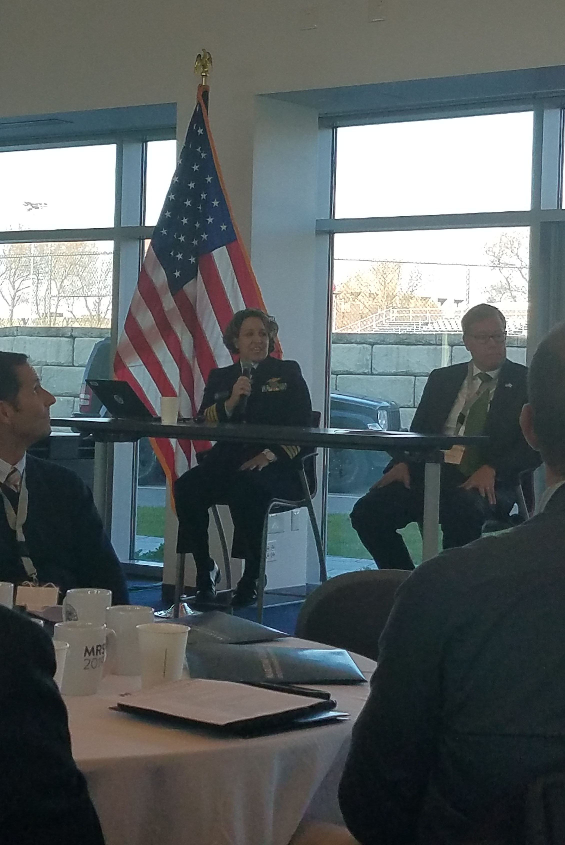
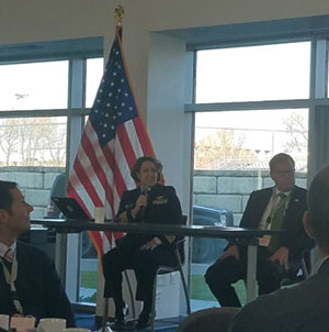
Coast Survey updates Marine Board on National Ocean Service activities
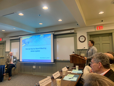
Heather Gilbert provides updates at the Marine Board
meeting.
Heather Gilbert, NOAA senior advisor to the Committee on the Marine Transportation System, attended the fall meeting of the
Transportation Research Board - Marine Board on Nov 5-7 in Falmouth, Massachusetts. The Marine Board, of which NOAA is a sponsoring agency, identifies research needs and provides a forum for exchange of information relating to new technologies, laws and regulations, economics, the environment, and other issues affecting the marine transportation system, port operations, coastal engineering, and marine governance. At the fall meeting Heather updated the Board on NOS activities, including
autonomous technologies,
PORTS®, the
National Spatial Reference System, and the
sunsetting of traditional paper charts. For more information contact
Heather.Gilbert@noaa.gov
NOAA participates in Girl Scout STEAM Night
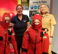
Rita Bowker and Cmdr. Fionna Matheson
with girls scouts dressed in survival suits.
Physical Scientist
Rita Bowker from the Atlantic Hydrographic Branch, and
Cmdr. Fionna Matheson, chief of operations at the Marine Operations Center-Atlantic, facilitated a NOAA booth at the Nauticus STEAM Night for Girl Scouts in Norfolk on October 12. The event provided hands-on activities in the science, technology, engineering, arts, and math (STEAM) fields. In addition to teaching the group about NOAA and the various career paths available, they also led 150 students (grades 1-8) through different activities. The girls wore a blubber glove in ice, observed the stratification of different salinities, made a cork and needle compass, and the highlight of the night - gumby suit races! For more information contact
Rita.S.Bowker@noaa.gov.
Coast Survey participates in panel on Navigation Risk to the Maritime Transportation System
Capt. Kretovic discusses NOAA's Precision Naviagation
program and Coast Survey's plan to sunset raster products
and services.
On November 13-14,
Capt. Elizabeth Kretovic, Coast Survey deputy hydrographer,
Heather Gilbert, and
Rear Adm. Sam DeBow (NOAA, ret.) (Lynker Technologies), attended the
10th Annual Maritime Risk Symposium held at State University of New York Maritime College in the Bronx, New York, in collaboration with the National Academy of Sciences. This event brought together academic, government, and commercial entities to discuss the threats, challenges, and risks associated with the Marine Transportation System, both internationally and domestically. Kretovic spoke at a panel discussion on Navigation Risk to the Marine Transportation System. She presented on NOAA’s Precision Navigation program and Coast Survey's plan to sunset raster products and services. For more information contact
Elizabeth.Kretovic@noaa.gov.
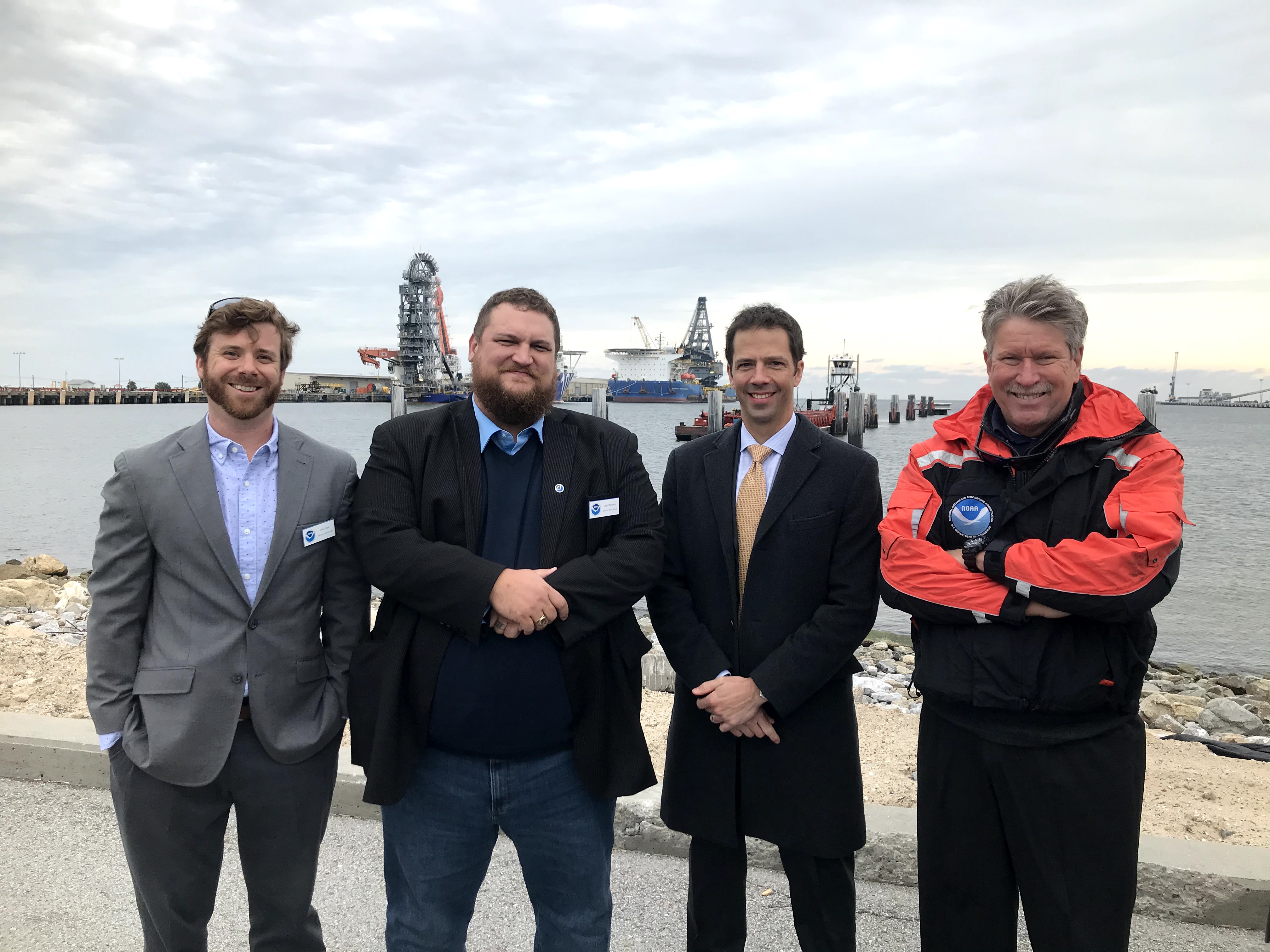
Coast Survey features mobile units and unmanned systems at Ocean Enterprise Facility groundbreaking event
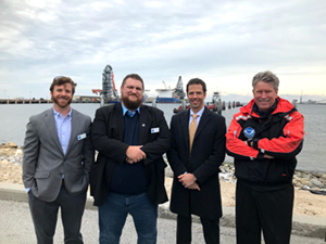
(Left to right) Alex Ligon and Joshua Bergeron, NRT-Stennis;
Dr. Neil Jacobs, Assistant Secretary of Commerce for
Environmental Observation and Prediction; and Tim Osborn,
Western Gulf Coast navigation manager, at the Ocean
Enterprise Facility groundbreaking event.
Coast Survey's Navigation Services Division featured its unmanned systems at the groundbreaking event for the Ocean Enterprise Facility, a new maritime technology research and development center in downtown Gulfport, Mississippi. NOAA anticipates the new facility will help expand partnerships and collaboration in the region, as part of NOAA’s Unmanned Marine Systems Program. Coast Survey’s
navigation response team (NRT) homeported in Stennis Space Center, Mississippi, was on hand to present their mobile and unmanned survey capabilities. The team is co-located with NOAA’s National Data Buoy Center and adjacent to other federal and state partners involved in seafloor mapping and unmanned hydrographic survey systems, which supports the team’s basic operations and is conducive to the research, development, and implementation of unmanned systems. For more information contact
Capt. Chris Van Westendorp
NOAA Ships and Contractor Operations
Weekly Hydro Ship Activity Report - Week of November 10 - November 16, 2019
Navigation Response Team Activities
NRT-Stennis - The team is processing data from Mississippi Sound, Big Bend, Florida, and response surveys.
NRT-Fernandina Beach - The team is in Brunswick, Georgia, surveying for theBrunswick project as well as Calibogue Sound at the request of the U.S. Coast Guard
NRT-Seattle - The team is processing data for the Bellingham and Tacoma, Washington, projects.
NRT-Galveston - The team is surveying Galveston Bay.
NRT-New London - The team is processing data for South Channel.
Bay Hydro II - The team is processing data for the Delaware River project.

Staff Updates

Tina Perry
Nautical Publications Branch of Navigation Services Division welcomes
Christina "Tina" Perry as a cartographer. Prior to joining the team, she worked as a lead geospatial analyst for a mapping company, which catered to the natural gas and oil field companies of the Midwest. She began her career by serving in the U.S. Navy at Waterfront Operations on Marine Corps Base Hawaii, where she performed search and rescue, environmental and shoreline protection, anti-terrorism force protection, and received her small craft pin from the U.S. Navy. Upon honorable discharge, she completed a bachelors degree in GIS from Southern Utah University. Tina is passionately interested in further exploring GIS and its technology to assist in meeting global challenges.
Opportunities
Pacific Hydrographic Branch Hydrographic Team Lead. The detail assignment will be located in Seattle, will start in January 2019, and will last approximately 6 months. Applications (including resume and statement of interest) are due to
Cmdr. Olivia Hauser by COB
Friday, November 22, 2019. You must get supervisor approval before appling.
IT Services Branch Chief. This position is located in Silver Spring and reports to the chief of the Coast Survey Development Laboratory. The detail will start in early April and last for 120 days.
The position is open to NOAA employees at Band 04 (GS-13/14 equiv.) for temporary promotion, or employees at Band 05 (GS-15 equiv.) as a detail. If you are interested please send
Julia.Powell@noaa.gov your resume and a brief statement of intent and qualifications related to the announcement by COB,
December 6, 2019.
Training
The next NOS Communications and Media Training is scheduled for Tuesday, December 10, 9:00 a.m. to 4:00 p.m., in Silver Spring, Maryland. In the training, you will review and practice communication skills (including plain language and messaging) and working with news media. If you are interested in attending, please get supervisor approval and contact
Brady.Phillips@noaa.gov from NOAA Communications.